Quantcast
Channel: 52 Weeks of Ancestors – DNAeXplained – Genetic Genealogy
Viewing all 422 articles
Browse latest View live

A Crown Jewel for Rachel Rice (c 1707 – after 1767) – 52 Ancestors #252

$
0
0

Rachel’s life story, unfortunately, must be told through the life of her husband, children and the historic events that surrounded her in colonial Virginia.

We know Rachel’s first name thanks to the will of her husband, Joseph Rice, wherein he mentions his wife, Rachel, twice. We have no idea who Rachel’s parents might be.

Joseph wrote his will on December 14, 1765 and in the will, after leaving land to his sons and son-in-law, along with items to daughter Mary Rice, Joseph then turns to his wife, Rachel:

  • Well beloved wife Rachel remainder of personal estate during her natural life.
  • Sons John, William and Charles after decease of wife, 7 pounds current money of Virginia.
  • Rest of estate divided equally after decease of wife. Wife Rachel and David Rice and John Watkins executors. December 14, 1765.

The will was probated on June 16, 1766, so Joseph died sometime close to June.

When Joseph died, three of his sons were underage, meaning that four children were not. If he had underage sons that were 20, 18 and 16, for example, that means that Rachel, assuming she was his only wife and the mother of those children, was approximately 43 years of age 16 years earlier, making her roughly 59 when Joseph died. This suggests Rachel was born about 1707.

The only other actual document we have involving Rachel is the 1767 tax list where she is listed with son John, which tells us that John is age 16 or over in 1767.

I believe Rachel eventually lived with her son Charles, assuming she lived that long, based on this item from Joseph’s will:

  • To my well beloved son Charles Rice the remainder part of my land whereon I now live after the death of my well loved wife to him and his heirs forever.

Birth

If Rachel was born about 1707, her birth might have been recorded in the parish records of either Hanover County or New Kent.

The Saint Peter’s Parish Register exists for New Kent County from 1680 to 1787 and is transcribed here.

Only one birth of a Rachel occurred in the right timeframe.

  • Rachel Jackson was married to Edward Bettes in March of 1708 and a daughter, Rachel, was born in 1709. Her mother, Rachel Jackson Bettes died in 1719.

Rachel might have been named after other Rachels as well, and some might have been named after her.

  • Rachel daughter of Edward Huchens and Rebecca was baptized in 1686.
  • Rachel daughter of Edward Johnson and Elizabeth was born in 1686.
  • Rachel Cox was born to George Cox in 1690.
  • Rachel daughter of Alice Doe was born in 1690.
  • Daniel Murfield married Rachel Coker in July of 1708.
  • Rachel Watson died in 1726.
  • Rachel Slayden and her husband Arthur had children in 1730 and 1735.
  • Rachel Watson, daughter of Alexander and Esther Watson was born in 1734.
  • James and Rachel Blackstone had a daughter in 1735.

St. Paul’s Church in Hanover County was established in 1704 and has records beginning in 1706, but apparently only the vestry records remain. No Rachel’s appear before the mid-1700s.

If Rachel Bettes isn’t the right Rachel, and I’m not suggesting that she is Rachel Bettes, then either our Rachel’s birth record doesn’t exist or she wasn’t born there.

Early Life

We know that Joseph Rice was found in Hanover County listed in a merchant’s debt book in 1743 and again in the 1744-1745 book. In 1746, Joseph purchased the land the family lived on the rest of his and Rachel’s lives on Sandy River in Amelia, soon to become Prince Edward, County, Virginia.

Since we know that three children were underage in 1766, they clearly had to have been born after arriving in Amelia/Prince Edward County – birthed in the new homestead.

Older children would have been born in Hanover County where baptism records don’t exist, so the wagon lumbering westward would have carried Joseph, Rachel and at least 4 children.

It’s likely that either there were more children and they either died or married and moved away before 1766, or, Rachel buried several babies in Hanover County. Perhaps a combination of both.

Most couples had children on the average of every 18 months to 2 years, for approximately 22 years of marriage. Someplace between 11 and 14 or 15 children would have been born, assuming no deaths at birth which would have resulted in an earlier “next” pregnancy.

Only 7 children total are mentioned in the will and Icay, although not mentioned, is very probably #8.

Dissenters

Religion is always a hot-button. Religious doctrine defines many of our life choices as well as our personal beliefs. For example, Joseph and Rachel did not own slaves, while most of their neighbors and even Joseph’s brother, Matthew, did own slaves. Based on Joseph’s land purchases and estate, the fact that he didn’t own slaves wasn’t based on money, so it clearly had to be based on a moral compass, likely a religious belief. Quakers, Brethren and some Methodists eschewed slave ownership.

Joseph Rice’s son-in-law, James Moore didn’t own slaves either, and James’s son William Moore had become a dissenting minister in the Methodist faith by 1775.

In 1759, Joseph Rice built a dissenting “meeting house” on his property in Prince Edward County.

Dissenters in colonial Virginia were those who did not want to worship in the Anglican church even though their actions were illegal at the time. Catholics were outlawed, but dissenters were any non-Catholic faith such as Presbyterians who arrived from Pennsylvania between 1738 and 1743, Methodists and Baptists. In Virginia, legal activities, such as marriages, were required to be performed by Anglican ministers, resulting in many marriages performed outside of the Anglican church not being registered with the clerk at the county courthouse.

Women at that time didn’t have a lot of choice in selecting a faith different from that of their husband. Rachel was a dissenter’s wife, and therefore by definition a dissenter, whether or not she would have made that decision without the influence of her husband. Either way, that choice, whosever it was, affected her life in numerous ways. For example, the work that was performed by slaves elsewhere fell to the family members – and much of it to the wife.

While wives at that time weren’t sold as chattel property like slaves were, they didn’t have many rights and fewer realistic options.

Dissenting, however, seemed to run in Rachels’ family, so perhaps she had been raised in a family with “radical” religious ideas.

Rachel’s nephew through her brother-in-law, David Rice, was a Presbyterian minister, also named David Rice, another dissenter, who settled and was beloved in Kentucky.

William Rice, perhaps Rachels’ son, built a meeting house, believed to be Baptist, in 1775, just 9 years after Joseph Rice died in Prince Edward County. Rachel may have lived long enough to witness that!

Dissenting seemed to run in the family!

Rachel’s Children

Joseph’s will provides us with the names of Joseph’s children, presumed to be Rachel’s children as well.

In order mentioned:

  • Son-in-law James Moore, who is married to Joseph’s daughter. James Moore’s wife, possibly Mary Rice, was born about 1723 based on the ages of known children.
  • John Rice, underage in 1765, so born after 1744, appears in Prince Edward County records as early as 1752, so this John is clearly not John, the son of Joseph.
  • William Rice, underage in 1765, so born after 1744, appears in the county court records in 1766 as a patroller for 20 pounds of tobacco per day as pay. These records are likely for William, the son of Joseph and Rachel. In 1775, William Rice built a dissenting meeting house on the main road.
  • Charles Rice, underage in 1765, so born after 1744, first appears in the Prince Edward records in 1761, so that Charles cannot be the son of Joseph and Rachel.
  • David Rice, born before 1744, appears near Rachel on the 1767 tax list. Joseph’s brother Matthew also has a son named David.
  • Joseph Rice, born before 1744, appears near Rachel on the 1767 tax list with 1 tithe and the 133 acres left to him by his father.
  • Daughter Mary Rice who appears to be single in 1766.
  • Icay Rice, not mentioned in the will, but in May of 1765, Joseph states in a deed where he sold land to Icay that he was his son. Ican first appeared in the county records in 1760 signing as a witness, so would probably have been born in 1739 or earlier.

Rachel Rice 1765 deed Joseph to Icay.jpgRachel Rice deed 1765 Joseph to Icay 2.jpg

Joseph’s Estate

While life on the frontier in a homestead was indeed challenging, especially when compared to life today, Joseph and Rachel were not poor by the standard of the time in which they lived.

In colonial Virginia, when a man died, the estate was appraised and his effects sold or at least valued.

One can tell a great deal about the life of the family by the estate inventory since absolutely everything was included, down to the silverware.

Let’s take a look at Joseph Rice’s estate inventory, because those items will tell us a great deal about Rachel’s life too. The wife owned nothing separate from the husband, so her possessions, except for her clothes, would be included in his estate inventory. I’ve left the spelling, which was not standardized at the time, as found in the original.

  • 31 cattle
  • mare, 5 horses
  • 12 sheep
  • 10 geese
  • 16 hoggs

In that day and time, 31 cattle and 6 horses was a substantial estate. Five of those horses would probably have been stud horses, probably “rented out” to “cover mares” for local farmers.

  • Cart, wheels, old rake

A cart would have been a two-wheeled device as opposed to a wagon with 4 wheels. Wooden wheels broke often, so the wheels were likely spares from “other carts.” You can see colonial carts here that would have been used to ferry tobacco from the fields. Carts can be pulled by people, but wagons need horses or oxen.

Primitive rakes were nothing more than a backbone of wood with wooden teeth, attached to a handle.

Rachel Rice rake.png

  • 12 bells

Rachel Rice cowbell.jpg

These must surely have been cowbells. At that time, farmland wasn’t fenced so you needed to go and find your cows in he woods.

  • 4 jugs, butter pott

Rachel Rice jug.jpg

The jug was probably stoneware. I wonder what Joseph kept in his jug. Some jugs were whiskey jugs.

The butter pott was probably included in the inventory with the jug because it too was stoneware – a cup or small bowl into which churned butter was deposited.

  • some camphire and tickler (tuhler) bottles and a funnel

I can’t find either tickler or tuhler bottle, so perhaps this word is something different.

You can see a Camphor bottle, here. Camphor was used in colonial America as a purgative and was also believed to prevent illness. In 1793, a letter sent to a doctor in Philadelphia where a yellow fever outbreak was underway instructed people to use vinegar or camphor on their handkerchief when visiting the sick, to carry it in smelling bottles and use it frequently.

Camphor was a luxury, imported from Asia, the only place in the world where it was grown. In 1764, Sauer’s Herbal Cures Book referred to its usage. The Dutch imported Camphor into the Netherlands, which in turn exported it to the colonies. It was believed that because Camphor was acrid smelling and kept moths out of clothing, it would do the same for other agents of disease.

Most uses of camphor were external, because internal uses have unexpected, or maybe expected, results. Camphor “drives worms out of children and suppresses sexual passion,” so women were warned about not taking it internally. Camphor, especially camphor brandy, served to effect clandestine abortions. Fits, as mentioned by Sauer, were epileptic seizures.

Here’s what Sauer had to say:

Rachel Rice camphor.pngRachel Rice camphor 2.pngRachel Rice camphor 3.pngRachel Rice camphor 4.png

I had to laugh. Yes, Camphor combined with Opium and brandy will assuredly “calm feverish delirium,” because you’re out cold!

So sniff it, drink it, use it as a poultice, make it into Camphor Brandy, or mix with opium and brandy and if it doesn’t kill you, it will cure you!

So, I’m guessing between the Camphor bottles, funnel and jugs, that perhaps Joseph Rice was medicating his family with this wonderful all-purpose remedy, as needed – like any responsible head of household in the 1700s would do.

  • 4 pair cards

Given the word pair, these have to be wool cards.

Rachel Rice wool cards.png

Sheep were washed in a nearby stream before they were shorn in late spring or early summer. The sheep weren’t happy and resisted, requiring multiple adults.

Rachel Rice sheep shearing.jpg

This painting is from the later 1800s, but sheep shearing didn’t change much in a century.

Wool much be thoroughly greased before it can be carded using either rape seed oil or pig grease – three pounds of grease or oil per 10 pounds of wool.

Wool cards were typically leather covered wood with wire teeth. Matted wool was place on one card and them “combed” with the other, unmatting the wool much like brushing hair. You can see how, here.

By 1830, this process had been mechanized. The fact that Joseph Rice had 4 pairs of cards tells us that Rachel and her two daughters spun wool thread to be woven into clothing and the sheep tell us where it came from.

  • 3 drawing knives

A drawing knife is a traditional woodworker’s tool used for shaping wood by removing shavings.

Rachel Rice drawing knife

By Simon A. Eugster – Own work, CC BY-SA 3.0, https://commons.wikimedia.org/w/index.php?curid=7606363

Here’s a contemporary draw knife being used to construct a flatbow. According to Wikipedia, drawknives were used to remove large slices of wood for faceted work, to debark trees or to create roughly rounded or cylindrical billets. In essence, it’s used for curved shaving.

Did Joseph and his sons use these 3 for clearing his land and debarking the trees?

  • parcel carpenter tools

Rachel Rice carpenters tools.jpg

Carpenters tools consisted of mallets and hammers, wood screw vices, calipers possibly, chisels, saws, boring tools, wooden tools or metal braces and planes to smooth rough surfaces. Adzes would have been used to rough cut the wood or strip the bark from the wood before the more refined tools were used to make furniture or possibly for the interior carpentry of a home. You can read more here.

  • parcel shoemaker tools

Rachel Rice shoemakers tools.png

Shoes are a universal necessity. The fact that Joseph has shoemaker’s tools suggests that he made the shoes for his own family. The above image is from 1658 in a shoemaker’s shop, and below, from the Maine State Museum.

Rachel Rice shoemakers workshop

By Billy Hathorn – Own work, CC BY-SA 3.0, https://commons.wikimedia.org/w/index.php?curid=34037637

By Billy Hathorn – Own work, CC BY-SA 3.0, https://commons.wikimedia.org/w/index.php?curid=34037637

Shoemaking is typically a specialized skill, where the shoemaker makes shoes for many people and families. Every land-owner was indeed a jack-of-all-trades and the master of at least one.

Shoemakers also made boots. Shoes at that time were not constructed for left and right feet. Shoes needed to be switched back and forth so the shoe was not deformed to fit one foot at which point they were considered “ruined.”. Shoes were also passed down in families and inherited.

  • two old swords, pistol barrel

Old swords, so let’s suppose they were Joseph’s swords from when he was a young man, from about 1730 or so.

This Antique Arms gallery shows a wide variety of swords.

As I’ve discovered, there are multiple types of swords – two handed swords, one handed swords and sword styles varied in different places in the world.

Rachel Rice fencing.jpg

This plate from The Expert Swords-man’s Companion by Donald McBane (1728) shows a Scottish fencing master holding a basket-hilted broadsword, but on the table beside him are shown broadswords and smallswords. On the wall behind him, we see flintlock pistols and a target. Joseph Rice may have had all of these things.

  • 3 reaphooks, meal sifters
Rachel Rice reaphook

By David Jackson, CC BY-SA 2.0 uk, https://commons.wikimedia.org/w/index.php?curid=9977808

A reaphook is also known as a sickle.

Google shows several early primitive grain sifters. A meal sifter might have been for flour.

Rachel Rice grain sifter.png

  • old baskets, wool, flax

Baskets were heavily used, so not many remain today from the 1700s. The Colonial Williamsburg Foundation has a lovely basket-making article and slideshow on their website. Every family needed many baskets and white oak was preferred because it was the only tree in Virginia that would split thin and remain flexible enough to weave.

If you’ve never tried it, basketmaking is a long, tedious affair and makes your hands raw.

Wool and flax were both used to make thread to weave into cloth for clothes.

Rachel Rice flax

By D. Gordon E. Robertson – Own work, CC BY-SA 3.0, https://commons.wikimedia.org/w/index.php?curid=10227304

The perennial flax plant has beautiful blue flowers. Rachel probably loved the blooms, reaching across the horizon in a sea of blue.

Rachel Rice flax pods.jpg

The flax plant, shown above, became linen, eventually, after much work. The seeds from the pods were harvested, also known as flaxseed which can be eaten, then ground into a meal or turned into linseed oil.

Rachel Rice flax.png

The soft, flexible fiber used to weave clothing is extracted from the bast beneath the surface of the stem of the flax plant is called roving and looks similar to blonde hair.

Rachel Rice hackle

By Kozuch – Self-photographed, CC BY-SA 3.0, https://commons.wikimedia.org/w/index.php?curid=8040921

The hackle or heckle tool is used to thresh flax and prepare it for weaving.

Rachel Rice flax prep

By Pymouss – Own work, CC BY-SA 3.0, https://commons.wikimedia.org/w/index.php?curid=14770489

You can read more about flax production here.

  • bed (2), bedstead, furniture, bag of feathers

Rachel and Joseph had 2 beds, possibly two bedsteads and furniture, along with a bag of feathers that would have been curated from the geese to stuff the bed or beds. Some beds were stuffed with straw, so feathers were a luxury. Do you have any idea how many feathers it takes for a feather bed? 90 pounds

This article shows beds and bedsteads from a wealthier non-frontier home, but the basics are the same. The difference would have been that cabins wouldn’t have had ornate hangings.

Wikipedia tells us that:

Feathers for a featherbed could be saved from geese or ducks being prepared for cooking. In England servant-girls were often allowed to keep feathers from poultry they’d plucked and could save them to make a featherbed or pillows for their future married life. Live birds might have their soft downy breast feathers harvested three or four times a year, as described in an account from 20th century Missouri. Some poultry feathers were undesirable for mattress-making, especially chicken feathers. The best featherbeds were filled with a high proportion of down; larger feathers needed to have their quills clipped.

Lengthy preparation and good aftercare were essential. Before use, all feathers and down had to be aired outdoors in sun and breeze or stored indoors in a warm dry space; this would reduce smell and eliminate moisture. Even so, there could be what Harriet Beecher Stowe called “the strong odour of a new feather-bed and pillows”.

In other words, you could either smell the feathers or smell the stove. Apparently either or both was better than not sleeping on feathers.

  • barrell with salt

According to “Salt in Virginia,” Virginia has plenty of salt on its eastern edges – not to mention that seawater could be boiled. Apparently, Joseph purchased salt by the barrel, given that it was necessary for the preservation of “bacon,” as all pork was called at that time. One thing is for sure, Joseph couldn’t produce salt on his plantation unless he owned a salt mine.

  • 3 old chests and a box

This blanket chest from Virginia in the 1730s is probably very similar to the chests owned by Joseph and Rachel.

Rachel Rice chest.jpg

Additional photos of this beautiful primitive chest, which is for sale, can be seen here. Take a look at the closeup photos, especially of the beautiful joints. Be still my heart!

  • Corn, cotton, tand leather

Crops and leather. Leather, of course, was used to make shoes, some coats, breeches and furnishings. Nothing that died went to waste, except for humans.

Believe it or not, the history of hides and tanning in Virginia was a political minefield. Virginians couldn’t obtain enough leather from England, and the English didn’t want the Virginians exporting hides to England and ruining their markets. You can read about leather workers in Virginia here.

Tanning isn’t a pleasant process. It stinks, literally, and was relegated to the edges of a community or a specific stream branch. Hence, in Halifax County, James Moore’s land included Tan Trough Branch. Probably as far as possible from any house because no one wanted to go there when things were “odiferous.”

A hide to be tanned must be removed from the body before the heat leaves the animal. It gets worse from there. Wikipedia tells us about the history of tanning:

Formerly, tanning was considered a noxious or “odoriferous trade” and relegated to the outskirts of town, amongst the poor. Indeed, tanning by ancient methods is so foul smelling, tanneries are still isolated from those towns today where the old methods are used. Skins typically arrived at the tannery dried stiff and dirty with soil and gore. First, the ancient tanners would soak the skins in water to clean and soften them. Then they would pound and scour the skin to remove any remaining flesh and fat. Next, the tanner needed to remove the hair from the skin. This was done by either soaking the skin in urine, painting it with an alkaline lime mixture, or simply allowing the skin to putrefy for several months then dipping it in a salt solution. After the hairs were loosened, the tanners scraped them off with a knife. Once the hair was removed, the tanners would “bate” (soften) the material by pounding dung into the skin or soaking the skin in a solution of animal brains. Bating was a fermentative process which relied on enzymes produced by bacteria found in the dung. Among the kinds of dung commonly used were those of dogs or pigeons.

One piece of trivia you never wanted to know. Each animal contains exactly the right about of brains to tan its own hide.

Parent: Why, I ought to tan your hide.

Sassy child: No need, I have enough brains to do it myself.

Rachel Rice tanner.png

Here’s a tanner at work in Nuremberg in 1609. I guarantee you, no one but no one wanted this job.

  • money scales

Colonia Williamsburg tells us that the colonists didn’t have paper money. Their only money was made of precious metal and there really wasn’t any standard. Therefore, when credit and barter weren’t used, coins were weighed on a scale. Coins were often cut into 8ths, hence the saying, “pieces of 8.”

Rachel Rice money scales

By Photographie personnelle User:Poussin jean – objet personnel User:Poussin jean, CC BY-SA 3.0, https://commons.wikimedia.org/w/index.php?curid=1681347

This set of scales, complete with weights, is probably fancier than Joseph and Rachels, but it functions in exactly the same manner.

  • ladle, fleshfork

Rachel-Rice-ladle-1246355110-1566768516266.jpg

A ladle is typically a large circular spoon. This one has a maker’s mark.

Both a ladle and a fleshfork would be used for cooking. A fleshfork is a long-handled typically two-pronged fork used to hold down meat while being carved. The ladle and fleshfork would probably have been part of a cooking set that hung on a fireplace.

  • parcel of old books

This one hurts me. I would love, LOVE, to know the names of those books, because they would tell us so much about their owners. Books were precious commodities and rare on the frontier. This also tells us that Joseph knew how to read, and it’s possible that Rachel did too. If Rachel had signed a deed, would have known for sure. It’s likely that these books were religious in nature, but one glaring omission in the inventory is a Bible.

  • some bottles and old punchboles

Early bottles were all hand-blown glass and reused until they were broken.

Rachel Rice bottles.jpg

I took these photos of a glassblower at the Jamestown Glass House in the authentically reproduced glass-blowing studio.

Rachel Rice glass blowing..jpg

A punch bowl is interesting in that it suggests entertaining. A ladle would also be utilized with a punch bowl.

According to this article:

In the 18th century, drinking was the most popular of all tavern recreations…The kind of drink offered by an individual tavern was a factor in its location, the availability of supplies, and the economic status and aspirations of its tavern keeper. Drinking habits did not differ significantly from colony to colony, where the majority of the inhabitants were British. Rum was the most popular distilled liquor of the time. Punch was a combination of then luxurious ingredients. The drink was made using the rinds and juice of imported lemons, limes, and even oranges, commonly mixed with rum, and white or brown sugar. Lime punch was the most popular version of the drink…punch was served warm and sold in taverns by the bowl.  Toddy–rum mixed with sugar and water–and sangre–a mixture of wine or beer sweetened with sugar and flavored with nutmeg–were also dispensed by the bowl. Wine, imported from Spain and Germany, was also served in taverns, but was not widely available outside the cities. Madeira, served during the meal, was the most expensive and popular wine. The consumption of wine, like punch, was limited to the more affluent. Many colonials drank cheaper, fermented beverages made locally. Cider (hard cider) was sold by the jug. Beer was either imported from England or locally brewed. Brandy was usually imported, but native varieties were sold, made from peaches, apples, or cherries. Homemade liquors gained popularity during the Revolution when the importation of alcohol, beer, and wine was halted.

—Early American Taverns: For the Entertainment of Friends and Strangers, Kym S. Rice for Fraunces Tavern Museum [Regnery Gateway: Chicago] 1983 (p. 85-96)

This might explain the punchbowl, the jug and the cyder.

Beyond the home, colonials consumed food and drink within another social setting–the tavern. Ordinaries dotted the colonial landscape. Ferries and courthouses were prime locations. The numerous watercourses that interrupted overland travel in North Carolina often necessitated ferriage. While waiting for ferrymen and perhaps for favorable winds, travelers needed an opportunity to rest and refresh themselves. Ordinary keepers emanated chiefly from the middling ranks of society. Indeed, the occupation of ordinary keepers may have been a springboard to prominence, for the proprietors of public houses made many acquaintances…and maintained a creditor’s hold over many of their patrons. Dinner consisted of meat (sometimes two dishes), hot or cold, salted or fresh, with or without corn or wheat bread, and with or without small beer or cider. Supper and breakfast included a hot meat and small beer. Often breakfast consisted only of tea or coffee and wheat bread, hoe cake, or toast. A variety of alcoholic liquors was served in the provincial taverns. They were rated by the gallon, quart, pint, gill, and half-gill but often were sold by the bow, nip, or dram… Rum generally came from the West Indies or New England. Cider might be the ‘common Carolina’ variety or it might be imported from England or New England. It was sometimes designated as ‘summer’ and ‘winter’ cider and rated in quality from ‘good’ and best.’ Also popular were beer, brandy and wine. Varieties of beer included those form Europe [and} from the colonies. Ordinaries offered homemade peach and apple brandy as well as the imported drink. Mixed drinks, particularly punch, greatly appealed to the colonials. Punch, consisting of five ingredients, usually contained rum with ‘loaf’ or brown sugar. Another favorite was the toddy, made of rum, brandy, or whiskey…

—“The Colonial Tavern: A Gathering Place in the Albemarle [North Carolina],” Alan D. Watson, A Taste of the Past: Early Foodways of the Albemarle Region [North Carolina], James C. Jordan III guest exhibition curator [Museum of the Albemarle: Elizabeth City NC] 1991 (p. 36-41)

Joseph never applied to have an ordinary, but this sure makes me wonder, along with his location, if he didn’t have overnight travelers as guests from time to time – especially given that people would have traveled for significant distances to attend the meetings at his dissenters meeting house.

Of course, guests would have meant more work for Rachel, and possibly a little extra income too. How I would love to step back in time and have a meal with Rachel.

  • rifle, smooth bore gun belt, shot bagg
Rachel Rice rifle

By Antique Military Rifles – originally posted to Flickr as Kentucky’s, CC BY-SA 2.0, https://commons.wikimedia.org/w/index.php?curid=6369561

By Antique Military Rifles – originally posted to Flickr as Kentucky’s, CC BY-SA 2.0, https://commons.wikimedia.org/w/index.php?curid=6369561

An absolutely beautiful smooth longbore flintlock antique rifle can be seen here and here’s something about the history of shot bags and powder horns. View a muzzleloader re-enactment here along with the history of the accoutrements.

  • 2 smoothing irons, 2 candlesticks

A candlestick would have been the holder for a candle. The inventory doesn’t specify the material, but some would have been silver or brass and others perhaps pewter. It’s possible, but unlikely that they were wood. A few were blown glass candleholders and some were porcelain. I find it odd that there were only 2 for the entire house.

Rachel Rice candlestick.png

A smoothing iron is for ironing clothes, specifically linen. Truthfully, I never even thought about people on the frontier and ironing. I assumed (yes, my bad) that they wouldn’t have had any clothes “fancy enough” for ironing, nor would they have wanted them given the rigors of the lives they led. I was obviously wrong.

As it turns out, I have two smoothing irons, or parts of them.

Child's Iron

Child's Iron 2

These were children’s toy irons.

My mother told me that they were placed in the fire or on the stove, then used hot. When they cooled, they were put back in the fire to reheat. It was always best if you had two irons. That way, you could be using one while the other was heating. As we see below, Rachel had either one or two spares. I don’t know if the “iron” itself included one wedge or not.

  • 2 iron wedges, parcel of old hoes and axes

You can see two types of iron wedges above.

Hoes were critically important for weeding which prevented damage to crops and increased production. Weeds sucked water and nutrients from plants. Iron implements were a scarce commodity and expensive, so anything like hoes and axes were sharpened and well cared for.

Rachel Rice hoe.png

Colonial hoes shown above, thanks to Google.

Axes came in a large variety of shapes and sizes.

Rachel Rice ax

By Original uploader was Fir0002 at en.wikipedia – Originally from en.wikipedia; description page is/was here., CC BY-SA 3.0, https://commons.wikimedia.org/w/index.php?curid=3199225

You can’t chop trees down and clear land without axes.

  • parcel of pewter dishes

Rachel Rice pewter dish

I would wager that the pewter dishes used by Rachel and family were utilitarian and not decorative. Some pewter plates were beautiful, armorial and inscribed.

Rachel Rice pewter.png

Pewter was the social step above eating from wooden trenchers, but not as upper-crust as silver or porcelain. Pewter was the common man’s plate. I wish they had said how many were in a parcel. Often in estates, there aren’t enough plates for each family member to eat from one.

Pewter plates were relatively common, so lots of these are for sale today.

  • parcel of cyder casks

Casks were a type of barrel which was made by a cooper.

Rachel Rice cyder.jpg

This painting shows cider making in 1840. Those were not small barrels.

If Joseph and Rachel had cider, which fermented into hard cider, they obviously had apples, which implies an orchard. Rachel probably made apple pies and when apples were in season, apple everything including apple butter. Yum!

I can’t help but wonder if three are any old apples trees on Joseph’s land today. If so, that might be indicative of where his house was located.

  • parcel of salt

How much is a parcel?

  • 4 old saddles and horse harnesses

Leather would also have been used to make both saddles and harnesses. Colonial Williamsburg has a saddler shop with wonderful photos. Saddles came in various styles and sizes – including side-saddles for women – but those are often mentioned separately in estate inventories.

  • 3 bee hives

Everybody loves sweet things – even our ancestors.

Rachel Rice beehives.png

Some hives were boxes. I wonder if all 3 hives provided for their family, or if they sold to neighbors. I’d bet some of that honey went in the punchbowl to sweeten the rum punch.

  • whip and cross cut saw

Whips varied widely by purpose. Riding whips served more as reminders to the horse, but the cat o’nine tails was a torture device. Since Joseph and Rachel, thankfully, did not own slaves, let’s assume it was for the horses and used sparingly.

Rachel-Rice-crosscut-saw.jpg

Crosscut saws cut across the wood grain and are used by 2 men to fell trees. Ironically vintage saws are rare on the market today because they are coveted for their high quality over contemporary models.

  • 6 iron potts, a grinstone, pan

You can see a collection of old iron cooking pots here. Iron pots would have hung over the fire in the fireplace.

It’s hard to say whether the grindstone was one that was used manually or one used in milling. Since it’s combined with pots and pans, I’d wager that it was a kitchen manual grindstone, similar to what the Indians used to grind their corn and grains. We used to find these in the fields at home, generally with their stone remaining in the groove.

Rachel Rice grindstone.jpg

  • loom and slay

Rachel Rice weaver.jpg

A weaver in Nurnburg in 1425. Weaving didn’t change until the industrial revolution in the 1800s.

You can read about and see examples of colonial weaving, spinning and dyeing here. I’m not a weaver and I don’t exactly understand the purpose and function of a slay, so I found a YouTube video where a weaver explains and shows this process. The slay is an integral part of the weaving process. Weaving seems to have a language of its own.

If Rachel had flax, wool and a weaving loom, you can rest assured she was dyeing the textiles too, probably in the tub and pails listed next on the inventory. It seems as if the men taking the inventory were listing things as they walked around the house.

  • washing tub, water pails

Bathing wasn’t common or popular and might have happened once a year in the late spring. Today we would turn up our noses, but then, everyone simply smelled the same way.

  • wollen wheal

A woolen wheel was used for spinning the wool into thread before weaving, of course.

Rachel Rice spinning wheel

CC BY 2.5, https://commons.wikimedia.org/w/index.php?curid=308364

Spinning wool at the Conner Prairie living history museum loom house.

  • 2 tables, parcel of chairs

It’s interesting that they have 2 tables to go with that parcel of chairs. This might imply that their house was larger than the typical cabin which was about 16 by 18 or sometimes smaller. Their tables were likely made in Prince Edward County with Joseph’s carpentry tools, not hauled overland in their wagon.

  • shears, iron skillet, pickler bottle, bridle bitt

What the heck is a pickler bottle? Google failed me.

Rachel Rice shears

By Cstaffa – Own work, CC BY-SA 3.0, https://commons.wikimedia.org/w/index.php?curid=2974607

Given the wool, shears could have meant shears to shear sheep, above, or scissors. Or maybe one item was used for both activities.

Cast iron skillets would rust if left wet or neglected, but given that most kitchens only had one or two pots or kettles and maybe one skillet, it was in use every single day. Rachel had 6 pots, probably of different sizes, but only one skillet.

  • 3 beds, furniture

I wonder why these 3 beds were inventoried separately from the other 2. I’m guessing that perhaps these were located in the loft and were of a different quality. Note there are no bedsteads.

  • 3 cattle hides, knives, forks

At that time, sometimes families didn’t have enough utensils for all family members, so they shared or ate with their fingers, or both. Some families didn’t have enough chairs either, so sometimes benches were used or people sat on the floor or outside. I seldom see benches listed separately. They were considered very utilitarian, roughhewn and slapped together, while chairs were considered luxuries and furniture.

Rachel Rice silverware

By Reptonix free Creative Commons licensed photos – http://reptonix.awardspace.co.uk/photos/2012-03-18.htm, CC BY 3.0, https://commons.wikimedia.org/w/index.php?curid=18925667

This English dinner setting from about 1750 shows the silverware of the timeframe. Spoons weren’t used, and often people ate directly off of the knives.

Dishes weren’t washed as we know it today. They were wiped off and used again.

  • parcel of wax and talon

I think this may be tallow, not talon. Women made tallow candles using cotton or linen wicks, another use for that flax. Tallow candles were smelly, given that they were made from animal fat, but they could be kept for extended periods. Wax candles were not unpleasant, but wax was less plentiful. Tallow was used by poorer people. Some people used candle molds, but wicks could also be dipped into tallow to form candles for those too poor to afford molds.

Maybe Rachel used wax candles for company and tallow for everyday when no one else was around – although there are no candle molds listed.

Beeswax would have been made into candles too. You can read about the various methods of candlemaking here.

If you want to try making tallow candles, here’s how.

  • spectacles, razor, hone

Spectacles! Either Joseph or Rachel needed these, or maybe both and they shared them. Spectacles would have been considered a luxury and probably only utilized by someone who was trying to read. If Joseph Rice built a dissenting meeting house in 1759, it’s certainly possible he was the one reading and preaching on Sundays in his meeting house. Unless of course there was a traveling preacher who would have stayed with him, probably enjoyed some punch, and then preached up a storm on Sunday!

This person has a collection of 1700s spectacles on Pinterest.

Rachel Rice spectacles.png

And another one here.

Rachel Rice spectacles 2.png

Glassblowers in the 1700s tried to blow lenses of various thicknesses based on a cursory examination. This causes me to wonder how Joseph acquired his spectacles. I don’t know if there were glassblowers in Amelia or Prince Edward County, but I’m guessing not. That means that either Joseph went back east or somehow the spectacles made their way, perhaps with peddlers, to his plantation.

A razor at that time would have been a straightrazor.

Rachel Rice razor

By Dr. K. – I (Dr. K.) created this work entirely by myself., CC BY 3.0, https://en.wikipedia.org/w/index.php?curid=52832072

I have to tell you, the thought of running one of these implements over my neck, right by my juggler vein, makes me shudder.


Rachel Rice hone

By Dr.K. – Own work, CC BY-SA 3.0, https://commons.wikimedia.org/w/index.php?curid=19529904

A hone is a stone used to sharpen the razor..

Rachel Rice shaving.png

These instructions from the 1840s provide instructions for how to shave with a straightrazor.

  • paper, some bottles, old file

If Joseph Rice had paper, someone was writing, and it was most likely him. Paper was being made in America by 1690, but that “paper” was made out of old clothes, cotton and linen, rags and scraps, pulverized into mush and formed into somewhat of a parchment. Before 1816, all paper was made by hand.

Rachel Rice paper.jpg

This example of “paper” currency wasn’t really paper as we know it today, meaning created from wood pulp.

Glass bottles were blown and were never thrown away.

Rachel Rice glass bottles.png

Early bottles like these ones from the Jamestown Glasshouse were seldom clear. Green and blue were the most common colors.

Rachel Rice glass bottles 2.png

  • pair bullet moles

This would be bullet molds, not moles, although that could be the pronunciation at the time.

Early firearms were not made to any particular standard, so neither was the ammunition. Every person had to make their own bullets using a bullet mold which looks something like a pliers that formed the musketball shape. Ironically, these early musket balls were cast from lead which was superior to iron and able to be cast using a ladle over a wood fire. Iron required much higher temperatures.

Of course, today we know that lead is a poisonous, toxic metal.

Rachel Rice bullet mold.png

Firearms were often sold with the bullet mold, customized for the bore and chamber of that particular gun.

  • 3/4 of a hoggshead crop tobacco

Dodson hogshead

From other estate inventories, I’ve noted that a hogshead of tobacco was about 1300 pounds. Others are recorded as holding 1000 pounds.

Either Joseph’s land didn’t produce much tobacco, or this is what was remaining to be sold upon his death. I notice that Joseph’s estate didn’t list any wagons which would have been required for tobacco farming. Maybe one of his sons had already purchased his wagon.

Tobacco was the primary cash crop in colonial Virginia and extremely labor intensive. I wrote about tobacco production, here.

Rachel Rice tobacco.jpg

Without slaves, the work fell entirely to family members and paid laborers, that is, if Joseph could find any.

The absence of slaves speaks volumes. Clearly Joseph and Rachel could have afforded slaves, so the fact that they never owned slaves can only be a reflection of their convictions.

It would be an interesting study in Prince Edward County to inventory who did and did not own slaves based on tax lists and see if a common thread can be determined as to religion or even perhaps migration patterns. That might help identify Rachel’s family too.

The Undiscovered Gem

We have a list of what “Joseph” owned when he died, including things like plates, silverware, pots, pans, looms and other items that would have belonged more to Rachel than Joseph.

But there’s one thing of value that Joseph and Rachel probably didn’t know that they owned. An undiscovered treasure that remained dormant for the next 200 years or so.

When I write these 52 Ancestor articles, I research the county in which the ancestor lived, their neighbors, tax lists, deeds, history and anything else I can find. In this case, the estate inventory was especially enlightening, especially in terms of Rachel since we have so few documents that tell us anything about her life.

Knowing that Joseph and Rachel had a barrel of salt along with an additional parcel of salt, I was curious as to where the closest salt mine was located, so I googled salt mines in Prince Edward County, Virginia.

I didn’t find a salt mine, but I found something else much more interesting.

Amethyst.

Yes, amethyst.

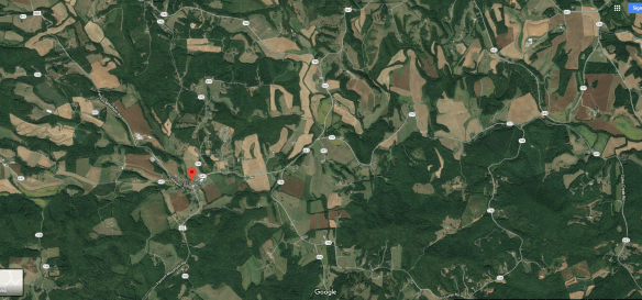
Discovered in 2 locations in Rice, Virginia.

The village of Rice, of course, is Joseph Rice’s plantation.

Rachel Rice amethyst.png

Pretty amazing!

Rachel Rice amethyst 2.png

This specimen was listed with several photos.

Rachel Rice amethyst 3.jpg

Amethyst is a crystal, so this stone has not been cut or faceted.

Rachel Rice amethyst 4.jpg

One location, a farm, was identified, but is no longer owned by the person who owned it at the time of discovery. Yes, I’m very tempted to have a look at the deed books and track his land backwards in time.

Rachel Rice amethyst 5.png

One farm is noted as half a mile east of Rice, and the other as a mile north. Clearly a vein runs under this land.

Depending on the actual location, at least one of these discovery locations could have been on Joseph’s original land and the second on the Atwood land Joseph purchased.

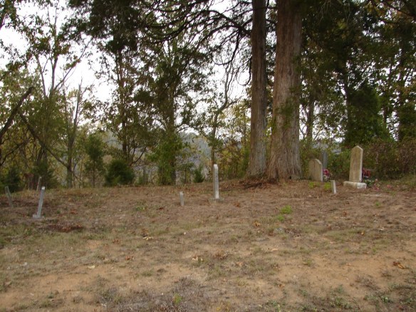
In other words, this beautiful purple crystalline stone peppered the lands of and near Joseph Rice. It probably extended to the lands of James Moore and Matthew Rice too, and of course, Rachel lived there until her death. She is probably buried with amethysts in the soil surrounding her grave.

These specimens were discovered topside, meaning no digging or mining was involved. I wonder if Rachel’s kids used to bring in “pretty rocks” found on the farmland or in the streams. Maybe after plowing revealed treasure buried for eons.

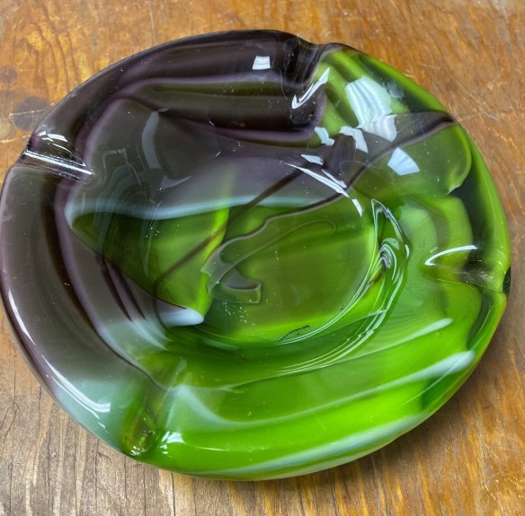
A rock collector died in 2013, and as luck would have it, the large photo above shows the specimen from his collection. It was for sale, but not anymore.

I bought it.

I’ve always loved purple, and amethyst has a long and storied history. Greeks believed Amethyst prevented intoxication. Medieval European soldiers wore amethyst amulets for protection in battle with the belief that amethysts healed people and kept them cool-headed. Amethyst beads have been unearthed in Anglo-Saxon graves in England and Anglican bishops wear an episcopal ring often set with an amethyst, an allusion to the description of the Apostles as “not drunk.” Tibetans consider amethyst sacred to the Buddha. It seems that many cultures appreciate the beauty of amethyst and have woven it into their folklore.

In the Old World, amethyst was considered one of the Cardinal gems, meaning one of the 5 gemstones precious above all others. That lasted until amethyst was discovered in large quantities in Brazil in the 1800s. Between 1746 and 1766, when Joseph owned this land, Amethyst was as valuable as diamonds, sapphires, emeralds and rubies. Indeed, amethyst, if discovered then, would have been more valuable than everything else in the estate put together, including the land.

Just think, Joseph’s sons and son-in-law, James Moore sold this land away, not realizing what they had at the time.

In the Middle Ages, Amethyst was considered royal and used to decorate English regalia including the Crown Jewels.

Rachel Rice sceptre.png

On the Royal “Head of Sovereign’s Sceptre with Cross,” shown above, used during coronations, above the pear-shaped diamond is a huge amethyst surmounted by a cross pattée encrusted with an emerald and small diamonds. To give perspective, that huge diamond is 530.2 carats, so that amethyst must be at least 100 carats if not more. That would probably be about 2 inches across. The diamond is 10 cM long, which is just slightly less than 4 inches long and 2.5 inches wide.

Rachel’s Amethyst

Rachel, you would have been rich beyond your wildest dreams with the precious Amethyst discovered on your land. It would have been like winning the colonial lottery. You could have had enough beds and plates for every family member and a fire tongs too!

Yes, I know this amethyst isn’t of the highest quality, but it’s certainly precious to me. I feel this stone has been waiting for me to find it, thanks to Rachel, since 2013 when the original collector died. My own crown jewel!

Perhaps it was always making its way to me:)

This stone is about 1x1x1.5 inches and I am ordering a special pendant so that I can wear it as a memento and tribute to Rachel Rice.

I name my stones, and Rachel is also the name of my daughter who passed away, so I have a special affinity for this gift from Rachel’s land. I’ve never before had an actual physical gift from the beyond.

Rachel, thank you. This stone is dedicated to you!

Rachel Rice amethyst 6.png

This amethyst is purple, of course, but from time to time the sun glints blue, as you can see in the photo below, reminiscent of the beautiful flax blooms on Rachel’s land.

Rachel Rice amethyst 7.png

______________________________________________________________

Disclosure

I receive a small contribution when you click on some of the links to vendors in my articles. This does NOT increase the price you pay but helps me to keep the lights on and this informational blog free for everyone. Please click on the links in the articles or to the vendors below if you are purchasing products or DNA testing.

Thank you so much.

DNA Purchases and Free Transfers

Genealogy Services

Genealogy Research


Dean Long: Wishing You a Good…Death – 51 Ancestors #253

$
0
0

Dean Long 1970s.jpg

I’ve been trying to figure out how to say this for some time now, so I’m just going to come right out and say it.

I certainly wish you a good life, but I also wish you a good death.

Let me explain.

A quarter century ago today, on Sunday of Labor Day weekend, my much-beloved step-father, Dean Long whom I called Dad, slipped away from us – after removing his own tracheostomy tube.

He took that drastic action because his life, and his slow, tortuous death had become untenable. He was ready to end his own suffering and check out.

Dean Long obituary extract.png

Of course, obituaries never tell us about actions like that. They focus on the positive and the family members – generally saying nothing at all about the final chapters of the person’s life.

Especially if it was less than wonderful.

Dean Long death certificate.png

I assure you, death from “end stage COPD” or slow oxygen starvation is less than wonderful.

Punctuation Marks

Our lives are punctuated by major events – the first of which, of course, is our birth. We have absolutely no control or input over that event.

Throughout our lives, other milestones occur – loves, marriages perhaps, births of family members, deaths of loved ones and eventually, our own passing over as our light winks out.

We do control the intervening events, at least to some extent, by our own choices.

But then, there’s death. We may or may not influence our own death, the cause and or the timing. Death may be sudden and swift, an accident perhaps, or long and lingering. It may be as a direct result of our choices, or not.

Landmarks

Each relationship has its own landmark events. My relationship with Dad was divided into three sections, the first being before he came into my life.

I didn’t know him until I was a tween, and he didn’t start dating Mom until I was a teen.

The transition into part 2 occurred in 1972 when he became my stepfather.

Mom Dean wedding

He had lost his own daughter as an infant who would have been about my age, before his wife’s death, so our unification as a family was a blessing for both of us.

For the next 22 years, our relationship was marked by seasons on the farm and normal family events. I gave him 2 grandchildren, he “gave me away” at my wedding.

Wedding me with Dad

He had faith and confidence in me when no one else did. He told me I could do anything I set my mind to, and I believed him.

The third stage has been since his passing, life without him.

A Personal Demon

Dad lived through hell with the slow, inevitable deaths of his daughter and wife. His only remaining child, a son, had issues that eventually would claim him too.

Dad had chronic health challenges himself, bleeding ulcers, then believed to have been brought on by stress. No one ever doubted that, given what he was living through on a daily basis at the time the ulcers developed.

Dad’s first wife and family were called into a hospital room more than once to be informed of the grim news that he wasn’t going to make it.

Like a cat with 9 lives, miraculously, somehow, he did. But Dad wasn’t immortal, and eventually became his own worst enemy. He ran out of lives and miracles.

Dean smoking.jpg

Dad smoked.

Dean Long smoking ad.jpg

When he was young, smoking was popular and fashionable. We can thank the tobacco industry for that. He was hooked.

Dean Long smoking ad glamorous.jpg

After they were married, Mom quit smoking, but Dad never did. Nicotine is incredibly addictive – the fourth most addictive substance in the world according to American Addiction Centers. Knowing people who have and haven’t kicked the habit, I can vouch for that statement. Even 30 years later Mom said she WANTED to smoke. She just didn’t.

Problems Begin

In the 1980s, Dad began to develop breathing problems. At first, he chalked it up to age and his other pre-existing health issues. By then he was, after all, 60.

He ignored it as long as possible as the symptoms gradually worsened, until ignoring them wasn’t possible anymore. One day in the early 1990s he had an “incident” at home. How my mother who was only a slip of a woman managed to drag him out of the house, shove his limp body into the car and drive the 25 miles or so to the nearest hospital emergency room is beyond me, but she did.

There was little hope. Mom thought sure he was dead and alternated between yelling at him not to give up and praying as she drove like a bat out of hell.

In spite of his condition, the ER staff revived him – barely. He remained hospitalized for weeks, and when finally released, he hadn’t had a cigarette since that fateful day.

He was told that if he stopped smoking permanently, as in didn’t start again, he would probably have several good years left, but if he did not, he would die of COPD, Chronic Obstructive Pulmonary Disorder, then known as Emphysema. I’ll spare you the photo, but if you’d like to see what lung tissue of a smoker with COPD looks like, click here.

It’s no wonder he couldn’t breathe.

Back to the Barn

Dad was a life-long farmer, and even though he had officially been “retired” for years, unless the farmer moves away from the farm itself, they never really retire.

Dad leased the land to his nephew, but he still kept his workshop at the barn which was his regular respite from all things worldly.

It was also a place where Dad could smoke without anyone knowing. Except of course, we did know. The smell gave him away.

He wound up in and out of the hospital for the next year or two, always swearing he wouldn’t smoke again, and always doing it anyway.

Labor Day, 1994

My life was a mess in 1994, from one end to the other. Every way imaginable – in addition to Dad’s illness.

My (now former) husband suffered a massive stroke in June of 1993, but hadn’t died. I was supporting the family and trying to earn enough to pay his gargantuan bills, PLUS being the caregiver for a severely disabled husband who could never be left alone, not even for a minute.

In early summer, not long after Father’s Day, Dad became ill again. The routine was disturbingly familiar – the hospital, intensive care, tubes, machines endlessly beeping and sleep-deprived prayers.

A few weeks later, Dad was sent to a “rehab hospital” where it was hoped he would recover enough to go home, or at least to a nursing home.

Dad wasn’t improving this time. Mom said he was getting worse and it didn’t look good. She was a wreck. Mom and Dad both needed me.

My friend who was a nurse came to stay with my husband so my daughter and I could go and visit Dad one last time. My son was at college and headed for the hospital directly from there.

Dad had been on a ventilator to assist his breathing, but a permanent tracheostomy was installed during his hospital stay, causing him not to be able to talk.

Dad, quite irritated with the trach, and that he was still alive and miserable, was done with both – and removed his own trach tube.

How he managed to find enough strength to do that is also beyond me – but he was one determined man, and he did.

That event in the rehab hospital caused him to be sent back to the regular hospital where he refused all treatment except for comfort care.

At least now he could talk to people.

The family had gathered and we were sleeping in shifts on the floor in the family lounge, taking turns sitting by his side. As the sun rose on Sunday morning of Labor Day weekend, Dad drifted in and out of fitful sleep. My daughter and I had not left the hospital in 2 days and we needed to go to the farm to take a shower.

Dad hadn’t yet passed away – in spite of removing his trach. Maybe there really was at least a glimmer of hope.

We told Dad we’d be back in an hour. He tried to make a joke about how difficult it was to die and how he wasn’t doing a very good job. My eyes filled with tears to see him that way, so small and weak and vulnerable, yet still trying to be jovial to make us laugh.

A man of very few words who rarely expressed emotion, he told us he loved us. That should have clued me.

As I walked into the farmhouse 20 minutes later, the phone was ringing. There was no need to go back to the hospital. Dad was gone. He had chosen his time and departed.

We turned around and went back anyway, for Mom.

Apparently, Dad was waiting for us to leave because he knew how upsetting it would be for my daughter and me to see him pass. He told Mom as much. Then he shut his eyes.

His last act on this earth was one of generosity – even in his death.

That was the story of those 22 years I spent as his daughter – he was always thinking about Mom and me.

Thankfully, Mom was sitting beside him, holding his hand, telling him to “go on.”

Somehow, I think he was waiting for me at the farm that day, by the time I arrived. I knew he was with me. I was not alone.

His Own Terms

In one way, Dad died on his own terms. He removed the trach and decided enough was enough.

But in another very crucial way, he did not. No one would ever choose to slowly suffocate.

Yes, you could say that he asked for it by continuing to smoke – and indeed he did.

Addictions are like that – you don’t think about the long-term consequences because you’re only going to do it “just this once” to quiet the cravings. Of course, there is always another “just this once.”

But by the time we had arrived at Labor Day weekend in 1994, the only thing Dad had control over was removing that trach tube. There was no turning back time.

Anger, Sadness, Grief

I loved and still do love Dad incredibly, but I was angry with him too. It seemed like his death was so senseless and futile.

He could have lived longer had he only been able to walk away from those evil cigarettes, if not in the early 1970s when Mom quit, then at least later.

But he was unable to do that.

He suffered terribly, and so did we.

I know one thing – if there was anything that could have motivated Dad enough to stop smoking, it would have been me, Mom and my kids. He told me that he felt he had failed us – although we reassured him that he had not and we loved him regardless.

I didn’t, but I wanted to say that he had only failed himself. I didn’t have to. He knew that. I didn’t want him to think I was disappointed in him.

It wasn’t his own death that concerned him, but what would happen to Mom.

Everyone suffered during Dad’s prolonged illness, his actual death, and the ramifications to the family afterwards. Those lasted more than another twenty years – beyond Mom’s death – and his death colored the quality of the rest of her life.

Thank goodness we had those 22 years, less 18 days, together as a family.

A Quarter Century

It’s been a quarter century ago this morning that he left us.

As I ponder this past 25 years, of course I grieve his actual passing and life without him. He was a Godsend to my family. A quiet, inspirational giant of humanity among men.

However, I’m also struck with the sadness and horrific slowness of his death.

In 1990 when my sister died, it wasn’t slow, but quick and sudden. We were shocked and no one except her husband got to say goodbye. In fact, I’m not positive that he did.

I used to think I didn’t know which was worse, sudden departure with no goodbyes or a more protracted exit, allowing goodbyes.

Clearly, there’s a range for everything. No one, but no one wants a prolonged suffering tortuous death. Just as clearly, very few would opt for an impaired life with little quality or becoming a burden on the family.

Some people might prefer a happy medium, with a little “notice” in order to get their affairs in order and say a proper goodbye, whatever that is for them.

We may or may not have influence or control over the circumstances of our death.

Our “affairs” should always be in order.

Wishing You a Good Death

Perhaps the nicest thing I can do for you is to wish you a “good death” when you’re the most vulnerable and no longer in control of your life. Whatever it is that “good death” means to you.

I know what it means for me.

I’ve prepared, well, except for my genealogy which is probably never going to be “done.” I have a lot more research to do, so I hope I’m graced with a lot more time to finish😊

Wills and other documents have been put in place because eventually, we all need them.

I know that the last time I see people may actually “be” the last time I see them – due to either their demise or mine.

Every time we get in the car to run an errand, we risk our lives at some level. I don’t know about you, but I’m not willing to stay home. I accept whatever level of risk is inherent with full comprehension that one day, somehow, someplace, my 9 lives will expire too.

I try to live my life with the understanding that if I get my way, my “good death” will be quick and sudden. Preferably sleeping with a cat or two laying on me, with no one bothered with hospitals and such. That means that one fateful day, an otherwise routine interaction with my family will in fact be their final memory of me. That’s how I’ll be remembered. I always try to keep that in mind and choose my words so that neither I nor they will have regrets.

May you experience a wonderful life, living every day and each experience to its fullest potential. Reaping every opportunity that life has to offer.

And when the time comes, may you also be blessed with a “good death.”

heart swirl

____________________________________________________________________________________________

Disclosure

I receive a small contribution when you click on some of the links to vendors in my articles. This does NOT increase the price you pay but helps me to keep the lights on and this informational blog free for everyone. Please click on the links in the articles or to the vendors below if you are purchasing products or DNA testing.

Thank you so much.

DNA Purchases and Free Transfers

Genealogy Services

Genealogy Research

A Visit to the Ancestral Kirsch and Koehler Homes in Fussgoenheim, Germany – 52 Ancestors #253

$
0
0

My Kirsch ancestors were born and lived in Fussgoenheim, Germany, along with Koehler family members. Recently, a friend, Noél who lives in the US but was traveling to Germany made me a fantastic offer – one I couldn’t believe – or turn down.

Noél offered to drive to Fussgoenheim during a trip to Germany and see if she could find the Kirsch/Koehler houses based on the photos in my blog articles.

Can you believe that? Well, neither could I, especially after discovering that the small local museum was entirely unresponsive and uncooperative. I had heard, for years, that the little museum housed genealogies and photos of the oldest local families as well as the oldest homes. Nope, they said, they know nothing – and then when I tried to make arrangements to visit, crickets.

A year earlier, when another cousin attempted to visit, they also found the door locked and the secrets firmly held. How sad.

I told Noél that I really could not impose on her vacation in that way.

Noél, an avid genealogist, however, was not to be deterred!

“Yes, the minutes are precious, but I can always make time for a fellow genealogist…plus you did help me…”

I can’t even begin to express my gratitude to Noél and her husband.

Historic Fussgoenheim

The article where I published the Kirsch/Koehler photos, taken by a cousin, Marliese, who was raised in Fussgoenheim and sent the photos in letters to a US cousin is titled Margaretha Elisabetha Koehler (1772-1823), Weak Child, Baptized in a Hurry – 52 Ancestors #228.

In early 1948, Marliese, then a teenager, wrote a letter addressed to “Koehler Family of Aurora, Indiana from Marliese in Fussgoenheim,” hoping that it would make it’s way to someone. It did.

In the letter she said:

Hunting through things, I discovered your address and pictures which my grandmother said were her American cousins, her only relatives.

More than a year ago, I decided to write but the thought that my letter might be regarded by you as a begger letter detained me from writing.

After providing additional family information, she closed:

We would be very happy to hear from you, the only relatives on my grandmother’s side.

She signed the letter, “Marliese, granddaughter, niece of Marie Kirsch.”

Hazel Koehler’s father, Henry, then age 79 answered Marliese on August 27th.

Marliese and Hazel wrote back and forth for more than 25 years, with Hazel saving everything, which eventually allowed me to corresponded with Marliese’s daughter briefly a few years ago.

I have never been so grateful for old correspondence. Their letters were immensely helpful, not only with genealogy but to gain historical perspective of both World War II and life in Fussgoenheim during earlier generations.

Fussgoenheim Kirsch home

Please note that in the original article I was uncertain about whether the house pictured above is the Kirsch or Koehler home, but rereading Marliese’s letters, including her address, combined with the address Noél found proves unquestionably that this home is the Kirsch home, not the Koehler home. I’m simply overjoyed, because this home still exists today AND I have photos.

Marliese tells Hazel:

We live in the old homestead of your ancestors, and in Germany the people that live on the farms need not suffer hunger.

Marliese’s letters portray a grim story of the war and the aftermath. I will include snippets throughout this “visit” to put the images in perspective and provide a bit of history about the family that lived in this home during that time.

Fussgoenheim Kirsch Koehler homes 2

In her November 1948 letter, Marliese says:

We still live in the old parental home and birthplace of your father and grandmother, because their house and acres were taken over by my great-grandfather, Jacob Kirsch. Even today some of the older people in the village call him Koehler Kirsch.

Marliese enclosed this identification document that included Jacob’s photo.

Jacob Kirsch b 1842 Fussgoenheim.jpg

Marliese continues:

I am 17 on Christmas Day. My father, Otto, 47, is the son of Marie Kirsch born in 1871, daughter of Jacob Kirsch whose sister Elizabeth married Philip Koehler with whom she immigrated to America. With them was also a brother John Kirsch.

Since my grandmother had no siblings and her father’s brothers and sisters went to America, they were her only relatives. I never knew my grandmother since she died 2 years before I was born.

Jacob, pictured above, is the great-grandson of  my ancestors, Johann Peter Koehler and Anna Elisabeth Scherer. He also descends from my Kirsch line in Fussgoenheim, but I’ve yet to figure out exactly how. Fussgoenheim has experienced record loss, but the Kirsch, Koehler and Koob families are very intertwined and it’s likely that Jakob descends from multiple ancestors in all 3 families, as do I.

Marliese goes on to say that:

The Kirsch family lived ever since 1626 in Fussgoenheim. Statistics which I have obtained which is one of the oldest families and John Kirsch 4th was one of the richest farmers in the area.

Fussgoenheim is about 70 km from France. I went to college where I studied both English and French.

While goods, according to Hazel, were no longer rationed in the US, they were in Germany according to Marliese, and would be for a long time to come.

Fussgoenheim street

In my articles, I always try to give directions so that any future genealogist could follow my path and find what I found. In this case, finding what I thought was the Kirsch home and publishing the location, I did myself a huge, and I mean huge, favor. I just didn’t realize it at the time.

The Genealogy

I pieced together the genealogy of the both Marliese and Hazel from their correspondence and subsequent documents. When Marliese first began writing, she had to depend on the memory of her parents, and needless to say, memories had faded with time. Eventually, she did obtain some documents from the town hall as well as a Koob descendant whom she describes as an old neighbor boy Walter Schnebel, and unraveled a bit more. Walter is reportedly writing a book.

Sometimes Marliese referred to people by thier nicknames which really threw me for a loop, necessitating piecing several clues together. Not to mention that names were recycled generation after generation, of course.

I won’t be including a lot of genealogy, but for reference and documentation purposes, I’m providing their trees.

Marliese's grandmother Kirsch's line

Marliese’s grandmother’s Kirsch/Koehler line. Marie was born in the Kirsch house in Fussgoenheim. Click to enlarge.

Hazel's Koehler Kirsch line

Click to enlarge. Johann Peter Koehler was Hazel’s grandfather, born in Fussgoenheim.

Roberta Kirsch Koehler tree

Roberta’s Kirsch/Koehler line. Click to enlarge. Philip Jacob Kirsch was born in Fussgoenheim.

Noél’s Trip

I tried to schedule an appointment at the museum in Fussgoenheim, with no luck. The people I was referred to never replied, and then neither did the original contacts. Very frustrating and not very welcoming.

Noél’s trip was imminent, so I crossed my fingers and hoped for the best, meaning that she could find something, even without local assistance. Frankly, I wouldn’t have blamed her one bit had she thrown in the towel at that point.

I waited to hear. I tried not to worry.

A month later, late one night, an email arrived from Noél, where she says:

Let’s start with the “not good” news.

My heart sank.

The museum in Mutterstadt is only open by scheduling an appointment in advance which we found out today at the Rathaus. So that was a bust. 😠 We tried to visit the library in Fussgöenheim in the hope of finding more information on the two families. Only open on Tuesday from 3-6 and Thursday 4-7  😔

By the way, the Rathaus is the city hall – the same place I had called and written trying to schedule someone at the museum. They aren’t open without an appointment, then refuse to schedule one. Yes, I’m still salty about that.

Now on to the good news.

Holding my breath now…

Your Google Earth research was positively spot on. And we have a huge number of pictures for you. However, they are locked in my camera until we can download them so I took a number on my cell phone to hold you over until we return.

Jumping for joy!!!!

Noél is apparently aware of my (ahem) ancestor-rock-addiction.

There were no rocks for me to grab at the Kirsch home but there were a number of rock-shaped pieces of stucco (that had fallen off the house) so I grabbed one for you.

Fussgoenheim stucco.jpg

This piece is large marble size – about three quarters of an inch.

You will be happy to know that I was able to walk beside the Kirsch home to take photos. Look at what is on the second floor in that picture…wonder if it came with the house???

Enjoy the pictures and I’ll send a ton more when we return. Let me know if you have any questions. FYI the house number for the Kirsch house is #9.

Then…drum roll…the photos!

The Teaser Pictures

Fussgoenheim-Kirsch-home-2.jpg

I am literally feasting my eyes.

Fussgoenheim-Kirsch-3.jpg

Click to enlarge

If you compare the original Marliese photo, you can see the “door in the door” above that was standing open in the photo from the 1930s or 1940s.

Fussgoenheim Kirsch wall.jpg

It looks like the house that Marliese marked secondly as the Koehler home is gone today and is where there is a gate in the wall between the two homes. I wonder when that happened.

Noél tried to find someone at home, but no one answered.

Fussgoenheim-Kirsch-garden-2.jpg

However, look at this beautiful garden area at the Kirsch home today.

Fussgoenheim Kirsch antiques.jpg

And this! THIS! Be still my heart. Were these items from the original house? Did my ancestors own these? What is that area beneath the roof and above the wall? Was it originally the barn and held these items? Marliese did send a grainy photo with her father driving a tractor, so it would have been housed someplace.

Fussgoenheim-Hauptstrasse.jpg

Looking at the Kirsch home from down the street. I still can’t believe I actually found it on Google maps, and Noél found it too.

Fussgoenheim-neighbors.jpg

The neighbors, further down the street. I can’t help but wonder if more relatives lived here. Of course they did! We just don’t know who they were.

I was ecstatic to receive these teaser photos, but there was much more on the way a few weeks later!

More Pictures

One rainy day when I desperately needed something uplifting, Noél’s envelope arrived, plopped down on the doorstep in the rain by the mail carrier. Thankfully, Noél had packaged things carefully.

I found these things inside:

  • A thumb drive with pictures
  • A small box with my stucco piece that had fallen from the Kirsch house
  • A guided tour with the photos printed in order that they had been taken

She went to a lot of effort on my behalf. Shall we accompany Noél?

Welcome to Fussgoenheim

I can’t tell you how excited I am!

Fussgoenheim has existed since at least 893 when a list of goods is found in the records of the Prum Abbey. Jerg Kirsch, born about 1630, is reportedly already in Fussgoenheim in the first records and noted as “mitpichter des Sankt Jopten Altargutes,” which I’m told translates to someking akin to “land church tenant.” Another researcher indicated that he was co-tenant of the Josten estate.”

Marliese, who had access to far more records than I do, indicated that the Kirsch family was in Fussgoenheim in 1626.

There may well have been another 800 years of ancestors living right here before Jerg. The first population details were recorded in 1560 when 150-200 people were living in Fussgoenheim. Today, there are about 2,500.

Fussgoenheim-sign-2.jpg

Looking at this sign, I surely wonder if any of my ancestors were here in 893. The town is reportedly in the process of publishing a book by Walter Schnebel, but I’m not holding my breath.

Fussgoenheim Ruchheimer and Hauptstrasse.jpg

Noél found the Rathaus at the intersection of Ruchheimer Strasse and Hauptstrasse.

Fussgoenheim-Rathaus.jpg

Around the corner, the library, also closed.

Fussgoenheim library.jpg

Not to be deterred, Noél and her husband went on to find the Kirsch and Koehler properties.

Fussgoenheim intersection Ruchheimer Hauptstrasse.jpg

Again, the intersection. To find the Kirsch home, Noél would turn to the right.

Fussgoenheim corner.jpg

They found the street.

Fussgoenheim-home.jpg

The older homes have the large doors which function as car doors, driveways and gardens today. Historically, the houses in the village were all joined for protection and defense – so these doors opened into work areas for the homeowners who were farmers and craftsmen. The fields were located behind the homes in very long narrow plots.

Fussgoenheim aerial fields.png

Here’s an aerial view with the top red arrow pointing to the intersection and the lower red arrow pointing to the Kirsch home. Note the fields to the rear of all of the properties.

Marliese’s mother wrote to Hazel in 1949:

You asked why our houses are so close together. Our ground is so rich that a farmer with 32-40 acres is considered a rancher of high standing. In normal times, a farmer with 8 to 12 acres can live solely off the crops which he can raise. The fields of various sizes are situated about the village and all is bottom land (not hilly.)

Then she adds:

When the war broke out, we could not buy enough to eat. We raise mainly vegetables and cannot raise livestock so must buy our draft animals.

My father’s sister’s only son just returned from Egypt where he was an English prisoner all this time. Now he’s 28.

Fussgoenheim Hauptstrasse 2.jpg

Many of the large doors open into a courtyard today. Most seem to be a car door with a person door included.

Fussgoenheim Hauptstrasse distance.jpg

Look! Look! I can see it, on the left just beyond the pink buildings in the distance!!!

Fussgoenheim Kirsch on Hauptstrasse.jpg

Here it is!

Fussgoenheim-Kirsch-front.jpg

Just look at that! The large door is almost as large as the house and is as large or larger than the portion of the building to the right of the door. I surely wonder what is inside today. The window in the right part is entirely shuttered and the ones on the second floor of the part on the left too.

Fussgoenheim Kirsch garden designer.jpg

Garten Testaltung translates into garden design. A gardener – how fun.

Fussgoenheim Koehler wall 2.jpg

To the right of the house is the garden wall where the old Koehler house used to stand. The extremely frugal Germans hardly ever tear anything down, so I wonder what happened to that building. Other buildings of the same age are being lived in and are well-maintained.

Fussgoenheim-Kirsch-Koehler.jpg

You can see that the house in front is gone, but several buildings to the rear remain.

Fussgoenheim Kirsch Koehler

It’s obvious in an aerial photograph too.

Fussgoenheim-Koehler-neighbor-house.jpg

Driving on down the street and looking back. I wonder what the difference was between the houses with the roofs with and without that little triangle shaped divit in the front. Maybe built at different times, or socio-economic class perhaps. The tallest buildings had more windows in total and 3 rounded ones.

Fussgoenheim architecture.jpg

Why are the upper windows small and rounded on top?

These are the kinds of questions the museum or local historian might have been able to answer.

Fussgoenheim-craftsman-homes.jpg

The sign on this house translates into “installer and heating builder master plant.” Another house with a large door that connects two buildings on the same plot of land.

Fussgoenheim door.jpg

I love those old wood doors. I wonder how old that wood is.

Fussgoenheim-Kirsch-windows.jpg

The Kirsch house has only one small rounded window, while some of the larger homes have 3 and an extra story.

I’ve also wondered when people who lived here obtained amenities like sewers and electricity. In one of Marliese’s letters, she said that they had electricity since 1910 in Fussgoenheim.

Interestingly, she also mentioned in that same letter that the family all has dark hair. So did our Kirsch line.

As Marliese chattered about the family, more than once she mentioned that people often didn’t talk about family members who “died young.”

Anna Maria Kirsch had a daughter, Maria Katherine (1825-1862) who was married to Carl Ritthaler who later moved to Maudach after his wife died. They had a son, Peter, born in 1860 and his name was Peter Ritthaler and now I hear that my uncle’s son-in-law came from Maudach. He said yes, his relatives came from Fussgoenheim and that his father who died 3 years ago was Peter. He said his grandmother was Koehler but she died young. He said he had a godfather in America but he doesn’t know much about it because his father talked little about it.

Taking a Walk

Noél was able to walk along the left side of the house.

Fussgoenheim-Kirsch-left-side.jpg

Note the corner where the stucco has been repaired. That’s your anchor point for the next few photos.

Fussgoenheim-Kirsch-corner-stucco.jpg

The wall of the Kirsch house. In the photos from the 1930s or 1940s, another house stood up against the Kirsch home on this side.

Even after the war ended officially, times were very difficult for German citizens. It was to this home that Hazel sent gifts to Marliese and her family who were terribly embarrased about their economic situation resulting from the war.

In a letter in 1948 titled, “To Our American Family from Your German Family,” Marliese’s mother writes to Hazel:

Thanks for that rich package to our Marliese which you have sent her. Marliese has never had these things because she was only 7 when the war broke out. We know them only by name.

However words fail me to say the things I should and feel because the knowledge of knowing we are not in a position to repay you.  No words can express the happiness which you have bestowed upon our child and none of us could keep back our tears of happiness to see her as happy as she was.

It is hard to select which item has brought her most happiness. Take for instance the nylon hose which is only a dream for younger girls over here. And solemnly she tells everyone that this treasure, her nylon hose, she will only wear on very rare and special occasions.

And then the chocolates and sweets; this also is treasured very highly. To prove it, Marliese and her father are fighting a civil war, because every time she checks upon the contents, somehow it has diminished. Questioning her father, he had to admit getting into it. He too is very fond of sweets. His excuse is that he has more of a right to take a piece now and then; so he says that his relationship is much closer than hers. This brought laughter and all was forgiven.

It is true that all the food things which you have sent have made us very happy but you ought not spend money on us. We do not go hungry. Of course it is impossible for us to obtain the things that you have sent. In years past we have learned to restrict ourselves of luxuries and delicacies.

You can imagine how happy it made us to receive your first package on Christmas Day, which is as you know Marliese’s birthday. She was ready to go to church Christmas morning as the mailman came. He said “Santa Clause from America is here.”

It fills my heart with joy and from the bottom of my heart I wish to thank you for all the happiness you have bestowed upon our Marliese. Actually you don’t even know her. I want to take the opportunity to introduce you.

Marliese as a child has filled our hearts with happiness. She was and is a good girl as well as brave. In school she was a top scholar. Her vocabulary is wide, therefore we sent her to college. There again she was one of the best scholars. The sad thing, however, is that we had to curtail her studying.

Financially we became embarrassed but most of all we needed her help at home.  Physically, I am not too well. It was a hard blow to her as well as the professors, but it could not be helped and now she is a very able hand in the house as well as in the field. Her heart however, is still on studying to further broaden her. Any problem that occurs here in document or writing or just plain figuring, it is Marliese who does it. Therefore it is more helpful and interesting to her when you write to us which is a change when she can answer your letters.

The prisoners of war who returned compared American and German farming.  Everything in America is mechanized but over here we must farm day in and day out. Between March and November we spend all our time in the fields and housework is much neglected. Only on Sundays we were allowed to catchup a bit. It is definitely not a nice life to live. It is very trying and tiresome. Farming is since June 1948 due to the stabilizing of the dollar(?), one of the most essentials. We have two hired hands, plus 4 by day in the summer. This last year we have had to do with one hand only and do the rest of the work ourselves.

Perhaps some of the space in the second building, to the rear and in the lofts was for the hired hands.

Fussgoenheim-Kirsch-left-wall.jpg

The windows would have been added since that time, perhaps when the neighbor structure was removed. This tells us that these buildings or additions to the Kirsch home were originally built before the neighbor house was demolished, and probably long, long before.

Obviously, even though the houses are built against each other, they do have separate support, framing and walls because the houses on both sides of the Kirsch home have been removed and this house still stands. I wonder how many hundreds of years old it is and what records might still exist.

Fussgoenheim Kirsch left wall 2.jpg

It looks like the Kirsch home has been expanded several times. The windows on this side look to be glass bricks, but the bricks in each section are different from each other.

Fussgoenheim Kirsch left wall 3.jpg

It looks the fourth addition has a more modern square roof on top. I’m reminded of the farm houses in the US. My Dad used to say you could always tell when it was a good year because houses had room additions and new barns.

Fussgoenheim Kirsch left wall 4.jpg

Notice the pink neighbor building butts right up against the Kirsch home. In some places, the stucco has fallen off and you can see the original brickwork.

Fussgoenheim Kirsch bricks.png

The bricks below are exposed on the front portion of the building at the driveway. We know this portion of the house was there when Marliese lived here, and her ancestors before her. These bricks below don’t look like they were laid with mortar. I can’t help but wonder if descendants still own this property, but I have a vague memory of Marliese’s daughter saying no.

Fussgoenheim Kirsch old bricks.png

Ok, let’s go back out to the street.

Fussgoenheim Kirsch exit.jpg

I must say, the building between these two wasn’t very large, only wide enough for a driveway now. However, as we’ll see in a minute, that wasn’t terribly unusual.

In the vintage photos, one man was wearing an apron that looked like a butcher’s apron, which might explain the need for a separate building that didn’t need to be very wide. Craftsmen in these villages practiced their trade where they lived.

Fussgoenheim Kirsch neighbor.jpg

Between the buildings, you can see another yellow heritage home across the street. I wonder who lived there when my ancestors lived here. Given that both the Kirsch and Koehler families married heavily into the Koob family, they surely lived in very close proximity.

Fussgoenheim Kirsch sidewalk.jpg

The sidewalks are new, of course. In the vintage photos, they look so to be quite uneven cobblestones, probably constructed at different times, then patched – the goal being mud reduction.

All of the buildings have the dark brown area at the bottom front-facing – both then and now. I wonder what it is and why. This one looks to be metal. Are the spaces vent holes?

Marliese’s father, Otto, may give us a clue in a letter he penned to Hazel on Christmas Day in 1949.

All through the war we lived in constant fear and danger day and night. We had air raids due to the fact that we live right in the vicinity of the two cities of Ludwigshaven and Mannheim.  Night after night we live in our basements in order to get some sleep and again today that fear of constant fear and hardship has arisen from the east (Russia) and we are praying to god to spare us from this danger. We are very well informed what communism is because our boys had fought in Russia and have felt with soul and body the principals of communism.  Thank God I was not a soldier but a factory worker.

This tells us that there is a basement in this house, so these must be basement windows of some sort. I wonder if basements were originally included as safety for the family. Germany has a very long history of warfare and invasions.

My ancestors stood and walked here on these streets. They were born and died here. Generation after generation for at least 400 years – in tough times and those that were prosperous.

Marliese Gets Married

Marliese never got to return to college. The war interrupted so many lives and plans.

By 1951, Marliese was able to send some things to Hazel from Germany, which pleased Hazel to no end. However, for some reason, they were prohibited from sending glass items.

I was very touched in 1954 when Marliese invited her “Aunt Hazel” to her wedding, a love-struck young bride.

Aunt Hazel was greatly appreciative, but unable to attend. Today, we hop on planes with barely a second thought, but not then.

In 1959, Marliese tells Hazel that they are paying her generosity forward by sponsoring two families in the “East Zone” of Germany.

Marliese and Hazel became fast friends, even though Hazel was more than 30 years older then Marliese. They shared news of births and deaths, and at one time, some 25 years later, recapped their quarter century of being enmeshed in each other’s lives. They had met when Marliese’s family was in great need and had seen each other through immeasureable joy and grief as family members arrived on and departed from this earth.

About 1974, Hazel writes, chatting about her cat, then:

So much has happened in 25 years.

Mama, Papa, Papa’s sister Blanche, Papa’s 2 sisters Aunt Anna Metzger and Aunt Laura Littell, cousins Harry and Earl Littell, and Dan Metzger have all passed on.  Also Papa’s half sister Aunt Minnie Gerlach also his 2 half brothers John and George Koehler.  Only one half brother left Herman Peter Koehler who lives in Florida.

Over there in Germany your father and grandfather were gone and you were 17.  Now you are married with 6 children. I hope your mother is well.  I have kept all your letters and pictures.

Marliese’s father and grandfather died 5 weeks apart and the grandfather lived with them in the Kirsch home.

Eventually, in the mid/late 1970s, Marliese shared with Hazel that her daughter was in the US and through another of her children had an 8 month old grandchild.

Marliese’s mother still lived in the Kirsch home in Fussgoenheim and I believe Marliese and her family did as well. Eventually, they all moved.

In 1977, Hazel wrote to Marliese’s daughter in the US. The torch was passed to yet another generation.

Hazel, who never married, told Marliese that she went every week to visit the Riverview cemetery in Indiana where her father, as well as Anne Marie Kirsch are both buried. Hazel said Anne Marie Kirsch Koehler (1804-1888), who immigrated as a widow after Martin Koehler died and remained that way the rest of her life, was the 7th person to be buried in that cemetery. Anne Marie was baptized as Anna Margaretha – Anne Marie was her family nickname.

Marliese continued with her interest in genealogy over the years, in spite of having a large family with at least 6 children. In a letter written some time after 1975, she said:

The ancestors left Germany because it was a time of need.  A lot of hard work and little money.

I had always wondered what prompted Philip Jacob Kirsch and several family members to undertake that journey, especially knowing there was no going back or seeing anyone left behind.

Marliese also mentioned that the French destroyed some of the records at some point, so the regions genealogical records are incomplete. I’ve since discovered the same issue.

It seems that the history of Germany is steeped in both warfare and economic ebb and flow.

The Koehler Family

By comparison, the Koehlers who lived next door, were relative newcomers.

Marliese writes to Hazel on her 17th birthday, Christmas Day, in 1948 saying that soap is a luxurty and simply cannot be obtained in Germany. She says she can’t remember the last time she ate chocolate. Chocolate and cocoa weren’t available at all for most of the 10 year war, “but they are “now” but are very expensive.” Too expensive for Marliese’s family.

She says they have been very busy laboring in the fields and she had to leave college to assist.

Marliese is embarrassed about their poverty and accepting gifts when she can return nothing. War was a decade of hell, encompassing almost all of lifetime that Marliese remembers. Families turned to God and the church, because their faith was often the only thing they had to sustain them.

We are praying to God that He may save our homeland for ourselves, because He would know the approximate time of another war involving our vicinity.  We would pack up and leave.  Maybe we are forced to leave and now I wish you a very happy New Year.

And then, Marliese shifted gears and told us this tidbit.

The old Koehler homestead is not in Fussgoenheim, but is in Rheingoeheim, exactly 8 miles from Fussgoeheim. There are many people there with that name. Our great-grandmother came from there with that name. My mother remembers that her great-grandmother had relatives in America, but cannot remember particulars. I wonder if we are also related on my mother’s side.  I am trying to find the birthplace of Martin Koehler.

In July 1939, Marliese added this:

My father belongs to a singer society and one day when he was coming home from a rehearsal he told me that Martin Koehler, your grandfather, is one of the charter members. He verified it by explaining a large picture on which were all charter members and others that had joined is proudly hanging on the wall of the home of the Society. The picture is in the form of a tree and Martin Koehler is one of the roots as a charter member. And my father is one of them.

We had been told that Martin Koehler, my father’s grandfather was a music teacher and it must be the connection he had with this society and being a charter member, where the folks got that idea.

Not long ago I was told by an old woman that we are related to you on my mother’s side. My mother’s great-grandmother was Barbara Koehler and hailed from Rheingoehheim and now I have found out that Rheingoenheim and Ellerstadt are the same line and clan.

That tidbit about the Rheingoenheim and Ellerstadt families is quite interesting, because those villages aren’t exactly neighbors.

Fussgoenheim Ellerstadt Rheingoenheim

I don’t find the Koehler family in Rheingoenheim, but across the Rhine in Seckenheim in older generations. Rheingoenheim is between the locations, so that makes sense.

Fussgoenheim Ellerstadt Rheingoenheim Seckenheim

Johann Peter Koehler was born in 1723 and died in 1791, in Ellerstadt. However, at least some of his children moved to the neighbor village, Fussgoenheim. Johann Peter’s daughter, Margaretha Elisabetha Koehler was born in Ellerstadt, but she married Andreas Kirsch of Fussgoenheim.

The Koehler home belonged to Johann Martin Koehler and Anna Margaretha Kirsch. I don’t know if Marliese ever found this informatoin, but Martin was born on October 23, 1796 in Ellerstadt. In 1821 he married Anna Margaretha Kirsch, the daughter of my ancestor Andreas Kirsch and his wife Margaretha Elisabetha Koehler who lived next door in the Kirsch house.

Margaretha Elisabetha Koehler was the daughter of Johann Peter Koehler and Anna Elisabetha Scherer of Ellerstadt. Johann Peter and Elisabetha were the grandparents of Johann Martin Koehler. These 2 families began intermarrying and continued for several generations.

After Johann Martin Koehler, a musician, died in 1847 or 1848, Anna Margaretha Kirsch Koehler immigrated to Dearborn County, Indiana with her 3 sons and her brother, Philip Jacob Kirsch’s family.

Ironically, Philip Jacob Kirsch’s son, Jacob, born in Mutterstadt Germany in 1841 founded an establishement in Aurora, Indiana called “The Kirsch House.” Of course, I think fondly of this home in Fussgoenheim as “The Kirsch House” too – the original one.

The Kirsch House

So many of my ancestors lived in this this very house, looked out of these windows and touched this wood. Some, their identities, unknown today, probably roofed this structure with baked ceramic tiles centuries ago. Others passed by and married into the Kirsch family. In a small village, everyone knew every person who lived in every house. There were no strangers and few secrets.

Fussgoenheim Kirsch Koehler ancestors.png

The ancestors blocked above in red we know lived or died in Fussgoenheim. The red stars we can probably safely assume did. Johann Peter Koehler lived in Ellerstadt, the next village over, just two miles up the road, but you know he visited his daughter and several of his other children who married in Fussgoenheim.

The Koob family also figures prominently in both of these families, so I wonder if the Koobs lived in one of the neighbor houses in the pictures.

Fussgoenheim Kirsch home looking up.jpg

Looking up at the Kirsch home as we walk past. These two families were surely in and out of both houses as if they were one.

Noél was able to photograph the garden area of the Kirsch home.

Fussgoenheim-Kirsch-antiques-2.jpg

Those are incredible wagon wheels, crocks and lanterns! I see a plow, I think, a yoke for oxen and so many other pieces of memorabilia. Horseshoes, baskets and harnesses. Noél’s camera took amazing, clear, photographs and I was able to zoom in for a great view.

Fussgoenheim Kirsch garden 2.jpg

Facing the home, at right is the smaller building to the right of the main large door, and indeed, that large brown door is access to the alleyway between the two structures for parking. The actual house doors open into this garden/driveway area.

I believe the wooden gnarly thing beyond the small tree in the very corner of the photo to the left is an old grapevine.

Fussgoenheim-Kirsch-garden-6.jpg

Person after my own heart – a rock on the steps.

The carved or cast stone basins are watering troughs.

Fussgoenheim Kirsch garden 7.jpg

A millwheel and a barrel, along with more wagon wheels and a broom.

Fussgoenheim Kirsch garden 5.jpg

Goodness. Baskets and bells and tables and chairs and stumps, plus a garden gnome of course.

What a beautiful way to decorate a small space.

The Koehler House

Stepping back onto the sidewalk, the building to the right, above, is the small structure to the right of the large brown door when facing the building from the street, with the one window, before the garden walls starts, below.

Fussgoenheim Koehler wall 3.jpg

The wall is where the Koehler home used to be.

Fussgoenheim Koehler tiles.jpg

I wonder if the building in back of where the Koehler home stood is original or new.

Fussgoenheim-Koehler-building.jpg

I think it looks to be newer, based on the windows.

Fussgoenheim Koehler garden.jpg

Noél was able to see over the top of the gate.

Fussgoenheim  Koehler garden 2.jpg

The right side of the structure behind where the Koehler house stood.

Fussgoenheim Koehler garden 3.jpg

Like all of the old homes in this village, it seems to be a combination of living and work space.

Fussgoenheim Koehler garden 4.jpg

This property today looks possibly to be a combination of 2 earlier properties.

Flooding

I’ve wondered if historically this area flooded. The buildings seem to have some moisture-looking damage at ground level, and the fronts all seem to be “buffered” in some way for a foot or two above the sidewalk.

Marliese wrote to Hazel sometime in the spring of 1949.

Last year in a calendar from our homeland, the Pfalz, I read that many years ago families by the name of Hohenbacher from our town as well as the Pfalz immigrated to America as well as did hundreds of other families. They homesteaded in different states and so it came while reading in the calendar I found Aurora, Indiana. I found a street in Aurora named Hohenbacker. Is that so? I had to write to you and have been so happy to receive your letters.

We live 10k from the Rhine, so don’t have to fear a flood. It used to flood, but it is dammed in its banks.  When your grandmother was here, there was still the danger of high water or floods, but not now.

Aunt Hazel, in your letter to asked me my wishes. Well, this is a little bit embarrassing. I do not want anything. I cannot see that I should burden you with things that are costing money. I am happy that I can write to you and get an answer from you. We have lived through so many years of war and had to make the most of it and better times I do hope are ahead. Direct hunger, we have not, because we always have our bread and potatoes. We are managing and make the best of it with our clothing. We have learned to be satisfied and I am not reared to live in luxury. At the beginning of the War, I was only a little girl. We could not purchase anything and so all clothing for me was retailored from my mothers and grandmothers. Today it is not quite as bad. We are able to purchase the most essential things, but all goods and materials are expensive but cheap. We still do the best we can and only buy when necessary and so again I would like to say it would only hurt me to know you have to spend money on me. If I only knew that times would get better and I would be in a position to repay you, then I would say that I would be happy and pleased over most anything to say outright I need everything, but this I only whisper to you for I am so afraid that you would be sorry you had answered by letter and the greatest heartache for me would be to stop corresponding with my aunt in America.

We take so much for granted today. Eventually, Marliese was able to send a cuckoo clock to Hazel for her father, but sadly it arrived after he died a tragic death.

Hazel was so pleased to be able to send gifts to Marliese and her family that brought joy.

Ancient Homes

Fussgoenheim Kirsch goodbye.jpg

The Kirsch and Koehler homes were probably some of the oldest houses in Fussgoenheim, situated a few houses from the Rathaus where government affairs occurred, and the present-day library is located.

How do we know these buildings are ancient?

According to Fussgoenheim history, until the 1800s, only the eastern route consisting of Hauptstrasse, translated literally to “main road,” and Ruchheimer Strasse was populated.

Fussgoenheim map.png

The settlement in Fussgoenheim of many peasants, craftsmen and merchants led to a significant population increase in the first half of the 1800s from about 500 inhabitants in 1815 to about 1000 in 1840.

The 16 members of the combined Kirsch and Koehler family left for Indiana on June 14, 1847 from the port of Le Havre, according to the Mutterstadt, Germany civil register which recorded the date. The entire town of both Mutterstadt and Fussgoenheim must have turned out to say goodbye as a wagon loaded with their worldly possessions began the 450 mile overland journey to the port of LeHavre where they would board a boat to cross the Atlantic. A year and three weeks later, on July 4, 1848, they would finally arrive in the port of New Orleans, to board a paddlewheeler that would paddle its way up the Mississippi and Ohio Rivers, arriving in Aurora, Indiana a couple weeks later where they may have had family or friends waiting.

Aurora was very similar to the Rhine valley where the Kirsch family had lived for countless generations.

Growth and Expansion

It wouldn’t be until about 1950 that the population of Fussgoenheim reached 1500 according to official records, but Marliese said in 1948 that the population was about 2500.

During the growth period beginning in the early 1800s, settlement expanded in a westerly direction because the steep slope on the eastern border constituted a problem.

The Kirsch and Koehler homes reach far back into antiquity, probably predating the Hallberg Castle, built by Jakob Tillmann von Hallberg just down the street from the Kirsch home in Fussgoenheim in 1740.

Fussgoenheim Hallberg Castle.jpg

Jerg Kirsch predated Jacob Tillman in Fussgoenheim by more than 100 years.

While the Kirsch and Koehler families were craftsmen in the 1800s, we don’t know much about their lives in the 1700s. Jerg’s son, Johann Michael Kirsch, my ancestor who died in 1743 was noted as a court member or juror. This could well have been where he served!

It’s likely that many if not most of the village residents who lived along Hauptstrasse worked for the wealthy Hallberg family, including the Kirsch family who lived at 9 Hauptstrasse and eventually the Koehler family at 11 Hauptstrasse. The castle was only a 5 minute walk away.

Fussgoenheim Kirsch 9.jpg

Even the Kirsch house number is decorated with horseshoes constructed to look like a flower – a lovely wink to the past. I so wonder if these were salvaged from the barn.

Fussgoenheim Koehler 11.png

House number 11, the Koehler home, or where it was, well, let’s just say it’s not what it used to be.

Given the smallness of the village and how few homes would have existed – it’s very likely that other ancestors lived in these houses in earlier generations as well. If a village had 500 inhabitants, and each family had 10 members, that’s only 50 homes in 1815 and 100 homes by 1850. We could probably look at the church records between 1750 and 1800 and figure out who those 50 household (500 people) around 1800 would have been.

I suspect that by the time records began to be kept, everyone was already related. In the 1800s, everyone was literally related to everyone else. By that time, the Kirsch family had been there for at least 200 years, roughly 8 generations of intermarrying. Maybe the Koehler bloodline was a welcome addition, although somehow I’m thinking that a village only a couple miles away was also quite interrelated.

Saying Goodbye

Alas, it’s time to say goodbye to the Kirsch home and where the Koehler home once stood.

Fussgoenheim Koehler Kirsch goodbye.jpg

Will this house still stand in another century, given that the houses on either side have already passed into memory sometime in the past 75 years? It’s difficult to maintain a vintage home.

If they don’t, Marliese and now Noél will have preserved at least a part of this wonderful home’s legacy for future generations. I can’t say a large enough thank you to Noél for her extremely generous gift.

Fussgoenheim aerial.png

My heart is touched to be able to visit, through Noél, this beautiful home in the quaint village of Fussgoenheim, a medieval farm village sewn into a patchwork quilt of fields in the German countryside.

A place where the land is nourished with the ashes, and DNA, of generations of my ancestors.

Ancestors Stories

If you’d like to read more about this family, I’ve written the following individual stories and there are more to come:

______________________________________________________________

Disclosure

I receive a small contribution when you click on some of the links to vendors in my articles. This does NOT increase the price you pay but helps me to keep the lights on and this informational blog free for everyone. Please click on the links in the articles or to the vendors below if you are purchasing products or DNA testing.

Thank you so much.

DNA Purchases and Free Transfers

Genealogy Services

Genealogy Research

Hot on the Trail of Elizabeth (c1720 – 1758/1782) Ulrich’s Parents, Thanks to Mitochondrial DNA – 52 Ancestors #255

$
0
0

I’m so close to discovering the identify of Elizabeth Ulrich’s family that I can taste it – but I’m not quite there. Maybe you’re the person who has the critical piece information that solves this puzzle.

I’m looking for several things – and any single one would help:

  • Information about the Heinrich Angle (Henry Angle or Engle) family of Pennsylvania and Maryland in the 1700s. There’s more information about this mystery man later in this article.
  • Information about Mary Elizabeth Angle born about 1740, the wife of Johann Jacob Brumbaugh who was reportedly the daughter of Henry Angle of Washington County, MD.
  • Any descendant of Hans and Christina Berchtol born in Krottelbach Germany and died in either Konken or Steinwenden. The descent needs to be through all females to the current generation which can be male. Their two daughters, other than Susanna Agnes Berchtol who married Johann Michael Mueller, were Ursula born about 1696 and Barbara (Barbel) born about 1693. It’s not known if these sisters survived and there is nothing to suggest they immigrated from Germany. I know this is a long shot, but it’s the best bet to obtain the mitochondrial DNA of Susanna Agnes Berchtol given that she has no proven daughters. I’ve always wondered if Elizabeth Ulrich was actually a Berchtol and the only way to prove or disprove this is through mitochondrial DNA.

berchtol-miller-mtdna

  • There is a suggestion that Susanna Agnes Berchtol and Michael Miller had a daughter, Barbara Miller who married John Garber and died in Shenandoah County, Virginia about 1808. Autosomal DNA suggests this as well, but unfortunately these Brethren families are so heavily intermarried, with several missing wives, that concusions can’t be made based on autosomal matches, at least not yet. I would like to find anyone descended from Barbara through all females as well. If that person’s mitochondrial DNA matches that of Elizabeth Ulrich, that’s a huge piece of evidence. If this is you, please contact me – I have a DNA testing scholarship for you!
  • Direct matrilineal descendants of any of the families mentioned in the History of the Church of the Brethren in the Southern District Pennsylvania that would have founded the York County congregation about 1738 and before 1745 including “Leatherman, Martin, Ulrich (Stephen Sr.), Greib/Gripe/Cripe, Becker, Stutzman, Dierdorff and Bigler.” Two additional Mennonite families in that same vicinity who married into the Miller line were Berchto/Bechtol/Bechtel and Garver/Garber. Direct matrilineal descendants mean through all females to the current generation, which can be males.

We Have Elizabeth Ulrich’s Mitochondrial DNA (YAY!!!)

Recently, a cousin, Craig, found my original article about Elizabeth Ulrich, born about 1720, either in Pennsylvania or Germany. She died after 1758, possibly before 1766 but definately before 1782 when Stephen Ulrich remarried. It’s important to remember that these people didn’t speak English, so Elizabeth would have had to have spoken German to communicate with her husband.

The great news is that Craig is her direct matrilineal descendant through all females, meaning he carries her mitochondrial DNA which is haplogroup U2e1. That’s the key to finding her family!

Craig descends from Elizabeth’s daughter, Hannah Ulrich who married a Puterbaugh and I’m incredibly grateful that he contacted me!

Craig’s Matches

Elizabeth Ulrich’s DNA matches a person whose ancestor is Elizabeth Rench born in 1787, who married Abraham Deeter and died in 1858.

Elizabeth Ulrich mtDNA match.png

Elizabeth Rench was the daughter of Catherine Brumbaugh and Peter Rench born in 1762 in Hagerstown, MD and died in 1818 in Miami County, Ohio.

Johann Jacob Brumbaugh’s wife was reportedly Mary Elizabeth Angle, daughter of Henry Angle of Washington County, MD and who died in 1806 in Bedford County, PA.

Henry Angle’s wife is said to be possibly Elizabeth Diehl.

A second mitochondrial DNA match also descends through Elizabeth Rench although Catherine’s surname is shown in this tree, below, as Clary. This person’s earliest known ancestor is listed as Mary Elizabeth Angle though, so Clary appears to be in error – a phenomenon not uncommon in trees.

Elizabeth Ulrich mtDNA match tree

Click to enlarge

Note the line above Peter Rench – Susanna Ulrich, daughter of Daniel, son of Stephen Ulrich and Elizabeth. These Brethren families were definitely intermarried a couple of generations later.

If you’re thinking to yourself, these are Brethren names and the exact Brethren migration path, from Frederick County, Maryland, through Bedford County, PA and on to Miami County, Ohio – you’re exactly right.

And of course, Elizabeth Ulrich and her family were Brethren and followed that exact same path too.

Where is Elizabeth Ulrich?

Elizabeth married Stephen Ulrich (Jr.) in roughly 1742, the same year he bought land in York County, PA. Based on this marriage date, it stands to reason that Elizabeth’s parents also lived in York County, or nearby, at this time. They were almost assuredly either Brethren or Mennonite.

By 1751, Elizabeth and Stephen Ulrich had moved to Frederick Co., MD, along with a number of other Brethren families, including Michael Miller. Hagerstown, the same place that Catherine Brumbaugh and Peter Rench lived was located in Frederick County at that time.

Washington County, MD whose seat is Hagerstown was formed in 1776 from Frederick County.

Now, we have the same group of Brethren families in the same county in Maryland at the same time.

Mary Elizabeth Angle

FindAGrave shows the following information for Mary Elizabeth Angle Brumbaugh.

Mary Elizabeth Angle Brumbaugh FindAGrave.png

Of course, we all know to interpret sites like FindAGrave as hints and not confirmation of anything without additional sources. It’s a great hint though!

Brumbaugh History

We find the following informatoin in the North American Family Histories.

Brumbaugh history.png

Brumbaugh history 2.png

I would love to see the 1780 deed mentioned above. It’s not available in the deed books for Frederick County on Family Search unless you’re in a Family History Center.

Getting out my Brethren Encyclopedia, on page 219, we find:

Brumbach Family (Brumbaugh)

Most Brethren members of the family descend from these immigrants. Johann Jacob Brumbach, (arrived Philadelphia, Aug 31, 1750 on the ship Nancy) : Johannes Henrich Brumbach (Philadelphia Sept 30 1754 on the Neptune or the later’s two recorded immigrant sons, Conrad and Johannes (Philadelphia, October 7 1765 on the ship Countess of Sussex). Jacob Brumbach settled in Frederick Co., MD, married Mary Elizbeth Angle, daughter of immigrant Henry Angle, and joined the Brethren. Other principle settlements were in Washington Co., MA, Franklin, Bedford and Huntington Co PA. From these points the family spread westward into Ohio and were among the first settlers in Elkhart and Kosciusko Co, Indiana.

There is a Georg Engel who arrives in Philadelphia in 1737, but of course without significant additional information, there is no way of knowing if he is connected.

Is This a Red Herring?

There is no way of knowing without more information if this is “something” or a red herring. The geography and Brethren connection make me suspect it’s “something,” but we need a lot more than my suspicions combined with circumstantial evidence, no matter how strong. Even with mitochondrial DNA evidence.

We do know that Elizabeth Ulrich, wife of Stephen, was born about 1720, but we don’t know if that occurred in the US or abroad. We know that she was probably married to Stephen in York County, PA about 1742 or so because that’s where her husband’s father, also Stephen Ulrich (Sr.), had purchased land.

Without looking for an Engle, Angle or Diehl, we can’t connect the dots in that region. In the book, History of the Church of the Brethren of the Eastern District of Pennsylvania, on page 382, we see that there are two Engle men in that area in 1800, so they may have been there earlier too, although the earliest records are incomplete. There is no Diehl mentioned that early, but Mennonite families are not recorded in this book and they did live nearby the Brethren – and intermarried.

It’s also worth noting that present day York County, across the river from Lancaster County, PA is only about 100 miles from Philadelphia, a primary port for immigrant arrivals, along with Baltimore, about 50 miles distant.

Additional Sources

Apparently in the Palmer Papers, Heinerich Engel’s wife was reported as a Diehl.

Heinrich Angle wife.png

Also, in the Brethren Digest V9 Issue 63 where Mary Elizabeth Angle was discussed, according to the note about the wife of Henry Angle. I have sent the person who posted the note a message.

I e-mailed the Fendrick Library who holds the Palmer papers and they have kindly offered to copy the relevant page for me.

I contacted the Brethren Heritage Center where a volunteer asked who published the Brethren Digest. Good question. I’ve been unable to determine the answer, so the name of the publication may possibly be misquoted. If anyone recognizes this or has more information, including the article itself, please contact me.

Henry Angle’s Will

In this document, which is a poor copy I found posted on Ancestry, Heinerich Angle’s 1810 will confirms that he was Brethren, but his daughter appears to be “Mary Brewer,” not Mary Brumbaugh, although this is clearly a transcription of the original. This does call Mary’s identity into question along with Henry as the father of Mary Elizabeth Brumbaugh.

Heinrich Angle 1810 will.png

Furthermore, if Mary was born in 1740, her father would have been born between before 1720, so a will dated in 1810 means that Henry would have been very old – in his 90s. Not impossible, but unlikely. Is this perhaps the wrong Henry Angle?

I tend to think so, because if Mary Elizabeth Angle Brumbaugh died in 1806, as shown on her tombstone, then her father would not have mentioned her in a will written in 1810, not to mention by the name Mary Brewer.

The 1790 census isn’t much help, as it shows Henry Angle of Washington County, MD with 3 males over 16, 2 males under 16 and 5 females. This suggests that he’s not an elderly man, but it’s not conclusive. One of the other males over 16 could be an adult son and one of the women could be the son’s wife, so we can’t really get an idea of Henry Angle’s age.

If Mary Elizabeth Angle born 1740 who married Johann Jacob Brumbaugh is the daughter of Henry Angle who died after 1810, then Elizabeth born circa 1725 who married Stephen Ulrich couldn’t have been Mary Elizabeth Angle’s sister. For that to happen, Henry and his wife would have been born in 1700 or before in order to have a daughter born circa 1720/1725 which puts him at 110 years old in 1810. While I’m open to a man dying in his 90s, I’m not buying that he lived to 110.

Therefore, Elizabeth could have been this Henry Angle’s wife’s sister or aunt, but not his daughter – IF Mary Elizabeth Angle Brumbaugh’s father is the same Henry Angle that died in 1810. I don’t think that he is, given that he called his daughter Mary Brewer and Mary Elizabeth Angle Brumbaugh died in 1806. I suspect this Henry Angle may be the son of the earlier Henry Angle, and therefore the brother of Mary Elizabeth Angle who married Jacob Brumbaugh.

Until proven otherwise, I’ll assume the 1810 will is NOT for the man whose daughter is Mary Elizabeth Angle that married Johann Jacob Brumbaugh. Dang all these “same names” anyway!

Therefore, Elizabeth Ulrich could potentially be the daughter of Henry (Heinrich) Angle and his wife, just not the one who died in or after 1810.

If Mary Elizabeth Angle was Heinrich Angle’s daughter, it’s also unlikely that he had a second daughter named Elizabeth, but without primary documentation of some sort, there’s no way to know Elizabeth’s complete name, or if Mary Elizabeth’s is actually accurate.

Some of my DNA matches on Ancestry show Henry (Heinrich) Angle in their trees, but show a death of March 14, 1780 – however, all without documentation. is wife, Elizabeth Diehl is shown born in 1714 and dying in 1767, also without documentatoin or sources. If this information is accurate, clearly Elizabeth Diehl cannot be the mother of Elizabeth Ulrich who was born in the 1720s and married Stephen Ulrich in about 1742.

Therefore, if Elizabeth Ulrich is related to Elizabeth Diehl, and those dates are remotely accurate, she would have to be her sister, not her daughter. Of course, the dates may not be accurate.

Mary Elizabeth Angle Who Married Johann Jacob Brumbaugh

The Palmer Papers reportedly state that Heinerich Angle’s (also spelled Engle) wife was a Diehl.

If she was a Diehl, and if her sister or daughter was Elizabeth who was to married Stephen Ulrich (Ullery) in about 1742 in York County, PA, then Elizabeth’s Diehl father would have had to have been in that area too. Lots of “ifs.”

Henry Angle pedigree.png

Could this work? Yes.

Does it work? I don’t know.

We need more information.

At the suggestion of a Diehl researcher, I checked the book, “Diehl Families of America,” by E.H. Diehl printed in 1915, with no luck.

Possibilities

What are the possibilities?

  • This is a red herring and the exact full sequence DNA match to another Brethren family in the same time and place is happenstance. I know that’s unlikely, but it’s certainly possible, as much as I’d like to believe that it’s not.
  • Elizabeth, Stephen Ulrich’s wife and Henry Angle’s wife are related, but back in Germany.
  • Heinrich Angle’s wife was a Diehl and finding her parents and family will provide us with the information we need to connect the dots to Elizabeth who married Stephen Ulrich. Wouldn’t that be a dream come true!
  • Heinrich Angle’s wife was not a Diehl after all.
  • Obtaining the mitochondrial DNA of the other Brethren and Mennonite families mentioned at the beginning of this article will rule them in or out. Tests might provide a mitochondrial DNA match with families known to be in the same church, and pietist German immigrant group in York County. Or, conversely, a non-match would rule out those same families. Sometimes negative evidence is quite valuable to rule out possibilities.

Options

  • Perhaps Craig, the mitochondrial descendant of Elizabeth Ulrich has another mitochondrial DNA match that leads someplace – anyplace. I’ve checked the full sequence and lower level matches and no other match leads anyplace useful. They are reflective of German heritage in general but all encounter brick walls in other locations. Rats!
  • Autosomal DNA links to a Diehl family. This is certainly a possibility. Craig has not taken the Family Finder test, but I and many others have. Everyone descended from Elizabeth married to Stephen Ulrich can check their results for any Diehl descendants – especially from Heinrich (Henry) Diehl from Maryland. However, given the level of Brethren intermarriage, finding a Diehl may result from later intermarriage. I have about 75 Diehl matches between Family Tree DNA, MyHeritage and Ancestry, and they are mostly interrelated in my Brethren line in some fashion, many in multiple ways.
  • Wait for more mitochondrial matches. Waiting is not my strong suit, but sometimes we don’t have a choice and one never knows what each new day will bring. After all, it brought Craig!
  • Dig through the relevant records in Frederick and Washington County, Maryland along with York County, PA.
  • Locate the missing records mentioned earlier in this article.
  • Find someone who has actually researched this specific Angle/Diehl family. Is this person you?

Do you have any information on a Diehl line in the Brethren/Mennonite part of Pennsylvania, including Philadelphia, from the early mid-1700s? How about from Baltimore or Frederick or Washington County, Maryland, the area associated with Heinrich Angle?

Please let me know if you do.

Eventually, we will solve this puzzle! We’re adding evidence piece by piece. I so wish Elizabeth could just tell us the answer.

______________________________________________________________

Disclosure

I receive a small contribution when you click on some of the links to vendors in my articles. This does NOT increase the price you pay but helps me to keep the lights on and this informational blog free for everyone. Please click on the links in the articles or to the vendors below if you are purchasing products or DNA testing.

Thank you so much.

DNA Purchases and Free Transfers

Genealogy Services

Genealogy Research

Charles Campbell (c1750-c1825): Unique Y DNA Chips Away at Parental Brick Wall – 52 Ancestors #256

$
0
0

I’ve been struggling for years, decades actually, to identify the father of Charles Campbell of Hawkins County, Tennessee. We’re finally making progress by combining family oral history with traditional records research, Y DNA, and the process of elimination – thanks to a combination of people.

I think you’ll find the twists and turns in this journey interesting. It sure has been enlightening!

Thank Goodness for my Campbell Cousin!

Recently, my Campbell cousin agreed to take a Y DNA test.

He descends from my John Campbell through son William Newton Campbell whose line migrated to Texas. William died in 1908 in Davidson, Oklahoma.

Charles Campbell testers.png

Sadly, both earlier testers from the Charles Campbell line have passed away, so their Y DNA tests can’t be upgraded. My Campbell cousin represented by kit 905207 has been the critical link in what I think might just be a chink in the long-standing brick wall of Charles Campbell.

And if it isn’t THE chink, it’s still chipping away at that wall.

Who Were Charles Campbell’s Parents?

Charles Campbell was in Hawkins County in 1788, in what would become Tennessee in 1796. He may have been in Sullivan County as early as 1783.

The people who settled in this part of eastern Tennessee, and specifically in the neighborhood along Dodson Creek where Charles Campbell owned land and lived most of his life arrived in what is known as the Rockingham migration.

In fact, this 1784 tax list from Rockingham County, VA shows several people who were Charles Campbell’s direct neighbors in Hawkins County, including Michael Roark whose property abutted Charles’. In addition, the Grigsbee (Grigsby) family is found nearby as well as the Kite family whose property is just down the road beside the Louderbacks.

Charles Campbell 1784 Rockingham.png

However, looking on the 1782 tax list for Rockingham County doesn’t show Charles Campbell who was having children as early as 1770, so was assuredly an adult on personal property tax lists, someplace, by 1782, assuming he wasn’t in a wagon on his way to the next frontier.

Note that Lexington, Virginia, now in Rockbridge County, but then in Augusta County, is on the same migration path down the Shenandoah Valley – the only reasonable path from Rockingham County to the area on Dodson Creek just south of Rogersville, Tennessee.

Charles Campbell Rockingham to Rogersville.png

It’s 72 miles from Rockingham to Lexington. You have to go through Rockbridge County, on the main road at that time, to get to east Tennessee from Rockingham County.

We know, from deeds, that Gilbert Campbell lived on the main road, a location at the ferry where travelers would stop to rest, and talk, and discuss the new frontier where land was available for the asking.

This is most likely the path that Charles Campbell traveled in the 1780s. But where did he come from, and who were his parents? Is there any way to make that discovery?

Y DNA Matching

Our Campbell tester matches both of the earlier two descendants of Charles Campbell, as expected, but there’s another person that this group matches as well.

At 111 markers, my cousin matches a descendant of Gilbert Campbell who wrote his will in 1750 and died in 1751 in Rockbridge County, VA.

Charles Campbell match.png

Looking at the Campbell DNA Project, the Campbell men are part of the HUGE group 30, compromised of many, many Campbell descendants. However, look at who kit 81436, a descendant of Charles through son George, matches most closely.

Charles Campbell Gilbert match

Click to enlarge

Yep, Gilbert again.

The Campbell Article

All I can say is that I’m extremely grateful for the Campbell DNA Project at Family Tree DNA, because without this project, and project administrator Kevin Campbell, this brick wall wouldn’t even be threatened.

Kevin along with James A. Campbell wrote an article that was published in the Journal of the Clan Campbell Society (North America) Vol. 43, No. 2, Spring 2016.

To set the stage, two groups of Campbell families settled in Augusta County, VA in the late 1730s as land became available in the Borden tract. Both groups had as their progenitor a man named Duncan Campbell, born in Scotland. No confusion there, right?

One Duncan moved to Ulster County, Ireland and died. His descendants immigrated into Pennsylvania in 1726, then on into Augusta County about 1738, according to the article’s endnotes.

This is the group, shown along the South River where the green arrows point, that our Campbell line matches most closely.

The Tinkling Spring Church, the first formed in the area is shown as well. For many years, the minister baptized children in homes because either a church building didn’t yet exist or was too distant. He baptized Gilbert’s son, Charles, in 1741.

Charles Campbell north and south.png

The second Campbell group, shown in red, settled along the North River in present-day Rockingham County, about 15 miles north of Staunton, then Orange County where we find a description of a deed in 1745. This family’s oral history relates that their ancestor, also Duncan Campbell, never left Scotland before immigrating to the colonies.

The red line is unquestionably not our line.

Gilbert Campbell’s land was located in present day Lexington, further south yet.

In the article, Kevin describes how he determined that the Campbell families of Southwest Virginia, specifically Augusta County, are actually two separate Duncan Campbell lines of Campbell men. This doesn’t mean they are unrelated historically, but it does mean their common ancestor is many generations in the past.

Thankfully, the 2 lines have developed enough mutations over time that patterns exist in both lines that set them apart from each other.

Let me review the relevant portions of the article that are pertinent both geographically and historically, as well as genetically.

This excerpt is indeed exactly how I feel about my Charles Campbell.

“Just looking at land transactions involving Charles Campbell from 1740-1770 in Augusta County and lands just south of Augusta County was disheartening. How many Charles were there? How did they relate? One needed a genealogical chart just to map Charles Campbell.

Who was, or were, Charles Campbell of Augusta County?”

The researcher who said that was Catherine Bushman who reported that there were two Charles Campbells in Augusta County in the 1740s on to past mid-century. One Charles Campbell was found on the North River who held land with Hugh Campbell at Mount Crawford. A second Charles was found on the South Shenandoah River who had multiple, sizeable land holdings. These men lived 20 miles apart.

But neither of these men can be our Charles, because our Charles died about 1825, so he would not have been alive and owning land by 1740.

But still, we have two adult males named Charles who might be the parents or relatives of my Charles. Unfortunately, neither of them appear to live in the green group.

The DNA of the North and South Augusta Campbells

Kevin compared the DNA of several males who are proven to descend from the North and South Augusta County Campbell lines.

On all 10 differentiating markers that form the signatures of the North and South groups, our Charles Campbell men match the South Campbell group, meaning that our Charles Campbell group is more closely related to Duncan Campbell whose descendants lived along the South River – the descendants of “White David” Campbell and his brother Patrick Campbell.

“White David” and Patrick were the sons of John Campbell and Grissel “Grace” Hay, who was reportedly the son of Duncan Campbell and Mary McCoy.

To the best of our knowledge, neither of these families had a Gilbert. Who was Gilbert?

Gilbert Campbell

The descendants of Gilbert Campbell have another defining group of markers that are only found among this group.

Charles Campbell Gilbert markers.png

While all of the testers have tested at marker CDY, only three have tested at markers DYS710 and DYS510. The other two yellow men are deceased, of course, but it’s very likely they would match kit 905207 given their proven line of descent.

The only close Campbell line matches who carry these markers are our three men and the descendant of Gilbert plus an unidentified William born in 1750 in Virginia and died in Alabama. The closest is Gilbert and he’s in the right place at the right time.

So, where did Gilbert Campbell live and what do we know about him?

I reached out to Kevin Campbell again, and he provided what he could. There isn’t much known, but combining what he provided with what I found elsewhere, there is at least something.

Gilbert lived in the right place at the right time, in what is now Lexington, Virginia, located in Rockbridge County.

Gilbert Has a Son, Charles

Perhaps the single most exciting piece of evidence discovered about Gilbert Campbell, in combination with his location, is that he had a son named Charles.

In the book Tinkling Spring, Headwater of Freedom, A Study of the Church and her People 1732-1952 by Howard McKnight Wilson, published in 1954, we discover the following:

Page 73 – The location of this road is shown at strategic points on the original map of Maryland and Virginia made by Colonel Joshua Fry…and Colonel Peter Jefferson…in the year 1751. Leaving Philadelphia, the road went through the present location at Lancaster, PA turned southwest and crossed the Potomac at Williamsferry (now Williamsport, Maryland) and continues south by the present site of Winchester, VA. It kept to the east in the Shenandoah Valley, then down Mill Creek and across North River of the James at Gilbert Campbell’s Ford, and on toward Roanoke, turning southward just west of Tinker’s Creek on the outskirts of the present city of Roanoke.

Page 74 – Orange County, VA court order dated May 23, 1745, the Augusta County people were authorized to make the first improvements upon this road, where it fell within the bounds of the new county. Report of the commissioners is as follows: …Inhabitants between the mountains above Thompson’s Ford and Tinkling Spring do clear the same and the said road continue from Tinkling Spring to Beverley Manor line and that Patrick Campbell, John Buchanan and William Henderson be overseers and that all the inhabitants above Tinkling Spring and Beverley Manor line do clear the same and that the said road continue from Beverley Manor line to Gilbert Campbell’s Ford on the north branch of the James River and…that the road continue from Gilbert Campbell’s Ford to a ford a the Cherry Tree Bottom on the James River…and that a distinct order be given to every gang to clear the same and that it be cleared as it is already blazed and laid off with two notches and a cross…dated April 8, 1745.

Page 471 – Record of Baptisms by Reverend John Craig. Charles Campbell, son of Gilbert Campbell, October 15, 1741, at the house of Gilbert Campbell on the North Branch of the James River.

Woohoooo – look at that!!!

What other records exist for Gilbert and his wife?

In the Scotch-Irish Settlement in Virginia by Lyman Chalkey, Volume 1, page 27, we discover what was surely the high drama soap-opera of the day. Everyone who could possibly attend court would have, and those who couldn’t surely waited anxiously for the sound of hoofbeats upon the road – the first person to return so they could hear what had happened.

Charles Campbell Gilbert 1747.pngCharles Campbell Gilbert 1747 2.png

Of course this begs the question of the identify of Mary Ann Campbell, and was she related to Prudence in some fashion? Unfortunately, Mary Ann is still anonymous, but we do have information on the immediate family members of Gilbert, and she’s not a daughter.

Gilbert Campbell’s Family

The family group sheet provided for Gilbert Campbell by the Clan Campbell Society provides the name of the wife and children of Gilbert. Gilbert’s wife was named Prudence and is reported with a surname spelled both Osran and Puran (Chalkey pages 19 and 22), in Augusta County Court records and elsewhere as Osmun and Ozran. Prudence died before March 16, 1768. The society lists their marriage as having occurred in Pennsylvania, but the source is not mentioned, with information as follows:

Gilbert died before February of 1750 (old date, 1751 new date.)

  • Son James born about 1734 in Ireland, married Elizabeth.
  • Daughter Elizabeth born about 1736 in Ireland, married a Woods.
  • Daughter Prudence born about 1738 in Ireland, married a Hays.
  • Daughter Sarah born about 1740 in Virginia.
  • Son George born October 21, 1740 and died on February 7, 1814, both in Augusta County. Married in 1765 to Agness McClure 1746-1797.
  • Daughter Lettis born in 1743 in Albemarle County married John Woods. (Note that if George was born in Augusta County in 1740, it’s unlikely that Lettis was born in Albemarle.)
  • Charles Campbell born in 1741.

If their date for the birth of Gilbert’s son, James, is accurate, he cannot be the father of our Charles who was born before 1750, based on the dates of the births of his sons. How the society estimated the date of James’ birth is unknown.

Land

In 1742, Gilbert purchased 389 acres of land in the Borden Tract (Forks of the James River, now in Rockbridge County,) from Benjamin Borden for 11 pounds, 13 shillings, and 4 pence. The Crossing of the North Fork of the James (now Murray) River was known as Campbell’s Ferry. Roughly a decade after building his home, Gilbert died. According to Chalkey, persons owning land adjacent to Gilbert’s were John Moore (Chalkley, v3, p263), John Allison (ibid, p. 267-8), Robert Moore (ibit, p. 272) and Joseph Walker (after Gilbert’s death) (ibid, p. 340).

This is interesting because Jane Allison married Robert Campbell, the son of John Campbell and Grissel Hay, in Rockbridge County. Robert wound up in northern Hawkins County, Tennessee and his son James was long believed to be the father of brothers George and John Campbell. I chased this James, and his children for years, and there’s not even a shred of a hint of evidence that he was the father of George and John.

However, there could have been some morsel of truth in that they could have been related.

Gilbert’s Will

The abstract of Gilbert Campbell’s will is found in Lyman Chalkley’s Chronicles of the Scotch-Irish Settlement in Virginia, Vol. 3, p.19., Baltimore: Genealogical Publishing Co., 1989.

The original is found in Augusta Co. Court, Will Book No. 1, p. 294. The abstract reads as follows, along with additional information:

Page 294: 29th August, 1750. Gilbert Campbell’s will, of Forks of James River, plantationer

  • Wife, Prudence Campbell, alias Osran
  • Son, George (infant)
  • Son Charles (infant)
  • Daughter, Elizabeth Woods, alias Campbell
  • Son, James
  • Daughter, Prudence Hays
  • Daughter, Sarah Campbell
  • Daughter, Lattice Campbell

Executors, James Trimble, Thomas Stuart and Andrew Hays.

Teste: James Thompson, Robert Allison, Alex. McMullen.

Proved, 26 February, 1750 (current 1751), by Thompson and Allison, and probate granted to Andrew Hays.”

Page 308. — 27th February, 1750-51. Andrew Hays’ bond as executor of Gilbert Campbell, with sureties Charles Hays, James Walker.” (Chalkley, v. 3, p. 20).

Page 372. — 23 May 1751. Gilbert Campbell’s appraisement, by Alex. McMullan, Robert Allison, James Thompson, Andrew Hays. (Chalkley, v. 3, p. 22).

Page 373. — 23rd May 1751. Appraisment of goods left by Gilbert Campbell to his wife, Prudence Campbell, alias Puran. (Chalkley, p. 22)

Will Book No. 2. Page 243. — 17th May 1758. George Campbell’s bond (with Robert McElheny, Robt. Moore) as guardian to Lettice Campbell, orphan of Gilbert Campbell.” (Chalkley, v. 3, page 48.)

Chalkley’s Abstracts, Vol 3, p. 102: Will Book No. 4 includes the following statement: “Page 82. . . 16 March 1768. Prudence Campbell’s proven account. . . “

It’s worth noting that James is not mentioned as an infant, meaning he was born before in 1729 or earlier, so the society’s estimate of 1734 is off by several years, unless they have used age 16 as the definition of “not an infant.”

It’s interesting that no guardians were appointed for George or Charles, or those documents haven’t been preserved/discovered/reported.

While Chalkey provides the extract of Gilbert’s will, in an old Rootsweb list posting, Gilbert’s full will is provided by Tim Campbell.

1750 Page 294: 29th August, 1750. Gilbert Campbell’s will, of Forks of James River, plantationer–Wife, Prudence Osran Campbell, alias Osran; son, George Campbell (infant); son, Charles Campbell (infant); daughter, Elizabeth Campbell Woods, alias Campbell; son, James Campbell; daughter, Prudence Campbell Hays; daughter, Sarah Campbell; daughter, Lattice Campbell. Executors, James Trimble, Thomas Stuart and Andrew Hays. Teste: James Thompson, Robert Allison, Alex. McMuIlen. Proved, 26th February, 1751, by Thompson and Allison, and probate granted to Andrew Hays. Augusta County Will Book 1

A copy of this document in is Tim Campbells’ files. Gilbert Campbell left his plantation to wife Prudence until son George came of age, at which time she was to have half, then when son Charles came of age, she was to have just the house and adjacent field, i.e., the 2 boys were to receive parts of the plantation as they came of age. George was to receive the half “next to the river” and Charles was to receive the other half. Children Elizabeth, James and Prudence were to receive one crown apiece. Charles and George were to pay the other 2 siblings, Sarah and Lattice, 2 pounds each and 20 pounds was to be set aside for their well being out of the plantation.

Land Location

Rockbridge County VA Deed book A page 7, April 7, 1778 – Joseph Walker sells to William Graham 291 acres (then in Botetourt, now Rockbridge County), bounded on north by James River, corner Gilbert Campbell’s and John Moore’s.

The part of Rockbridge where Lexington is located appears to have fall into Botetourt County for about a year.

Using Borden’s land grant map located here, along with an index located here, I have been able to locate Gilbert’s land in what is now Lexington, Virginia adjacent a James Campbell who was possibly/probably Gilbert’s brother. One of James’ tracts adjoined Gilberts and another was close by.

Charles Campbell Rockbridge map.png

On the detailed plat maps, here, that can’t be reproduced, tracts 198 and 184 are adjacent, while 172 is a bit more distant on the bend of the river. By searching for the names of Gilbert’s neighbors listed in deeds, you can see that the Moore, Allison and Campbell families all lived adjacent one-another.

Charles Campbell Gilbert google map.png

Looking at Google maps, it’s easy to overlay the approximation of Gilbert’s land, along with that of James. The James who obtained the 434 acres of land in 1756 could have been Gilbert’s son by either age estimation, but he could also have been a brother, other relative, or unrelated. The James obtaining the 175 acres of land adjacent Gilbert’s land in 1768 could have been brother or son, but is likely related.

Charles Campbell Lexington.png

A Campbell researcher descended from Gilbert’s son George tells us the following:

In my visit to the Rockbridge Co Historical Society last year I learned that the town of Lexington is on Gilbert’s plantation of 389 acres. Washington and Lee Univ. sits on top of the hill where Gilbert’s home was located. Gilbert’s ferry was where the waterfall is crossing the now Maury River (renamed from North River.) Has anyone found the marriage for Gilbert and Prudence??? I found in a book at their public library that Gilbert was quite active in the Presbyterian Church. Does anyone know where in Rockbridge he is buried?

Here’s a closer view of that area.

Charles Campbell Gilbert closeup.png

A very, very interesting aspect of this land is that the trail may not go cold with the death of Gilbert. When Gilbert died in 1751, his will dictated that his land descend to his two sons, George and Charles when they came of age.

Additional Charles Campbell Information.

Charles, the son of Gilbert would have come of age in 1762.

Our Charles had sons John and George in about 1770 and 1772, but it’s not known how many other children he might have had, or his wife’s name.

Aside from the names of his sons, the location of his land and neighbors in Hawkins County, the only other firm piece of information that we have about Charles Campbell is that he died sometime before May 31, 1825 when a survey for neighbor Michael Roark mentions the heirs of Charles Campbell. A court record entry says that a deed of sale was to be recorded by Charles’ heirs, but it was never recorded in the deed book, and his heirs names are never given in any Hawkins County record. Nor did he have a will. So frustrating.

In Rockbridge County, formed in 1777 from parts of Augusta and Botetourt County, we find the following records:

  • 1764 John Campbell committed for abusing Henry Filbrick and disrupting the court. Charles Campbell committed for abusing the court.
  • 1764 Charles Campbell qualified as ensign.
  • Vol. 1 March 19, 1765 – John Moore to Charles Campbell, 230 acres in Borden’s track, corner John Houston’s land, Wit William Mann, Archibald Reaugh, Samuel Downey, Delivered to C. Campbell’s executors March 23, 1827.

Note the date in 1827 when this was actually delivered to Charles’ executors.

When I saw this note indicating that Charles Campbell had died by 1827, I became very excited. Is this the same Charles Campbell who had died in Tennessee? Did he still own land, absentee, in Rockbridge County?

John Moore’s land abutted Gilbert Campbell’s. There could be two different John Moores, but this is likely Charles the son of Gilbert.

1765 Page 46.-14th August, 1765. George Campbell, Agness Campbell, his wife, and Prudence Campbell (widow of Gilbert Campbell), his mother, to Andrew McClure, £130,194 acres in Forks of James and in the fork of Wood’s Creek and North Branch of James; corner Joseph Walker. Teste: Jno. McCampbell, Charles Campbell. Delivered: grantee, September 1770. Deed book 12

This 194 acres is probably George’s part of his father’s estate. Note that Charles signs and a John McCampbell does as well, or McCampbell is actually Campbell. Andrew and William McCampbell had grants north of James Campbell who lives on the bend of the river, west of Gilbert.

Of Gilbert’s 389 acre plantation, this leaves 195 acres remaining, plus Prudence Campbell’s house and field.

1766 – Charles Campbell (Borden’s land) appointed appraiser.

Page 137 – May 20, 1766 – Charles Campbell (Borden’s land) appointed Constable.

Page 138 – Charles Campbell – certificate for hemp.

Vol 2 Page 403 – 1767 Charles Campbell listed on Borden land, also noted as a constable.

In 1768, James Campbell also obtained a certificate for hemp. He is also appointed constable.

We know that Gilbert’s son Charles’ brother was James.

Vol 3 Page 484 – May 24, 1769 John Sproul and Margaret to Alexander Wilson, 250 acres in Borden’s tract, corner Andrew Steel and William Alexander, corner Robert Telford, Robert Lowry. Wit Charles Campbell, Thomas Alexander, Robert Wardlaw

April 27, 1769 Thomas Vance and Jenat to John Campbell. 148 acres on the North Branch of James, corner Mr. Thomas Vance, Wit James Cowan, John Alison, Charles Campbell, John Shields Jr.

Given the mention of John Alison and Charles Campbell, this appears to be near Gilbert’s land. The Allisons lived adjacent Gilbert and also directly across the river. There’s a John Campbell involved. He’s not the son of Gilbert – could be be the son of James?

Page 485 – June 15, 1769 Charles Campbell and Margret to Joseph Walker, 199 acres on Woods Creek in Fork of James River, corner Arthur McClure, Joseph Walker’s line, Robert Moore’s line, Wit James Hall, Joseph Walker, Delivered Joseph Walker June 1783

This has to be Charles, the son of Gilbert. The acreage equals exactly that of his share of Gilbert’s land and the neighbors are the same. Joseph Walker was a neighbor of Gilbert Campbell. This is also the timeframe when a Charles Campbell shows up purchasing land in East Tennessee. Did he sell out to move on? The land was sold in 1769, but never “delivered” until 1783.

Between 1768 and 1771, a chancery suite was in process involving Charles Campbell (trustee) for work to be done at the New Providence Meeting House that involved Wardlaw, Houston, Moore, Walker – all familiar names. This church was founded in 1746 on land purchased by the Kennedy family. John Brown, married to Mary Moore, the “Captive of Abbs Valley,” was the pastor for 42 years, resigning in 1794. This church was about 15 miles north of Lexington.

There is a 1773 suit where John is a son of Charles Campbell, so this Charles cannot be ours because his son John was not born until between 1772 and 1775.

Page 196 – Feb. 17, 1778 – Justice in the new Rockbridge County, Charles Campbell. This is likely Gilbert’s son.

1791 – Rockbridge County, VA Deed Book B, p. 340. 11 October 1791, 270 acres from    Robert Harvey and Martha his wife, heirs-at-law to Benjamin Borden dec’d of Botetourt County, VA to Charles Campbell between said Campbell’s plantation and John McCray’s land, Robert Wardlaw’s line. Signed: Robt. Harvey, Martha Harvey, Teste: William Buchanan, William Wardlaw, Wm. Wardlaw, Alexr. Sproul, Jas. Campbell, Delivered Anniel Rodgers per order of Saml. L. Campbell, one of the exors of sd. Chas. Campbell dec’d 26 March 1827.

This deed has a very similar date as the John Moore to Charles Campbell deed in 1765 that was delivered to Charles’ heirs in 1827. This deed goes further though and references Campbell’s plantation. It doesn’t say anything about Charles heirs being in Tennessee, and if this is our Charles, we know for sure that John and George were living in Claiborne County by then, and Charles Campbell was deceased by sometime in 1825 in Hawkins County. Of course, this land could have been owned absentee for all those years by Charles of Hawkins County.

The following deposition was found in the Rockingham County Circuit Court book, page 122:

Mary Greenlee deposes, 10th November, 1806, she and her husband settled in Borden’s Grant in 1737. Her son John was born 4th October, 1738. She, her husband, her father (Emphraim McDowell, then very aged), and her brother, John McDowell, were on their way to Beverley Manor; camped on Linvel’s Creek (the spring before her brother James had raised a crop on South River in Beverley Manor, above Turk’s, near Wood Gap); there Benj. Borden came to their camp and they conducted him to his grant which he had never seen, for which Borden proposed giving 1,000 acres. They went on to the house of John Lewis, near Staunton, who was a relative of Ephraim McDowell. Relates the Milhollin story. They were the first party of white settlers in Borden’s Grant. In two years there were more than 100 settlers. Borden resided with a Mrs. Hunter, whose daughter afterwards married one Guin, to whom he gave the land whereon they lived. Her brother John was killed about Christmas before her son Samuel (first of the name) was born (he was born April, 174xxx). Benj. Borden, Jr., came into the grant in bad plight and seemed to be not much respected by John McDowell’s wife, whom Benj. afterwards married. Jno. Hart had removed to Beverley Manor some time before deponent moved to Borden’s. Joseph Borden had lived with his brother Benj.; went to school, had the smallpox about time of Benj’s. death. When he was about 18 or 19 he left the grant, very much disliked, and dissatisfied with the treatment of his brother’s wife. Beaty was the first surveyor she knew in Borden’s grant. Borden had been in Williamsburg, and there in a frolic Gov. Gooch’s son-in-law, Needler, has given him his interest in the grant. Borden’s executor, Hardin, offered to her brother James all the unsold land for a bottle of wine to anyone who would pay the quit rents, but James refused it because he feared it would run him into jail. This was shortly after Margaret Borden married Jno. Bowyer. John Moore settled in the grant at an early day, where Charles CAMPBELL now lives. Andrew Moore settled where his grandson William now lives. These were also early settlers, viz: Wm. McCandless, Wm. Sawyers, Rob. Campbell, Saml. Wood, John Mathews, Richd. Woods, John Hays and his son Charles Hays, Saml. Walker, John McCraskey. Alexr. Miller was the first blacksmith in the settlement. One Thomas Taylor married Elizabeth Paxton. Taylor was killed by the falling of a tree shortly after the marriage. Miller removed and his land has been in possession of Telford. Deponent’s daughter Mary was born May, 1745. McMullen was also an early settler; he was a school teacher and had a daughter married. John Hays’s was the first mill in the grant. Quit rents were not exacted for 2 years at the instance of Anderson, a preacher.

Wow, talk about a goldmine of historical information!

Given that in 1806 Charles Campbell seems to be still living near where his father lived, by John Moore, this seems to preclude Gilbert from being the father of our Charles Campbell.

However, our Charles could be the son of the early James Campbell, if James was the brother of Gilbert. It’s also possible that our Charles is a grandson of Gilbert through his son, James, who was apparently of age by 1750 when Gilbert wrote his will.

Rockbridge County Tax Lists

Rockbridge County Tax lists are available in some format from 1778 to 1810, so let’s see if we can find a pattern there.

Tax List Name Additional Info Comment
1778 Charles Campbell 2 tithes
Charles Campbell (possible second entry, according to a different source)
George Campbell 2
1782 A (alpha list) Charles Campbell Esq 1 tithe, 2 slaves, Fanny, Dennis, 9 horses, 30 cattle Alexander, John, Henry, Joseph Sr and Jr. Campbell also Crockets
George Campbell 1 tithe 7 horses 12 cattle
George Campbell 1 tithe 6 horses 17 cattle
1783 George 1-0-0-6-14 Tithes, slaves>16, slaves <16, horses cattle,
George 1-0-0-7-9 Joseph, Joseph, John, Alex with note Dougal, Duncan, Henry Campbell
Charles 1-1-1-7-28 Slaves Jenny, Dinnis
1784 George 1-0-0-6-14 Joseph, Hugh, David,
George 1-0-0-6-11
Charles 1-1-1-9-29 Slaves Fanny, Dennis. Other Campbells incl Alexander, Duncan, Henry
1785 George 0-0-0-5-10 John, Joseph, (both no tithes), Joseph, Hugh, Andrew, Duncan, Alex, David, Robert Campbell
George 1-0-0-3-4
Charles 1-1-1-9-28
1786 Charles 1-1-1-11-26 Slaves Fanny and Dennis, other Campbells include Joseph, John (no tithe), Andrew, Henry, Samuel,
1787A George 0-0-0-3-6 Duncan, Henry, Samuel, Robert (no tithes), Alex no white tithes
Charles 1-2-0-11-30
1787B George 0-0-0-3-18 David, John, Joseph, Joseph, Andrew, Hugh
1788 A George 1-0-0-2 Robert, Duncan, Alex, Henry, Samuel,
Charles Campbell, Esq 2-2-0-10
1788B George 0-0-0-4 Andrew, John, Joseph, David, Hugh
1789A George 1-0-0-2 David, Duncan, Alex, Henry, Samuel
Charles 2-2-0-11
1789B George 0-0-0-3 Hugh, John Jr., Andrew, Robert
1790A George 1-0-0-2 Samuel, Henry, Henry Jr, Duncan, Alex, David,
Capt. Charles Campbell 2-2-0-10
George 1-0-0-2
1790B George 1-0-0-4 Alex, Hugh, John, John, Robert
1791A George 1-0-0-2 David, David, Duncan, Henry, Samuel, Alex
George 1-0-0-2
Capt. Charles 3-2-0-10
1791B George 1-0-0-5 John, John, John

I skipped ahead to 1800 and Charles is still on the tax list. He’s easy to recognize because he seems to be wealthier and has more livestock, not to mention slaves.

Given his presence in Rockbridge County, clearly Gilbert isn’t the father of our Charles. But the name Charles clearly runs in Gilbert’s line too.

What About James Campbell?

It’s worth noting that there is no James Campbell on these early tax lists, at all, so the James who owned land in 1756 and 1768 either died or moved on. Could this James be the father of our Charles?

Depending on his age, it’s certainly possible.

The son of Gilbert named James is probably accounted for by an 1804 deed from James Campbell who lives in Kentucky in the suit John McCleland of Rockbridge County vs James Campbell involving the Hays family.

On the muster list of the year 1742 – on Capt. McDowell’s list – Gilbert Camble and James Camble are listed together, so this James was clearly of age then, meaning he could have been the father of Charles Campbell who would have been born in 1750 or earlier.

I need to work on James, in particular land sales, to see if I can figure out what happened to him.

The James Story

The oral history of James Campbell being the father of John and George Campbell took root years ago with an earlier researcher.

Several years ago, Mary Price sent me information titled “Campbell – Dobkins Connections” which she compiled in the 1960s and 1970s before her mother’s death. Unfortunately, Mary was elderly at the time and only sent me the first few pages, although she meant to send the rest and thought she had. I’m hopeful maybe she sent the entire document to another researcher who will be kind enough to share.

Unfortunately, some of the books in Claiborne County (TN) Clerk’s office that Mary accessed were missing by the time I began researching a generation later, and I fear that much of what she found may have gone with her to the grave.

Mary descended from the same John Campbell that I do. All 3 of John’s sons, Jacob, George Washington and William Newton went to Texas.

  • Jacob Campbell was born in 1801 in Claiborne County, TN, had 5 sons and died in Collin County, Texas in 1879/1880.
  • George Washington Campbell was born in 1813 in Claiborne County, died sometime after 1880 and had at one son, John C., born in 1845. In 1860, he’s in Collin County, TX, along with Mary Price’s relatives, in 1870 in Denton County and in 1880, in Cooke County.
  • William Newton Campbell was born in 1817 in Claiborne County and died in 1908 in Davidson, Tillman County, Oklahoma. In 1870, 1880 and 1900, he lived in Denton County, Texas, He had 5 sons, all born in Tennessee and all died in or near either Tilman County, Oklahoma or Ringgold in Montague County, Texas.

Our Documented Campbell Line, According to Mary

Mary Price starts with John Campbell:

John Campbell was probably born in Shenandoah Co., Va. in the 1770s. In the 1950s a descendant of John Campbell interviewed some of his uncles in Texas who were in their eighties as to the name of John’s father. They all said his name was James Campbell as they were told by their grandparents.

That means the uncles would have been born in the 1870s and were probably second-generation Texans.

There is a James on the 1783 tax list for Shenandoah Co., Va. It is not known if he ever moved to Tennessee. Perhaps he did, to Jefferson Co., Tn., however, we have no proof. We researchers have found that there were new numerous Campbell families – all using the same first names – in almost every county searched.

We have been unable to find a will or an estate settlement for this James Campbell.

Claiborne Co., Tn. was formed in 1801 from parts of Grainger and Hawkins Co. We find our John Campbell serving on the jury in 1803. In 1802 our John purchased land in Claiborne Co., Tn. from Alexander Outlaw. Outlaw lived in Jefferson Co., Tn. and was married to a Campbell lady. This Alexander Outlaw also had dealings with our Jacob Dobkins in Jefferson Co., and also with our Dodsons in Jefferson Co., Tn.

Mary’s family was from Tom, Oklahoma, east of that area, but her grandfather, Lazarus Dobkins Dodson, according to Mary, settled in Texas in the 1880s or 1890s near the Campbell relatives. He married in Denton County in 1899 and died in Cass County in 1964.

Charles Campbell Texas.png

Given the proximity, I’d wager that the Campbell men Mary mentions were the ones in Collin County. Given the people involved, they were at least 3, if not 4 generations removed from John Campbell, and of course, they had never lived in Claiborne County. Their grandparents or great-grandparents moved to Texas.

George and John Campbell’s father appears strongly to be Charles Campbell, not a James. There is no James that fits. But Charles, who lives in the neighbor county, on Dodson Creek, down the road from the Dobkins family, sells land to his sons, John and George, who jointly dispose of that land just before arriving in Claiborne County. In Claiborne, they are both married to Dobkins sisters and live very close to Jacob Dobkins, their father-in-law. Furthermore, I match 45 Dobkins descendants who descend through other children of Jacob Dobkins.

It’s not surprising, several generations removed, that Mary’s relatives remembered the name of John’s father incorrectly, but John’s grandfather may indeed have been James.

It’s worth nothing that the name Gilbert never appears in the children of John or George.

John Campbell has children:

  • Jacob (his wife’s father’s name)
  • Elizabeth (his wife’s sister’s name)
  • Elmira
  • Jane
  • Martha
  • Rutha
  • George Washington (George is his brother’s name)
  • William Newton

George Campbell has children:

  • Dorcas (his wife’s mother’s name)
  • Peggy
  • Jenny (his wife’s sister’s name)
  • Charles (his father’s name)
  • James
  • John (his brother’s name)
  • Elizabeth (his wife’s name)

Back to Mary’s Story

The Campbell family, from which our John Campbell descended were originally from Inverary, Argylishire, connected with the famous Campbell clans of the Highlands of Scotland, and emigrated to Ireland near the close of the reign of Queen Elizabeth in about the year 1600. The Northern portion of Ireland received, in that period, large accessions of Scotch Protestants, who proved to be valuable and useful citizens. Here the Campbells continued to live for several generations until at length, the emigrant and progenitor of our Campbell Clan to America, old John Campbell arrived in 1726 in Donegal, Lancaster, Pennsylvania with 10 or 12 children.

Some of his children had already married and had children of their own. It did not take long for them to start making records. Old John Campbell’s son, Patrick who was born in about 1690 was serving as a constable by 1729.

About 1730, old John Campbell along with 3 of his sons, Patrick among them, removed from Pennsylvania to what was then a part of Orange Co., which later became Augusta Co., in the rich Shenandoah Valley of Va.

This Patrick Campbell became the ancestor of the famous General William Campbell and William brother-in-law and first cousin, Arthur Campbell. These two men were prominent men in Southwest Virginia and Northeast Tennessee during the time of our Campbell’s there.

Arthur Campbell (1743-1811) lived just over the Claiborne County, TN border in Middlesboro, KY, with his son James transacting business in Claiborne County. I chased this line for years and it’s not ours.

Our line of Campbell (John) was no doubt close kin to them, but so many John Campbells, that I cannot tie him in or document him for sure.  But I do not have any doubt that this is the clan we descend from.

The Campbell family that eventually migrated to Claiborne County Tennessee is first documented with Dugal Campbell in 1490 in Inverary, Argylershire, Scotland and is the Campbell clan. His son Duncan b 1529 had son Patrick b 1550 who had Hugh b 1580 who had Andrew b 1615 who had son Duncan b 1645 who married Mary McCoy in 1672. Duncan and Mary immigrated to America with their children and grandchildren.

Their oldest son, John was born in Drumboden, near Londonderry, Ireland and married Grissel Hay, but died on the boat to America in 1725. However, they already had children, Robert b 1718 in County Down Ireland, died Dec. 24, 1810 in Carters Valley, Hawkins Valley, Tn, Archibald, Colin, William and Catharine. Some researchers show additional children.

Robert Campbell married Letitia Crockett b 1720/30 d abt 1758 in Prince Edward Co, Va. They had James Campbell b 1745/49 died before May 31 1792 in Carters Valley, Hawkins Co, Tn., Alexander b 1747, Elizabeth b 1751, Catharine b 1753, Anna b 1755, Jane b 1757, Martha b 1757, and Robert b 1761.

James and Letitia Allison, a niece of his father’s second wife Jane Allison, had John Campbell b 1772/75 d Sep 22, 1838, Elizabeth and George b 1770. James was killed by the fall of the limb of a tree while at work stocking a plow at his home in Carter’s Valley, 19 miles from Rogersville, Tn. The widow married William Pallett, settling in Warren Co.

Mary states the informatoin about John Campbell who died in 1838, meaning our John, being the son of James Campbell and Letitia Allison as fact, but it was then and is still unproven. She had found a James Campbell and assigned John to him.

I chased the Robert Campbell family too, relentlessly, for more than a decade – researching on site, finding Robert’s land and several cemeteries but not any sons of the James who died there in Carter Valley in 1792. There’s NO evidence that he’s the father of John. Nothing in the court records for orphans at his death. Nothing at all.

Robert Campbell Carter Valley.jpg

The land in Carter Valley is beautiful, and I was sad that I couldn’t find any evidence since Mary had seemed so sure. It was a beautiful wild goose chase:)

Robert Campbell Carter Valley Cemetery.jpg

It is interesting to note though that Robert Campbell settled for some time in Rockbridge County, married an Allison, and is found on tax lists before moving on to Hawkins County. He probably knew Gilbert and may have been related.

However, there is absolutely no connection found between Robert’s son, James, or his widow and her second husband, to Claiborne County or any John or George Campbell. Believe me, I tried.

Given the name of Allison, and the affiliation of Gilbert Campbell with Allisons and Crockets in Rockbridge County, I’m not entirely convinced the Prince Edward County Campbell’s were terribly far removed from the Rockbridge County Campbells. They may have know they were related and may have been relatively closely related, aunt/uncle, first cousins, even undocumented siblings perhaps.

The name of James Campbell may still be important in our search, because Gilbert Campbell’s brother appears to be James, or at least a James is associated with Gilbert in some way, aside from being his son. A William Campbell lives close by too.

Y DNA would not be able to differentiate between brothers and autosomal DNA is too many generations removed. If we knew the names of James Campbell’s wife, meaning the James who was the probable brother of Gilbert, we might be able to use autosomal DNA to determine a connection with her family.

However, without additional actual documentary evidence, such as information about James, his wife or even a definitive surname for Prudence, we’re mired in the mud.

According to Governor David Campbell

The grandson of “White David” Campbell, to differentiate him from his cousin “Black David” due to his fair coloring, not as a racist designation, became governor of Virginia and thankfully recorded a great deal, in his own handwriting, which has been preserved today at Duke University.

Ken Norfleet, perhaps the preeminent Campbell researcher, quotes David as follows after providing an introduction:

THE ANCESTORS OF JOHN CAMPBELL

I have no documentary evidence which substantiates the existance of any of the early generations of Campbells prior to John Campbell (d. 1741), husband of Grace Hay. Hence, mention of these early Campbells should be carefully qualified. The early generations of Campbells shown in this genealogical report are those cited by Governor David Campbell in a note I found among his papers (see below).

NOTE OF GOVERNOR DAVID CAMPBELL OF VA

Governor David Campbell (1779-1859) of VA was a meticulous researcher and it is mainly due to his work that the story of John Campbell and Grace Hay (parents of White David) and their descendants has survived. Governor Campbell’s papers and other documents are part of the Campbell Papers Collection (about 8,000 documents) located at Duke University, Durham NC. A microfilm copy of the Campbell Papers is located at the Tennessee State Library and Archives in Nashville. In 1996, while reviewing this microfilm copy, I found the following note, in Governor David Campbell’s handwriting, on microfilm reel number 1 (my comments are in brackets):

“Genealogy – The Campbell Family

“The farthest back the Campbell family can be traced is to Duncan Campbell of Inverary, Scotland, the place where the old Duke of Argyle and most of the Scotch [sic] Campbells lived. It was in the latter part of Queen Elizabeth’s reign that Duncan Campbell moved from Inverary to Ireland. Not long afterwards, in the reign of James First, when he had come to the throne, forfeitures were declared at Ulster in 1612, and Duncan Campbell bought a lease of the forfeited land from one of the English officers. One of his sons, Patrick, bought out the lease and estate in remainder, whereby he acquired the [land in] fee simple. How many other sons Duncan may have had is not known.

“Patrick had a son Hugh, and he a son Andrew. The generations from Andrew to our great-grandfather John [husband of Grace Hay] are not stated. It should be to Duncan, father of John Campbell, [who] emigrated to America with his family in the year 1726 and settled in the Sweet Ara river where Lancaster now stands in Pennsylvania. He [meaning John Campbell, husband of Grace Hay] had six sons, Patrick, John, William, James, Robert and David. Three – to wit – John, William and James were never married. John died in in England having gone there with Lord Boyne and became [his] steward.”

LETTER OF GOVERNOR DAVID CAMPBELL TO LYMAN DRAPER

Governor David Campbell (1779-1859), in a letter to Lyman Draper, dated 12 Dec 1840, had this to say concerning the origin of his branch (White David’s) of the Campbell Clan in America (my comments are in brackets):

” … The Campbell family from which I am descended were originally from Inverary in the Highlands of Scotland – came to Ireland in the latter part of the reign of Queen Elizabeth & thence to America. John Campbell [husband of Grace Hay] my great grandfather and the great grandfather of Gen’l William Campbell of the Revolution came from Ireland with a family of ten or twelve children, leaving behind him only one son, and settled near Lancaster in Pennsylvania in the year 1726. His eldest son Patrick was the grandfather of Gen’l William Campbell. His youngest son David [White David] was the father of Col Arthur Campbell and my grandfather. So that Gen’l Campbell and myself were second cousins. The family remained in Pennsylvania but a few years and then removed to the frontiers of Virginia, in that part which afterwards formed the county of Augusta. Here they lived many years. John Campbell (my father) the eldest son of David and Col Arthur Campbell the second son were born, raised and educated in this county. Gen’l William Campbell was also born, raised and educated here. …” [see Draper Manuscripts, Kings Mountain Papers, 10DD6, pages 1 and 2.]

From my own research, I can place these Campbells in Beverley Manor by 1738 – in that year Patrick Campbell acquired 1546 acres of land in the Manor. John Campbell (husband of Grace Hay) died in about 1741 as his estate was appraised/inventoried in that year. In summary, based on my own research among the records of Orange and Augusta Counties VA, Governor David Campbell’s story of the origins of his family in America appear to be entirely reasonable.

E-MAIL MESSAGE OF DIARMID CAMPBELL RE ANCESTORS OF JOHN CAMPBELL

Date:01 January 1998

” …although a number of people have attempted research in Ireland absolutely no further information has appeared about the ancestry of Duncan Campbell who married Mary McCoy.

“Pilcher states quite clearly at one point in her book that her information on those earlier (likely fictitious generations going back to Inverary) were taken by her from an elderly relation who thought she remembered that information. Pilcher had not intended to publish her book and it might have been better had she not, since the misinformation has misled so many and God knows how many family histories have now been published giving her bogus material as their source. Her later material appears to be more sound, although since she often gives no sources or references (as to where material was found), it means that anyone of the descents of those whom she outlines has to re-do the research.

“I have also thought that there might be some connection between the Drumaboden and the 18th century Virginia Campbells. But none has as yet appeared. Two professional research efforts in Ireland have so far been conducted, one just completed and the other in the ’80s.These were conducted by getting a group of descendants to put up some funds each and were coordinated through the Genealogists of the Clan Campbell Society of the time. While both were helpful in clarifying where no information could be found (so making easier any future research efforts), neither produced any clarification on the ancestry of either family going back from Ireland to Scotland.

“If you want the results of the second research effort you could write to the Society Genealogist, Dr.Ruby G. Campbell PhD, 3310 Fairway Drive, Baton Rouge LA 70809 USA, and ask her to let you know what to send her for the photocopying and mailing costs. But the information is not, I seem to remember, directly concerned with Drumaboden. …

” … There are in fact three sets of Northern Irish Campbells who may or may not be connected: Drumaboden, Duncan and his cousin Dugald Campbell, and the 18th century Virginia Campbells descended from one John Campbell who came over to Pennsylvania at a fairly advanced age in the 1720s or 30s.”

What Does This Mean, Exactly?

You may be wondering right about now what all of this means, to me. You might be wondering why I just didn’t stop when I discovered that Gilbert’s son, Charles never left Rockbridge County.

Clearly, my Charles in Hawkins County can’t be Gilbert’s son – so why didn’t I just throw in the towel and call it a day?

Negative evidence isn’t all bad, even though it’s disappointing when we were hoping for something more.

Let me just say that I’m really grateful that I did the extra research NOW, not in Rockbridge County in 3 weeks, because that’s where I was headed.

To be quite clear, it’s still possible that my Campbell line descends from James, Gilbert’s probable brother or possibly Gilbert’s son, James – although that’s much less likely, given his age. I need to find deed records for the earlire James selling his land to determine what happened to him, and if he can potentially be the father of my Charles.

However, even if we don’t know the identity of Charles Campbell’s father, YET, we know one heck of a lot more now than we did before this exercise, such as:

1 – We know that we don’t match the North River Campbells, and I can disregard those lines.

2 – We know that we DO match the following South River line in some way:

  • Duncan Campbell and Mary Ramsey
  • John Campbell (the immigrant) and unknown wife
  • John Campbell (1645) and Mary McCoy
  • John Campbell (1674) and Grace/Grizel Hay, immigrated to Pennsylvania in 1726. They had 6 sons. John died in England and James in Ireland, leaving Robert and William who never married, along with Patrick and “White David.”

3 – We know that we match Gilbert’s Y DNA more closely than any other lineage,  represented by descendants of the South River group in Augusta County through John and Grace’s sons David and Patrick Campbell.

4 – We have discovered a unique Y DNA “signature” in our line that will assuredly help us unravel future matches – and may lead to another match that is even more revealing.

5 – We have identified a James Campbell to follow. Given the close geographic proximity of James to Gilbert, as well as the “rumor” of James in our line, in addition to the fact that George named a son James – the James who owned land adjacent to and near Gilbert may in fact still be a good candidate. In fact, right now, he’s our best candidate!

I’d love to discover more about that James Campbell and locate a Y DNA descendant to test.

Seeking James Campbell

Do you descend from a James Campbell found in Orange, Augusta or Rockbridge County, Virginia in the 1740s through 1770s? Did he own land on the James River sometimes after 1756 and before 1782?

We know by 1782 that James wasn’t living in Rockbridge County, because he’s absent from the tax lists.

Do you know the name of the wife of the James Campbell who was associated with Gilbert Campbell?

Do you descend from Gilbert Campbell and his wife, Prudence?

If you descend from the Augusta, Rockingham or Rockbridge County Campbells or from the Lancaster County, PA lineage, have you DNA tested?

I’d love to hear from you.

______________________________________________________________

Disclosure

I receive a small contribution when you click on some of the links to vendors in my articles. This does NOT increase the price you pay but helps me to keep the lights on and this informational blog free for everyone. Please click on the links in the articles or to the vendors below if you are purchasing products or DNA testing.

Thank you so much.

DNA Purchases and Free Transfers

Genealogy Services

Genealogy Research

Phoebe: Board of Trustee Member at 16 – 52 Ancestors #257

$
0
0

Phoebe JCF Photo.jpg

I’m just going to have to ask your forbearance. This is my granddaughter, Phoebe, who at the age of 16 has just been appointed to an advisory board of trustees for a nonprofit organization, Jackson Community Foundation. No, that’s not a typo. She’s only 16, and it’s no small nonprofit.

I’m proud as punch, as you’ve already figured out, I’m sure.

I’m the grandma and that’s my job.

However, Phoebe truly is remarkable. I know every grandma thinks that, so this is exactly why I’m asking forbearance.

You see, this almost wasn’t a happy story. In fact, it almost never happened at all.

We Nearly Lost Her

I’m holding Phoebe, my first grandchild, in the photo below, immediately after she was born, just before I realized she was turning blue. Actually, her hands already look blue in this photo. The nurse was unconcerned and told me this was “normal,” but I knew otherwise and let’s just say I became very assertive very quickly. By the time I waylaid a nurse, any nurse, Phoebe’s lips were blue.

There was no time to lose. When that second nurse realized what was happening, Phoebe was quickly whisked away into neo-natal intensive care where she spent the next week or so. She was not absorbing oxygen and nearly died.

Phoebe born.jpg

We were terrified.

This was a tough time for our family, in many ways. For her parents and me too. I had already lost one newborn baby, and this was eerily similar – way too close for comfort. Years before, I held my own baby as she passed away.

Thankfully, Phoebe improved and clearly survived, but that wouldn’t have been the case without modern medical care. A few decades ago, she would only have been one of those anonymous blank spaces in the census – a child only suggested by their absence and not known by their presence. Except, for us, as for those families, she would never have been anonymous. She would always have been a hole in our hearts.

Homecoming

A week or so later, she came home from the hospital.

Phoebe newborn quilt.jpg

Here’s Phoebe being held by her aunt the day she came home from the hospital – with her “welcome to the world” quilt from Grandma.

I made each of my grandchildren a quilt when they were born. That’s just the first of many quilts I’ve made them. I’m so glad they love grandma’s quilts – and now they like to quilt with grandma too.

I started quilting when I was young with scraps from making my own clothes when I was about the age Phoebe is now.

Phoebe and me as teen.png

Here are photos of Phoebe and me at about the same age. I fought to straighten my hair. Phoebe embraces her lovely curls.

My first professional photo wouldn’t be taken until I was 26 and out of college.

Phoebe is light years ahead of me and just sparkles with energy and enthusiasm!

Phoebe with daughter.png

Phoebe with my daughter at about the same age.

The Wedding

When Phoebe was three months old, my daughter made Phoebe a tiny dress to match the wedding décor, and Phoebe was in her grandmother’s wedding.

Phoebe at my wedding.jpg

Of course, Phoebe has no memory of that day, but I surely do!

Phoebe wedding 3 months.jpg

Fortunately, we took photos, because this wedding photo would be the only full family photo we would ever have.

Phoebe family wedding photo.jpg

These pictures make me cry today, for the loss, but also for the love. My mother and brother are both gone now.

Phoebe my wedding dress.png

This spring, Phoebe standing in the bedroom with my mother’s furniture, trying my wedding gown on.

Phoebe my wedding dress with sister.png

Someday, it will be hers to wear if she chooses.

Phoebe and Mawmaw

In our family, until this generation, grandmothers were called Mawmaw. Sadly, Phoebe also has no memory of my mother, Mawmaw.

Phoebe with Mawmaw.jpg

This is one of only a couple photos of Phoebe with my mother. This was Phoebe’s first Christmas and the only one with her great-grandmother.

Here’s Phoebe’s photo beside my mom’s high school graduation picture.

Phoebe with Mom.png

Making Memories

As Phoebe began to grow up, we started making family memories, like this one at Disney World.

Phoebe at Disney.jpg

And yes, as any good grandparent would do, Phoebe went to the Bippity-Bop Boutique and magically became transformed into a Princess. That boutique is a goldmine designed to mine the bank accounts of grandparents which it does VERY successfully, I might add.

Our family events seem to be punctuated by quilts.

Phoebe Princess quilt.jpg

I finished this quilt for Phoebe at Disney so she could have her very own special princess quilt to go with the one-of-a-kind special princess dress I made for her to wear at Disney. I was concerned that she would be upset that she didn’t have a more traditional princess dress like the other young princesses, but she wasn’t, and loved her unique “grandma princess dress.”

Phoebe Tinkerbell dress.jpg

What a great adventure.

Phoebe fountain.jpg

Even if it was beastly hot.

Phoebe facepaint.jpg

Phoebe got to wear both lipstick and nail polish for the first time! She was so excited, and then facepainting too.

Phoebe grandpa shark.jpg

There are just no words for some things, but grandpa makes scary things not so much!

Phoebe Disney family.jpg

I’m not sure who these other family members are. I must have missed something in my genealogy.

Grandma’s Princess

Planning for college or not, she’s still my Princess – even though she’s old enough to drive the chariot now. How did that happen anyway?

Princess Phoebe.jpg

For the next couple of years after Disney, we had princess everything!

Phoebe with princess jewelry.jpg

At least that made gift shopping easy.

Phoebe princess hat.jpg

Now that’s some hat. Even the English would be jealous!

But something was in the offing that was even better than being a princess.

Becoming a Big Sister

Phoebe big sister.jpg

Phoebe became a big sister!

Phoebe grandpa big sister.jpg

We nearly lost this baby too, for an entirely different reason. We didn’t realize it at the time, but this child was in constant pain for months.

Phoebe with baby sister.jpg

Phoebe loves her sister, even though her sister didn’t always love to be carried around like a baby doll!

Phoebe sister first steps.jpg

A year and a risky, life-saving surgery later, Phoebe was there for her sister’s first steps, with Dad and Grandpa. What an exciting red-letter day.

Phoebe with Disney dress.jpg

After that, Grandma made Disney dresses and goodies for both girls.

Phoebe sister with Disney dress.jpg

It was difficult to take photos of Phoebe’s sister, because once she started walking, and running, she never slowed down!

Phoebe bedtime yoga.png

The girls are inseparable. Here, they are doing “bedtime yoga” to quiet down before bedtime, under grandma’s quilts. I love it that their parents share these wonderful photos with me!

Sports

Phoebe began to engage in sports from a young age. She ran her first (partial) race with her dad when she was 3.

Phoebe first marathon.jpg

He’s pinning her runner identification on. A rite of passage in this family. Phoebe was so excited.

Phoebe first run.jpg

You can see her in the brightly colored clothing right up front, in the center. Unfortunately, she got run over by another runner, fell and bumped her head on the concrete, but got back up, crying, but carried on. Her Dad picked her up, which made her unhappy.

Phoebe with Dad.jpg

Dad carried her part of the way, first in his arms, then on his shoulders as he ran. She was on top of the world there.

Sometimes, it’s not about winning but being present in the moment.

Phoebe and gymnastics.jpg

Phoebe has always loved all kinds of sports. Gymnastics, horseback riding, volleyball, soccer, basketball, karate,swimming and I’m sure I’ve forgotten something.

Phoebe and soccer.jpg

I love the look of intensity on her face. She’s a dedicated athlete.

Phoebe and kids.jpg

Phoebe has always been a team player and enjoys working with young people, volunteering her time at various camps and events including coaching soccer.

Essential Lessons

Phoebe jewelry.jpg

Grandma teaching Phoebe the essentials of life. How to select jewelry. Next, we moved on to chocolate and dessert😊

Phoebe dessert.jpg

Hey, a grandma’s gotta do what a grandma’s gotta do!

Phoebe missing tooth

And you’ve got to show grandma your missing tooth.

Not only that, but she lost that first tooth after tripping over another dancer at a recital. Afterwards, she proudly rushed off the stage displaying her prize tooth gripped tightly in her hand! She didn’t miss a beat dancing! No one would ever have known what happened – but she also didn’t lose the tooth. Great recovery!

Phoebe recital.jpg

Who can resist those eyes? Not me, that’s for sure.

Phoebe red shoes.jpg

Not sure exactly how, but somehow she wound up in Kansas. You don’t suppose she clicked do you?

Phoebe fabric shopping.jpg

We’ve now graduated to fabric shopping for quilts with grandma! Yes!

Phoebe, Nora and Quilts

My mother only quilted at Missionary Circle, but this quilt made by her grandmother, Nora Kirsch Lore, represented the State of Indiana in the 1933 Chicago World’s fair.

climbing vine quilt

Nora is Phoebe’s 3 times great-grandmother.

Phoebe with Nora.png

Here’s Phoebe beside Nora at age 22 in 1888 when she was married.

Maintaining the family tradition, Phoebe likes to quilt with Grandma now.

Phoebe planning college quilt.jpg

Sometimes the hardest part of quilting is making decisions. Here, Phoebe’s planning blocks for a college quilt.

Farms are Fun

Phoebe and goat.jpg

Phoebe has lots of interests, farm animals among them. Somehow, I think that runs in her blood.

Peewee.jpg

My daughter with our orphan goat, Peewee, when my kids were growing up. Peewee wore diapers in the house and wore a yellow sweater to town for walks on a leash.

Phoebe pumpkins.jpg

Phoebe doesn’t know it, but on the farm at home, my dad used to plant pumpkins every year just so the grandkids could grow and select their own pumpkin for carving. She would have loved that, and him. I’m sure he’s watching over her now.

Phoebe and sister in labyrinth.jpg

Grandma doesn’t exactly have a farm, but I do have a labyrinth.

Phoebe buckets.jpg

Our ancestors carried water and also maple sap in buckets like these.

Phoebe sawing.jpg

I think she’s moved on to chain saws now.

Phoebe horse and boots.jpg

Perhaps Phoebe has her grandmother’s “boot” gene.

Phoebe and unicorn.jpg

Phoebe is no one-trick pony, um, I mean, unicorn, though. Not one bit.

Music

Phoebe Mississippi.jpg

Phoebe loves music. All kinds of music.

Phoebe drums.jpg

Phoebe and the family drum corps.

From a very young age, she was attracted to any musical instrument.

Phoebe tongue.jpg

You know, how you hold your tongue really DOES matter!

Phoebe guitar.jpg

Phoebe plays a number of instruments, but loves to play the piano. For hours on end.

Phoebe piano with sister.jpg

Alone or with someone. Sometimes her sister sings along.

Phoebe and piano.jpg

Phoebe was playing with the Jackson Symphony Orchestra and winning state-wide championships before she was 12. The first year she won, she was actually competing in the youngest category that began at 13 – and they didn’t know exactly what to do because she was actually “too young” to win. The prize was money and a scholarship.

Phoebe and Dad by piano.jpg

Sometimes her dad had to come directly from work to be at her recitals and events. I love this picture of them together!

Phoebe piano professional.jpg

This was probably actually Phoebe’s first “professional” picture.

Phoebe piano competition.jpg

I have miles and miles of footage of Phoebe playing soul-searing, breathtaking music. Songs were even composed for her to play at university competitions.

Phoebe award.jpg

Phoebe accepting a state-wide award with her teacher.

Phoebe trophy.jpg

You’ll excuse me if I call Phoebe a child prodigy, because she is – and I am, after all, the grandmother. I will, however, spare you the videos, although you’d probably enjoy them😊

Phoebe did not get her musical talent from me.

Phoebe with Edith.png

Phoebe’s great-great-grandmother, Edith Lore Ferverda played the piano beautifully, accompanying a great many dance recitals as my mother performed.

Genetics

PHoebe swabbing.jpg

As Phoebe has continued to mature, she developed an interest in science. Here, she’s swabbing for DNA testing.

I have NO IDEA where she got the idea to do something like that😊

Granddaughter DNA 2016

Next, Phoebe wanted to sequence DNA. Here, she’s in the lab at Michigan State University doing just that with strawberries.

We’ve spent hours reviewing where her DNA segments originated – because she is lucky enough to have the autosomal DNA of 3 grandparents and one great-grandparent, plus several aunts and uncles.

Phoebe’s DNA as compared to mine. The blue areas on her chromosomes are what she inherited from me.

Phoebe me DNA

Nothing makes genetics personal like your own family members and the power of visual examples.

Just a Normal Teen

Phoebe easter eggs.jpg

Amid all of this serious stuff, Phoebe is just a normal fun-loving teen.

Phoebe balloons.jpg

Cutting up with her friends.

Phoebe dinosaur.jpg

Petting dinosaurs.

Phoebe chickens.jpg

Making friends with chickens!

Phoebe snow.jpg

Playing in the snow. Her sister is hidden behind the tree and just caused it to dump on Phoebe.

Phoebe rock.jpg

This young woman perseveres and conquers what she sets her mind on.

Phoebe victory rock.jpg

Phoebe Branches Out

Now in the second half of her teen years, Phoebe is branching out and finding her wings – or maybe her voice.

Phoebe tree.jpg

Yes, Phoebe still hikes and climbs trees. One of my favorite photos, a lucky shot.

However, when on the ground, Phoebe has taken a shine to the stage. She has danced for years, but the theater bug has bitten her recently.

Phoebe play.jpg

I was convinced that Phoebe was going to be a geneticist, but she has since developed an interest in the arts, aside from piano performances. She also sings, dances and now acts in community theater.

Phoebe stage.jpg

Of course, my mother performed professionally – so maybe Phoebe comes by that ability naturally.

Barbara Ferverda dancing 1944 2 pro

Must have “skipped a generation,” or two, because I guarantee you, I have absolutely no talent there.

Phoebe Mom DNA.png

Is Phoebe’s dancing and theatrical ability handed down on the red segments above, passed down to Phoebe from my mother, through my blue segments? If so, those genes didn’t express in my generation.

Public Service

While Phoebe was recently appointed to the board of trustees, this is not her first time working as a public servant.

Phoebe volunteers at the Dahlem Outdoor Environmental Education Center and has been a volunteer assistant camp counselor since she was 13. She has been attending since she was 5. It’s one of her favorite places.

Phoebe moose.jpg

Phoebe’s on the committee for the annual Goblin Walk Fundraiser. She’s a moose, above, in brown, and a hummingbird in the blue/green sweatshirt, below.

PHoebe hummingbird.jpg

Beauty

Phoebe sees beauty everyplace and in everything.

Phoebe photographer.jpg

She has a great eye for color and detail and enjoys photography in grandma’s garden.

Phoebe taller than grandma.jpg

Phoebe was quite pleased with herself the day she realized she was taller than grandma.

What Phoebe doesn’t realize is that the white and purple phlox blooming beside us is from her great-grandparent’s farm. Yes, Mawmaw and Pawpaw are with us in subtle ways.

I dug the Phlox and brought it home the day Dad passed away. A few years later, it moved along with me to a new house and is now migrating to my children’s gardens a quarter century later.

Our ancestors are with us, not only in our DNA, abilities and appearance but in other subtle ways too.

Someday, I hope these same plants, or their descendants, will grow in Phoebe’s own garden. In the mean time, I’ll be the steward of the plants because she has a lot of cultivating to do.

The future is bright and full of promise. Whatever Phoebe’s life choices, I’m privileged to witness this remarkable young woman develop her potential, find her grounding, fledge the nest and fly on her own.

I have no doubt that Phoebe will leave this earth a better place than she found it.

Phoebe 6 generations.png

Her ancestors would be very, very proud of her. This one already is!

______________________________________________________________

Disclosure

I receive a small contribution when you click on some of the links to vendors in my articles. This does NOT increase the price you pay but helps me to keep the lights on and this informational blog free for everyone. Please click on the links in the articles or to the vendors below if you are purchasing products or DNA testing.

Thank you so much.

DNA Purchases and Free Transfers

Genealogy Services

Genealogy Research

Michael McDowell Jr. (c1747 – c1840), Revolutionary War Veteran, Spy, Miller and Apparently, Rabble Rouser, 52 Ancestors #258

$
0
0

I’m struck by how much Michael McDowell’s life reads like a book with distinct chapters. One closes and as the wagon pulls away from the old homestead and another opens.

Michael did that at least twice in his adult life.

I first found Michael McDowell in present day Hancock County, Tennessee and worked my way backward in time, which was anything but easy.

For starters, Hancock County records burned, twice. At the time Michael lived, it was Claiborne County, whose records are incomplete. The place where he lived also bordered Lee County, Virginia and the border between Virginia and Tennessee was disputed for the entirety of Michael’s lifetime. And not to mention various census years that I need that are missing.

For decades, I’ve felt like the great genealogy gods have a perverse and somewhat perverted sense of humor. “Oh, you’ve overcome that road block, well, try this one! Hahahahah.”

In reassembling Michael’s life and that of his parents and children, I’ve had to connect many dots. Some snapped right in, like puzzle pieces nestling together like Russian tea dolls, but a few…not so much. The further back in time we go, the more scarce and difficult the pieces. It’s doesn’t help any that his father’s name was Michael McDowell too, as was his son.

Our Michael McDowell Jr. was born about 1747, possibly in Lunenburg or Albemarle County. His father’s trail goes cold in 1755 in Bedford County where Michael Jr. entered the Revolutionary War in 1777.

The name of Michael’s mother is unknown. She could have been from anyplace between Maryland and Lunenburg County, Virginia. If she was the same age as Michael’s father, she would have been born about 1720, or about 27 when MIchael Jr. was born. It’s likely that someplace, Michael Jr. has siblings.

Revolutionary War Pension Application

One of our most valuable pieces of information about Michael McDowell is his application for a Revolutionary War pension found in Claiborne County, Tennessee. Two versions exist, one somewhat more detailed than the other.

Michael McDowell, Page 31 section 28, Michael McDowell S 1690 Virginia Service:

This day personally appeared before Samuel Powell, Judge of the Circuit Court of Law and this equity in Claiborne Co., TN. Michael McDowell, age 85, in order to obtain benefit of an act of Congress, passed June 7, 1832. He made this application 1832. States he entered the service in Bedford Co., VA 1777 or 1778. He was drafted to perform 3 months tour of duty and he belonged to Company of Capt. Arthur which was attached to the regiment of Col. James Calloway. He then marched to the lead mines in the western part of Virginia and built a fort, and also under Capt. Wm. Leftridge at the same Fort. And after his term expired, returned home to his residence in Bedford Co., VA, and again volunteered under Capt. Arther, and marched against the Indians, and again after returning home joined with some neighbors and friends with the citizens of the country calling themselves spies, to protect women and children from the skelping knife of the savage. He went to see his Capt. Arther who now lives in Kentucky and he is so parallized and so polsed? so that he can not speak, so as to be understood.

John Hunt a citizen of Claiborne County, Tennessee, certify that I am well acquainted with Michael McDowell, and it is reputed and believed in the neighbourhood where he lives that he was a Revolutionary War Soldier.

Affidavit of James Gilbert, one of the clergyman of the Baptist Church, state I am well acquainted with Michael McDowell.

John Hunt, High Sheriff of said county, makes the same statement.

This affidavit gives us a lot of information about Michael, including that he and his friends called themselves spies.

His age is given, which puts his birth about 1747.

We know that in 1777, Michael was 30 years old and living in Bedford County, Virginia. He was married by that time, with his son Edward born in 1773 and his son Michael (the third) being born before 1774.

Information from “TN Pension Roll of 1835” copied by William Navey:

Michael McDowell – Claiborne Co., TN – Private VA Line, $30 annual allowance – $90 amount received, Sept. 20, 1833 pension started – age 87 in 1835

State of Tennessee, Claiborne County This day personally appeared before Samuel Powell, Judge of the Circuit Court of law and equity in the state of Tennessee the same being a Court of Record, Michael McDowell age 85 years who being first duly sworn according to law doth on his oath make the following declaration in order to obtain the benefit of an Act of Congress passed June 7, 1832. States that he entered the services of the United States under the following named officers and served as herein states that he resided in the County of Bedford in the State of Virginia and some time in the year of 1777 or in the year of 1778 he was drafted to perform a three month tour of duty in the services his county and that he belonged to company commanded by Capt. Arthur which said company was attached to the regiment commanded by Col. James Calaway then marched to the lead mines in the western part of Virginia and we then built a fort and we were there stationed until my time of service has expired and then it was that Col. Calaway called upon us to volunteer our services in the cause of our country for the time of three months which this applicant did do in good faith and he states most positively that he did serve his country under the command of Capt. William Selfridge at the same fort and after his time of service had again expired this applicant returned home to his residence in the State of Virginia in Bedford County and some time after this applicant returned home he again volunteered himself under Capt. Arthur and he then marched against the Indians who were committing many defamations on the inhabitants of Virginia and the applicant states that he served in the campaign as long as his services was required by the commanding officer, but the precise time he does not recollect and then being discharged from service he returned to his residence in the County of Bedford. And this applicant begs leave further to represent to the department that some time after he had returned home from the last above mentioned campaign that he united himself with some of his neighbors and friends together with a vow to protect the women and children from the scalping knife of the savage and often performing a great deal of hard labour in the service of our country and after the spring of the year had set in and the savages had left the frontier we again returned home the applicant states that he believes taking the whole of his service together that he served in the cause of his country for the term of nine months although it may be more or it may be less. Said applicant also states that he has no documentary evidence of his services nor does he know of any living testimony by whom he can prove his services. He a few days ago went to see his Capt. (to wit) Capt. Arthur who now lives in the State of Kentucky and that he found that the said Arthur is paralyzed and so palsied that he cannot speak so as to be understood which now fully appears no reference to a document, herewith presented and signed by one of the Justices of the Peace in said state. Hereby relinquish his every claim to a pension or annuity except the present and declares that his name is not on the pensions roll of any agency of any state whatsoever. Sworn to in open court Dec. 1832

If this was sworn in December 1832, chances are very likely that Michael had already had his birthday for the year. His year of birth subtracts to 1748 in this document.

In a publication listing Tennessee veterans of the Revolutionary War, Michael is listed as having been born in 1745. The source of this information is not given.

I obtained Michael McDowell’s Revolutionary War Pension file from the National Archives.

Michael McDowell Rev War1.jpg

The actual pension act was found in Michael’s pension papework.

Michael McDowell Rev War 2.jpg

Michael McDowell Rev War 3.jpg

I originally though that Michael signed this document himself, but after looking more closely, he didn’t.

Michael McDowell Rev War 4.jpg

The “X, his mark” is present. Of course, we don’t know from this document alone whether Michael was simply too elderly and too feeble to write, or if he never could. Other documents will tell that story.

Michael McDowell Rev War 5.jpg

Michael McDowell Rev War 6.jpg

MIchael McDowell Rev War 7.jpg

Michael McDowell Rev War 8.jpg

$90 was a lot of money in 1832 – enough to purchase a farm or at least land to clear for a farm.

Michael McDowell Rev War 9.jpg

Michael McDowell Rev War 10.jpg

From these documents, we can put together roughly the following timeline:

When What Where
1777 or 1778 3 month tour Lead mines with Arthur and Callaway
Additional 3 months at lead mines Callaway requested, served under Leftridge
Home after the second three month tour Bedford County
Some time later Volunteered again to march against Indians With Arthur
Returned home Bedford County
Some time later Spied on Indians – returned home after spring when Indians departed

Michael states that he served 90 days in total, more or less. Given the dates above, his time spying on the Indians would have had to have been in either late 1777 or late 1778. If he was drafted in 1777, most of that year would have been consumed with the 6 months contiguous duty at the lead mines.

Michael McDowell Rev War 11.png

This final document is interesting in that it lists Michael as an invalid. It’s possible, at 85 years of age, that his invalid status is simply a result of his age, meaning he can no longer farm, and had nothing to do with his service or an injury. He did not apply in 1818 at which time destitute soldiers could apply.

These documents reveal more too. Michael left Bedford County and marched to the western part of Virginia. At this time, Tennessee and Kentucky didn’t exist, so Virginia just trailed off into nothing – with no western border as shown in the Fry and Jefferson map from 1775, below.

Michael McDowell 1775 Fry map.jpg

Revolutionary War Service

In the book, Virginia militia in the Revolutionary War: McAllister’s data we find several references to lead mines as well as the officer’s surnames noted in Michael McDowell’s pension application.

This book reveals: Capt. Benjamin Arthur R. Sept. 29, 1781 from Bedford County. James Callaway Co. Lt, S, Dec. 8, 1778. We then find Lt. Col. William Leftwich, S. Feb. 28, 1780. I’m not quite sure what that means, but it does confirm that they served.

Bedford County: 1776. Capt. Wm. Leftridge against Tories and Indians at Lead Mines, 47, 157.

This suggests that there might have been an encounter.

1780 – Capt. Robt. Adams’ Company guarding Lead Mines, 153.

Greenbrier County 1780: Capt. Thomas Wright raises a Company to go against the Indians at Detroit. But it was marched to Lead Mines on Holston, and then to Logan’s Station in Kentucky.

Jarvis Fields, in his pension application tells us that he served from Bedford County as well and he was called to duty in 1779 by Col. Calloway for guard duty at New London, in Bedford County, “the British prisoners taken at the Cowpens being confined there and at Lynchburg.”

Henry Cartmill who served from Botetourt tells us this about the possible location of the lead mines:

At another time he ranged the mountains between Fincastle and Sweet Springs in search of Indians. Himself and many others assembled at the lead mines in Wythe to meet Col. Fergerson who was said to be advancing from the Carolinas with a large force of Tories. After going as far as Stone House in Botetourt, they were stopped by Col. Skillern, commanding the Botetourt militia, until more men could be collected. News reaching them that the Tories were dispersed, they returned home.

Colonel Ferguson was killed at the Battle of King’s Mountain in October 1780.

William King states that he was enlisted in Bedford County in 1778 and for two months, he guarded the lead mines in Wythe County. Other men refer to the lead mines in Wythe County, as well.

William Murphy is very detailed in his pension application:

About Aug. 1, 1776, from Bedford under Capt. William Leftridge, Lt. Calloway, Ensign Joseph Bond. Guarded Chiswold lead mines till relieved by other troops. In April, 1777, was substitute three months for Lewis Dusee (?), who was drafted from Thomas Jones’ Company in Henry. Served under Capt. Peter Herston, Lt. William Ferguson, Ensign Edward Tatum in Col. Christie’s regiment. Marched 200 miles to Long Island in the Holston to stand guard during a treaty with the Cherokees.

Volunteered in April 1780, to serve three months against the Cherokees. Went as sergeant under Capt. Jno. Clark and Lt. John Bond, Gen. John Sevier being in general command. Marched to the headwaters of the Tennessee and killed a number of Indians, with the loss of Capt. Davis and Lt. Bond killed, and Jasper Terry wounded.

In February 1782, volunteered three months under Capt. John Clark, and Lt. John Murphy, of Washington County, N. C. (now Tenn.), Col. J. Brown commanding the regiment, and marched across Nolachucky and French Broad in pursuit of the Indians who had attacked Sherrill’s Station on the frontier, losing one of their number in the attack. We overtook a band, supposed to number 60 to 100, and killed, as was said, thirteen of them. In August 1782, drafted against the Indians again and hired George Doggett as substitute, but Gen. Sevier insisted that I go. Served under him in company of Capt. Thomas Wood and Lt. Vathan Breed, all the officers being of Greene Co. (Tenn.) We destroyed several Cherokee towns, killed a number of Indians, and took some prisoners. John Watts, a half-breed gave up a white woman named Jennie Ivey, who was taken from Roane’s Creek a year before.

The reference to Chiswold’s lead mines gives is a critical clue.

Michael McDowell lead mines.jpg

This waymark exists today at the intersection of interstate 77 and Route 52, but the actual mines were about 10 miles further south in the Austinville Community on a bluff on the south bank of New River. Known variously as the mines on Cripple Creek, the Austinville mines, or the Wytheville mines, they were discovered in 1756 by Colonel John Chiswell.

The original Fort Chiswell was built during the French and Indian War where the current village of Fort Chiswell stands, but was paved over when the intersection of I77 and I81 was constructed in the 1970s.

Given that Michael McDowell said that they built a fort, it’s probable that they built a fort at the actual mines to protect the lead, an extremely valuable commodity to both the militiamen and the Tories who were attempting to capture the mines.

The website, Diggings, below, shows the mine with the green balloon and the deposits in red. The information on the site states that production at the Austinville East Lead Zinc Mines began in 1753 and concluded in 1981.

Michael McDowell Austinville.png

This would be where Michael McDowell camped and built the fort.

MIchael McDowell mine.png

Today, the two routes from Bedford County to the lead mines, both through gaps in the mountains, would be either 110 miles or 125 miles.

Michael McDowell mine map.png

A Google satellite view of the vicinity shows extensive mining efforts at Chiswell Hole.

Michael McDowell Chiswell Hole.png

If the location of the original lead mines is accurately positioned by the green locator of the Diggings map, the original mine location would be where the white roofed building, below, is located today.

Michael McDowell mine location.png

Unfortunately, none of these roads are “drivable” today utilizing Google street view. Maybe in a few years.

Indians, Spies and Scalpings

In both application versions, Michael mentions being an Indian spy, banding together to protect people and that the Indians subsequently left the frontier. What can we discover about when and where this might have occurred?

Michael says he “marched against the Indians, and again after returning home joined with some neighbors and friends with the citizens of the country calling themselves spies, to protect women and children from the skelping knife of the savage.” He also mentions that he and his fellow spy citizens returned home in the spring, meaning they tracked Indians in the cold of winter.

We know that this was after Michael marched to the lead mines, which was probably about April 1777, based on the information unearthed about the mines and other men who served there, and after Michael served with Col. Leftridge and then marched with Captain Arthur against the Indians. After all that is when he “joined with some neighbors and friends.”

In Michael was at the lead mines in April of 1777, then he went home in about October of 1777.

We know that this was probably related to the peace treaty signed with the Cherokee Indians in July 1777 ceding the Watauga lands or in July of 1781 when they ceded more land, both events taking place at the Long Island of the Holston. Another treaty during this time was the Treaty of Fort Pitt signed in November of 1778 with the Delaware. It’s difficult to know which event might have resulted in the Indians leaving the frontier as he mentioned, an event that allowed him to finally return home for the last time – although it’s most likely prior to 1781.

Two articles shed light on this time period and events that clearly impacted Michael McDowell.

The first is found in The Virginia Magazine of History and Biography, Vol. 23, No. 2 (Apr., 1915), pp. 113-123, article by David I. Bushnell, Jr.

In the first of a series of articles titled, “The Virginia Frontier in History – 1778”, David Bushnell tells us that in 1774, Cornstalk, Chief of the Shawnee entered into a peaceful agreement with Lord Dunmore and subsequently became friendly with the English.

However, in November 1777, at Fort Randolph which was located at Point Pleasant (now West Virginia,) Cornstalk along with his son were brutally murdered. Ironically, Cornstalk had come to warn the settlers and his killing was in revenge for the murder of a settler by an Indian.

During the winter months that followed, the settlers realized what grave danger they had brought upon themselves by killing Chief Cornstalk and prepared for the now-expected attack by the Indians. In January 1778, Col. William Preston sent a letter from Montgomery County, Virginia, begging then-governor Patrick Henry of Virginia for assistance, expecting the Shawnee to descend upon the settlers at any time.

A widespread attack was expected, “upon all Frontier Inhabitants from Pittsburg to the lower Settlements of Clinch and the Kentucky.”

Col. Preston writes:

“I acknowledge, Sir, that this detestable murder was committed by backwoods men who ought to have behaved in a manner very different; and I am sorry to inform your Excellency that upwards of 100 persons in the County alone have yet refused to take the Oath of Allegiance to the State, many of whom are disarmed and the remainder soon will, who cannot claim, nor are they entitled to Protection while they continue Obstinate.”

“The inhabitants in this and the neighboring counties, especially those most exposed to danger are in the greatest consternation. Several thousand good subjects ought not to suffer for the indiscretion and obstinacy of a few. Being generally in low circumstances, they are not able to remove and support their families in the interior parts of the state, and by continuing at their homes, without the assistance of government, or the immediate interposition of Providence, they and their helpless families must fall a sacrifice to savage fury and revenge.”

“Should this (assistance) be omitted or delayed, I am fully convinced from long experience that this county or a great part of it will be depopulated before May next and the enemy, like blood-hounds, will pursue until they overtake their prey, even to the south side of the Blue Ridge, as they did not many years ago.”

Preston goes on to ask for provisions, stating that the lack of salt prevented people from laying up the quantity of pork that they would have otherwise done. He says they will be out of provisions in two months. Normally pigs butchered in the fall would last until at least the following summer when crops could be harvested.

Preston also asks for Indian corn to be purchased and says there is none in his or neighboring counties. Furthermore, “the want of lead is a most discouraging circumstance. They offer any price but they cannot purchase it.”

Guns don’t work without bullets and lack of lead for their muskets made the settlers little more than sitting ducks.

According to the response recorded in the “Journal for Council for 1778” in the Virginia State Archives, Greenbrier County also submitted a request and on February 19th, the Council agreed to the following:

  • One pound of lead for each militia man
  • To direct trusty scouts to range towards the enemy’s country
  • To advise proper stockades for receiving the helpless inhabitants, wherever the savages have in in their power to penetrate
  • To direct the County Lieutenants of Botetourt and Montgomery to consult together on the expediency of establishing a post near the mouth of Elk River for keeping up the correspondence between GreenBrier and Fort Randolph
  • To do so in the matter they judge best to reinforce the garrison at Fort Randolph with 50 men from the militia of Botetourt
  • That earnest and close pursuit of the foremost scalping parties be made in order to discourage others
  • To apprehend and deliver up the people concerned in that murder

On March 27, 1778 they recommended ordering 50 men from Rockbridge County, Virginia to Fort Randolph and 50 men each from Botetourt and Greenbrier County to “post at” Kelley and authorized 1000 pounds for “commissary.”

The order to “direct trusty scouts to range towards the enemy” stems from the following document passed by the General Assembly on May 5, 1777 as found in Henning (Vol IX, p294-295):

“The lieutenant or next commanding officer of the several counties on the western frontier, with the like permission, shall appoint any number of proper persons, not exceeding 10, in any one county to act as scouts for discovering the approach of the Indians…who on such discovery shall immediately give notice thereof to such militia officer.”

The scouts were instructed not to fire on the Indians, except in self-defense, but only to report locations to the militia officers. Their job was to find the Indians and spy upon them. Their instructions were to not lose time, to stay constantly “on foot” and after they “have fully ranged the part of the country which it was supposed would take 2 or 3 weeks,” they should report back. They were to take their own provisions, but they would be paid for them. I wonder if that ever happened.

However, now we know where the term that Michael used, “spies,” originated in this context.

Interestingly enough, on the back of a paper were listed locations, probably made by a scout, showing the locations visited. The author believes the numbers represent the number of miles:

  • From Culbersons bottom to the big Crab Orchard – 60 (Crab Orchard is in Kentucky)
  • From there to Maiden Spring – 15
  • From thence to Elk Garden – 17
  • To the Glade Hollow – 13

Underneath that is a total line and then 105.

  • To Cowins fort – 10
  • Moores fort – 5
  • BlackMores – 2
  • To Mockinson Gap – 18
  • To ye Great Eatons (?) – 8
  • To Capt Donelsons line – 8

Another total line and 174.

Fort Blackmore was located in what is now Scott County, VA, as is Moccasin Gap.

According to Familypedia.wikia, this 1774 copy of the Smith map with red circles indicates the locations of forts as shown on Daniel Smith’s original map, now in the Draper collection, item 4NN62. The red line became the Kentucky Trace.

1774 Smith map.png

This area includes part of the present Virginia counties of Tazewell, Russell and Scott from the Clinch River to the Holston.

Col. Preston apparently became more fearful and requested additional protection in May of 1778, the following being noted:

“The Board being informed of Col. Preston’s expored situation on the frontier and that is was apprehended (should be obliged to remove) most of the back inhabitants would quit their settlements, they do advise the governor to empower Col. Preston to keep a sergeant and 12 men stationed at his house as Draper’s Meadow to enable him to continue at his habitation and to encourage others to do so.”

In a second article in The Virginia Magazine of History and Biography Vol. 23, No. 4 (Oct., 1915), pp. 337-351 by David I. Bushnell, Jr. we find additional information.

A report detailed the importance of maintaining 4 forts, one of which is Fort Henry in Ohio County and one at Fort Randolph, which is on the Ohio at the mouth of the Kanawha river, the scene of the treacherous murder of Chief Cornstalk in November 1777. That act was the touchstone of the rebellion that caused the Indians to attack the settlers on the frontier. Fort Randolph was stated to be “200 miles distant from the settlements” and 150 men were requested for that location.

Michael McDowell Fort Randolph.png

Indeed, Fort Randolph is about 266 miles from Bedford County, VA.

Michael McDowell Bedford to Fort Randolph.png

Also requested for the various forts was 1500 gallons of whiskey. That’s a LOT of whiskey!

The two documents presented…enable us to picture the frontier posts as they were during the summer of 1778. Small groups of militia, at widely separated spots in the vast primeval forests. Nearby were the clearings and log cabins of the settlers. Supplies were scarce and consequently difficult to obtain and of a high price: a condition which resulted in more than one expedition being either postponed or abandoned. Scouts were ever on the alert for the approach of the warriors from beyond the Ohio; the accepted boundary between the white settlements and the Indian Country later to become the Territory Northwest of the Ohio.

That same year a census of the tribes was prepared by William Wilson at the request of the War Office as reported in the Virginia Historical Magazine:

1778 tribal census.png

1778 tribal census 2.png

The tribes were widely separated and the number of hostile warriors was given as 330, certainly a very conservative figure; but nevertheless, they were sufficiently numerous to spread terror over many hundreds of miles of the frontier.

In the endeavor to gain peace for the Virginia frontier, and the friendship of the Indians beyond the Ohio, Congress planned a treaty to be held at Fort Pitt, July 23, 1778, to be attended by commissioners of the government and representative of the different tribes. This was destined to be the first treaty between the United States and an Indian Nation, and was signed September 17th.

Michael’s Revolutionary War papers take us back to Bedford County, Virginia where he lived after being dismissed the final time from his Revolutionary War service – and presumably once the region became relatively safe again after November of 1778.

What we don’t know is which spring Michael was referring to, 1778, which is unlikely, given the above information, or perhaps the spring of 1779.

Bedford County, Virginia

Michael McDowell Bedford County

Bedford County is mountainous and rough. I visited Bedford County, years ago, and Bedford isn’t much different from surrounding counties. In essence, Bedford is part of the Appalachian range which extends for thousands of miles as an expansive sea of craggy rocks interspersed with tiny patches of green that farmers have been trying to cultivate since before the Revolutionary War. It’s also breathtakingly beautiful with incredible vistas.

Bedford County hosts a section of the Blue Ridge Parkway, a beautiful WWII era road that runs along the summits of the mountains offering stunning vistas, in particular the Peaks of Otter in Bedford County, shown below – visible for a hundred miles in any direction on a good day.

Michael McDowell Peaks of Otter.jpg

This might have been particularly relevant for Michael McDowell’s father, Michael Sr., who we know lived in Halifax County, Virginia in 1752. This means that if Michael Jr. was born in 1747, he might have been born in present day Halifax County which was Lunenburg County at that time. Interestingly, you can see the Peaks of Otter from Halifax County, below, at a location called “Top of the World.”

Perhaps Michael saw these mountains and felt irresistibly drawn towards them – an area that was then the risky, unsettled frontier.

Peaks of Otter

The photo above was taken from Halifax County, looking 50 miles distant to the Peaks. Did Michael live here, or see this on his way back and forth to the tobacco warehouses in Danville, in Pittsylvania County? As a young boy, did he dream of adventure there? One day that dream would come true.

Michael McDowell Peaks of Otter valley.png

Looking across the roof of the Peaks of Otter Lodge today, from the Blue Ridge Parkway.

Many of the men who settled in Bedford County were Scots-Irish, and before that, they were Scottish families, so trying to farm fields filled with rocks was nothing new to them. Perhaps it even reminded them somewhat of home, or the homeland of their fathers and grandfathers anyway.

After finding Michael McDowell’s Revolutionary War record, of course I began digging in Bedford County for more information.

Ironically, some of the information I found in Bedford County in June of 2005 referred me back to Claiborne County, Tennessee.

At the Bedford Co. Historical Society, I found a McDowell family file and it held a contact from California from 1989 and 1990 who descends from our Michael McDowell

The researcher mentioned that in Mary Hansard’s book, Old Time Tazewell, Michael’s son Nathan S. McDowell is mentioned as being of Irish descent, which the researcher interpreted to mean that Michael was born in Ireland. As it turns out, Michael Jr. wasn’t, but his grandfather, Murtough McDowell, was.

Blackwater River

On September 24, 1783, Michael purchased 75 acres on the North side of Blackwater River in Bedford County from James Stevens. and on March 22, 1784 the purchase was confirmed in court. Witnesses to the sale were Richard Richards, Skinner Devaul(?) and Ambrose Rains.

Michael McDowell Blackwater River Bedford.jpg

It’s important to note that this does not say Michael McDowell Sr. or Jr., which it surely would have stated if there were two Michael McDowell’s living in the same county at the same time.

On the 1782 Bedford County tax list, we find only one Michael McDowell, listed with 1 free male above 21 years, no slaves, 4 horses, 11 cattle with 1 white tithable, himself.

Unfortunately, the tax list is semi-alpha, which means it’s not in household order, so we can’t look at the list to identify his neighbors. There are no other McDowell residents listed.

In 1783, we find Michael with 1 poll tax, 1 male over 21, 2 horses and 4 cows. Most people had both more horses and more cows that Michael.

By 1784, Michael is gone from the tax list but he doesn’t sell that land until 1793 as a resident of Wilkes County, NC.

It appears that the area of Bedford County where Blackwater River was located became Franklin County.

The Blackwater River runs for about 20 miles as the crow flies, west of the area called Callaway, to the left of the pin below, and the county line at far right where it opens into what is now Smith Mountain Lake, formed by the Roanoke River.

Michael McDowell Callaway.png

Given that Michael served under Colonel James Calloway, which means that Michael probably served with his local muster group, my strong suspicion is that Michael lived near James Calloway. Given that Callaway is located on Blackwater River, Michael probably lived in this region too.

Indeed, this is probably where he grew up because his father apparently applied for a land grant in 1754 on the Black Water River – although beyond the initial application we never find any additional informatoin about Michael Sr.’s 400 acres. He could well have forfeited the grant for any number of reasons.

The north and south branches of Blackwater are born near Calloway and flow eastward to the Roanoke.

Michael McDowell Blackwater River 2.png

Today, this area is a mosaic of farmland, but at that time, it was probably still forested, and men like Michael would fell trees to make room for fields.

Michael McDowell Blackwater satellite.png

Someplace, Michael’s land was probably here in this crazy-quilt mosaic of farmland and forest.

Michael McDowell Blackwater River Callaway Road

Today, Callaway Road where it crosses the Blackwater River. This would have been a ford when Michael lived here.

The Arthur family lived nearby too, with several deeds showing land near Goose Creek, in Bedford County, 4 or 5 miles east of the Roanoke River where Blackwater River empties.

This was Michael’s stomping ground growing up. It’s probably where he married his wife.

We know that Michael McDowell Sr. was on the Bedford County tax list in 1755, and given that our Michael was born in 1747 or 1748, the 1755 Michael had to have been Michael Sr., not Junior.

Or stated another way, it couldn’t have been Michael Jr. and there is a small possibility that the 1755 Michael was not Michael Jr’s father. Given that he was the only McDowell living in Bedford County by the same name, there’s a good chance that the 1755 Michael is indeed Michael Sr., the father of Michael Jr.

I checked all Bedford County deeds 1761-1771, wills 1759-1810 and court orders 1754-1761 – no Michael McDowells. He certainly kept a low profile.

There are also records in Bedford County for one Ephriam McDowell, no known relationship and these two male lines carry completely different Y DNA.

Michael McDowell bought land in Bedford County in 1783, but in 1784 he is not listed on the Bedford County tax list and a Michael McDowell is listed with 1 white poll in adjacent Botetourt County. Is this the same man? If so, was he trying out different locations? Why did he leave just after purchasing land?

If this isn’t the same Michael McDowell, what happened to that second Michael McDowell in Botetourt County? Where did he come from and where did he go? The only other McDowell in Botetourt in 1784 was George. However, there was a Michael in Botetourt, earlier, in 1774 who was found to be delinquent on his taxes.

If this was our Michael in Botetourt, he clearly didn’t stay and it was a very short chapter in a very long book. Our Michael is also not the Michael McDowell who served out of Pennsylvania in 1776-1777 in the Revolutionary War.

Where is our Michael?

Pat Bezet and Mary Kay McDowell

A few years after visiting Bedford County, I found Pat Bezet on an old Rootsweb board along with Mary Kay McDowell, the wife of Les who Kay believed to be a Michael McDowell Jr. descendant through Michael’s son, Luke. These women had done a massive amount of research on Michael and family, and I would spend the next several years following in their footsteps, trying to add additional tidbits. They were both very generous about sharing their work. However, it was interesting that even though we were all plowing the same fields, so to speak, that we all found things that had either been overlooked by the other parties or found different records altogether. Six eyes are obviously better than any two. By reviewing available records again, I’ve recently found things that all three of us missed previously.

Mary Kay McDowell systematically sifted through nearly all of the published Virginia sources available in the 1970s, 80s and 90s.

The results of our research and trips are intermingled in this article, with many thanks to both ladies.

Albemarle County, Virginia

It’s likely that Michael McDowell Jr. was born in 1747 or 1748 in Lunenburg County, Virginia or possibly in Albemarle County. Michael’s father, Michael Sr. was found in both locations.

Keep in mind that Halifax County where we positively identify Michael McDowell Sr. in 1752 was Lunenburg before that.

We find a similar name in Albemarle County, VA in the 1745 road records, dated June 27th in which Andrew Wallace was appointed surveyor of the highway from D.S. to Mitchams River and both Merlock (also transcribed as Mirlock) McDowell and Micha McDowell were ordered, along with other men to clear the road. Albemarle county as was formed from Goochland in 1744, although deed, court and will records did not begin in Albemarle until 1748. Albemarle road records are lost beginning in 1748. Research into Albemarle records from 1748-1753 produced nothing, nor did research into Goochland deed and will records from 1731-1749.

The name Merlock sounds very close to Murtough, Michael’s father’s name, raising the question of whether Michael was Merlock’s brother. It’s also worth noting that in Maryland, Murtough’s name was also spelled Murto, with the surname as Mackdowell and Mackdaniel. Names were spelled as the person hearing them understood them and spelling wasn’t standardized at the time.

If Michael was in Albemarle County, he was familiar with the Three Notch’d Road which is the road the crew where he was assigned was instructed to clear and open in 1745. Men were assigned to crews along the road where they lived.

The Virginia Department of Transportation document titled, “The Route of the Three Notch’d Road: A Preliminary Report” written in 1976 shows the “1740 House,” an old tavern near the site of the D.S. Tree, near present day Ivy Virginia. Today the building, also known as the “D. S. Tavern” is on the National Register of Historic Places.

The original 3 Notched Road was begun about 1742 and the route was marked the entire length between Richmond, VA and the Appalachian Mountains in Augusta County, VA – including running directly through Albemarle County and is currrently US 250. US 250 was rerouted in some places, but is basicaly the same road in Albemarle County.

If indeed this is our Michael’s father in the 1745 road record, this 1740 House which stood and functioned as an ordinary at the time was probably intimately familiar to him, both inside and out.

Michael McDowell Three Notched Road.png

The D. S. Tree is reported to be in the final segment of a the “Three Notched Road” between Secretary’s Ford on the Rivanna River, (near the old woolen mill adjacent to I-64 on the east side of Charlottesville) to the D. S. Tree in Michael Wood’s road, the road east from Wood’s Gap to Ivy.

MIchael McDowell 1740 tavern.png

Today, this private home is at the intersection of Dick Woods Road and 250.

Early deeds refer to Stockton’s branch of Mitchum River, and also Stockton’s ford.

Michael McDowell Woods Gap.png

An aerial view shows the mountainous area between Ivy and the top of the mountain range.

Michael McDowell Woods Gap aerial.png

According to Edgar Wood’s History of Albemarle county, Virginia, the D. S. Tree had the initials of David Stockdon, an early patentee of land nearby, carved into it. That tree no longer exists.

Here’s a section of what was called the “Three Notch’d Road” also known as the Mountain or Mountain Ridge Road, now US 250, which today intersects with the Ridge Parkway.

Below, Mountain Ridge Road, another name for the Three Notch’d Road.

Michael McDowell Mountain Ridge Road.png

Today, on the Blue Ridge Parkway at Jarman Gap.

MIchael McDowell Jarman Gap

The Appalachian Trail runs alongside Skyline Drive, which is the Blue Ridge Parkway.  I’ve hiked much of this area. You can see Wood’s Gap Road in this aerial.

Michael McDowell Appalachian Trail.png

Below, the road descending to Lickinghole Creek.

Michael-McDowell-Lickinghole-Creek.png

Here’s the view on Three Notched Road crossing Lickinghole Creek today.

Michael McDowell Lickinghole

Three notched road ascending the Blue Ridge below.

Michael McDowell Three Notch ascending Blue Ridge.png

Jarman(s) Gap Road today just before it begins ascending the mountains. Wood’s Gap is now Jarman or Jarmans Gap.

Michael McDowell Jarman Gap Road.png

Google Street View does not drive on roads with no center line. The trip from Jarman’s Gap Road alongside Lickinghole Creek, above, to Jarman Gap which is one of two gaps crossing the mountain range is maybe 5 twisty-turny miles on road 611 – complete with switchbacks.

Michael McDowell road ascending mountain.png

And of course, a 3 notched tree. The original D.S. tree stood east from Wood’s (now Jarman’s) Gap to Ivy, probably on the same property where the 1740 D.S. Tavern stood.

Michael McDowell three Notched tree.png

Ivy to Jarman Gap. Today you must use the Park Entrance, but not so then when they took the more direct route up the side of the mountain, marked with red arrows.

Michael McDowell Ivy to Jarman Gap.png

Michael Sr. worked here, opening the roads still in use today, but looking very different. The area where he was assigned was from the D.S. Tree to Mitchums River, which is Mechums River today – a distance of about 3 miles.

Michael McDowell Ivy to Mechums River

That means he would have lived someplace along this route probably on a spring branch of a creek where fresh water was available. This is likely where Michael McDowell Jr. was born.

I’m not convinced that the blue 250 portion is the original road, but Google didn’t drive down 738 which looks like it might have been the original road.

However, there is a portion where 738 and 250 join, and that was likely the original portion, as is the portion where Dick Wood’s Road and 250 intersect.

Michael McDowell Ivy to Michums River aerial

In fact, when I enlarged the photo, I could clearly see 3 Notch’d Trace, the portion that exists today, and the portion which no longer exists. You can see Mechums River at left and where it is crossed by 250. At right, with the arrows is the old section of 3 Notch’d Road.

MIchael McDowell 3 Notched Trace

Michael McDowell Sr. labored to maintain the road so that horses and wagons could ford Mechums River, below, today where 250 crosses. This could have been Stockton’s ford referenced in the various early Albemarle deeds.

Michael McDowell Ivy Road at Meachums River

At the intersection of Ivy Road and 3 Notch’d Trace, a remaining segment of the original road, we can see the Appalachian Mountains in the distance.

MIchael McDowell Ivy Road at 3 Notchd Trace.png

Those mountains would beckon to Michael Sr., whispering, “Come,” and he did, but first he took a detour.

Lunenburg County, Virginia

Lunenburg County, where we find Michael next, was formed in 1745 from Brunswick County. The 1748 tax map for Lunenburg is the first tax list available, so we don’t have any way of knowing whether or not Michael Jr., born about 1747 was born in Lunenburg or perhaps Albemarle. It’s also possible, although unlikely that the Michael in Albemarle wasn’t Michael Jr.’s father, and that he was still in Maryland before arriving in Halifax County.

Pat included the Lunenburg County 1748 tax list where Michal McDanel was shown with 1 tithe in the district taken in June by Mathew Talbot from Bleu Store to Little Roanoke. The Roanoke is now called the Staunton which forms the northern and much of the eastern border of Halifax County.

Michael McDowell Lunenburg 1746 tax map

Sunlight on the Southside by Landon Bell provides the Lunenburg tax lists, where extant. We find the McDowell family mentioned in the intro portion as being from Lunenburg Co., VA before they went to NC.

In 1749, we find Michael McDowell in William Caldwell’s district, which bordered Halifax on the north on the Staunton River. In 1752 Halifax was formed from Lunenburg, where Michael McDowell. had 1 white tithe, meaning white male over 16, and no negroes.

In 1749, the Lunenburg road orders included a Michael McDaniel, who may have actually been Michael McDowell.

In 1750 we find Michael McDowell in Nicholas Hale’s district with one tithe and neighbors that included Jacob and John Pybon.

In 1751, Michael is missing from the list and in 1752, Halifax County was formed from Lunenburg. We already know that Michael McDowell Sr. is in Halifax in 1752 where he signed a power of attorney to sell his father’s land in Maryland.

The Lunenburg Order books 1746-1755 reflect the following:

June 1753, Michael McDuel vs Jacob Pyborn – Pyborn not inhabitant of county – suit abates.

Trouble with the neighbors, it seems.

May Court 1754, John Thompson vs Michael McDuel – defendant not inhabitant of county – suit abates.

This tells us that Michael McDowell Sr. left between June of 1753 and May of 1754, and it might give us some idea of why. Trouble was brewing perhaps.

Given that Michael lived in Halifax in 1752 and is found in neighboring Lunenburg in 1753 – it appears that he might have moved often, perhaps back and forth across the county border, or maybe he lived near the Staunton River.

Michael Jr. would have been 5 or 6 years old in 1752 or 1753, so likely remembers moving frequently and probably remembered Halifax County.

Bedford County was created in 1753 from Lunenburg County, but as it turns out, Michael didn’t live initially in what would become Bedford County. He was in Halifax, at least for a short time before moving on to Bedford.

Halifax and Bedford 

Halifax County was formed from Lunenburg in 1752, and that’s where we find Michael McDowell in that same year, selling his father’s land in Maryland. Thank goodness for this link, because without it, we would never have been able to connect Murtough McDowell in Baltimore County, Maryland with Michael McDowell in Virginia.

Details are provided in the article about Michael McDowell Sr., but suffice it to say that Michael Jr. would have been about 5 years old when his father was selling his grandfather’s land. Michael Jr. probably never got to meet his grandparents. Maybe he heard stories about his grandparents’ lives back in Ireland. His father may have been born there. Michael Sr. was born around 1720 and his father was in Maryland by 1722.

An important aspect of the documentation of Michael Jr.’s life is that Michael McDowell Sr.’s signature was never recorded as being signed with an X. Michael Jr., on the other hand, never signed his name without using the X.

In 1754, we find a mysterious entry in Marion Dodson Chiarito’s book, “Entry Record Book 1737-1770” which covers land in the present counties of Halifax, Pittsylvania, henry, Franklin and Patrick, she says the following:

This book contains land entries in the western portion of the original Brunswick County, namely Halifax, Pittsylvania, Henry, Franklin and Patrick. The area concerned was south of the Roanoke-Staunton River, west of Tewahomony Creek, now Aaron’s Creek which divides Mecklenburg and Halifax cuonties, and extending to the Blue Ridge Mountains. These counties were formed from Lumemburg which was separated from Brunswick in 1746.

Marion continues:

It must be pointed out that an entry for land was but a statement of intention. Ownership of land resulted from satisfying the requirements for settlement the land and improving it. For this reason, many entries were voided.

On page 161 of Marion’s book, on page 203 of the original entry taker book residing in current day Pittsylvania County, we find an entry for a man who might be Michael McDowell:

Michael McDuell 400 on a Branch of Black Water River beginning at a white oak with 4 chops in it in the fork of said branch then up both forks and down the branch.

If this was Michael McDowell Sr., I’ve failed to find a deed of sale at any time, and he is next found in Bedford County, formed in 1754, which indeed did have a Blackwater Creek that extended from today’s man-made Smith Mountain Lake southwest to beyond Callaway, where Michael McDowell Jr. appears to have lived.

By 1755, Michael Sr. was found on the Bedford county tax list indicating that Michael Jr. lived in Bedford County from about the time he was 8 years old.

The next piece of Michael Jr.’s life is his Revolutionary War pension application where he states that he served from Bedford County in 1777 or 1778 and returned there to his home when discharged. Michael McDowell Jr. would have been 30 years old in 1777 and based on the ages of his oldest children, had been married about 5 years by then.  If still living, his father, Michael Sr., would have been at least 57 years old.

We have no idea when Michael Sr. passed away, but Michael Jr. bought land in Bedford County in 1783 with no indication that there were two Michael McDowell’s living there in either 1782 or 1783, nor were there any other McDowell taxpayers.

Was Michael alone? There aren’t any other McDowell males, but his mother could well have been living. He could have had sisters who married and lived nearby. His wife, Isabel, surely had family in Bedford County.

Those details will probably never be revealed, but if Michael had no family there, that might have been part of what encouraged him to move again – although it’s quite strange that he left just a few months after purchasing property – and without selling it.

There are missing pieces of his story.

On to Wilkes County, North Carolina

What? Another move?

Wilkes County, NC?  This man did not let any moss grow under his feet. Just saying.

So far, we have Michael McDowell Sr. in Baltimore County as a son of Murtough. Probably in Albemarle in 1745, in Lunenburg County between 1748-1750, selling land in Baltimore in 1752 from Halifax County and then on the Bedford County tax list in 1755.

MIchael McDowell Sr life.png

This is the migration journey of Michael McDowell Sr.

Michael Jr. was born someplace (probably in Virginia) in 1747 and served in the Revolutionary War in 1777 and 1778 from Bedford County. It wasn’t until 1783 that there is a record of Michael purchasing land, then leaving by the next year without selling his land. He was possibly living in Botetourt County, adjacent to Bedford – at least some Michael McDowell was found on the tax list there.

Michael McDowell Bedford Botetourt.jpg

Sometime after that, Michael Jr. moved to Wilkes County, North Carolina, although we do have a 2 or 3-year gap in Michael’s life. Where was he?

Michael McDowell Ivy to Halls Mills.png

Michael would add the area near Halls Mills on Sparta Road in Wilkes County, today, to his lifelong journey.

On February 4, 1786 there is a Wilkes County deed from John Hall Sr. to Michael McDowell for 161 acres including “the plantation where Michael McDowell now lives. Witnessed by William Abshire, James Gambill and Andrew Vannoy.”

This tells us that Michael was already living in Wilkes County.

The connection with the Vannoy family would continue for generations – into Tennessee  where their descendants 5 generations later, my grandparents, would marry.

Another 1786 reference to Michael McDowell was found in a November 24th deed between Owen and Robert Hall for “156 acres on Andrew Vannoy’s line, Mickel McDowell’s corner and the line between Hall and Mikel McDowell.”  Jacob McGrady witnessed this deed. Given that Michael was Andrew’s neighbor, that also explains why Andrew witnessed his purchase.

Michael McDowell first appears in Wilkes Co in 1786 on the tax lists (he is absent earlier) with 1 poll and 160 acres and in 1787 with 162 acres and 1 poll. Therefore, we know that 1786 is probably when Michael moved to Wilkes County.

The 1787 “census” of North Carolina shows us that Michael had in his household:

  • 1 white male age 21-60
  • 2 white males under 21 or above 60
  • 1 white female
  • no blacks

Michael Jr.’s sons, Edward, born in 1773 and Michael (the third) born before 1774 account for these two “under 21” males. Michael III and Edward first appeared in court records witnessing a deed in 1799.

James McDowell, not a confirmed child of Michael, was born about 1779 based on his age when he signed as a witness to a deed in 1801.

Michael Jr.’s son John was born in 1782 or 1783 based on a deposition as well as his gravestone, so we know for sure he was under 21 in 1787. He’s missing from this record.

This discrepancy for a long time caused me to question whether all of Michael’s sons were in fact his sons. DNA has partly answered that question, but not entirely.

Early Court Records

In 1787, in Volume 2 of the Wilkes County Court Minutes (January 25, 1785 – November. 1, 1788) Michael is mentioned on July 25th in the State vs Michael McDowell – indictment for trespass.

Trespass at that time often meant something different than the current meaning, although since the state is bringing charges and not a neighbor in a civil suit, perhaps not. In some cases, trespass means that one man charged another with farming part of his land, encroaching over the property line. In this case, since the state brought the charges, it sounds more like the trespass infraction we are more familiar with today.

Michael is found not guilty by a jury.

On the very next page in the minute book, and the very next day at court, Michael is listed on a jury.

Also on the same day; Michael McDowell versus George Lewis on appeal. A jury is sworn and this case is found for Michael, with his damanges assessed to 3 pounds, 7 pence and costs.

However, on he is again charged with trespass and the same jury is ordered to hear Michael’s case as is hearing the case of Owen Hall and John Hall Senior and wife, “case for words,” which is found for the plaintiff.

The State then moved Michael’s case to the civil docket and finds him guilty of trespass, as charged.  Apparently, Michael’s case has something to do with the Hall family dispute. Recall that the Halls were his neighbors. This also makes me wonder if Michael’s wife, Isbael, was a Hall. If so, and if she was the mother of Michael Jr., that means that the Hall family would have been in Bedford County in 1773 when Michael’s first son, Edward, was born. There are Hall families in Bedford in this timeframe, but of course, that doesn’t mean that they are the same Hall families, or connected in any way.

A year later, in July of 1788, Michael is again listed on a jury and on the tax list in both 1788 and 1789 with 160 acres and 1 poll, meaning only one male over the age of 16. Being listed as a juror indicates that he was a citizen in good standing, but that would change in 1790.

Michael’s record up until now contains multiple services as a juror, and also an involved trespass charge.

However, sometime much more serious happened in 1790.

Criminal Charges

Criminal Action Papers Wilkes County, NC – July Court session – 1790:

State vs Michael McDowell, William Abshers and Owan Hall, labourers, who on July 20, 1790 did beat, wound and ill treat Betty Wooten.

Three men – beating a woman. That’s unconscionable by any standard of measure. Once again, this involves the Hall family.

The Abshire family lived on the south side of Mulberry Creek.

In 1787, Michael would have been 40 and 43 in 1790. No hothead kid, that’s for sure. This charge is much more serious than trespass.

Ok, who was Betty Wooten?

Betty Wooten

In the 1790 census, the only Wooten in Wilkes County was one Elizabeth, probably called Betty for short, who had no adult men in her household, 1 male under 16, and 5 females. According to the July 29, 1788 administration bond, she was the widow of Lewis Wooten. If her children were all born at 2 year intervals before her husband’s death, and she was his age and married at age 20, Betty would have been about 35 in 1790 when she was beaten.

Betty Wooten lived near the Sebastians, three houses from Jacob McGrady, who lived three houses from Owen Hall, who lived beside Michael McDowell who lived two houses from Andrew Vannoy.

Owen Hall was Michael McDowell’s neighbor and in the 1790 census, he was married with 2 males over 16, 3 under 16 and 4 females. If he had children every 2 years and married at age 25, he would have been about 40 years old.

William Absher was born about 1769 and died in 1842 in Wilkes County, so he would have been 21. The 1790 census reflects that he is married with a child, living beside Frank Vannoy, Andrew Vannoy’s brother.

Honestly, what possessed those men? There is certainly far more to the story. How I would have loved to have been a mouse in that house. All of those houses. What happened in that lawsuit? This had to be perceived as very serious for the state to bring a criminal action. And what exactly does “ill treat” mean? Is it code for something else?

Michael McDowell didn’t serve on a jury for the next 3 years.

Michael Jr.’s son, Michael III

Michael McDowell Jr. had a son, Michael, who we’ll call Michael III (the third). It’s possible that Michael III was the person in trouble in 1790, but not terribly likely – he would probably have been under 20. In 1789, Michael Sr. only pays for 1 poll tax, meaning that his sons were not yet 16. That suggests that Michael III was not born before 1783 although it’s possible that Michael was born as early as 1778. Michael III doesn’t otherwise appear in the records until 1799, signing a document as a witness for his father which would suggest he’s 21 at this time, or born 1778 or earlier. Still, in 1790, Michael III would have been 12 if he were born in 1778, so he’s not likely the preson who beat Betty.

Note here that the Michael who signed the deed signed with an X, but Michael the witness, presumably Michael III, signed his name.

This is an important generational differentiation, because Michael Sr. in Virginia apparently could write, Michael Jr. could not, but Michael III could.

The 1790s in Wilkes County

In the 1790 census, we find Michael McDowell living in Wilkes County among and near people who would also move to Claiborne County, Tennessee just a few years later, specifically the Baker, Herrell and Vannoy families.

Michael McDowell 1790 census Wilkes.png

In 1790, Michael had the following members in his family:

  • Males under 16: 4 (John 1782/3, Michael c1778, Edward 1774 and possibly James c1780)
  • Males over 16: 1 – Michael himself
  • Females: 2, one of which would be his wife and the second would be daughter, Mary born c1787

This tells us that Michael had 3 additional children between 1787 and 1790, 2 sons and a daughter or the 1787 tax list was incomplete – the more likely scenario.

If Michael was born in 1747/1748, he would probably have married at about 25, so roughly 1770-1775. He would have been having children from about 1771 or 1772 to roughly 1793 or perhaps somewhat later, depending on the age of his wife of course.

Therefore, the 1790 census should show all of his children, with the exception of any child born after 1790. It’s very unlikely that any of his children had already left home.

In 1790, Michael had 5 children, assuming that one of the females was his wife.

In 1790, Michael is shown on the tax list with 156.5 acres and 1 poll. Why does he have 156.5 acres this year and from 160-162 acres previously?

In 1791, the Wilkes County tax records are not complete and he is not shown through 1794, so they may be only partial as well.

On July 31, 1792, page 35, the court notes record an order for Michael McDowell to “have leave to rebuild and continue the mill formerly the property of said McDowell.”  Now indeed, this is a curious order. Did the mill wash away? Did it burn by some chance? What happened that he needed to rebuild the mill? So tantalizing and frustrating at the same time! This is the only indication we have of Michael’s occupation other than the lawsuit of 1790 lists the three man as laborers.

Maybe the 1790 Michael was Michael’s son, but I would have expected the suit to say that if it were. The fact that no Sr. or Jr. designation exists suggests that the younger Michael was not of age, so no designation was yet needed.

This court entry also tells us of a major catastrophe in Michael’s life. Given his run-ins with the law, I have to wonder if there wasn’t some form of “neighborhood justice” going on here. Of course, that could also be my overactive imagination, but beating a woman is a pretty severe offense and would garner long-standing animosity from her family.

Mix that with a little alcohol and that’s the perfect recipe for retribution.

From a 1793 deed, we discover Michael’s wife’s name when Michael sold his land in Bedford County. Did Michael sell his property in 1793 to pay the bills while the mill was being rebuilt, to pay for the rebuilding of the mill or to help replace income he would have lost while the mill was out of order? There was no insurance in those days.

It was Pat Bezet that discovered Michael’s wife’s name, Isbell.

I found a sale of property or deed for Michael and Isbell McDowell. Isbell is listed as his wife in Wilkes Co., N.C. The property they are selling is in Franklin County, VA. The timeframe for the sale was 1793. If you look at the forming of the counties, Franklin was formed from Bedford and Henry County in 1785.

On February 16, 1793, Michael McDowell and his wife, Isbell, from Wilkes County, NC sold their 75 acres of land on Blackwater River, which was at that time located in Franklin County, VA after it had been divided from Bedford.

Michael McDowell Blackwater 1793 sale.jpg

Michael and Isbell both signed three times, all three times via a mark. Witnesses included John Abshire, Robert Hall, Jacob McGrady, Edward Abshire and another John Abshire who appears to be different from the first one, differentiated by his ability to sign his name. Jacob McGrady was the local minister.

There’s clearly a connection of some sort with the Abshire family, given that the 1790 record of the assault on Betty Wooten included Owen Hall along with William Abshear as defendants.

This deed confirms that the Michael McDowell from Bedford County is one and the same as the Michael McDowell in Wilkes County. What we don’t know is the reason this land wasn’t sold before Michael moved to Wilkes County. Obviously Michael didn’t need money from the Virginia land to purchase his land in Wilkes.

For some time, I thought that maybe the Michael McDowell in Bedford County was Michael McDowell Sr. If that was the case, then Michael Jr. would only have sold this land after Michael Sr. died. The problem is that the purchase deed in 1783 doesn’t say anything about Michael Sr. or Jr., indicating that there weren’t 2 men in the county by the same name. The 1782 and 1783 tax lists only show one Michael McDowell and we know our Michael was married and having children before this time, having served in the Revolutionary War in 1777 and 1778. He was a married adult and certainly wasn’t living with his father.

While we can’t prove definitively, I suspect that Michael Sr. died in Bedford/Franklin County, VA years before, sometime after 1755 and before 1782, and we can safely say that the land on Blackwater River always belonged to Michael Jr. If Michael Jr. had sold this land as part of an estate, he would have had to share with heirs, and he clearly sold this entire tract himself.

Unfortunately, Michael Sr. simply disappeared after 1755 in Bedford County, apprently never owning land before or after he sold his father’s Maryland land in 1752 out of Halifax County.

In November 1793 in Wilkes County, once again Michael served on a Jury, as he did in May of 1794 and 1795.

In 1793 and 1794, an attorney, Joseph McDowell is recorded in Wilkes County, but he dies in 1802 with no connection to Michael.

In 1795 and 1796, Michael McDowell in Capt. McGrady’s district is shown with 1 poll tax and 160 acres on the tax list adjacent John Abshire and near the preacher Jacob McGrady. Other neighbors include the Vannoys, members of the Shepherd family and others who would intermarry and move to Claiborne County, Tennessee at the same time as Michael McDowell.

At some point, Claiborne County, the next frontier, probably became the topic of local chatter – at the mill, at church, wherever people gathered.

In November of 1796, Michael served again as a jury member.

The 1797 tax list shows Michel with 1 poll and no acres. What happened to his land?

There is no tax list for 1798.

In 1799, Michael McDowell sold land to the preacher, Jacob McGrady. The deed is in very poor shape, but you can make out the words “Mulberry Creek” and Robert Hall’s line. I could not find the acreage listed, so we don’t know if this is all of Michael’s land, or just part.

Michael McDowell 1799 deed to McGrady (2).jpg

The deed is signed by Michael using his mark and then witnessed by a Michael McDowel who can sign, an Edward McDowel who cannot sign and a Robert Hall who cannot.

My guess would be that the reason that Michael had no property tax in 1797 and 1798 is that he had rented the land to Jacob McGrady, who eventually bought the land, but was paying the taxes on the land as part of their rent or lease agreement.

We are left with the question of how, without land, Michael made a living? In 1797, Michael would have been 50 years old.

The same year as his land sale, in 1799, Michael McDowell, in Capt. Gradie’s district (6) is shown with 200 acres and 1 poll. Where did this land come from? Michael’s original land purchase was 161 acres.

On May 3, 1799, the State versus Michael McDowell for tresspass, again. The jury found Michael not guilty, as charged, and order that George Lewis pay the costs. He also served on a jury the same day in lieu of another juror. I’m wondering if it’s because Michael is present in the courtroom and can serve when another juror didn’t show up.

The same day, Michael also files Michael McDowell vs George Lewis: Appeal. The jury is sworn and finds for Michael, his damages 3 pounds 7 pence and costs.

In August of 1799, Michael again serves as a juror.

The 1800 tax list for district 6 is missing but we do have the census that provides us with at least some information.

1800-1810

The 1800 census holds some surprises. For example, it looks like Michael has daughters we don’t know about.

Michael McDowell 1800 census Wilkes.png

1800 Wilkes County NC census, Morgan District – Michael McDowell

  • 1 male over 45 (Michael 53)
  • 2 males 0-10 (Nathan, Luke, William?)
  • 1 female over 45 (wife)
  • 1 female 10-16 (Mary)
  • 2 females 0-10 (unknown daughters)

Based on the 1800 census, Michael’s older sons have already left the nest, but where are they? Perhaps they are workers on someone else’s farm, or they are living someplace with in-laws if they have newly married.

Dec. 12, 1801 – a Wilkes County deed conveyance between Humphrey Cockerham and Abel Sparks on the east fork of Swan Creek is witnessed by a James McDowell, possibly son of Michael McDowell. Who was James McDowell? We don’t see this name again, nor is there “room” on Michael McDowell’s 1787 tax list for another male who would have been of age in 1801, but there is on the 1790 census. James could have been just passing through.

On May 8, 1802, Milley Carter, administrator of the estate of Henry Carter who on May 3, 1799 had a land entry for 40 acres, sued Michael McDowell and David Hickerson. Found for the plaintiff regarding “a piece of land supposed to be the property of Michael McDowel joining Benjamin Sebastian’s land.” Ordered by the court for the sheriff to sell the land. For some reason, Jeffery Johnson, Constable, was mentioned.

On August 4, 1804, suit was filed by Elisha Reynolds versus Allen Robinett and Michael McDowell for debt. Jury finds no payments nor setoffs and awards fir the plaintiff with damages. Of course, we don’t know if this is Michael or his son. Michael does serve on a jury the same day, so I suspect this is the elder Michael.

I get the distinct impression that we may be missing some land transactions.

In Book F-1, a November 12, 1805 deed for that same 156 acres conveyed in 1786 refers to the line of Andrew Vannoy and Michael McDowell again.

A hint about the area where Michael McDowell lived in Wilkes Comes from his neighbor’s land grant. John Herrold’s son, William Herrold/Herrell, would marry Michael’s daughter Mary in 1809.

Land grant entry number 1246 and grant number 2421 for 200 acres for John Herrold states that the land is on the Chinquepon Branch of the Hay Meadow Creek on the waters of Mulberry beginning near the head of the said branch and that it is against Michael McDowell’s line. The survey was entered November 16, 1801 and was actually recorded in Feb 1802. Chainers were John Roads and Michael McDowall.

There is a drawing of the survey but it simply looks like a square and there are no watercourses noted. The name is spelled variously Herrild, Herrald, Herrold. John paid “4 pounds” for this survey in 1804. I find it interesting that they are still using the old English money measures and not dollars.

Finding Michael’s Land

During a visit in 2004, 200 years later, now-deceased cousin George McNiel helped me located John Harrold’s land on Harrold Mountain.

Harrold mountain

Having found John’s land, of course, we’ve also in essence found Michael’s land, or at least the neighborhood, because their land abutted.

Michael McDowell Waddell Drive.png

Harrold Mountain is where Waddell Drive is located today, with the Harrold cemetery on the land originally owned by John Harrold.

harrold-mountain-across-from-zion.jpg

John Harrold’s land abutted Michael McDowell’s, and his son married Michael’s daughter.

Haymeadow Creek, mentioned in John Harrold’s grant, is to the far left, with Harrold Mountain Road crossing it. John’s land was probably larger than the area shown.

Michael McDowell Harrold land.png

The Zion Baptist Church is a very old “primitive Baptist church” where many Harrold family members are buried. It’s likely the church where Michael attended as well, and where Jacob McGrady preached. The remnants of the original log cabin church were located in the woods behind the current church, years ago, according to old-timers in the neighborhood.

Zion Baptist Church

We know beyond a doubt that Michael’s land was on a watercourse, probably Mulberry Creek. His neighbors the Sebastians, as well as John Harrold had land on Mulberry Creek. Andrew Vannoy owned land adjacent Michael, and he lived north of Mulberry Creek.

The court records tell us that Michael had a mill. On the map below, John Herrald’s land and Haymeadow Creek is to the right. Sebastian Road in in yellow. Mulberry Creek is at left with the red arrows. Note the Mulberry Primitive Baptist Church.

Michael McDowell Mulberry and Haywater.png

The Mulberry Primitive Baptist Church is shown with the red arrow, below, so this area is likely Michael McDowell’s, with John Herrald’s land to the right, probably out of view. Michael’s land was probably larger than this view.

Michael McDowell Mulberry Primitive.png

The Mulberry Church wasn’t formed until 1848, but it serves as a good landmark for Mulberry Creek.

Sparta Road runs through a valley that is pretty heavily treed on the right side, so it’s difficult to find a view of the area where Michael would have lived. This would have been the road Michael traveled to access his land, of course, not paved and likely only wide enough for a wagon.

Michael McDowell Mulberry Creek.png

Here we can see Mulberry Creek running alongside the road.

Michael McDowell mountains.png

The Mulberry Primitive Baptist Church would be hidden behind the clump of trees at left, with the mountains in the distance, in the center, probably belonging to Michael.

It would have been difficult to eek a living out of this land. No wonder Michael had a mill someplace on Mulberry Creek. Halls Mills could be the location. On the map below, we can see the locations where the various families lived. Halls Mills is on Mulberry between John Herrald’s land, Vannoy Road and McGrady where Jacob McGrady lived, so it’s a good candidate and we know Michael lived adjacent the Hall family.

Michael McDowell neighbor lands.png

Vannoy Road actually arched further to the north shown by the red arrows.

This is really rough terrain. I was warned NOT to drive Vannoy Road around the mountain between Buckwheat Road and Sparta Road, near McGrady, even in a Jeep.

Michael McDowell Vannoy Road.png

It’s a dirt 2 track with no room for 2 cars and no place to turn around. I was told by the locals that it’s in essence a game of chicken and someone gets to back up. They even avoid this road.

The 1805 tax list shows Mich. McDowell with 1 poll and 233 acres in Capt. Rouseau’s district adjacent a John Findley and beside James Patten *Store. The asterisk is unexplained on the list. Based on later information, this entry appears to be Michael McDowell III.

The same year, another Michael McDowell with 200 acres and no poll is shown in Captain Kilby’s district, listed beside Jacob McGrady and Andrew Vannoy. Edward Dancy is next door, then we find John McDowell with 1 poll and no acres. This second Michael McDowell in Capt. Kilby’s district would be the elder man, Michael Jr., now age 58 and probably with either an old age or an invalid exemption which is why he had no poll tax. There has to be some benefit to all of those aches and pains of old age.

John McDowell is Michael’s son. We know this because on November 5, 1800 in the court notes, we find that Michael McDowell Junior is appointed constable, with William Abshare and Michael McDowell Senior for his securities.

Given that we know there were two Michael McDowells in Wilkes County, an older and a younger, and given that both signed a deed in different capacities in 1799, the Michael involved in these transactions might be either man. However additional information shows us that an 1813 transaction could not have been the elder Michael McDowell Jr., because he was in Claiborne County, TN by that time. Anything involving Michael McDowell from 1810 or later in Wilkes County was not Michael McDowell Jr., because he was gone by then.

Michael McDowell III appears to have lived only in Wilkesboro, not on the mountain where he was raised.

1810 and Beyond in Wilkes County

The Wilkes Co. census in 1810 shows the younger Michael McDowell on page 848 and Jacob McGrady (the preacher who married William Herrell and Mary McDowell in 1809) on 868. In other words, Michael McDowell III does not live near where his father lived.

No older Michael McDowell is present. In 1800 Jacob McGrady is on page 55, Michael is on page 54 and John Herrell Sr. and Jr. are on page 46. They are the only Herrell’s in Wilkes Co. It is spelled Harral. William Herrell/Harrold/Herrald who married Mary McDowell is also missing.

In 1810, Michael McDowell (III) is listed in Wilkesboro itself, not the area on Harrold Mountain where Michael Jr. lived. Michael III is age “to 45” with 4 young children and owning 10 slaves. This is not Michael Jr., but his son who would have been age 30-35, estimating that he had been married 9 or 10 years to have 4 children.

Where is our Michael McDowell? There is no other census listing in the entire US for a Michael McDowell. Keep in mind that the Tennessee and Virginia 1810 census schedules were destroyed.

In the book “The Land of Wilkes” by Johnson Hayes, written in 1962, Hayes mentions in Chapter 10, page 91, under “County officers from the beginning to 1960, among others, Michael McDowell in 1810. This surely must be Michael III, because Michael Jr. has probably already departed for Claiborne County and Michael III has established himself in Wilkesboro.

March 27, 1810 Deed Book G-H – Robert Keeton to Michael McDowell, negro woman named Betty and her child named Sandy

August 27, 1811 – Between James N. Fenely and Michal McDowell…negro man named Charles, age 35. Witness John Finley. Signed James N. Fonely, page 211

These slave transactions hurt my heart. I wonder if a difference in conviction caused Michael McDowell Jr. to leave Wilkes County, apparently with the rest of his sons, daughter and son-in-law, while Michael McDowell III remained behind, purchasing slaves. Their lives clearly followed divergent paths.

Dec. 15, 1811 – Deed Book G-H, NC Grant 1817 John Herrald 200 acres Chinquepin Branch of Haymeadow Creek, the waters of Mulberry, Michael McDowell’s line

December 14, 1811 – NC Grant 2847 William Sebastian, 200 acres waters of Mulberry Creek the south side of Wheatley’s Mountain, near the head of Miny Branch…McDowel’s line

This land would have been surveyed prior to this time, so the references to McDowell’s line would have been historical in nature.

Wheatley family deeds indicate that they owned land near the Reddies River, between the river and the top of the range to the north.

Michael McDowell Wheatley Mountain.png

On this map, we see Sparta road with the red arrow, Mulberry Creek with the purple arrow, Gambill Creek with green and the Reddies River with tan. Sebastian Road is just to the south as is Harrold Mountain.

Based on the various deeds and descriptions, Wheatley Mountain appears to be this piece of heavily forested land.

Michael McDowell Wilkes neighborhood.png

This aerial map of the entire neighborhood takes into consideration everything we know from the various deeds. Vannoy Road is in yellow at left. Michael’s neighbor was Andrew Vannoy.

Vannoy Road intersects with Sparta Road near McGrady and Jacob McGrady bought Michael’s land when he sold.

The Wheatley family owned land between Roaring River and the top of the mountain.  The mustard arrows at right track the West Fork of the Roaring River, with Gambill Creek shown in Green. The Gambills were Michael’s neighbors.

Harrold Mountain, towards the bottom, owned by John Harrold, adjoined Michael’s land on the waters of Mulberry Creek. Mulberry Creek, purple, tracks Sparta Road, red, all the way through the valley.

The grey arrow points to Sebastian Road near Harrold Mountain.

In 1810, we begin to see activity by the younger Michael McDowell, the next generation.

Feb 12, 1812 – Between Michael McDowell and Joseph Baker..$400…negro boy named Seaser, age 9. Witness James Waugh and R. Carson. Signed Michael McDowell, page 377

In both 1810 and 1813 a Michael McDowell purchases more land in Wilkes, including a one-acre lot in the town of Wilkesboro in 1813 (which was established in 1799). We don’t have records of the disposition of this land, but we know it can’t be Michael McDowell Jr., because he is in Lee County, Virginia in 1810.

Moving On to the Next Frontier

Yes, Michael McDowell Jr. moved once again, this time to the next outpost in the westward migration journey – Claiborne County, Tennessee on the Virginia border with Lee County.

MIchael McDowell Ivy to Slanting Misery map.png

Michael’s no spring chicken, and he’s starting over at age 63 in a place that can only be termed inhospitable.

Another chapter closes, and a new one opens. What lies ahead?

A place aptly named Slanting Misery.

______________________________________________________________

Disclosure

I receive a small contribution when you click on some of the links to vendors in my articles. This does NOT increase the price you pay but helps me to keep the lights on and this informational blog free for everyone. Please click on the links in the articles or to the vendors below if you are purchasing products or DNA testing.

Thank you so much.

DNA Purchases and Free Transfers

Genealogy Services

Genealogy Research

Recreating Historic Photos Today – 52 Ancestors #259

$
0
0

As genealogists, we are always looking for new ways to have fun as well as share pieces of our family history with others. Especially others who might, just might, appreciate either the people involved, the history or the genealogy. Like, you know, the younger generation.

You just never know what might plant that seed.

Recently, my granddaughter, Phoebe, had a class assignment to obtain photos of a grandparent as a child and then take pictures of them today that shows the same spirit.

I was the fortunate grandparent selected, which meant that I also had the opportunity to look through old photos to find ones from my childhood, and to share with Phoebe stories of that time and place.

Until I began sorting through the photos, I never thought about why there weren’t any photos, other than school class photos, for about a 10-year period. Reflecting further, I realized that it was because we didn’t own a camera. We were “economically challenged” and a camera was a luxury. I never thought about it at the time.

My grandmother had a camera, but she died in 1960. My father apparently had a camera, because there were a few photos of me and Mom together that he had taken prior to his death in 1963.

I had never really talked to Phoebe about poverty and how we coped. I never knew anything different and our life, such as it was, just seemed normal to me. I didn’t think about discussing that time or those things.

I never told Phoebe that there weren’t places like Salvation Army and Goodwill at that time for low cost clothing. I had never explained about the kind-hearted woman, Gladys Caylor (1904-1997) who refurbished donated clothes, cleaned and repaired them, then invited people in need to “shop” in her living room and porch – never charging anyone one penny for anything.

We always took as little as we could, leaving as much as possible for people who needed more than we did. There were people much worse off than we were – people without food or shelter. We struggled and rationed our food, but never starved. I remember giving most of what little food we had left to a starving homeless beggar. I asked mother why, and she told me that he needed the food far more than we did – and “there but for the Grace of God…”

I learned about compassion at a very young age. Demonstrated lessons of heart stay with us for a lifetime.

I don’t know what we would have done without that generous lady. Mother was always embarrassed and tried to pay Mrs. Caylor, but she would never accept anything. She always insisted that it was nothing, that she enjoyed visiting with and helping people. She invited us to come and visit with her often, always feeding us while we were there too – whether we agreed to eat or not:)

May her soul rest in peace. She made such a difference in our lives.

Me suspenders.jpg

I had never explained that we always, always, selected clothes “too big,” even if they were free, so I had room to “grow into them.” I don’t think I ever had clothes that actually fit. I don’t remember wearing suspenders, but I assuredly did, as evidenced by this picture, to hold my pants up!

I hadn’t failed to explain because this was a secret, but simply because I didn’t think about it. It’s just how life was and it seemed unremarkable. This was my normal – and I’m none the worse for any of it today. In fact, I’m probably a better person because of those challenges – and examples.

Me Feb 1960.jpg

These pictures are cute now and at the time, I was unaware that not everyone’s life was the same. Sometimes ignorance really is bliss. Other than losing important people in my life, I was mostly a happy child.

In preparation for our photo shoot, I sent Phoebe several pictures that she could select from. When she arrived, I didn’t know what to expect, other than we would have fun!

Foreshadowing

The first photo that Phoebe selected is one with me holding an iron and looking a bit pensive. I remember helping Mom making those curtains hanging in the window – I think from what was left of an old sheet.

Me iron.jpg

Phoebe commented that the thing behind me didn’t look like an ironing board. I explained that we didn’t have an ironing board. When we needed to iron, which seemed like all the time, we put layers of blankets on that table, with a sheet over them, and that was our ironing board.

In this case, apparently the table wasn’t yet cleared to be transformed into an ironing board.

Phoebe thought there were flowers on the table, but looking closely, there were dyed Easter eggs and two chocolate bunnies, so this photo was taken near Easter.

Now for today’s recreated photo.

Me iron today.jpg

We found a flowered top in my closet, also now too large, that appropriately had been gifted to me second hand. It’s actually one of my favorites.

I’m a quilter, so the photo of the 5-year-old me holding an iron truly was prophetic as were the salvaged curtains.

Today, I have a large ironing board that my friend made for me using a sheet of plywood. It’s larger than most ironing boards, made specifically for ironing quilt tops, so we used a quilt as a cover and put a bouquet of flowers in the middle. My scissors are in evidence too, along with a plate collection from Mom and her mother.

I showed Phoebe her great-grandmother’s wedge irons for doll clothes that were heated in the fireplace.

Child's Iron 2

We discussed when electricity was wired into homes. My mother didn’t have electricity as a child.

Laughter and Smiles

Phoebe said that when she thinks of me, she thinks of me smiling and laughing because I smile “all the time.” If her father had been along today, he would have rolled his eyes and said, “that’s not the mother I knew.” 😊

Thinking about that made me laugh!

Me Playskool.jpg

Looking at the photos I sent Phoebe, apparently I did smile a lot, even then.

Me Timmy.jpg

Me with Timmy. I loved that little doggie. He let me dress him in doll clothes.

Me 1957.jpg

I loved Rex and my grandmother too. Apparently, something was VERY funny.

Me 1981.jpg

There’s about a quarter century between these photos. Not much changed!

Me wedding with Mom.jpg

And another quarter century later. I came by this trait honestly. That’s my mother beside me at my wedding reception.

Me laughing today.jpg

Phoebe snuck this one in on me.

If I’m going to be remembered for something, I want it to be for laughing and smiling a lot!

The Prom

I only went to one prom in my life – and this was it. My hair had already been straightened with an iron and curled in just the places I wanted it to curl. I spent years fighting with my hair. Now I just embrace it. So much easier.

Me prom prep.jpg

Mom had worn stage makeup while performing for years, so she knew exactly how to apply makeup while not getting it all over oneself. Not me, I struggled and still do.

Here, I’m sitting at Mom’s vanity in her bedroom before the prom working on my makeup. Mom sat at this vanity every single day to arrange her hair and apply makeup. Her parents gave the vanity, along with the rest of the bedroom set, to her as a birthday gift when she turned 16.

After mother passed away, in 2006, I inherited the vanity along with her other bedroom furniture. Today, this graces the guest bedroom where Phoebe and her family stay when they visit.

Me vanity today.jpg

We found Mom’s hand mirror that was laying on the vanity in the prom photo from 1971. Had I thought, I actually have the table runner, the gold powder box, the white porcelain tray and the pincushion too.

Phoebe and I looked through the drawers and I showed her the pea and marble-sized “pretty rocks” that her father had collected and given to his grandmother as a small boy.

Moms pebbles

Phoebe holds them in her hand today, but Mom held these smooth pebbles close to her heart her entire life.

Second Grade

I remember being so proud of myself in this picture of my second grade class. I’m the girl in the back row, second from right in the blue dress, just to the right of Mrs. Malone, my teacher.

I was quite proud because the smallest children were in the front row with the smallest desks. The medium height kids were in the middle two rows with medium desks.

Only the tallest kids were in the rear row and we had the “big kid” desks.

Me second grade.jpg

We were told to sit up straight and look busy. Notice our reading books on our desks. Reading was my favorite activity.

I explained to Phoebe that the classroom had two magazine subscriptions. One was to National Geographic magazine and the other was to Highlights for Children.

The day each month when those arrived was the best day EVER. I liked both magazines, but I devoured National Geographic, cover to cover. I read them over and over.

Me National Geographic today.jpg

In June 2018, I was featured in a story in National Geographic magazine about the Lost Colony of Roanoke. It just so happens that I still have my own desk that I used at home as a child. My kids both used this desk too.

You can see how small and low to the ground the chair and desk are. The top of the desk is below my knee, with the chair seat maybe 6 or 8 inches off the floor. I’m amazed I could sit down that far today, or get up😊

It’s braced with iron and miraculously still solid after all these years. I think it has a couple more good generations left – so maybe this will be Phoebe’s one day too.

Phoebe told me to hold up the National Geographic magazine with the Lost Colony article and look proud of myself – just like second grade. Mrs. Malone would be proud. So would Mom.

Phoebe loved the symbolic bookshelf behind me. At first, I was unhappy about the packing boxes in the photo, but they too are symbolic. Now I’m packing and sorting, preparing for life’s next exciting chapter, wherever it leads.

I’ve come so very far from that desk in Mrs. Malone’s classroom.

Roberta Estes Computer Scientist

In the Gene by Gene lab, Courtesy of the History Channel, “In Search of The Lost Colony of Roanoke” documentary which can be viewed here: https://www.history.com/shows/in-search-of/season-2/episode-3

I’m firmly convinced that the enchanted, mesmerizing world revealed in the National Geographic magazine was part of what piqued my curiosity about all things scientific. The first influential steps in a lifelong journey. Today, I’m honored to be an affiliate National Geographic, Genographic Project researcher.

Happy Birthday

Me 5th birthday.jpg

This picture was taken on my 5th birthday. You can count the number of candles on the cake. I don’t remember what was in the gifts, but since my birthday was right after school started, many times I received books and school supplies.

While that might sound disappointing to some people, I didn’t mind at all. I loved books!

Oh, and I still love chocolate cake too!

Me at table today.jpg

Today, I often sit at the kitchen table and write my blog stories, like this one. Of course, I have my handy dandy phone by my side now too.

Phoebe took the photos in both black and white and color, adjusting the various camera settings. After all, this was a class assignment that we turned into a really fun afternoon.

We couldn’t decide which version we liked better. The black and white is more authentic to the original photo, but the colorized one reflects life today.

Me at table today color.jpg

As luck would have it, these photos were taken right after my birthday, so half a century (plus) after the original birthday photo. The new phone and red case was my gift from Jim. How times have changed. We didn’t even have a phone at all when the original photo was taken, and computers that weren’t the size of a building were something waiting in the distant future to be invented.

While overseas recently, my friend gifted me with books. Some things never change.

The only thing missing from this picture was chocolate and that’s because I cleared it off the table without thinking!

Throughout our photo shoot, we talked about things like trait similarities between generations. Who has whose smile? Who loves chocolate? How are we and family members alike and different? Phoebe didn’t have an opportunity to know my mother in person, but maybe she knows her a little better today than she did yesterday.

If we don’t take the opportunity to share our memories, even the ones we don’t think are important or relevant, they die with us.

Your Turn

It’s your turn now.

What kinds of old photos do you have that might be recreated? Maybe during the upcoming holiday season?

What seeds might be planted?

Is there an opportunity to utilize old photos to share the history of your family and family members individually, and have fun at the same time?

What things did you take for granted about your life that the are foreign to a younger generation?

What started you on the path to where you are today?

Whose kindness made a difference in your life?

What pebbles do you hold close to your heart, and why?

______________________________________________________________

Disclosure

I receive a small contribution when you click on some of the links to vendors in my articles. This does NOT increase the price you pay but helps me to keep the lights on and this informational blog free for everyone. Please click on the links in the articles or to the vendors below if you are purchasing products or DNA testing.

Thank you so much.

DNA Purchases and Free Transfers

Genealogy Services

Genealogy Research


Michael McDowell Jr. (c 1747 – c 1840): Slanting Misery – 52 Ancestors #260

$
0
0

In the first article about Michael McDowell, Michael McDowell Jr., (c1747-c1840), Revolutionary War Veteran, Spy, Miller and Apparently, Rabble Rouser – 52 Ancestors #258, I told the story of Michael’s early years.

When Michael McDowell was about 63 years old, when most people are looking forward to sitting around a cozy fireplace on chilly mornings, Michael set out on yet another great adventure, lumbering along in a wagon pulled by his three horses and slowly making his way across mountains to the next frontier.

Michael McDowell Wilkes to Slanting.png

On average, wagons traveled approximately 10 miles a day. This journey, crossing the Appalachian Mountains through a pass someplace would have taken about 3 weeks, presuming that no wagon axles broke or anything else unforeseen happened to slow their progress during their bumpy trek.

Sometime in late 1809 or early 1810. Michael McDowell and most of his family left Wilkes County, North Carolina and settled on the border between Lee County, Virginia and Claiborne County, Tennessee, along the Powell River. They probably made the journey in the fall, after harvest, but before snow, or in the spring before planting – although mud would have been worse during that time.

We know that Michael had arrived in Lee County by mid-May of 1810.

Michael McDowell Powell River map.png

The 1810 tax list of Lee County, Virginia, located just across the county and state line from where Michael McDowell eventually settled in Claiborne County, Tennessee shows the following men on a tax list taken on May 12th:

  • Michael McDowell 1 poll, 3 horses
  • John McDowell 1 poll, 1 horse
  • Edward McDowell 1 poll, 2 horses
  • Luke McDowell 1 poll, no horses

A “poll” means this man is paying for 1 male over the age of either 16 or 21, depending on the time and place. They are listed separately, which indicates that they live in separate households. None of these men owned slaves over age 12 on this list, nor is there any indication they ever owned slaves at all.

Another indication that Michael lived initially in Lee County is that in 1812 when his son-in-law, William Herrell (Harrell, Harold, Herald) purchased land, Herrell was identified as “of Lee County, Virginia” in the deed. It’s also possible that the state line was indeterminate at that time. A Supreme Court case filed in 1893 sought to clarify the Virginia/Tennessee state line, as there had been disputes since the original surveys of the border between these two states. The Herrell/McDowell lands were only about half a mile, or less, from that eventual border.

Pushing Further Into Kentucky

A hundred miles further northwest, Pulaski County Kentucky Marriage Records transcribed by the Pulaski County Historical Society document the following marriages:

  • April 18, 1811 – Edmon McDowell married Lucy Haynes, Thomas Haines bondsman, Thomas Hansford present
  • November 7, 1811 – William McDowell married Anna Herrin, Wesley Short present
  • December 8, 1811 – Luke McDowell married Francis Fields, Wesley Short present

I find no documentation in these marriage records that these were Michael’s sons, but the 1810 tax list in Lee county is at least suggestive that Edmon (Edward) and Luke are connected with Michael McDowell Jr. Wesley Short stands with both William and Luke, connecting them. A William McDowell is later found with Michael where he lived in Claiborne County. However, for the William in Claiborne to have been the William who married in Pulaski County in 1811, he would have had to have moved back to Claiborne County sometime after his marriage.

What was the draw in Pulaski County, Kentucky? They aren’t the only men from this region to settle there.

Thompson Settlement Baptist Church

Michael McDowell’s Revolutionary War pension application in 1832 tells us that that he has a good relationship with the Baptist preacher, James Gullut (Gilbert), who he had known for 15 or 20 years which means they met roughly between 1812 and 1817. Now, we just need to find out which Baptist church James Gullut (Gilbert) was associated with.

At the Thompson Settlement Baptist Church, founded in 1800 and located across the Tennessee/Virginia border on Powell River in Lee County, Virginia we find records of James Gilbert being received by experience and baptized on April 23rd, 1815 by Reverend Andrew Baker.

“Received by experience” means that Gilbert was “saved” and subsequently baptized in this church, not transferred from another church. If he had transferred from another church, he would have been “received by letter.”

Michael McDowell Thompson Settlement.png

The Thompson Settlement church was located on Powell River, in Lee County, some 15 miles from where Michael McDowell lived on land aptly named “Slanting Misery.” And trust me, it is – I’ve been there.

Michael appears to have initially settled, at least temporarily, in Lee County, Virginia but that didn’t last for long, settling by 1812 in Claiborne County, Tennessee, just over the Lee/Claiborne line. He may not have moved very far, half a mile or so, or he may not have moved at all – believing that the area where he lived was actually in Lee County. The boundary was disputed and other settlers in Carter Valley in Hawkins County discovered they weren’t living in Virginia, after all. Maybe Michael did too.

Getting to the Thompson Settlement Church in Lee County from Michael McDowell’s land was no small feat, given that the wide Powell River probably had to be forded, at least once, if not twice, and there were mountains in the way. I’m not at all sure it wouldn’t have taken a day to get to church in a wagon – and you had to take the wagon in order to transport a family. In fact, probably the entire extended family. A day coming and a day going would make church a 3-day event – and that just wasn’t feasible every week for a farming family. Not to mention that trip in the winter would have been both miserable and perilous.

MIchael McDowell Thompson Settlement to Slant Misery.png

It’s no surprise that the Rob Camp Church was eventually formed about 3 miles away, just past the Clarkson’s, in the part of Claiborne County that became Hancock County, but not officially until 1844, after Michael McDowell’s presumed death.

McDowell Rob Camp Church

It’s likely that a group of church members had been meeting locally for a long time. In 1842, the church minutes stated that the members met at the home of Rob Parkey. Parkey Gap is in the ridge of mountains just south of Slanting Misery, so “church” might have been simply at a neighbors house.

If Michael hadn’t already died, his membership was never transferred to Rob Camp. He would have been 97 at that time.

Thompson Settlement Church

The Thompson Settlement Church records provide a few nuggets of information.

Events recorded reflect members being tried within the church and censured for activities like playing marbles, dancing and drinking, letting us peep into the rules and daily church life. We also gain insight into the lives of the membership, and the clergy.

On July 1, 1822, “Brother James Gilbert is licensed to use a public gift when he may think proper.” In essence, this means they are giving him the official nod to preach, whenever he is ready.

Then, on May 1st, 1823, “Brother James Gilbert is set apart for ordination, and Brother William Wells and Brother William Jones to be called as a Presbytery to ordain Brother Gilbert to the ministry.” Gilbert was ordained the following week.

In 1835 and 1836, James Gilbert is still with the church, so we know that in 1832 when he gave a deposition for Michael McDowell, he was indeed the minister. Based on the information provided in Gilbert’s autobiography, it sounds unlikely that he would have endorsed Michael if he were not a church member, because in that place and time, not being a church member equated to being an unrepentant sinner.

This tells us that Michael McDowell was a member of the Thompson Settlement Church – the first indication of any kind that he was a church member. James Gilbert was probably also Michael McDowell’s neighbor, because in 1845 when James Gilbert and others established the Rob Camp Church in what was then Hancock County, Michael McDowell’s neighboring families were among the first listed church members with James Gilbert among the parishioners. Rob Camp was an offshoot or sister church to Thompson Settlement and a lot closer.

A list of members who belong to the Thompson Settlement Church in Lee County, VA detailed members in the year 1835 and Mikel McDowell is noted, with no indication as to what happened to him. Nancy McDowell is listed as well, with “dismissed.” John McDowell’s wife, Nancy, died in 1841, per her gravestone. I guess death is one method of dismissal.

Another membership list dated Saturday, September 1, 1838, includes the name of Michael Macdowell, with a note beside the name, “dismissed.”  Is this someone other than the elderly Michael McDowell, or is dismissed recorded instead of deceased, perhaps? I don’t see deceased on the list for anyone, so I’d suggest that dismissed means “no longer a member.” Clearly, the disposition of these members was added later, not when the list was created. The fact that he was listed on this 1838 list means he was alive then.

We know that Michael was not in the census in 1840 under his own name, but he may have been living with family members.

Claiborne County, Tennessee

In Michael McDowell’s pension application in 1832, the good Reverend Gilbert states that he has known Michael for 15 or 20 years. This places Michael’s arrival in the area no later than 1812-1817, and perhaps earlier – but we knew that from the tax list.

Michael’s son, John, said in a deposition that a group of families migrated about 1810. That year is of course confirmed by the Lee County, Virginia, 1810 tax records.

Michael McDowell Wilkes to Claiborne.png

Three of Michael’s sons married in Pulaski Co., KY in 1811, although initially I wasn’t entirely convinced that these men were all Michael’s sons. We do find Edward signing that 1799 deed in Wilkes County as a witness for Michael McDowell Jr. and William is found later with Michael in Claiborne County. Y DNA adds evidence that indeed Edward and Luke were sons of Michael McDowell. To date, the only McDowell men matching this group above 12 markers are men who descend from those two sons of Michael.

Where was Michael McDowell in the 1810 census? The Claiborne County 1810 census is lost, as is the Lee County, VA Census. There is no McDowell in Pulaski County in the 1810 census.

In 1845, John McDowell, son of Michael McDowell, when giving a deposition on behalf of his sister, Mary McDowell, who married William Herrell, testifies that about 1810 a group of families moved to Claiborne County, and that both he and Mary McDowell Harrell were among those families. I’d wager that Michael McDowell was driving a wagon in that train, the back full of the family and a few of their belongings. They couldn’t have brought many things in a wagon that also had to transport the family. There were probably multiple wagons given that Michael and his sons had a total of 7 horses after arrival. Or maybe the sons rode horseback instead of in the wagons.

At least 4 of Michael’s younger children would have been riding. We know that Michael’s oldest son, Michael III, stayed in North Carolina, but the rest of his known children moved north with Michael. His daughter, Mary, was pregnant at the time with her first child.

I surely wonder what prompted Michael to uproot and leave, given that he was well-established in Wilkes County and had been for about a quarter century. Maybe with his children at marriage age, he knew if he didn’t relocate “now” he never would, because his children would be establishing their own homes and would be reticent to leave.

If Michael left Wilkes for Claiborne in 1810, he would have been 63 years old. Not a young man – older than I am today and I certainly would not want to undertake that journey, especially not under the conditions of that time and place in a wagon with no shocks or springs, over badly rutted roads, up and down mountains. Makes me ache to even think about that. Not to mention shudder when thinking about those cliffs and precipices. No thank you.

Michael would have had his youngest children riding behind the seat, in the wagon or walking alongside, perhaps encouraging a cow to keep up. In 1800, Michael had 4 children age 0-10, so they would be between 10 and 20 in 1810.

William Harrell’s first land purchase in Claiborne County was on October 10, 1812 and was witnessed by none other than his father-in-law, Michael McDowell.

May term 1813 – Oct. 10 1812 John Claypool and Eliza his wife of Claiborne and William Harrold of Lee Co Va. for the sum of $200 a tract of land lying in Claiborne on the N side of Powell River including a stripe of land on the opposite side of said river included in a tract of land conveyed to William Bails by James Allen bounded as follows: Beginning on the back line in a deep hollow at two hickories and at a dogwood, thence to a white oak marked AB (with the right side of the A the same as the back of the B) thence to the south line of said tract containing 100 acres more or less it being part of a tract of 440 acres conveyed to said William Bails by James Allen as above said conveyance bearing the date Jan. 20, 1809. Witnesses William Briance, Michael McDowel (his X mark), William Hardy. Registered Dec. 3, 1813.

Notice that Michael signed with an X, like he did every previous document. It appears that Michael was not able to read or write. That didn’t keep him from transacting business.

Land

In January of 1814, Michael was granted 15 acres plus 200 acres previously assigned to John Braham. Perhaps Michael had been living on John’s land ever since his arrival. Or maybe he settled on the land he eventually purchased, given that William Herrell’s land was right next door.

Michael McDowell 1814 land grant.png

The great thing about Michael’s land grant is that it tells us exactly where this land is located.

District 6, Powell River by 4 Mile Creek and it’s bluff adjoining Herrell’s line beginning on the north bank of Powell’s River above the mouth of 4 Mile Creek then up the rivers…to the east bank of 4 Mile Creek…

Michael also received another 25 acres in the same location.

Slanting misery panorama

During one on my visits, I took these photos which I’ve assembled as a panorama, taken from the top of “Slanting Misery,” Michael’s land, looking left to right from the Harrell land to the Clarkson grant. In the next 3 generations, these families would intermarry and become my ancestors.

On February 1, 1817, Michael McDowell witnessed a deed for the purchase of land by his son, John McDowell. Another witness was William McDowell. This is the first instance of William McDowell in any record, unless you count the 1811 marriage in Pulaski County, Kentucky.

Although the land that’s being surveyed below isn’t Michael’s, it’s the best overview of the area and property owners that I’ve ever found because the drawing includes all of the families along Powell River. Notice the survery is for a Parkey, the same family as where church was being held. The Parkey’s owned significant land along the Powell River, including south of the river.

parkey survey 2 cropParkey survey 3

A current map shows the following locations. Before GPS and Google Maps, this is how we found land and locations. It worked!

MIchael McDowell topo map.jpg

Additional information is recorded in the Claiborne County Court Notes from the Court of Pleas and Quarter Sessions 1819-1821:

Thursday Nov. 11, 1819, Page 31 – John McDowell appointed as a juror to the next session.

Wed. August 16 1820, Page 162 – Ordered by the court that Alexander Ritchie be appointed overseer of the new road leading from the 9 mile post at Doherty’s to the Powell Valley Road at John Hurt that is from the said 9 mile post to Powels River and have for hands the following bounds that is all Capt. Thoms McCarty’s company south of Wallen’s Ridge and the following named hands on the N side of said ridge – William Herrold, John McDowell, Joseph Baker, William Baker, William Medlock, William McDowell and Robert G. (or C.) Parks.

I suspect Parks was really Parkey.

In 1824 Michael McDowell granted a deed to John P. McDowell in Claiborne County, for “love”. A second transaction was the reverse. Did these men trade land?

In these records, we need to differentiate between John McDowell and John P. McDowell, who were different men.

John McDowell’s 1825 survey was located on the far northern end of “Slanting Misery.”

Michael McDowell John 1825 survey.jpg

William McDowell’s 1829 survey is shown below, adjacent William Herrell in the area that would be called Herrell’s bend of Powell River.

william herrell 2 survey

The 1830 census for Claiborne County shows:

Michael McDowell:

  • 1 male 80-90 (Michael 83)
  • 1 male 30-40 (unknown, born 1790-1800)
  • 1 female 70-80 (wife about 77)
  • 1 female 20-30 (unknown, possibly wife of male 30-40)

The unknown male could possibly be son William. Although William had land surveyed in 1829, he isn’t listed on the census.

Michael was living beside his son, John McDowell, age 40-50, so born between 1780-1790, with John’s 5 children.

They live less than a dozen houses from William Herald who married Michael’s daughter, Mary McDowell, in 1809 in Wilkes County.

Michael McDowell 1830 census Claiborne.png

Nathan McDowell is living in Claiborne County as well, but not close to Michael. He is age 30-40, so born between 1790-1800, as is John P. McDowell, age 30-40.

In 1832, we find another 50 acre survey for John and William McDowell, jointly.

Michael McDowell 1832 John and William

The John and William McDowell 1832 4 Mile Creek survey mentions Michael McDowell as a chain carrier. In 1832, Michael McDowell was 85 years old. He must have been a quite spry 85, or maybe this Michael was a grandson?

Michael McDowell 1832

John and William’s land was the north end of Slanting Misery, adjacent Michael McDowell’s land.

The map below shows the exact area as the survey above, including the location where the river is forded at McDowell Shoal with the red arrows. You can see the 2 tracks on the other side of the river, on Slanting Misery.

Michael McDowell ford of river.jpg.png

The land at the mouth of 4 Mile Creek is the land Michael sold to his granddaughter, Margaret Herrell and her first husband, Anson Martin. After Anson’s death, Margaret married Joseph Bolton and they became my great-grandparents. They probably lived right here.

Michael McDowell 4 Mile Creek mouth.png

River Road runs alongside Slanting Misery, across Powell River from Slanting Misery. Michael owned land on both sides of the river. The yellow arrow is the mouth of 4 Mile Creek, and the green arrows mark the two fords of the river today.

Michael McDowell 4 Mile Creek ford and barn.png

This view shows 4 Mile Creek, the fords and the barns on Michael’s land. Michael’s house stood near the barns and cemetery. McDowell Shoals is to the far right on River Road, above.

Michael McDowell McDowell Shoals.png

This high area along River Road, looking across the Powell River to Michael’s land is called McDowell Shoals. You can see the island in the middle of the river that used to support a swinging rope bridge.

On May 16, 1832, the surveyor surveyed 50 acres of land on both sides of 4 Mile Creek for Michael and the chainer was John McDowell.

Michael McDowell 1832 survey

Today, driving along River Road, we cross 4 Mile Creek just before it dumps into the Powell River. Michael owned this land.

Michael McDowell River Road 4 Mile Creek.png

By this time, Michael was 85 years old, and he’s still amassing land!

We know his age due to his application in court on May 17, 1832 for his Revolutionary War pension. It was no small endeavor to travel to the courthouse in Tazewell, either. That journey began with fording the Powell River, as map shows, which runs high in the spring, sometimes VERY high.

Michael McDowell to court.png

That trip to town probably required a couple days and equally as long to return. Michael and whoever went with him probably stayed in town during the week to attend court. The entire adventure to appear before court probably took a week or more. Not to mention that “court,“ which occurred quarterly, was the entertainment of the day. If you went to all of the trouble and effort of attending court, you were surely going to stay for the entire spectacle. Who wants to leave the movie at intermission? Court was the soap opera of 1800s Appalachia, with adult beverages flowing freely. Not to mention that Michael would have gotten to mingle with the other Revolutionary War veterans who were also applying for pensions. I can just see those old men telling stories and “swapping lies,” as my Dad would have said. Maybe over some whiskey at the tavern.

In 1833, a deed was granted from Michael McDowell to S. and W. (Nathan S. and William) McDowell “for love,” confirming a close relationship. I wish he had told us the exact nature of those relationships.

The Claiborne County 1833 tax lists shows Michael living beside William McDowell and William Herreld who lived 5 doors from John McDowell.

Michael McDowell 1833 tax list.png

John McDowell obtained a grant in 1834 on the Powell River, just below the mouth of 4 Mile Creek.

Michael McDowell 1834 JOhn grant

And another grant in 1836. This family was a land baron! It’s just that the land was rough and not very productive.

1836 land grant.jpg

I thought surely that Michael was finished obtaining land, but not according to the Tennessee land grant books found in the Middlesboro, KY library. In 1836, when Michael would have been 89, he was granted another 40 acres. I have to wonder if a lot of this land was “scrub” by this time, or others would have already patented the land had it been productive farmland.

Last First Year Acres District Book Page Grant County
McDowell Michael 1836 15 E dist 8 669 70038 Claiborne
McDowell Michael 1836 25 E dist 8 669 70039 Claiborne

The 1839 Claiborne County Tax list is in alphabetical order, not house order, and it tells us that Michael had 40 acres valued at $100, taxed at $5. There is another 60 acres listed as school and valued at $50 and taxes at 2.5. He has no poll, due to his advanced age, and under the tax column, it shows .05, which does not add up to the total of the previous columns, but then neither do the rest so I’m apparently misunderstanding something.

It appears that at least part of Michael’s land is missing, although that simply might mean that others were farming the land and paying the taxes. Some deeds could have been conveyed by hand and not recorded as well.

In his lifetime, Michael was granted a total of 330 acres. He conveyed land to John P. McDowell in 1824 for “love” and to Nathan and William McDowell in 1833, although the acreage is not stated.

Given that Michael obtained yet another two land grants in 1836 for 25 and 15 acres, and was taxed in 1839 for 40 acres, this appears to be the amount of land that Michael has left.

Anson Martin and Margaret Herrell

On June 20th, 1840 Michael McDowell along with William McDowell sold 2 acres of land to Anson Martin at the mouth of 4 Mile Creek for $50. Anson had married Margaret Herrell, Michael’s granddaughter, about 1828. I have to wonder why they only purchased 2 acres. That certainly wasn’t enough to farm. Would they have established a mill at the mouth of a creek?

At this time, Michael would have been 93 years old and it is presumed he died shortly thereafter since he is not listed individually on the 1840 census, and not listed on the Rob Camp Church membership in 1844. He is probably buried on his own land on Slanting Misery, close to the confluence of Four Mile Creek and the Powell River in what is now Hancock County, but like most of the early pioneers in this area, there is no marked gravestone to identify the exact location in the cemetery.

The Claiborne County 1840 census shows us that there are a John and William McDowell, both living near William Herral, with William McDowell having a female aged 80-90, possibly his mother.

Additionally, the Reverend Nathan McDowell who had moved further east in Claiborne County has a male living with him, age 80-90. Are these two elderly people Michael McDowell and his wife?  Perhaps they both needed help, and two children each took one parent.

Or, maybe, just maybe, there was something else going on.

A Scandal

Michael McDowell’s son-in-law, William Herrell served in the War of 1812 not long after the family settled in Claiborne County. William came home, while many of their neighbors, including James Claxton, their neighbor who lived in the next river bend to the west, did not.

After the war, William Herrell and Mary McDowell Herrell continued to live on the land adjacent Michael, as they would until Michael’s death. From the distance of almost 200 years, life seems routine based on what few records exist. Deeds and court records, mostly, with a few tax records sprinkled in for good measure.

It’s in those tax records that we find the first hint of the scandal that must surely have enveloped the family, if not the entire community and possibly further.

William Herrell is taxed in 1836 and 1839 on land and a slave worth more than half the value of his land.

In the 1900s, the whispered story that William Herrell had two wives lived on, even into the late 1900s. Told in hushed voices so that children wouldn’t overhear. Of course, that made the savvy children strain to listen harder – thankfully – because it was one of those nearly 90-year-old children that heard her grandmother tell that story – and told me around the year 2000. Her grandmother KNEW the family involved, but wouldn’t say who, other than “William Harrell had two wives,” and then just clucked her tongue.

Of course, there were two unrelated Herrell families in the region during that time, our William Herrell who lived in the far north part of the county, and another Herrell family who lived in the far southern part of Claiborne County, bordering on Grainger County, about 30 miles distant. There was also a William Herrell in the Claiborne/Grainger group, my friend’s ancestors, but this rumor didn’t seem to pertain to him as he never owned slaves, which confused my 90+ year old friend. According to my friend, those two families didn’t realize they weren’t related back in time and (at least she) presumed they were because their names were the same.

It wasn’t until I discovered that “my” William had two wives that this persistently repeated story made sense. It was quite by accident that I discovered which Herrell family was involved.

I don’t mean that William had one wife who died and he then married a second wife, but that he had two wives at the same time. Technically, if not legally, bigamy. Not only that, but one wife was white and one was black. In that time and place, THAT might have been the bigger cluckable offense. Which also explains, of course, why this it wasn’t legally bigamy. Not only was it illegal for a white person to marry a black person, there was more to this story.

And no, William Herrell was not Mormon, so his actions were not religiously directed. In fact, not surprisingly, we don’t find any evidence of William in any church records.

Apparently, the white Herrell family and black Herrell family in northern Claiborne, the part that eventually became Hancock County, “always knew” they were somehow related, even though exactly how had been long forgotten, at least according to oral history from some of the family. Others, however, knew more. In fact, their oral history included the fact that Cannon, the son of Harriett, William’s slave, wound up owning some of William’s land via inheritance.

One thing is for sure – Cannon Herrell and the rest of the Harrell family all lived together, apparently harmoniously, along the Powell River for generations – including today.

Harriett Herrell was William Herrell’s slave, but at some point, as the story goes, she became his second wife according to my friend. Eventually, my elderly friend told me that when she was young, in the early 1900s, her grandmother, great-aunts and others still discussed the scandal of the William Harrell with the white wife and the black wife. She said that topic never got old, and all “those old women did was gossip about people.” Obviously a very interesting and unusual story to hold thier attention for so long.

William reportedly built Harriett a house on one side of his property, his wife Mary McDowell Herrell’s house on the other side, and he would live with one until she got mad at him and kicked him out. Then he’d live with the other until she got mad and kicked him out, when he’s go back and live with the other wife again as the circular scenario continued to repeat.

There is one part of the original story that doesn’t add up. That tidbit is that Harriett “had a whole passel of kids,” which she did not according to available records, or her descendants. There are no stories of Cannon having siblings other than Mary’s children. Of course, we don’t know how many children Harriet bore that might have died, or, God forbid, might have been sold.

A second problematic part from the Cannon family oral history is that William Herrell left Cannon land, which it appears that William did not. We know this in part because at the time William Herrell died, in 1859, intestate, Cannon was still legally a slave and William could not have bequeathed him land. That does not mean that in 1872, Mary McDowell Herrell couldn’t have left or given Cannon land. The deeds burned, so we’ll never know for sure.

However, Cannon did eventually own some of William’s land, living adjacent Alexander Herrell, his half-brother, although Cannon purchased the land outright. That deed occurred after the first courthouse fire.

Mary McDowell Herrell, William’s wife and Cannon’s step-mother, raised Cannon with her children after Harriett’s death and could certainly have left Cannon money when she passed, sometime after 1872. William did claim Cannon as his child, according to all parties, and Cannon carried the Herrell surname. Cannon is listed on the census with the family in 1870. In 1850 and 1860, he is listed as mulatto – one of only two people in that broad region. Cannon’s parentage was clearly no secret to anyone.

Cannon lived with Mary and her adult daughters until after Mary died. According to the census, Cannon seemed to be doing financially fine on his own – better than his stepmother and sisters combined. Mary owned the property, but Cannon owned more personal property than the women. It probably took the efforts of everyone, working in tandem, to farm and earn enough to survive, given the location of their farm.

How did I find Cannon?

In the 1830 census, William Herrell (spelled (Harold) did not own a slave.

In the 1840 census, William Herrell owned one female slave, with a male slave under the age of 10. That child was Cannon Herrell who was born between 1827 and 1838, depending on the record you reference. Keep in mind that slaves were taxed according to thier age, and younger males were taxed as a lower rate than older males.

On the 1850 slave census, Cannon is shown as age 12 and Harriett is gone.

On the 1860 slave census, Cannon is owned my “Mary Herrel and 5 others,” clearly her children as a result of William’s death in 1859, where Cannon is listed as age 33. That would put his birth in 1827, the earliest date we find.

In 1870, Cannon is living with Mary and his age is given as 35, putting his birth in 1835. In 1880, he has married and gives his age as 45.

Cannon Herrell death 1916.jpg

Cannon’s death certificate in 1916 says he was illegitimate and doesn’t name a father which is not unusual under the circumstances, meaning a white man fathering a child with a black woman. It does list Cannon’s mother’s name as Harriett Herrell.

I considered that there was one other possibility, which is that William Herrell’s eldest son, Alexander, fathered Cannon with Harriett. Alexander, born on Christmas Day, 1820, would have been 16 or 17 when the child, Cannon, was conceived IF he was born in 1838. At this point, I think it’s more likely that Cannon was actually born earlier, possibly in 1830, given that the family actually had a full birth date which is recorded on Cannon’s death certificate. Other records indicate 1834, 1835 and 1837. Any date before 1838 would likely exclude Alexander.

In 1829, William Herrell’s white wife, Mary, bore her last child, Malinda. I would suggest that many tears were shed by both Harriett and Mary during those years. Both would have been trapped in a situation neither one wanted and neither could control. I suspect they spent a lot of time together.

Furthermore, if William empregnated Harriett once, it’s nearly certain that behavior didn’t cease. The behavior clearly wasn’t “common and accepted” because in 1850, Cannon was only one of two mulattoes listed in that region.

It was 1838 when Margaret Herrell Martin, William’s oldest child, and her husband, Anson Martin, requested to be dismissed from the Thompson Settlement Church. There was no “other church” to join at that time, in this region, which suggests they left the church for other reasons. I’d can’t help but wonder if it had something to do with the scandal which may have just been occurring and assuredly was hotly debated for a variety of reasons.

Slavery in Claiborne County was unusual, and slavery in this part of the county was almost unheard of, although in 1830, the Bales family who is listed adjacent William Herrell had one slave, and John Parrott, another two properties away owns a few slaves including a female slave of the age that could have been Harriett. By1850, Peter Parkey owned slaves too.

Just a few years later, these families would fight for the north during the Civil War.

In this part of Claiborne County, there was no flat land to be cultivated. Plantations were impossible. Slaves were few and far between, and when a landowner was found with slaves, it was generally one, or at most, two. Poverty was a common thread. No one had enough money for anything, let alone slaves – so William’s purchase of a slave between 1830-1836 is mystifying – especially having been to see his land and his family’s hardscrabble existence clinging to the river banks.

The portion of this article titled “Roberta and Mary’s Great Adventure” shows the Herrell property.

Given these circumstances, it’s not surprising that what occurred between William and Harriett was so scandalous, not to mention the strong primitive Baptist regional leaning. And poor Harriett, caught up in all of this. I can’t help but wonder if she died in childbirth, but there is absolutely no evidence of that.

Two years later, in 1840, Margaret and Anson bought the two acres from Michael McDowell. Were they trying to live someplace away from Margaret’s father’s land and the family drama? Granted, the land at the mouth of 4 Mile Creek wasn’t very far from her parents – but maybe far enough.

Did Margaret ask her grandfather to sell her two acres? Margaret’s parents were William Harrell and Mary McDowell, Michael McDowell’s daughter. Margaret’s brother was Alexander Herrell. Everyone lived in close proximity to one another.

Regardless of whether William Herrell or Alexander Herrell fathered a child with Harriett, Y DNA confirms that one of them did – and it was most likely William. I’d say almost certainly.

Regardless of which male fathered Cannon, William’s wife, Mary and her family may have been ostracized, especially at church, as a result. Harrell Bend and surrounding area was already quite remote and remains so today – it’s own microcosm.

Michael McDowell, Mary’s father, was certainly alive in the 1830s when Harriett gave birth to Cannon. I’m guessing, given that Michael never owned a slave and neither did any of his sons in Claiborne County, that Michael was not one bit pleased when William Herrell who was both his son-in-law and neighbor purchased a slave between 1830 and 1836, then (presumably) proceeded to cheat on Michael’s daughter with that slave.

This is the same Michael McDowell who beat Betty Wooton in Wilkes County in 1790 and was prosecuted more than once for trespass. Michael apparently had something of a temper, so I’m guessing it had abated somewhat by the 1830s – or he was just too old to do anything about the situation.

The slave, Harriett, probably had absolutely no say in any of this and was also a victim, in more ways than one. Slaves controlled absolutely nothing, including their own bodies. In 1838, William would have been about 50 years old and she was probably young.

To make matters even worse, the fact that Harriett was possibly purchased as a second wife compounded an already difficult situation. When Cannon was born, if William’s fidelity was ever previously in question, all doubt was removed. If Alexander was the father instead of William, which is not what the original oral history on either side of the family indicates, scandal would still have spun around the family, especially in the church.

Making matters even more sticky, Nathan S. McDowell, Michael McDowell’s son and Mary McDowell Herrell’s brother, was a Baptist preacher, described as having a “very crabbed disposition.” He had already purchased land in Claiborne County, but in 1837 he began serving as moderator of the Big Springs Baptist Church south of Tazewell, 18 miles distant.

This family was probably torn from stem to stern, although Nathan was reported to have refused to swear an oath of fidelity during the Civil War. Still, adultery is adultery and sin is sin, regardless. Not to mention the human emotions of Mary, Harriett and all the family members other than William who caused this mess.

Mary McDowell Herrell, about 50 in 1838, was probably EXTREMELY unhappy with her husband, to put it mildly. Betrayal is incredibly painful – especially if Mary suspected that William bought Harriett with that plan in mind and she could do absolutely nothing. Regardless of the circumstanced under which this occurred, William bore sole responsibility for being intimate with another woman – and “how” could have been even worse if the act was not consensual. For that matter, can a woman held in bondage to a man actually give free consent? I don’t think so.

Michael McDowell was elderly and probably also very angry with his son-in-law, William Herrell. He had obviously been close to William since at least 1810 and had spent the time since as neighbors on the Powell River.

Mary lost her husband’s fidelity in the 1830s (if not before) when William fathered Cannon, lost her father about 1840, her son-in-law (Anson) in about 1845, gained an orphan half-sibling of her children between 1840 and 1850 when Harriett died, as well as losing her husband, William, in 1859. Mary may not have grieved William’s death on a personal level, we don’t know. They had children and shared a lifetime together. They were economically tied and more work would have fallen on Mary and her children’s shoulders after his death. That 20 years or so of Mary’s life must have been living hell – and Michael couldn’t have helped but notice his daughter’s pain.

In the 1870 census, after William’s death and Cannon was freed, Cannon is still living with Mary McDowell Herrell and her adult daughters. That smaller family unit was reported to be very close. I hope so. They deserve that.

Nope, no family drama going on at Slanting Misery. Nada. Nothing to see here folks! Move right along. This has all the makings of a good soap opera. Downton Abbey’s got nothing on the McDowell/Herrell clan living on the Powell River.

It’s nothing short of a miracle that Michael McDowell who roughed up Betsy Wooten in 1790 didn’t personally put William Herrell into a grave for cheating on his daughter. Maybe Michael was simply too old (90 in 1837), or maybe that’s why Michael may have been living with Nathan in 1840. Maybe he tried. It appears that Isabel, Michael’s wife was living with William McDowell in 1840, unless that female is William’s mother-in-law.

Perhaps Michael got sent to live with the preacher son 18 miles away because the entire family felt everyone was safer with some distance between Michael and William Herrell. Or maybe the family simply hid Michael’s gun(s), much like we hid my mother’s car from her for her own (and others’) safety during her last few months.

I understand that William Herrell is buried in the Herrell Cemetery although there is no marker. I’m sure he would not have been welcome in the McDowell Cemetery if in fact Cannon was fathered by William Herrell. Mary’s brother, John, owned the McDowell Cemetery land when William Herrell died. I don’t know whether Mary is buried with William in the Herrell cemetery, or maybe she was buried in the McDowell cemetery, with the rest of her family. That decision rested with her children, and the decision may have been predicated upon whether Cannon was fathered by William (probably) or Alexander Herrell (probably not), along with whether or not William “repented” and if Mary forgave him.

Cannon’s family certainly believed he was fathered by William, and Cannon lived beside Alexander on the land he purchased, for the duration of both men’s lives.

It’s possible that this stress contributed to Michael McDowell’s demise – although he was clearly elderly.

Let’s visit the McDowell Cemetery on Michael’s land where he most assuredly rests.

Where is the McDowell Cemetery?

Michael McDowell’s descendants helped me find the old McDowell Cemetery on Slanting Misery, which was no easy task, I assure you. By looking at this tranquil land today, you’d never guess it’s storied history.

Let me begin with a letter from Mary Kay, married to (now deceased) Les McDowell, Michael’s descendant through son Luke.

This is Mary Kay. Michael McDowell is my husband Les’s ancestor.

Twice we have waded the Powell River to the Old McDowell Farm, in 1997 and 1999. The first time I photographed the gravestones there. The second time we took a large crowbar over there to turn over a big stone in hopes of seeing scratchings indicating that it was for Michael. Unfortunately, it was just a plain stone; no evidence of it ever having had anything on it. However, in “witching” the graves, there are definitely at least three other bodies there – two men and one woman. We think that Michael has to be one of the men, but I guess we’ll never know.

Grave “witching,” also called dowsing, a technique using a rod or stick often made of hickory is a very old technique used traditionally to avoid digging up existing graves when new burials were being dug, and more recently to locate old graves. It sounds ominous, but it wasn’t and isn’t. I grew up with this tradition which is also used to find underground water when wells are being dug.

Back to Mary Kay:

Mary Parkey, the historian for the Claiborne County Historical Society at that time, had the original deed to that land, in Michael McDowell’s name. I wanted to purchase the deed from her, but Mary wouldn’t sell it, but did provide a photocopy. The original was in the house fire that took Mary’s life a few years later, along with many other irreplaceable documents.

Mary Parkey, now deceased, was descended from both Margaret Herrell and Anson Martin, and Alexander Herrell.

Mary Kay sent a list of the names of the people buried in this cemetery surveyed in 1994. The name of the cemetery is Speer-McDowell and the location is given as the Bill Brooks Farm, formerly Edd Breeding. Locally, it was just called “The Old McDowell Farm” and as late as the 1990s, Joe Herrell still owned the adjacent farm at that time.

For nearly 200 years this land had remained in the same family.

  • Hettie Greer (w/o R. L. Greer) b. 06-25-1892; d. 12-26-1918 (her mother was Mollie Thompson and her father was James Speer)
  • E. Speer b. 11-29-1845, d. 01-13-1923 (James Edward Speer, son of John Roe Speer and Rachel Denton)
  • Mary E. (Mollie) Speer (wife of J. E. Speer) b. 03-11-1873, d. 06-27-1914
  • Hettie Edds, (w/o J. E. Speer) b. 11-19-1829, d. 02-05-1888
  • R. Speer b. 1820, d. 18–?
  • Caroline McDowell b. 01-16-1830, d. 10-04-1899 (daughter of John McDowell, no record of marriage)
  • Surena McDowell b. 3-11-1826, d. 11-07-1893 (daughter of John McDowell, no record of her ever marrying)
  • John McDowell, aged 94, d. 10-17-1817 (This year is incorrect, he died in 1877. Clearly the 7 was misinterpreted.)
  • Nancy McDowell, aged 47, d. 12-03-1841 (means she was born in 1794 and is probably John’s wife)

Reconstructing the Family from a Letter

A letter from Mary Opal Herrell in 1997, when she was 80, said that her grandpa Jim Speers first wife was a McDowell and that he is buried in the McDowell cemetery between his first wife and second wife.

The 1880 census shows James Speer, age 33, living with Matilda, age 41, with daughter Elnora, age 7. Caroline age 47 is married to R.M. Tipton who works on the farm, and Bird Campbell, a male age 15 is a servant, along with Surena McDowell age 51, listed as a sister-in-law.

In the 1900 census, James Speers states that he is born in November 1846, age 52, and is married to Mary, born in March 1873, age 27. They have been married for 9 years, have 2 living children, Hettie born in 1892 and Leonidas born in 1893.

The second wife appears to be Mary Opal’s grandmother. Mary Opal’s mother died when she was just a year old in the flu epidemic. She said that John McDowell sold the land to Jim Speers. Mary Opal said that her Aunt Nora, Jim’s daughter from his first wife never accepted Jim’s second wife. Nora was “raised by the McDowell women.” Mary Opal Herrell appears to be the daughter of Hettie Greer who died in 1918.

In the 1870 census, James Spear, age 22, is living with John McDowell, who is age 89 (so born in 1781) and James apparently married John’s daughter, Matilda, by 1872. The Hancock County courthouse burned, twice, so the deed between John McDowell and James Speer which would have been conveyed probably between 1872 and 1877 when John died went up in flames.

Fortunately, between the cemetery records, the census and Mary Opal’s old letters, we reassembled the family, at least somewhat.

Visiting the Cemetery

Let’s visit the cemetery!

The first group of photos were provided by Mary Kay and show Mary Kay’s husband with a local gentleman crossing the Powell River and their discovery of the cemetery on Slanting Misery.

First, let’s look at an aerial view. The red arrow below marks the actual location where people drive or walk across the river when the water is low enough. It’s the only location accessible on both banks of the river.

MIchael McDowell ford and island.png

After Michael lived here, a swinging bridge was hung across the river someplace in the area of the green arrow. I believe the tiny white dot in the center of the river just above the green arrow is the old foundation of the bridge on an island. The bridge was washed away decades ago in one of the legendary floods.

The photo below shows the men wading the river, marked by the red arrow above, and the gate on the Slanting Misery side. When I waded the river, the water was higher.

Michael McDowell powell river.png

This next photo shows the group walking along Slanting Misery, roughly parallel with the river.

Michael McDowell shed.png

I had to visit the location twice. It couldn’t find the cemetery the first time, so Mary Kay sent instructions, which I’ve included below, although all of the buildings except the barn were gone when I visited.

The buildings are landmarks — if you didn’t see these you were not at the right place. You come to the shed first, and it will be on your left. Quite a ways further, the barn will be on your right. The cemetery isn’t far from the barn and will be on a hill on your left.

Michael McDowell barn.png

I never saw the barn the first time, and asked Mary Kay if she could provide additional instructions.

I’m wondering if you missed seeing it because you thought it was a more “structured” graveyard than just an area with stones. It is too bad that there wasn’t a fence around it, before the cows damaged the stones. The person who owns it has no connection with McDowells.

Mary Kay sent one photo of another landmark that I could use – assuming I could find the landmark.

The cistern and what looks like stones from a house foundation are “after” the shed, and I think, on the left on the way to the cemetery.

Michael McDowell well.png

I strongly suspect that the foundation is that of the original house which was probably nothing more than a log cabin. It looks very small, but that was common then.

Michael McDowell cemetery.png

Finally, the cemetery. It was overgrown in 1997 when she visited and in 2004 when I visited as well.

Michael McDowell cemetery 2.png

The current Google map shows Slanting Misery.

Michael McDowell Slanting Misery.png

The entire peninsula is between 2000 and 3000 feet long, and the Virginia/Tennessee border is about that far north of the northern tip of the Slanting Misery.

The next photo shows a closeup of the river ford and the barn.

Michael McDowell river ford.png

Last, I believe the area with the red arrow is the cemetery. It’s difficult to correlate from the air, and several years later.

MIchael McDowell cemetery location.png

Michael Gets the Last Laugh

Never in my life have I ever managed to go on a “normal” genealogy adventure. There is always some unexpected twist or turn of some sort, and this time was no different. Ancestors truly do have a sense of humor – I’m totally convinced.

My first visit attempting to locate the McDowell cemetery was extremely disappointing. It was the dregs of summer and the thermometer hit at least 100 degrees. We were miserable. Had I any idea of the difficulty involved, I would never have attempted this, so it’s probably a good thing I didn’t know.

After crossing the river, I walked up the two track for a short distance, then made the mistake of climbing UP Slanting Misery. I thought from that vantage point, I would surely see the cemetery – because I couldn’t see it, or a barn, or anything from where I was.

You can’t tell from the aerial, but the center of Slanting Misery is really quite high in comparison to the perimeter. The reason the river carved out a peninsula is because Slanting Misery is a granite mountain with a little topsoil – but very little.

After climbing UP Slanting Misery, I knew immediately why Michael had named it that. The question remains WHY he purchased this land.

We had been cautioned about the cows when we obtained permission to visit, which is why there is a fence on the 2-track road into Slanting Misery, after crossing the river. At least, I think that’s why the fence is there. Maybe the cows ford the river too.

Regardless, we closed the gate carefully so there would be no bovine escapees.

McDowell Powell river.jpg

My first glance of Slanting Misery gives no hint as to either slanting or misery. But across the Powell River lies both.

You can see the “driveway” on the other side of the river just beyond the tree branch, above. I was concerned about sinking in the mud and a rapid undertow. I can walk, and swim, so I didn’t want to risk driving and sinking.

This is literally the “front door” or “driveway” to this property. It’s the mountainous South – these kinds of things happen. The best or only way “in” is across the river. I was told there is an alternative, but it’s literally a half hour drive up and around and back down again – and it’s very difficult going. Better to ford the river.

Powell River McDowell shoals.jpg

Half-way across this river, looking upstream at McDowell Shoals, you can see what is left of an old island. The local people tell me that this was the location of an old swinging footbridge at one time. Apparently not everyone wanted to ford the river.

The words “swinging footbridge,” as in rope bridge, causes me to hyperventilate and sweat. I find that concept terrifying. The bridge washed out in a flood back in the 1970s, as I understand, but it had been there for years, as in decades, prior.

No one lives on this rather inaccessible land today – it’s used simply for grazing cattle.

The hill is high and the river over millennia has carved its way around the “bluff” made of granite. That’s the slanting part of Slanting Misery.

The misery part relates to the humans.

slanting misery hill

After climbing to the top of Slanting Misery, I naïvely thought I would be able to easily spot the cemetery. I mean, how difficult could this be?

The answer is – incredibly.

The photos below show a panorama of sorts, looking towards the Herrell lands to the left and then panning to the Clarkson land at the right.

Slanting misery pano 1

Slanting Misery pano 2

slanting misery pano 3

During the first visit, I didn’t know to look towards the barn for the cemetery, nor did I realize that the cemetery was entirely grown up in vegetation.

I left empty handed, knowing I was so close, yet so far away.

I can’t believe I actually did this twice, on two separate trips. In fact, I intentionally went back to try this a second time.

Second Time is “Charmed”

My second experience a year later was somewhat different. Not only did I have photos and more detailed instructions from Mary Kay, I also enlisted the assistance of a local gentleman with the historical society who is also my cousin, Boyd.

Boyd grew up in this area and knew it well. I was so grateful that he agreed to accompany me.

Once again, we crossed the river, except, this time I decided to simply drive my Jeep. The water was lower than before, about knee high and I didn’t see any reason NOT to drive the Jeep. After all, that’s what Jeeps are made for, right?

After arriving on the other side, I turned the Jeep around, pointing it back in the direction from which we had come. I parked in the river, because there wasn’t anyplace else. We got out of the Jeep, quite pleased with ourselves, waded a few feet to the shore, opened and closed the gate, and proceeded to walk towards the barn, up the 2 track, which I had been assured, was within easy sight of the cemetery. I knew I could find it this time, and I wasn’t leaving until I did!

Boyd had never been there before, but he was certainly game, and off we went, determined to succeed – chatting about history and ancestors.

This land is so breathtakingly beautiful.

Slanting Misery looking to Clarkson land

This is Slanting Misery, looking towards the Clarkson land.

On the way to the barn, I noticed what looked to be a historic trash pile and found a piece of metal, maybe from a tractor or piece of Oliver farm equipment.

Michael McDowell metal.jpg

I doubt this was Michael’s, but Michael lived here, near the well, near the cistern and near the barn. This was his domain for three decades.

The house had to be someplace very near this location. I think the stones beside the cistern from Mary’s photos were the house, but they were gone when I was there.

The green cedar tree on the far left, if you are approaching the barn, marks the cemetery.

McDowell Cemetery at left by barn.jpg

The cemetery is really not a on hill, it’s more of a knoll.

McDowell Cemetery tree.jpg

 You’d never know this is a cemetery if you didn’t know what you were looking for.

The condition was appalling, but it was sold outside of the family, AND, it’s very inaccessible. This photo was taken roughly 15 years ago, so the cemetery is probably in even worse condition today if it could even be located. The photos of the headstones below are a combination of Mary Kay’s photos and mine.

McDowell Cem Mary Speers.jpg

Mary Speers, wife of James.

McDowell Cem Mary Footstone.jpg

The footstone for Mary Speers.

McDowell Hettie Greer.jpg

The stone for Hettie Greer.

McDowell Cem John McDowell.jpg

John McDowell’s stone – barely legible.

Did you know that cows are really curious beasts?

Especially if they have come to associate humans with feeding time.

McDowell Cem Knoll.JPG

They noticed us in the cemetery and came to see what we were up to. Besides, in the cow’s world, it was THEIR cemetery and we were trespassing.

I grew up with cows and wasn’t the least bit worried.

Boyd, on the other hand, was getting increasingly nervous and said he thought we should begin walking back towards the Jeep.

I thought this was a bit odd because he was a farmer, but after all, he was the local person with experience. I was extremely reluctant to leave, because I wasn’t finished in the graveyard. Or at least I thought I wasn’t. I wanted to take a few more photos and I wanted to poke around and see if I could find a stone that might have been overgrown. Surely Michael was here someplace!

As it turned out, I really was finished.

Another cow approached Boyd, and Boyd started talking and backing. He shouted to me, “Come on, HURRY UP,” and he began to move quite quickly, then turned and ran. Then I began to run, because a cow had begun to chase us in a rather threatening way.

This cow had horns!!!

I realized that that was no cow, but was the bull, and he was protecting his harem from us.

At home, where I grew up – we borrowed a neighbor’s very happy bull. No one kept their own bull – and the neighbor’s bull was very happy because of that.

Worse yet, the bull was between Boyd and me, with Boyd in the lead and the bull following on his heels, which meant that when Boyd escaped, the bull would turn around, facing me and would be square between me and the fence.

Hopefully, Mr. Angry Bull just wanted to chase us off and meant us no harm. Hopefully! I really didn’t want to find out, AND you have to assume that any bull that is chasing you isn’t just wanting to say hello.

I had never been chased by a bull before…or since either for that matter. Not something I need to experience again in this lifetime – which I was just sure was destined to be ended momentarily.

It didn’t seem far from the river to the barn when we were walking IN and chatting, maybe a quarter to half a mile, but running back, being chased by a very large bovine, the distance to the gate seemed interminable. Worse yet, we had closed and latched the gate with a lock and chain.

I had absolutely no idea I could run that fast, or that far. Think of it as an impromptu stress test.

In 2005, I was looking at the half century mark and pole vaulting the gate wasn’t something I had in mind, but taking stock of my options, that suddenly seemed quite reasonable.

About 150-200 feet from the gate, Mr. Angry Bull veered off to the left into the brush – along what I now know is a second path. Boyd, somewhat older than me, but probably in much better shape, slowed down to a trot and I was extremely relieved. I had NO desire to turn around and go back. I did, however, desperately wish we had driven the Jeep inside the field instead of leaving it on the other side of the gate.

Boyd and I continued to trot and reached the gate. I, thankfully, was still holding my camera. The adrenaline still pumping, we sprinted over that gate and heaved a huge sigh of relief on the other side, seeing the Jeep waiting for us in the river near the edge, a few feet in front of the gate. We took a minute to catch our breath…until we realized Mr. Angry Bull was waiting for us, having taken a shortcut.

We were now trapped against the gate by the bull, with the bull between us and the Jeep, stamping his foot in the river, splashing the water.

I’m not sure if I actually audibly screamed, or if it was simply a silent scream of terror in my mind that happened.

I do know that the bull was MASSIVE and stomped angrily at us, having planted himself directly between us and the Jeep, expressing his disdain. I think he was drooling. His eyes might have been red and shooting flames too. Boyd and I began to play an insane game of ring-around-the-rosie with Mr. Angry Bull.

Swear to God on Michael McDowell’s grave – which I never found but am still sure is there.

Me, Boyd, my Jeep, the river and Mr. Angry Bull. Sounds like a country song. The only thing missing was a dog and a shotgun and we could have used the assistance of either or both at that moment.

The other problem is that once we reached the Jeep, we had to open the doors towards us, which means we had to step backward, with a bull in hot pursuit. Stepping backwards would have taken a second, or two, or three – but when you’re running away from a bull – seconds suddenly seem monumental.

In retrospect, I suspect that the bull was simply playing with us by this time. Irritated at the stupid humans. He clearly had chased people out of his field before, because he knew EXACTLY where the shortcut was located and how to gain the advantage at the gate.

The bull moved aside slightly, heading back for his shortcut. We dashed for the Jeep.

As we watched behind us for the bull to follow, charging again out of the overgrowth. The bull however, was already waiting for us, probably watching us watch for him – but he was watching us from BEHIND the gate already. If bulls can laugh, he unquestionably did. We surely looked as idiotic as I felt.

Make no mistake, that gate had absolutely NO EFFECT on that bull – he made that perfectly clear.

By the time Boyd and I finally got into the Jeep, I quickly turned on the ignition.

Thankfully, I had left the keys in the car, something I NEVER do. Thank Heavens, because there is no way on God’s green earth I was getting out and going back in that field to look for missing keys.

The adrenaline was rushing and I quickly threw the Jeep into drive and gunned the engine, heading across the river.

Too fast.

Yep, that river water sprayed right up into the engine compartment and drown out my engine. The Jeep lurched to a stop in a spray of water.

Dead!

Now, we’re sitting ducks in the middle of the river, and Mr. Angry Bull is going to have his way with us after all!!!!

McDowell stranded in the river.jpg

Not that I want to tell tales on my cousin Boyd, but let’s just say that we looked at each other and both said the same thing at the same time – something that is not repeatable in church and would assuredly have gotten us censured in the Thompson Settlement Church of our ancestors.

Lord have Mercy.

We braced for what we knew was coming.

I wondered if the glass in the Jeep would hold?

Would Mr. Angry Bull use those horns to break through the windows in the doors or bust out the windshield?

Would he come through?

How much of him?

His whole body or just his head and those terrible horns the size of a house?

Would it help to get in the back seat? Could we even climb over? I wasn’t getting out, that’s for sure.

For God’s sake, how can you defend yourself from a bull?

There is no training for this.

I’ve seen those ugly photos of matadors gored by bulls – although they certainly deserved that they got.

Us, on the other hand, we were only guilty in “bull court” of getting too close to the harem.

Does that infraction receive the death penalty?

We braced!

Then….

nothing

Absolutely nothing.

Silence.

Dare we look?

Boyd and I kind of sat in embarrassed, awkward silence for a minute. Realizing how ridiculous we surely looked – and grateful that the only witnesses to our folly were each other.

The bull, quite pleased with his prowess, I’m sure, turned his back on us and headed back into the pasture to brag to the girls how successfully he had protected them.

They were probably already telling him how wonderful he was, fanning him and feeding him the bull equivalent of grapes.

Mr. Now Very Pleased With Himself Bull wasn’t the least bit interested in us anymore. He’d had his fun.

Thankfully.

Pondering what to do next, given that cell phones certainly didn’t work there, I asked Boyd if we should get out and begin walking to his house.

The answer was an emphatic “No!,” followed by a much calmer, “you might want to try the engine again.”

It’s hard to think clearly when you’ve just come within inches of having your life ended by a bull.

Vroom!

I slowly, VERY SLOWLY, drove back across the Powell River, onto River Road along McDowell Shoals, pretending nothing embarrassing had happened at all, and away from Michael McDowell’s Slanting Misery forever.

Michael’s Children

Michael’s children remain a real conundrum. Let’s take a look at what we know and what we don’t.

A few we know with varying degrees of certainty, one is iffy, and then there are two that are unknown.

In order to compile as much as possible about his children and probable children, I utilized the various tax, census and other records available when creating this chart.

First appears Birth Year 1787 Wilkes 1790 Wilkes 1800 Wilkes 1810* 1820* 1830 1840
Michael Jr. himself Rev War 1777 1747 21-60 (40) >16 >45

Born before 1755

Lee Co tax 80-90 80-90

1750-1760 With Nathan

Isbel – wife Son born 1782, pos son 1778 1750-1755 female female >45

Born before 1755

70-80

1750-1760

80-90 1750-1760 with William Herrell
Michael III 1799 deed witness 1765-1778 <21 <16

Born after 1774

Gone? Wilkes Co. to 45, 4 kids
John (wife Nancy d 1841) 1810 in deposition 1782 <21 (age 5) <16

after 1774

Gone? Lee Co tax 40-50

1780-1790

50-59

1780-1790

Edward m Pulaski 1811 1799 deed witness, 1811 marriage 1774-1775 ? missing <16 after 1774 Gone? Lee Co tax Pulaski

>45 (<1775)

50-60

1770-1780

50-60 1780-1790
James* 1801 deed witness <1780 ? missing <16

Born after 1774

?
Mary 1809 Wilkes marriage to William Herrell 1785-1789 (m 1809) B After 1787 female 10-16 1784-1790 Clai-borne Clai-borne
Luke* m Pulaski 1811 1810 tax list 1792-1797 B after 1787   0-10 1790-1800 Lee Co tax
William* 1817 doc, or 1811 marriage 1795* B After 1787 Missing ? 30-40

1790-1800

40-50

1790-1800

Nathan S. 1833 deed from Michael to Nathan 1797* B after 1787 0-10

1790-1800

30-40

1790-1800

40-50

1790-1800

Female 1800 census 1790-1800 0-10 1790-1800
Female 1800 census 1790-1800 0-10

1790-1800

20-30

1800-1810

*Nathan is born in 1785 if oral history of him being 80 and refusing to take oath at Cumberland Gap is accurate. 1790-1800 if census is correct. Based on other records, I suspect the census is correct.

*William witnessed deeds in Claiborne from 1817 on. Born circa 1795 from census records. If this is the same William, he was married in 1811 in Pulaski County, KY.

*1810 Claiborne County, TN and Lee County, VA census lost

*1820 Claiborne County census lost

*Nathan McDowell, ‘precher” is found in Owsley Co., KY in the 1850 census, age 53, born in Tennessee and Easter McDowell, age 52 born in NC. This puts his birth in 1797.

*William born in 1795 is age 55 in 1850, born in NC wife Sally, age 50, is gone in 1860. Sally is not the wife of William McDowell married in 1811 in Pulaski Co., KY.

*Luke is found in DeKalb County, TN in both 1860 and 1870, placing his birth date in 1797.

*1833 Michael deeds land to Nathan and William, for “love”

*James witnessed a deed in 1801, but never appears in a record again.

The problem when trying to reconstruct Michael’s family is that two males appear to be missing from the 1787 census, along with conflicts in the 1800 census as well.

Were the records wrong? Were his sons living elsewhere? Or were these men not all Michael’s sons?

Let’s see what evidence we have for each child or potential child.

Michael McDowell III

Michael’s oldest son was probably his namesake, Michael.

Michael McDowell III, likely son of Michael McDowell Jr. is first found in Wilkes County signing as a witness for Michael McDowell, his father in 1799. In 1802, Michael McDowell III is noted as Michael McDowell Jr. when appointed as a constable with Michael McDowell Sr. providing his security. As late as the 1810 census, Michael III is present in the county with 4 children, but disappears from the records before the 1820 census.

James McDowell

If James is Michael McDowell’s child, he only appears in one 1801 record. I classify this as very weak evidence, but it remains a possibility. He may have died. James is not a name that repeats in Michael’s family.

Edward McDowell

There is genetic confirmation that Edward McDowell who was born probably after 1774 and before 1778 was the son of Michael McDowell Jr. Edward signed the 1799 deed for Michael Jr. along with Michael III. Edward serves as a juror in May of 1804 in Wilkes County,

Edward was noted on the 1810 Lee County Tax list beside Michael McDowell Jr. and Michael’s son, John. The next year, Edward married Lucy Harris in Pulaski County, KY where he is listed through the 1840 census. According to these documents, Edward was apparently born sometime between 1774 and 1781.

Edward’s children are:

  • Martin McDowell
  • Mariah McDowell b c 1812 Married Stephen Hail and then Moses Roberts
  • Sarah McDowell b c 1814 married Archibald Haynes
  • Michael McDowell b c 1816
  • Eliza McDowell b c 1818
  • Montgomery McDowell b c 1820
  • Son b c 1822
  • Thomas McDowell b c 1824 married Seleta McDowell (said to be his first cousin, the daughter of Luke McDowell,) then 2nd Vernettie Fisher
  • Franklin McDowell b c 1826
  • Son b c 1828
  • Son b c 1831
  • Son b c 1833

Edward is reported to be the brother of Luke McDowell and Edward’s son reportedly married his first cousin, Luke’s daughter.

Edward died in January 1858 in Pulaski County, KY.

Luke is confirmed to be Michael McDowell’s son via Y and autosomal DNA testing.

Edward’s descendant matches Luke’s on Y DNA and other known descendants on autosomal.

John McDowell

April 30, 1783 – October 7, 1877, according to his tombstone.

In the 1850 census, John’s birth state is shown as Tennessee, which we know cannot be correct. Tennessee wasn’t a state until 1796, to begin with, and we know that Michael McDowell Jr. was living in Virginia in 1783. John’s 1860 census shows his birth location as Virginia, 1870 shows that he was born in North Carolina.

Roll the dice, take your pick!

John McDowell filed an affidavit in 1872 stating that he was 90 years old and had been acquainted with both William Herrell and Mary McDowell before their marriage, stating that he was at their wedding in 1809 in Wilkes County.

John McDowell further states in his affidavit that he left Wilkes about 1810 and that Mary and William were married about a year before that. We have every reason to believe that William Herrell and Mary relocated about that same time (probably in the same wagon train) to Lee County or the Powell River area of what was then Claiborne County.

This puts John’s birth in approximately 1782. The census later shows his birth as 1781. His gravestone when it was still legible reportedly said he died October 7, 1877, age 94 years, 5 months, 7 days, which means his birth calculates to April 30, 1783.

John’s wife is reported to be Nancy, surname unknown, which is confirmed by the headstone in the McDowell cemetery.

In 1830, John is shown on the census beside a Henry McDowell. I wonder if this is another son of John.

In the 1850 census, John is shown with the following family members:

  • Hill McDowell (probably Hillary, male, age 25)
  • Surrena McDowell – 22
  • Matilda McDowell– 21
  • Caroline McDowell – 20
  • John McDowell– 18

John, age 18 in 1850 was born February 12, 1833 and died on February 17, 1895 in Lee County, Virginia. He married Susannah Jones and they had 7 children, including three males, below:

  • T. Clinton “Clint” McDowell who married Gertrude Smith in Kentucky in 1900.
  • James Hillary McDowell born 1861, married Nelly Flanary and died in 1959.
  • John Ervin McDowell born 1871, married Alpha Jesse and died in 1951.

James Hillary McDowell had 4 sons, Willie born 1892, Hubert born 1987, Walter born 1904 and Paul born 1911.

John Ervin McDowell had 8 sons, Fred born 1905, Rylie Columbus born 1906, James Elmer born 1908, Robert Lee born 1909, Marvin Richard born 1911, George Ervin born 1914, Albert Jesse born 1918 and Lawrence William born 1924.

The 1994 Hancock County family book includes an article by Lyle McDowell and reports that John McDowell’s daughters, Surena and Caroline never married and are buried on the farm with John and his wife, Nancy.

From Lyle McDowell, John McDowell’s children other than Hill, Serena, Matilda, Caroline and John include:

  • William Franklin McDowell who moved to Owsley County, KY about 1840, along with his brother Irvin. Lyle indicates that William Franklin is his great-grandfather.
  • Irvin McDowell (July 7, 1825-Octoer 9, 1882) Hamilton Cemetery, Hamilton County, TN

Lyle also reports that John’s son, John, born 1833 moved to Lee County, VA, which is accurate.

John P. McDowell

John McDowell born in 1783 is not the same man as John P. McDowell who sells land in 1838 on Strait Creek in Claiborne County. That land in the deed is noted as where John P. McDowell lives. That deed is witnesses by a Capps male, suggesting a relationship with Nathan McDowell and his wife, Esther Capps.

In 1824, Michael McDowell deeds land to John P. McDowell “for love.” It appears that John P. is not Michael’s son, because Michael already has a son John, so this is probably Michael’s grandson. Furthermore, on the 1836 and 1839 Claiborne County tax lists, both John and John P. McDowell are listed, and they do not live close to each other. John lived adjacent Michael, but John P. does not.

John P. McDowell was born about 1799 in TN (according to the census) and died in Buchanan Co., MO, after the 1870 census but before 1880. He married Rebecca Capps in 1821 in Grainger County, TN, the neighboring county south of Claiborne. He had sons:

  • William McDowell born in 1825
  • John Pryor McDowell born in 1831
  • Jacob Y. McDowell born in 1836
  • David McDowell born in 1844

Given that the older John McDowell was the son of Michael McDowell Jr., this John P. McDowell was probably being raised by the McDowell family because he was closely related, probably Michael’s grandson.

John P. McDowell was clearly associated with Nathan S. McDowell but could not have been Nathan’s child given that they were only about 5 years different in age. My guess would be that John P. McDowell is the son of Michael’s son, Michael McDowell III who disappears from the records in North Carolina after 1810 but before 1820. Or, John P. could be the son of James McDowell who disappears in Wilkes County after 1801 – meaning that Nathan was John P. McDowell’s uncle. Given that Nathan had no children, he would be a good candidate to raise an orphan nephew. This is purely speculation but they had to be connected somehow.

What is certain is that Michael McDowell would not have deeded John P. McDowell land “for love” if he weren’t somehow closely related.

A Y DNA test on a male McDowell descendant of John P. McDowell would be quite interesting in that it would (hopefully) match one of the McDowell lines. I would love to compare the Y DNA of a John P. McDowell descendant to a male McDowell descended from John McDowell who died in 1877 in Hancock County or other McDowell males that have tested.

John’s Photo – But Which John?

Lyle McDowell provided the following photo, but as you can see, the 2 John McDowell’s are likely conflated, meaning John born in 1783 and John P. McDowell born in 1799. Many of the genealogy trees on Ancestry have done this as well.

1994 book John P. McDowell photo.jpg

I don’t know if this is the John P. McDowell who died in Missouri before 1880, or the John McDowell in Claiborne/Hancock County born in 1783 and who died in 1877. Given that this man’s hair is black, and the camera wasn’t even in use until after the Civil War, I question the providence of the photo. I’m suspecting that it came from the Hancock County McDowell line, given that’s the focus of Lyle’s research and that Lyle simply added the middle P. in error, not realizing that there were actually two separate men.

I wonder if this might be the older John’s son, meaning John McDowell born in 1833. If that John born in 1833’s photo was taken when he was ago 50 or 60, in 1883 or 1893, the black hair would be more readily acceptable than a photo taken of John McDowell born in 1783 who would have been about 87 in 1870, the first practical time for this photo to have been taken, and this John in the photo has entirely black hair. That’s hard to believe at about age 87. It’s also possible that the photo had been “restored” but his eyebrows don’t appear to have been modified.

Regardless, it’s probably the closest we will ever get to seeing Michael McDowell Jr. through the face of another McDowell male. If this is John born in 1833, he is Michael McDowell’s grandson.

Did Michael McDowell Jr. resemble this John? I’d wager that he did, at least somewhat.

Mary McDowell

Mary McDowell was born about 1787 and married William Herrel in 1809 in Wilkes County. You can read her story here.

William McDowell

William is presumed to be a son of Michael because William is found consistently with Michael in the Claiborne County records beginning in 1817. Of course, there is also a William marrying in 1811 in Pulaski County. If William was actually born in 1795, per the 1850 census, then the 1811 William marrying in Kentucky can’t be this William because he would have only been 14 at the time. However, if William was actually born in 1790 instead of 1795, then he could have been the male in Pulaski County in 1811.

Some William McDowell is married in 1811 in Pulaski County, KY to Anna Herrin. (Luke and Edmon are also married in Pulaski that same year.) We find nothing more about William in Pulaski County, but a William McDowell does appear back in Claiborne County TN about 1817. Of course, the William born in 1795 also comes of age that year, so what happened to the William who married in Pulaski County in 1811 is uncertain, as is his identity.

In 1828, William McDowell deeds his land grant in Herrell bend to William Herrell.

Michael McDowell deeds land to William and Nathan in 1833 “for love,” so there is little question that William is his son or at least very close kin.

One of the last documents signed by Michael McDowell is jointly signed with William conveying land to Anson Martin on June 20, 1840. We don’t know who William’s wife is, but in the 1840 census, he has a female of age 80-90 living with him. Chances are good that that female is either his mother-in-law or Isabel, Michael McDowell’s wife.

In 1850, William McDowell is noted as age 55, being born in NC and had no children living in the household. His wife is Sally, age 50, so not Anna, the name of the wife in 1811 in Pulaski County, TN. It does not appear that William had any children.

Luke McDowell

Luke was born about 1792 in North Carolina and died in 1879 in DeKalb County, TN. He is listed on the 1810 tax list of Lee County Virginia with Edward, Michael and John McDowell.

In 1811 in Pulaski County, Luke married Francis Field.

In 1850 in Dekalb County, Luke is noted as a blacksmith and age 58, placing his birth date as 1792 in North Carolina. In 1860, he is age 68 and also shows his place of birth as North Carolina.

Luke’s children are:

  • Curtis McDowell born February 1810 died 1882, married Margaret Jadwin
  • William Field McDowell born September 1811 died 1861 in Illinois, married Mary Gott and then Deborah Test
  • Cynthia McDowell born 1812 died 1890, married Joseph Cantrell
  • Kitty McDowell born circa 1814 died 1840-1850, married Thomas Rigsby
  • Son born circa 1816
  • Son born circa 1818 married Margaret
  • Seleta McDowell born circa 1825, married Thomas McDowell (son of Edward) circa 1848

Luke’s descendant through son William Field McDowell, son John Benjamin McDowell, son Luke Bradley McDowell, son John William McDowell and 2 more generations has confirmed Luke as the son of Michael using both Y and autosomal DNA.

Luke’s Y DNA matches that of Edward.

Luke and Edward’s descendants autosomal DNA matches that of Michael’s descendants in Claiborne County through John McDowell and Mary McDowell Herrell.

Nathan McDowell

Michael’s presumed son Nathan S. McDowell was born about 1797, according to the 1860 census.

Nathan married Esther Capps (born 01-19-1798 died 03-02-1892) of Grainger County, TN. She was the sister of John Capps. They are not known to have any children.

In 1833, Michael McDowell deeds Nathan land, along with William McDowell, “for love.”

Nathan was a school teacher and minister of the Baptist denomination. A sketch of his life appears in the book “Old Time Tazewell” by Mary E. Hansard.

In Mary Hansard’s book, she states that Nathan was reported to have refused to take an oath of allegiance to the North, at Cumberland Gap, during the Civil War. He was taken to a northern prison where he died shortly, about the age of 80. His wife was apparently very proud of his bravery and how he died. However, that doesn’t exactly correlate with the census research, given that he was already living in Kentucky prior to the Civil War and wouldn’t have been 80 until 1879, long after the Civil War was over. I don’t find him in the 1860 census.

Minutes of Davis Creek Church in Speedwell in Powell Valley 1797-1907

  • Nathan S. McDowell made application for letter of dismissal for Sister Hannah (no date)
  • 1840 received elder Nathan S. McDowell by letter

Prior to that, beginning in 1837, Nathan was the moderator at the Big Springs Baptist Church, south of Tazewell, shown today below at the intersection of Lone Mountain Road and Riddle Lane.

Big Springs Primitive Baptist Church

In the 1850 census, Nathan is living in Owsley County, KY, noted as a “precher” born in Tennessee, age 53, and his wife is Esther, born in NC.

It’s possible that Nathan was not Michael McDowell’s son, but his grandson. Nathan is closely associated with John P. McDowell who we know is not Michael’s son. These two men are about 5 years different in age. If Michael’s oldest son was Michael III, born in 1778 or earlier, Nathan born in 1797 could have been his son along with John P. McDowell.

Michael III disappears from Wilkes County after the 1810 census where he has 4 children, including 2 males under 10. The under 10 designation doesn’t fit exactly, but is a possibility.

Nathan S. McDowell and John P. McDowell are the only two McDowell men who are clearly connected with Michael who live in Claiborne County, but distantly. Both married Capps women. It’s possible that Nathan, who was childless, raised his nephew.

Children Summary

In summary, Michael’s confirmed or most probable children are:

  • Michael McDowell born between 1774-1778, either dead or gone from Wilkes County by 1820 (confident, but not confirmed)
  • Edward McDowell born circa 1774-1780 (confirmed)
  • John McDowell born 1782 or 1783 (confirmed)
  • Mary McDowell born 1787 (confirmed)
  • Luke McDowell born circa 1792 (confirmed)
  • William born circa 1795 (confident, but not genetically confirmed)
  • Nathan S. McDowell b 1797 (probably son, related in some way)
  • Daughter born between 1790-1800 (no further information)
  • Daughter born between 1790-1800 (no further information)

Possible children are:

  • James born before 1780 (unlikely)

The Unidentified Children

There are of course, two unknown daughters in the 1800 census. It’s possible that neither reached adulthood.

What Does DNA Say?

In 2004, Lewis McDowell, a now-deceased descendant of Edward McDowell who settled in Pulaski County, KY tested his Y DNA. Lewis was a long-time genealogist, then 93 years old, pictured here with his lovely wife the day he contributed his DNA, and welcomed the opportunity to participate.

Michael McDowell - Lewis.jpg

Lewis’s genealogy reflects that he descends from Edward, the son of Michael McDowell Jr. Amazingly, there were only two generations between Lewis and Edward McDowell who married Lucy Haines in 1811 in Pulaski County, Kentucky.

I wanted to compare Lewis’s Y DNA results with other McDowell male descendants of Michael through other sons.

Since Lewis McDowell’s death, he has since accrued Y DNA matches with three other McDowell males, all confirmed descendants of Luke McDowell.

Autosomally, many descendants of Michael McDowell Jr. who died circa 1840 in Claiborne County match each other, including Lewis, descendants of Luke, John and Mary McDowell Herrell, confirming their genetic connection.

Perhaps the best thing we can do for MIchael now is to find and confirm his children. I’m still looking for the children of his eldest son, Michael III, son William and potential son James, if in fact, James had children and was Michael’s son. We know that son Nathan didn’t have children, so we can’t confirm him genetically. There are no known children for William, but that doesn’t mean they don’t exist.

If you descend from any McDowell that is or might be connected, please check your autosomal matches, especially at Family Tree DNA where several known family members have tested. If you are a McDowell male, please take the Y DNA test at Family Tree DNA.

I’d love to hear from you!

______________________________________________________________

Disclosure

I receive a small contribution when you click on some of the links to vendors in my articles. This does NOT increase the price you pay but helps me to keep the lights on and this informational blog free for everyone. Please click on the links in the articles or to the vendors below if you are purchasing products or DNA testing.

Thank you so much.

DNA Purchases and Free Transfers

Genealogy Services

Genealogy Research

Daniel Vannoy (1752 – after 1794) Embattled, then Disappeared – 52 Ancestors #261

$
0
0

Daniel Vannoy Blue Ridge Parkway.png

Daniel Vannoy is the father of Elijah Vannoy who was born about 1784. This seems like such a simple statement, but believe me, identifying Elijah’s father was anything BUT simple. In fact, without DNA testing, we would never have been able to know which of the 4 sons of John Vannoy was the father of Elijah.

Fortunately, we know the identity of the wives of the 4 Vannoy sons. It was through matching the descendants of the ancestors of Daniel’s wife, Sarah Hickerson, that we identified Daniel.

I wrote about that here and here.

In a nutshell, Y DNA proved that Elijah was indeed a Vannoy male, and autosomal matches to Sarah’s siblings’ descendants proved that Daniel Vannoy and Sarah Hickerson were Elijah’s parents.

Birth and Baptism

Daniel Vannoy was born on February 22, 1752 in Rowan County, North Carolina, according to family Bible records.

The location of Daniel’s birth in Rowan County has been widely reported as Potts Creek, but Potts Creek, today, is about 90 miles southwest of the Jersey Church where we know positively that Daniel’s father was living. There may have been a different Potts Creek at that time, but it’s unlikely that Daniel’s father, John Vannoy moved away from the Jersey Settlement, and back again, especially given that settlers were even less safe further west. I’d love to know the source of the Potts Creek information.

Daniel Vannoy may have been named after Daniel Gano, one of the men who lived in Hopewell New Jersey and whose son, John, migrated not long after the Vannoy family settled in the North Carolina Jersey Settlement. The Reverend John Gano was the eventual minister of the Jersey Settlement church, at least until he high-tailed it back to New Jersey because of the unsafe conditions in North Carolina.

It’s worth noting that Gano recorded that the trip from New Jersey to the Jersey Settlement in North Carolina was 800 miles and took him 5 weeks – and he was riding a horse, not pulling a wagon which would have taken much longer – about 10 miles per day on average. That means that John Vannoy’s trip to North Carolina took about 80 days – if nothing broke and everything went well.

Gano returned to New Jersey in 1760 due to Indian trouble in North Carolina, but clearly John Vannoy and his sons remained. In February 1760, the Cherokee attacked Fort Dobbs and the white settlements along the Yadkin and Dan Rivers. War with the Cherokee lasted until August 1761 when a peace treaty was reached.

Daniel Vannoy was baptized into the Dutchman’s Creek Church on August 17, 1774 at 22 years of age.

August the Seventh 1774, there was added to the Church by baptism:
Daniel Vannoy

Dutchman’s Creek Church became Eaton’s Ford on the Yadkin in 1790. The Mulberry Fields Baptist Church, where Daniel was baptized was a more distant branch of Dutchman’s Creek.

Daniel was baptized as an adult and the family had clearly moved to the area known as Mulberry Fields, today known as Wilkesboro, by 1774.

Moving West

Daniel’s father, John Vannoy, owned land near Lick Creek Road Church when Daniel was born. The Jersey Church where Daniel would have first attended is a few miles up the road. Eaton’s Baptist Church is at the middle red arrow on the map below. The Mulberry Fields church was located at what is now Wilkesboro, about 75 miles northwest of the Jersey Settlement.

Nathaniel Vannoy lived at Mulberry Fields, but Andrew Vannoy eventually lived near McGrady, up on the mountain, another 17 miles further north. Daniel’s other brother, Francis, lived on Reddies River, in between Andrew and Nathaniel.

Daniel Vannoy Jersey to Wilkesboro.png

It’s interesting that Daniel Boone’s parents lived on Mulberry Fields on the Yadkin as well, and that Daniel Boone’s brother, Edward Boone was baptized the same day as Daniel Vannoy. In fact, the Boone family seems to be a presence in Daniel Vannoy’s life, with Squire Boon also found in the court notes with Daniel Vannoy.

Daniel Vannoy lost his father when he was about 25 years old, in approximately 1788, and shortly thereafter, Daniel married.

Wedding Bells

Like many young men, we don’t hear much about Daniel until he marries, but we do find Daniel on the Surry County tax list in 1774 and 1775 with 1 poll. That portion of Surry County would become Wilkes county a few years later.

Wilkes County was formed in 1777, and in Wilkes County, Daniel Vannoy and Sarah Hickerson were married on October 2, 1779.

Daniel Vannoy marriage.jpg

On his marriage document, we have Daniel’s only known signature. This tells us that he could read and write.

After Daniel’s marriage, he began farming and we find him in a variety of typical records for the next few years.

Court Minutes 1777-1788 – September 6, 1778 – page 3 – Court ordered that George Wheatley, Edmund (blurred), Jeffrey Johnson, Francis Vannoys, Jonathan Stamper Jr., William Johnson, Thomas Stubblefield, Francis Reynolds, James Reynolds, Moses Toliver, David Hickerson, Daniel Vannoys, Charles Burns, Andrew Vannoye, Joseph Pourter, Joseph Fannel (?), view road from end of road at Roaring River to court house.

Francis and Andrew Vannoy are Daniel’s brothers, and David Hickerson is Daniel’s brother-in-law.

Daniel Vannoy Wilkesboro Roaring River.png

Assuming the courthouse then was in present-day Wilkesboro, and the “end of road at Roaring River” is about at Elkin Highway today, this was about a 10 mile stretch of road. This length explains the next entry that divides the length into more manageable segments for maintenance. Daniel’s brother, Nathaniel, was responsible for opening and overseeing a section of the road.

The next day, Francis Reynolds was appointed as the overseer of the new marked road from the court house to Francis Reynolds Ridge Road, Francis Vannoy overseer of the road from Francis Reynolds Ridge Road to Roaring River, George Wheatley overseer of the road from Roaring River to Little Bugabo Creek, and William Warrel over seer of the road from Little Bugabo to the County Line.

Land

March 27, 1778 – James Fletcher entered 400 acres on the South side of the Yadkin River including an island at Moravian Lower line to John Prophets claim including improvement said Fletcher lives on (Caveated by Daniel Vannoy) – entry 47.

A property caveat is a legal document lodged to provide notice of a legal claim to a property. Lodging a caveat allows time for both parties to claim their interest in court. No other transactions can be registered against the title until the caveat is resolved.

Moravian Creek is south of the Yadkin River, while at least some of the rest of the Vannoy family settled several miles North of the Yadkin, although Nathaniel lived in the Mulberry Fields area.

We don’t know for sure if Daniel received this grant, but based on the next entry, it appears that he might well have.

October 7, 1779 – Charles Gordon entered 100 acres east corner east and west line Mulberry Fields tract joining Daniel Vannoy’s tract, entry 1236.

Let’s see if we can find this land.

Daniel Vannoy Moravian River.png

This land would be in Wilkes County near present-day Wilkesboro. The mouth of Moravian River is shown intersecting with the Yadkin at the upper red arrow, with what was then Mulberry Fields to the right.

Of course, in the intervening 221 years since Daniel tried to claim those 400 acres, roads were constructed, as well as many floods having occurred. I don’t see an island today, but that doesn’t mean much if the island was small.

The great irony is that when I visited Wilkes County in 2004, my favorite coffee shop, the Coffee Tavern, was located on the Yadkin River, quite near this location.

Daniel Vannoy coffee tavern.jpg

Now a dental office, this was about a mile and a half as the crow flies from the mouth of Moravian Creek on the Yadkin. Daniel’s land would have been more than half a mile wide by a mile long – but of course it might not have been rectangular. The Coffee Tavern is likely further east, but not by far.

I struggled to find this property today, but finally succeeded.

Daniel Vannoy Moravian to coffee tavern.png

I knew I was close, but the Coffee Tavern was actually further east at 1409 Willow Lane. Still, I stood on the back deck with my coffee and looked out over the Yadkin not far from where Daniel and his brother, Nathaniel lived. I had no idea then how close I was, but I clearly remember feeling moved.

The Yadkin was smaller than I expected, but it was clearly the lifeblood of, and responsible for, the settlement of this part of North Carolina.

Finally, I found the actual survey itself, and the island mentioned. There’s an important clue, “just below the mouth of Cub Creek.”

And North is down, not up.

Daniel Vannoy Cub Creek.jpg

I wasn’t far from this location at the Coffee Tavern – although it appears that Daniel only attempted to own this land but didn’t succeed. His brother Nathaniel lived close by.

Daniel Vannoy Mulberry Fields.png

This area in Mulberry Fields was clearly the early stomping ground of the Vannoy men.

Beaver Creek

Daniel then entered land further west. The descendants in Wilkes County have always said that “Elijah’s people” were from “over in Ashe County” – and it was true.

October 18, 1779 – Daniel Vannoy entered 100 acres on a branch of the New River called South Beaver – entry 1248.

Daniel Vannoy 1780 survey.jpg

Next in the file was the survey drawing which helped immensely in locating Daniel’s actual land.

Daniel Vannoy Beaver Creek survey.jpg

Daniel’s brother, Nathaniel would be his chain carrier for the survey.

This land would be in future Ashe County when it was formed in 1799.

Daniel Vannoy South Beaver.png

New River in Ashe county shown by the green arrows, and the South Beaver is shown by the red arrows. It’s about 5 miles long.

Daniel Vannoy South Beaver to Wilkesboro.png

The closest portion of South Beaver was not close to Wilkesboro – about 24 miles distant.

Andrew Vannoy was claiming land on Mulberry Creek by 1780, and Francis was living on the Reddies River by Lewis Fork by 1783. Nathaniel claimed land in Mulberry Fields.

Daniel Vannoy Beaver to McGrady.png

The closest points between Vannoy Road in Wilkes County and South Beaver Creek. Daniel’s brother Andrew lived close to McGrady near the Old North Carolina 16 location, known as the “Old Wilkesboro Road” which snaked its way through the mountains.

On December 6, 1779, Daniel was again serving as a juror in Wilkes County.

While things appear calm in the courtroom up until now, keep in mind that the country is in the middle of the Revolutionary War and many men from Wilkes County served. Nathaniel Vannoy was a Sergeant Major and Daniel’s brother Andrew was a Captain, but there is no suggestion that Daniel served.

The Feud Begins

September 4, 1781 – Court entry for Samuel Steward vs Daniel Vannoy.

A jury was called – no trial outcome is listed. This looks to be the official beginning of a feud between the Hickerson family and Daniel Vannoy – not even 2 years after his marriage to Sarah. By this time, their first child had probably been born.

This suit is likely a foreshadowing of things to come a decade later.

It’s worth noting that on the 1782 tax list, there are no Stewarts or Stewards and in the 1790 census, there is only one Steward family in Wilkes County, James Steward.

Three pages later in the court transcriptions, another suit involves a near neighbor.

Nathaniel Jud vs Daniel Vannoy.

Another jury is called, with no outcome listed.

I would like to have been a fly on that wall.

Court would have been quite interesting on April 26, 1786. Daniel was a juror in court that particular day, although not for this specific trial. The trial where Daniel served immediately followed this case.

State vs Bradock Harris – indicted assault, jury called, jury find guilty. Ordered defendant fined 5 pounds and be CARTED up and down the court yard from Humphries to Smothers with this inscription wrote in large letters on paper and fixed to his forehead and read loudly by the sheriff at each place. THIS IS THE EFFECTS OF AN INTENDED RAPE and the last part of the punishment be inflicted between hours of four and five o’clock this evening.

Court was adjourned for one hour and following were present: Charles Gordon, Russell Jones and William Nall, Esquires.

The caps are in the record and are not mine.

I’d wager that the court adjourned so everyone could go outside and watch the procession. Interesting that in the 1790 census, Bradock is married with 2 children.

The next entry for that day in the Wilkes County court is a case where Daniel Vannoy is a juror, so he would have witnessed the case above, including the punishment. Court in the 1700s was the soap opera entertainment of the day.

The fact that Daniel is serving in Wilkes County tells us unquestionably that he was living in Wilkes County and was a property owner at this time.

The 1782 Wilkes County tax list shows that Daniel had 100 acres of land, 1 negro, 1 mule or horse and 4 cattle. This implies that he did not obtain the 400 acres in Wilkesboro and was probably living on the South Beaver Creek land.

A few months later, we find Daniel in the records again. It appeared that he applied for another grant on Beaver Creek.

October 23, 1782 – NC grant no 274 – Daniel Vannoy 100 acres on Beaver Creek branch South fork New River page 229.

I thought this was a second piece of land, but it wasn’t. The first document is the entry for the grant, and this document, below, is the actual granting of the same land.

Daniel Vannoy 1782 grant.jpg

In 1787, Daniel is found on the tax list with a wife, 2 sons and a daughter.

We know now that one of those sons is Elijah Vannoy, but we don’t know the identity of the other son, nor of the daughter, assuming they survived, of course.

November 11, 1788 – Petition of the back inhabitants of this state humbly sheweth that there are many small pieces of land in the upper or back parts of this state now lieing vacant and the price of entering of land being high and the inhabitants in general low circumstances causes many families to live on rented lands whereas if the price of entering was reduced they might be in a capacity of getting land on their own. We pray that you would reduce the price of entering land so as to put poor men in a capacity of getting land to maintain their families on.

These petitioners look to be men from Wilkes County, NC. I recognize many of the names such as Vannoy, Shepard, Cleveland, Hickerson and McNiel.

We find Daniel Vannoy listed among the petitioners.

In 1790, Daniel is found on the census with his wife, 2 sons, a daughter, and a slave.

Daniel Vannoy 1790 census.jpg

Viewing the neighbors on the census list is often useful. Unfortunately, Daniel is the last person in the second district, but the people listed above him are likely recorded in some form of neighbor order.

In this case, Leonard Miller is married to Daniel’s wife’s sister, Jane. Does this mean that Daniel and Leonard are living not terribly far from Charles Hickerson, Sarah’s father, in Wilkes County?

July 28, 1790 – Daniel is a court juror.

November 12, 1792 – Daniel Vannoy witnessed a deed for William Curry Sr. and Jr, on the Middle Fork Fisher’s Creek.

November 7, 1793 – Court ordered Isham Harvell, William Chambers, William Mitchell, Charles Johnson, William Curry, Daniel Vannoy, Charles Foster Jr. James Harvil, William Hendren, John Hendren, John Howard view road from road leads from Old Store to Samuel Nicholsons to the Meeting House at road between Fisher’s Creek and Cub Creek.

Cub Creek intersects with the Yadkin in Wilkesboro, but Fisher’s Creek, now Fisher’s River, is about 35 miles East.

Daniel Vannoy Cub Creek to Fishers Creek.png

November 8, 1793 – Bastardy bond 50 pounds Reuben Carter charged with begetting bastard child on Mary Brewer, Daniel Vannoy and John Johnson bondsmen, page 383.

This bastardy bond for Reuben Carter makes me wonder if Daniel is related to either Reuben Carter or Mary Brewer, the mother of Reuben’s child. Note that on the census, Henry Carter is listed three houses above Daniel Vannoy.

April 6, 1794 – Between Daniel Vannoy and Nathaniel Vannoy 160 pounds for negro women named Winnie formerly property of Col. Charles Gordon and her child, Reubin. Wit Rowland Judd and Isaac Parlier. Signed Daniel Vannoy page 190

This hurts my heart to know that Daniel owned slaves. There’s no clue as to how or when he obtained those slaves.

Daniel’s In-Laws

Before the end of 1793, Daniel’s father-in-law, Charles Hickerson had died and is reported by his grandchildren to have been buried at Mulberry Fields.

We know Charles Hickerson had died because Daniel’s mother-in-law, Mary Hickerson died on or about December 5, 1793. Mary “published” a nuncupative will that was probated in Wilkes County at the February court term 1794 and recorded in Will Book A, page 386.

As they say, that’s when the fight began.

In the name of God Amen, I Mary Hickerson of the County of Wilkes and State of North Carolina, being of Sound mind and memory, blessed be God, do this the fifth day of December in the year of our lord one thousand seven hundred and ninety three make and publish this my last Will and Testament in the manner following, that is to say– First, I give my son Joseph Hickerson one purple rugg. I also give my daughter Jane Miller my chest and tea ware. I also give my daughter Mary Stewart and her son Samuel Hickerson one feather bed and also my daughter, Mary Stewart, all the goods in the above mentioned chest. And all the balance of my property to be equally divided amongst my daughters. I also leave my son David Hickerson three yards of white linnin. Also this is my last Will and Testament and Desire. Delivered in the presence of us Amy Hickerson Jane Miller.

No signature and no executors.

I suspect that Amy Hickerson is actually Ann, Mary’s daughter-in-law.

The problematic words in this will are likely “the balance of my property to be equally divided among my daughters.” Mary doesn’t name the daughters, nor does she say if that includes any deceased daughters who might have children. Or, maybe there wasn’t any other property left, based on how this will read, so any daughters not specifically remembered would have received nothing at all.

Mary Steward who had a Hickerson son, Samuel, is the probable the source of the alias of Samuel Steward in the 1794 slander case with Daniel Vannoy as well as the 1781 court suit.

It’s also of note that Mary did not leave anything to her daughter, Sarah, Daniel Vannoy’s wife, and that too may have been a source of conflict.

Was Sarah Hickerson Vannoy deceased before her mother? If so, Sarah clearly had children and Daniel would obviously have felt they should have inherited something from their grandmother.

If Sarah wasn’t deceased, why was she not specifically remembered. Did her only inheritance fall into the “balance of my property to be equally divided among my daughters,” but there was no property left to divide?

Slander and Assault!

Obviously, someone was very unhappy. That someone was apparently Daniel Vannoy and by inference, his wife, Sarah, assuming she was living. I do presume she was alive, because Daniel Vannoy never remarried, at least not that we know of. The Wilkes County marriage records exist prior to and after this date.

On May 7, 1794 we find this in the court notes:

Samuel Stewart alias Little D. Hickerson vs Daniel Vannoy – slander – jury called.

This tells us that Samuel Steward is of age, so born before 1773. In fact, he was probably of age by 1781 when the first suit was filed, meaning he was born before 1760, pushing his mother’s birth back to about 1740 or so.

This entry suggests that the man is now called Samuel Steward but his legal name is Little D. Hickerson – suggesting that he was illegitimately born to his mother, Mary HIckerson, before she married a Stewart/Steward man.

David Hickerson vs Daniel Vannoy – same jury, Leonard Miller forfeit his appearance as witness in case.

It sounds like Leonard Miller, Daniel’s brother-in-law, didn’t show up for court. He probably didn’t want to be in the middle, but if he was a witness, it’s likely he was there when whatever happened, happened.

Court ordered attorney McDowal to show tomorrow why a new trial shall not be granted in Samuel Hickerson vs Daniel Vannoy.

Here, he’s actually listed as Samuel Hickerson.

Leonard Miller is Daniel’s wife’s sister Jane’s husband.

David Hickerson is Daniel’s wife’s sibling.

Court ordered R. Wood to show cause why David Hickerson should not pay witness in suit.

I’m guessing that R. Wood is an attorney for David Hickerson.

In today’s parlance, everyone is lawyered up.

On November 2, 1794 – On motion of attorney McDowell on behalf of Daniel Vannoy, complainant, a sci fa issued to Samuel Hickerson alias Steward Hickerson Litle.

This is the fourth name for Samuel, aka whatever.

Scire facias is a writ requiring a person to show why a judgment regarding a record or patent should not be enforced or annulled.

In this case, the scire facias filing suggests that Daniel argues that Mary’s will should be set aside as pertains to Samuel, the son of Mary Steward to whom Mary Hickerson left all of her furniture and everything in that trunk. In essence, this probably included all of Mary’s worldly goods except the purple rug, chest, tea ware and 3 yards of white linen.

Or maybe there was an allegation that additional items were added to the chest that hadn’t been there before.

Of course, Mary Hickerson was Daniel’s mother-in-law.

As the leaves and seasons were turning and the anniversary of Mary’s death was approaching, things deteriorated further.

November 6, 1794 – State vs Daniel Vannoy, indicted assault and battery, fined 1 penny.

This is one of those verdicts where it appears that the court (no jurors were mentioned) had to find Daniel guilty, but they fined him as little as possible. This is what I refer to as a wink and a nod. Yep, you did it Daniel, as they patted him on the back and said, “yea, I would have too.”

November 7, 1794 – State vs Samuel Hickerson indicted assault and battery.

Unfortunately, no outcome is listed for this trial. It sounds like Daniel and Samuel had an old-fashioned brawl.

State vs William Curry, indicted assault and battery, jury called.

William Curry is the man for whom Daniel witnessed the deeds. I wonder if he’s somehow related too.

I’m not sure how William Curry is mixed up in this, but he clearly is based on the distribution of the costs.

Court ordered a fine of 5 pounds be remitted in State vs David Hickerson.

If a fine was ordered, David was found guilty. It’s worth noting that the fine is more than a penny.

Ordered William Curry pay Joshua Souther, John Love and the prosecutor in suit State vs William Curry, and Daniel Vannoy pay other witnesses – defendant found not guilty.

William isn’t guilty, but for some reason Daniel has to pay the witnesses. This is a mess.

Daniel was on a tear. Today, this is referred to as “going full southern.” I can’t help but think of Julia Sugarbaker.

Daniel was obviously furious about something and feeling very wronged. Was he actually?

November 8, 1794 – Bill of sale from Daniel Vannoy to Nathaniel Vannoy for negro woman named Wille, oath Isaac Parlier.

The next day, Daniel sold his slave, probably to pay the costs and witnesses. I don’t know if this case was a matter of money or of principle, or both, but clearly Daniel was “all in.”

This was the third slave Daniel sold in 1794, all to his brother Nathaniel.

Was Daniel preparing to leave?

January 16, 1795 – Between Daniel Vannoy and Patrick Lenin Cavender, 50 pounds, 100 acres on South Beaver Creek branch South fork of New River below his spring branch…gap between Frenches and Querrys Knobs. Wit David X Fouts and David Burket. Signed Daniel Vannoy pages 390 and 391.

Two months after those suits and after selling his slaves, Daniel sold his land.

This land sale document held the clue to actually locating Daniel’s land.

Daniel Vannoy Beaver Creek land.png

Frenches Knobs is the red balloon, above, and the area being pointed to with the red arrow looks very much like Daniel’s survey. Noticing the road to the right of the Beaver Creek Primitive Baptist Church holds another potential clue. It’s named Bob McNiell Road.

Daniel Vannoy land.png

This is roughly the area of Daniel’s land.

The Cemetery is named the Peter McNeill Family Cemetery according to FindAGrave. The Beaver Creek Primitive Baptist Church was founded in 1785, which clearly suggests that both Daniel Vannoy and the McNiell family were involved. This church was on Daniel’s land, which makes me wonder if he was actually one of the founders himself. He owned this land from 1780 when he staked the claim until 1795 when he sold it.

The oldest McNiell family burial is Peter Gaither McNeill born in 1827.

Daniel Vannoy Blue Ridge.png

Note that Daniel actually moved across the top of the Appalachian Range. Frenches Knob is shown with the red pin. The two arrows beneath show the Blue Ridge Parkway which runs in dog-leg fashion along the top of the ridge. I’ve also noted McGrady and Wilkesboro.

Visiting Daniel’s Land at Frenches Knobs

Let’s take a drive and visit Daniel’s land!

Daniel Vannoy Frenches Knobs.png

The beautiful valley between the knobs where Daniel lived. I can’t help but drink this in. This is heading Northwest on 163 right about at the east boundary of Daniel’s land.

Daniel Vannoy Frenches Knob view.png

The infamous Frenches Knobs, above, and an old barn in a field.

Daniel Vannoy Beaver Creek Church Road.png

The intersection of Beaver Creek Church Road and Bob McNiell Road with North Carolina 163.

Daniel Vannoy Beaver Creek Church cemetery.png

There’s a cemetery back behind Beaver Creek Church, shown at right above, but we know that William McNiel sold out and moved on, with Elijah Vannoy, to Claiborne County, Tennessee about 1811. This appears to be a related McNiell family, as William McNiel’s children left with him when he packed up his wagon.

I do wonder if Sarah Hickerson Vannoy might be buried here.

Daniel Vannoy land 163.png

This was Daniel’s land. I’ve now “turned around,” because Daniel’s land seems to end about here, and am driving back southeast.

Daniel Vannoy land knob and barn.png

I wonder if this was the location of the original homesite. Note the ancient tree in the front yard, and the old barn out back. Not to mention, it’s relatively flat and has a source of fresh water nearby.

What Happened to Daniel?

And then, after Daniel sold his land in 1795, in the next 4 years before Ashe County was formed…silence. Nothing in any Wilkes County Records.

Daniel is not found in the 1800 Wilkes or Ashe County census, but in Ashe County, only the census for the Morgan district still exists. He’s not found anyplace else for that matter either.

Daniel Cavender who purchased Daniel’s land in 1795 is not listed in the census either, but he could have died or sold the land in the intervening years.

Given that Elijah Vannoy married William McNiell’s daughter in 1809, let’s see if he’s listed in the 1800 census.

William McNiel is listed in the Morgan District of Ashe County with:

  • 4 males under 10 (Niel McNiell born about 1792, other 3 males unknown)
  • 1 male 10-15 (George McNiell born about 1788)
  • 0 males 16-25
  • 1 male 26-44 (William McNiell born c 1760)
  • 2 females under 10 (Mary McNiell born about 1792, Nancy McNiell born 1794)
  • 1 female 10-15 (Lois McNiel born about 1786)
  • 1 female 16-25 (Sarah McNiell b 1784)
  • 1 female 26-44 (Elizabeth Shepherd born 1766)
  • 1 female over 45 (unknown)

It’s possible that we found Sarah Hickerson Vannoy. Although this doesn’t fit exactly either. Sarah could be the woman over 45, as she would have been about 48. The extra male under 10 could be Joel Vannoy born in 1792, but Elijah, born about 1784 is missing.

In 1810, William McNiell is again living in Wilkes County, 5 houses from Andrew Vannoy. I find William still in the Ashe County court notes in 1809, but not in the Ashe County 1810 census, so it would appear that these families are moving together back to Wilkes County.

In 1810, Daniel Vannoy is still missing in the census, but there is a Sarah Vannoy who might be the widow of Daniel living in the Wilkesboro District, in Wilkes County, with no males, 2 white females 10-15, 1 white female 16-25 and 1 white female 26-44. Sarah would have been about 58 at this time, so whether this Sarah is the widow of Daniel is unclear. The ages don’t match, but the census is notorious for those types of issues.

There doesn’t seem to be another candidate for this Sarah Vannoy.

If this woman is Daniel’s wife, Sarah, then Daniel and Sarah had two more daughters between 1794-1800, but son Joel born about 1792 is missing. If this woman is Sarah, then the woman with William McNiell in 1800 might not be Sarah, as she has 2 additional small children not accounted for in 1800.

In 1810, when Elijah, Daniel’s son, then about 26, emerges on the census, it’s not in Ashe county which was formed in 1799, but in Wilkesboro District in Wilkes County which extends north of Wilkesboro, not far from McNiels and David Hickerson.

No Vannoy or McNiel (by any spelling) is on the Ashe County 1815 tax list either.

Daniel is most likely dead by 1817, because his son, Joel Vannoy who was born in 1792 married Elizabeth Saint Clary (Claire?) on March 18, 1817, and his marriage license was signed by Little Hickerson as bondsman. Surely, if Daniel was alive, he would have signed himself.

This may also suggest that Sarah was not estranged from her family – at least not in 1817, although her brother, David, Little’s father, had been in Tennessee by that point for several years – and so had Sarah’s son, Elijah Vannoy.

If Sarah was alive, it’s apparent based on where her 2 sons emerged that she moved back to Wilkes County.

Many Wilkes County families moved on to Tennessee around the 1810 timeframe, and maybe if Sarah was living, she was finding her family shrinking.

The only children of Daniel Vannoy that we know of, for sure, are my Elijah born about 1784, proven through DNA, an unnamed son and daughter born before 1788 according to the tax list, probable son Joel born about 1792 and a rumored daughter Susan, courtesy of long-time Wilkes County researcher, now deceased, Joyce McNiel. Susan was reported to have been born about 1804 and married George McNiel, born about 1802. Joyce proved that two other sons weren’t the father of Susan, but she was never able to prove who her parents actually were. DNA could probably do that today.

Of course, if the Sarah in Wilkes County in 1810 is Daniel’s wife, then Daniel had 2 additional daughters.

Possibilities

Daniel was quite active for years in Wilkes County, serving in court as a juror, which means he was a citizen in good standing.

This all seemed to come unraveled in 1793 and 1794 with the death of his wife’s parents and resulting conflict when he would have been in his early 40s. From that point on, Daniel simply disappears.

By 1799, when Ashe was formed, Daniel would have been living there, based on his land grants, that is, if he still owned land. However, Daniel had sold his land in 1795.

There are no further land transactions for Daniel Vannoy in either Wilkes or Ashe County.

Daniel’s son Elijah was born about 1784. Son Joel is reported to have been born in 1792 according to the book, “George Michael Eller and Descendants of his in America”, so he could not have been one of the males in the 1790 census. This also means that it’s unlikely that Sarah in 1810 in Wilkes County is Joel’s mother, because Joel would have been 18 and still living at home – or working on a farm someplace.

Furthermore, the fact that Elijah married Lois McNiel in 1809 or earlier, fully 14 years after Daniel Vannoy sold his land and disappeared suggests that Elijah was living someplace in Ashe County. How else would he have been courting Lois McNiell? Their first child was born 11 months after a court entry in Ashe County with William McNiell appearing as a court justice. You have to be in physical proximity to court.

Knowing that William McNiel was Daniel Vannoy’s neighbor in Ashe County, I can’t help but wonder if William McNiell raised brothers, Elijah and Joel Vannoy.

When Daniel was last in the records, Elijah was about 11 and Joel about 3.

Did Daniel die, intestate, in either Wilkes or Ashe County before 1800? If so, he would not have owned property at that time, because the Wilkes records are complete and there is no mention of Daniel after 1795. If he didn’t own property, he may have had no estate to probate.

If that’s the case, he went from being a slave-owning land-owner to not owing slaves or land without enough assets to probate. That would be unusual but certainly not impossible.

Did Daniel die in Ashe County sometime between 1799 when the county was formed and 1806 when the court records began? That’s certainly possible. A significant number of records were destroyed in the Ashe County courthouse fire in 1865.

If Daniel died sometime after 1806 in Ashe County, some of the court records exist. I’m reading them page by page, in the hope of catching a glimpse of Daniel. Currently I’m working on 1810, and no Daniel Vannoy. I don’t think he’s there. That’s 15 years after he sold his land and disappeared.

It is interesting that William McNiel, the father of Lois McNiel whom Elijah Vannoy would marry in 1809 lived in Ashe County, also owning land on the north side of the South Fork of New River.

William McNiel still owned land in Wilkes County that he sold to his new son-in-law, Elijah Vannoy, in 1810.

Daniel Vannoy and Sarah Hickerson were married in 1779. If Sarah was age 20 at the time, she would have been born about 1759. In that case, she could have borne children until about 1802. If she was slightly older, Daniel’s age, born in about 1752, then Sarah would have been giving birth until about 1795.

It’s certainly possible that the Sarah that appears in 1810 in Wilkes County is indeed Daniel’s wife, but there’s no record of her other than the census in Wilkes County.

The 1810 census exists for both Wilkes and Ashe Counties, and it’s apparent that Daniel is living in neither county at this time.

It’s possible that Daniel and family moved on when Daniel sold his land in 1795, except that Daniel and Sarah would not have left their son Joel, born in 1792, only 3 years of age, behind.

It’s also possible that Sarah and Daniel both died and the Vannoy boys were raised by one of their uncles, or someone else, in Ashe or Wilkes County.

On the census records, we do find that Andrew Vannoy has an unexplained male in both 1800 and 1810, but not two unexplained males. In 1787, both Joseph and Benjamin Darnell, born about 1780, were bound to Andrew Vannoy until they were 21 because their father had died. This extra male in 1800 could have been one of the Darnel boys.

Marital Strife?

The situation between Daniel and the Hickerson family had to take a toll. It obviously unraveled Daniel, because he is being sued for slander and assault by a number of people.

I can’t help but wonder if this situation caused his relationship with Sarah to deteriorate as well. At that time, extremely few people got divorced. In fact, divorces were only granted at the state level – and yes, I checked.

What was more common was for the man to simply “leave,” to move on to another place and perhaps remarry.

I have no evidence that this is what happened to Daniel, but I also have no evidence, not one shred, that Daniel remained in either Ashe or Wilkes County – even though his minor sons did.

The fact that Daniel sold his land as well as his slaves suggests he left. I can’t find any additional land transactions. I can’t find his wife. I can’t find a probate record, or his children being assigned guardians or bound out like the Darnel boys.

Yet, Daniel’s 2 sons emerge in Wilkes County in 1809 and 1817, respectively.

Did Daniel literally just disappear in life too?

I find his two known sons, both in Wilkes County, with Elijah’s marriage occurring in 1809 or before and purchasing land from his father-in-law, William McNiel, in 1810.

Perhaps the reason Elijah was willing to leave with the McNiel family for Claiborne County within the next couple of years is because both of his parents were gone, and his parent’s two families were estranged from each other.

Daniel’s son, Joel Vannoy, is found in Wilkes marrying in 1817 with Little Hickerson signing as his bondsman. Daniel probably rolled over in his grave – assuming he was in a grave someplace and not blissfully married in another state.

This certainly suggests that Joel Vannoy was close to the Hickerson family.

There’s are also other possibilities – more nefarious.

It’s not unheard of for vigilante justice to occur.

Maybe Daniel disappeared up in those mountains.

It’s rough, really rough, terrain. A body would never be found.

But given that Daniel sold both a slave and land, that looks like the less likely option – unless, of course, it was known that he had cash.

It’s apparent that Daniel was preparing to not live there anymore. What isn’t apparent is why his sons, ages 11 and 3, were left behind.

Daniel could also have committed suicide. I don’t ever recall people discussing things like that – but surely, they happened. Perhaps they were couched as accidents – suicides and murders both.

We know that Daniel’s grandson, Joel Vannoy, was mentally unstable and confined to an institution for some time. Was Daniel mentally ill too? Is that perhaps what happened to him in 1794 when he was in his early 40s? Are we witnessing a psychotic break from the distance of two+ centuries?

One thing is for sure, Daniel was one unhappy man in the last records we have of his life.

Then, he was simply…gone.

Daniel Vannoy's land from Blue Ridge Parkway

Overlooking Daniel’s land from the Blue Ridge Parkway.

______________________________________________________________

Disclosure

I receive a small contribution when you click on some of the links to vendors in my articles. This does NOT increase the price you pay but helps me to keep the lights on and this informational blog free for everyone. Please click on the links in the articles or to the vendors below if you are purchasing products or DNA testing.

Thank you so much.

DNA Purchases and Free Transfers

Genealogy Services

Genealogy Research

Sarah Hickerson (1752-1760 – before 1820), Silent Member of a Feuding Family – 52 Ancestors #262

$
0
0

Sarah Hickerson was nearly invisible, and she would have been lost forever to history were it not for her marriage to Daniel Vannoy on October 2, 1779 in Wilkes County, North Carolina.

Daniel Vannoy marriage

Why didn’t Sarah Hickerson’s father, Charles Hickerson, or brother, David Hickerson sign her bond? This is a bit unusual. Her husband, Daniel signed, along with Francis Reynolds who has no known connection at all.

Given her marriage date, Sarah Hickerson would have been born about 1758 or 1759, or perhaps slightly earlier. Daniel was born in 1752.

While Sarah’s father, Charles Hickerson, did not have a will, her mother, Mary Lytle Hickerson, did. At least a nuncupative will that served as the catalyst for dissention between Daniel Vannoy and Sarah’s family members, particularly her brother, David Hickerson, and her sister’s son, Samuel Hickerson aka Samuel Steward.

The Feud

In fact, this “disagreement” turned into a full-fledged feud. Think Hatfields and McCoys.

The problem, I think, was that Sarah wasn’t mentioned in her mother’s December 5, 1793 will, but the will did say that the remainder of Mary’s property was to be divided among her daughters.

As they say, that’s when the fight began.

In the name of God Amen, I Mary Hickerson of the County of Wilkes and State of North Carolina, being of Sound mind and memory, blessed be God, do this the fifth day of December in the year of our lord one thousand seven hundred and ninety three make and publish this my last Will and Testament in the manner following, that is to say – First, I give my son Joseph Hickerson one purple rugg. I also give my daughter Jane Miller my chest and tea ware. I also give my daughter Mary Stewart and her son Samuel Hickerson one feather bed and also my daughter, Mary Stewart, all the goods in the above mentioned chest. And all the balance of my property to be equally divided amongst my daughters. I also leave my son David Hickerson three yards of white linnin. Also this is my last Will and Testament and Desire. Delivered in the presence of us Amy Hickerson Jane Miller.

No signature and no executors.

I suspect that Amy Hickerson is actually Ann, wife of Joseph Hickerson, Mary’s daughter-in-law.

This presents an interesting quandry – because we don’t know if Sarah was alive or dead at the time her mother died.

The only thing we know for sure about Sarah Hickerson, other than the fact that she married Daniel Vannoy in 1779, is that she was definitely alive in 1784 when her son, Elijah, was born. That’s been proven via DNA results.

It’s probable that Sarah was alive in the 1790 census as well, because there is no record in Wilkes County that Daniel married anyone else and the census reflects a female of her age in the household of Daniel Vannoy.

In 1790, Daniel and Sarah had 2 male children and one female child. We don’t know who either of those two individuals were.

Sarah and Daniel are reported to have had another son, Joel, born in 1792 and I also have a DNA match with a man who descends from Joel – although in all fairness, Joel was clearly a Vannoy and if he was assigned to the incorrect parents, I could still match Joel’s descendants. I’d love to know if this man matches any Hickerson descendants directly. He doesn’t match any of the people I match who are descended from Charles Hickerson.

I match a total of 17 descendants of Charles Hickerson and Mary Lytle, 6 of them being through Elijah Vannoy, my ancestor, but 11 being through Sarah’s siblings:

  • David Hickerson
  • Jane Hickerson who married Leonard Miller. Leonard Miller was reported to have been a Tory, “having joined the Biritish a second time” reported by author Alice Pritchard, source Criminal and Civil Action Papers, C.R. 104 325, found in the NC State Archives.
  • Joseph Hickerson
  • Rachel Hickerson who married Braddock Harris around 1786 in Wilkes Conty. (Rachel born 1765-died 1822 Franklin, GA)

Rachel Hickerson?

Who was Rachel Hickerson? Another daughter that wasn’t mentioned in the will, apparently, judging from multiple DNA matches.

I was utterly shocked to discover that Braddock Harris was married to a Hickerson female because I literally stumbled over Braddock last week in the North Carolina State Archives BEFORE I discovered who his wife was.

Serendipity strikes!

Ok, so what’s so interesting about Braddock Harris?

Braddock Harris

I was researching Daniel Vannoy and Sarah Hickerson. In an every-name index book, Daniel Vannoy was listed as a court juror on April 26, 1786. The case heard before the one in which Daniel sat as a juror is transcribed below, simply because I found the topic and entry so unusual.

State vs Bradock Harris – indicted assault, jury called, jury find guilty. Ordered defendant fined 5 pounds and be CARTED up and down the court yard from Humphries to Smothers with this inscription wrote in large letters on paper and fixed to his forehead and read loudly by the sheriff at each place. THIS IS THE EFFECTS OF AN INTENDED RAPE and the last part of the punishment be inflicted between hours of four and five o’clock this evening.

Court was adjourned for one hour and following were present: Charles Gordon, Russell Jones and William Nall, Esquires.

The caps are in the record and are not mine.

I’d wager that the court adjourned so everyone could go outside and watch the procession.

Now you understand my utter shock when I discovered Braddock Harris’s wife was Rachel Hickerson.

I checked Ancestry on my laptop at the archives and found it interesting that in the 1790 census, Bradock was married with 2 children. At the time, I thought to myself that it appeared that someone was willing to marry Braddock, so he wasn’t entirely ostracized in the community. Or maybe, maybe, he was already married and was a married man attempting to commit rape.

But wow!

I had ABSOLUTELY NO IDEA that Braddock would marry or maybe had already married Rachel Hickerson when he was tried in 1786. It’s also possible that this charge of attempted rape was “upon the body” of Rachel Hickerson before they married.

But there’s more, far more, to this story.

Robbery and Arson

Court notes are so amazing!

In 1792, David Hickerson, Sarah and Rachel Hickerson’s brother, was a bond when John Robards was accused of burning Braddock Harris’s house down in the fall of 1790. Not to mention robbing it.

This day complained Bradock Harris to me a subscribing Justice of the Peace for said county of Wilkes on oath that he had just cause to believe that some time in the fall of 1790 that John Robards did rob his house and then burn it and Jain Miller did conseal part of said property all contrary to the lawes and good government of said state. These are therefore in the naim of said state to regular and command you to apprehend the said John Robards and Elizabeth his wife and Jain Miller and bring them before some Justice of the Peace for said county to answer the above complaint and that they may be further delt with as the law directs bearing fail not (now?) given under my hand and seal this 13 day September 1792 James Fletcher (seal). Memorandum of recognizance at March term 1 day Bradock Harris bound to prosecute in the sum of 50 pounds, Arson (Anson?) Gipson his security bound in the sum of 50 pounds. Jain Miller bound in the sum of 50 pounds and gives David Hickerson security bound in the sum of 50 pounds Joseph Herndon, Rachel Harris bound a witness for the state in the sum of 25 pounds. Joseph Herndon, James Fletcher, State vs John Robards and wife and Jan Miller. Warrant. Executed by Andrew Bryont.

Jane Miller is Sarah Hickerson’s sister, but more importantly, Jane Miller is the sister of Rachel, whose house was burned. David Hickerson posted her bond. The court entry states that Rachel Harris is testifying for the state, so that implies thta Jane Miller and Braddock Harris are not.

In other words, Jane Miller is accused of hiding items from her sister Rachel’s house after John Robards robbed and burned her house. David posted bond to guarantee that Jane would show up in court.

Holy Cow, what was going on in this family?

A year later, in March 1793, John Roberts (not Robards) was convicted of that crime with Joseph Hickerson, Samuel Hickerson and Rachel Harris as witnesses.

State of North Carolina Morgan District Superior Court of Law Match term 1793 jurors for the state upon their oath present that John Roberts late of the County of Wilkes in the district of Morgan labourer not having the fear of God before his eyes but being moved and seduced by the instigation of the Devil on the first day of March in the year of our Lord 1789 about the hour of ten in the night of the same day with force and arms in the county and district aforesaid  a certain dwelling house of one Braddock Harris there situate feloniously voluntarily and maliciously did burn and consume against the form of the statute in such case made and provided and against the peace and dignity of this state . J Haywood Att. Genl. State vs John Roberts, Indt., arson, Braddock Harris pros and witness. Joseph Hickerson, Saml. Hickerson, Rachel Harris Witnesses. Sworn and sent. William W. Erwin Clerk, J. Haryood Att. Gnl.

What happened to Jane Miller? In relation to this suit, we don’t know. It’s possible that I missed the entry. However, Jane has an interesting situation too.

Jane Miller appears alone in the 1800 Wilkes County census with 4 males and a female child. In 1806, Jane Miller married James Reynolds in Wilkes County, with David Hickerson signing for her marriage. It surely looks like Jane remarried.

I’d say Leonard died, except that one Leonard Miller was a Revolutionary War pensioner from Georgia and stated that he served under Capt. Cleveland. Capt. Cleveland lived in Wilkesboro. Did Leonard Miller just leave?

A Family Divided

So far, the family appears to be divided, as follows.

Side 1 Comment Side 2 Comment
Braddock Harris House robbed and burned in 1790
Rachel Hickerson Harris House robbed and burned in 1790, testified at trial Her sister, Jane Miller, accused of consealing stolen items
Jane Miller Accused of consealing part of stolen items
David Hickerson Signed bond for Jane in 1792 and for her marriage in 1806
Joseph Hickerson Testifies as trial
Samuel Hickerson Testifies at trial

This entire family is confounding!

War

Obviously, this family is at war with one another.

Sarah’s father, Charles Hickerson, died sometime between the 1790 census and her mother’s death after December 5, 1793. Given the information above, I originally thought that the theft might have had something to do with Charles’ possessions, but given that the robbery and fire appears to have happened on March 1, 1789, that theory is out the window – unless Charles’ possessions had already been mostly distributed.

Death and property brings out the worst in people it seems. Sometimes the battles begin even before the person dies.

However, this feud didn’t seem to be entirely new. As far back as 1781, just two years after their marriage, Daniel Vannoy, Sarah Hickerson’s husband was in conflict with Samuel Hickerson aka Samuel Steward who also had several other aliases.

September 4, 1781 – Court entry for Samuel Steward vs Daniel Vannoy.

We don’t know what that suit was about, but we do know it was filed by Samuel. Another suit was filed in 1794, just three months after Mary Lytle Hickerson’s will was probated.

Obviously, this feud heated up again. Like, to a full boil.

On May 7, 1794 we find this in the court notes:

Samuel Stewart alias Little D. Hickerson vs Daniel Vannoy – slander – jury called.

This tells us that Samuel Stewart is probably of age, so born before 1773. In fact, he was probably of age by 1781 when the first suit was filed, meaning he was born about 1760, pushing his mother’s birth year back to about 1740 or so. However, based on the letter from Mary (Elizabeth) Hickerson’s daughter, dated May 20, 1877, where she states that she is 86 years old, so born in 1791, Mary may have been quite young when she had Samuel.

This 1794 court entry suggests that the man was then or sometimes called Samuel Steward but his legal name is Little D. Hickerson – suggesting that he was illegitimately born to his mother, Mary Hickerson, before she married a Stewart/Steward/Stuart man.

This next entry appears on the same day:

David Hickerson vs Daniel Vannoy – same jury, Leonard Miller forfeit his appearance as witness in case.

Now David, Daniel’s brother-in-law, gets in the picture and he too files suit against Daniel.

It sounds like Leonard Miller, Daniel’s brother-in-law, husband of Jane Hickerson Miller, didn’t show up for court. He probably didn’t want to be in the middle, but if he was a witness, it’s likely he was there when whatever happened, happened.

Court ordered attorney McDowal to show tomorrow why a new trial shall not be granted in Samuel Hickerson vs Daniel Vannoy.

Here, he’s actually listed as Samuel Hickerson.

Court ordered R. Wood to show cause why David Hickerson should not pay witness in suit.

I’m guessing that R. Wood is an attorney for David Hickerson.

In today’s parlance, everyone is lawyered up.

On November 2, 1794 – On motion of attorney McDowell on behalf of Daniel Vannoy, complainant, a sci fa issued to Samuel Hickerson alias Steward Hickerson Litle.

This is the fourth name for Samuel, aka whatever, which may imply that he also uses the surname Litle.

Scire facias is a writ requiring a person to show why a judgment regarding a record or patent should not be enforced or annulled.

In this case, the scire facias filing suggests that Daniel argues that Mary’s will should be set aside as pertains to Samuel, the son of Mary Steward to whom Mary Hickerson left a feather bed and everything in that trunk. It’s also questionable based on the language if Mary meant a feather bed “each” for Mary and Samuel, or one for the both of them.

In essence, this probably included much of Mary’s, worldly goods except the purple rug, chest, feather bed, tea ware and 3 yards of white linen.

Or maybe the confusion wasn’t over the bed and there an allegation that additional items were added to the chest that hadn’t been in there before.

Of course, Mary Hickerson was Daniel’s mother-in-law.

As the leaves were turning and the first anniversary of Mary’s death was approaching, things deteriorated further.

November 6, 1794 – State vs Daniel Vannoy, indicted assault and battery, fined 1 penny.

This is one of those verdicts where it appears that the court (no jurors were mentioned) had to find Daniel guilty based on the evidence, or even his own admission, but fined him as little as possible. This is what I refer to as a wink and a nod. Yep, you did it Daniel, as they patted him on the back and said, “yea, I would have too.”

November 7, 1794 – State vs Samuel Hickerson indicted assault and battery.

Unfortunately, no outcome is listed for this trial. It looks like Daniel and Samuel plus William Curry had an old-fashioned brawl. David Hickerson was probably involved too.

State vs William Curry, indicted assault and battery, jury called.

William Curry is the man for whom Daniel witnessed the deeds. I wonder if he’s somehow related too or maybe just a neighbor in the wrong place at the wrong time.

I’m not sure how William Curry is mixed up in this, but he clearly is based on the distribution of the costs.

Court ordered a fine of 5 pounds be remitted in State vs David Hickerson.

If a fine was ordered, David was found guilty. It’s worth noting that the fine, unlike Daniel’s, is more than a penny. This suggests that David was the aggressor or instigator – at least THIS time.

Ordered William Curry pay Joshua Souther, John Love and the prosecutor in suit State vs William Curry, and Daniel Vannoy pay other witnesses – def found not guilty.

William isn’t found guilty, but for some reason Daniel has to pay the witnesses. This is a mess.

I have a mental image of these men rolling around scuffling on the barroom floor. That might not have been the case at all, It could have been in the churchyard, or at the mill, or maybe at one of their houses. I guess it’s a good thing none of them had a knife or gun at the time, or the charges might well have been much more serious than assault and battery.

Daniel was on a tear. He was obviously furious about something and feeling very wronged. Was he? Was Sarah? Was he righteously indignant, protecting his wife and family? Or was he simply out-of-control?

November 8, 1794 – Bill of sale from Daniel Vannoy to Nathaniel Vannoy for negro woman named Wille, oath Isaac Parlier.

The next day, Daniel sold his slave, probably to pay the costs and witnesses. I don’t know if this case was a matter of money or of principle, or both, but clearly Daniel was “all in.”

This was the third slave Daniel sold in 1794, all to his brother Nathaniel.

Was Daniel preparing to leave? That seems a bit extreme – but tensions, testosterone and passion was clearly running quite high.

January 16, 1795 – Between Daniel Vannoy and Patrick Lenin Cavender, 50 pounds, 100 acres on South Beaver Creek branch South fork of New River below his spring branch…gap between Frenches and Querrys Knobs. Wit David X Fouts and David Burket. Signed Daniel Vannoy pages 390 and 391.

Two months after those suits and after selling his slaves, Daniel sold his land – the land where he and Sarah lived.

Daniel Vannoy land

Daniel disappears in the records at this time.

Daniel Vannoy's land from Blue Ridge Parkway

Overlooking Daniel and Sarah’s land from the Blue Ridge Parkway.

The Scorecard

What’s been added to the scorecard?

Side 1 Comment Side 2 Comment
Robbery and Arson
Braddock Harris House robbed and burned in 1790
Rachel Hickerson Harris House robbed and burned in 1790, testified
Jane Miller Accused of concealing part of stolen items
David Hickerson Signed bond for Jane in 1792 and for her marriage in 1806
Joseph Hickerson Testifies as trial, although we don’t know in what capacity
Samuel Hickerson Testifies at trial, although we don’t know in what capacity
After Mary’s Estate Comment Side 2 Comment
Samuel Steward 1781 – Sues Daniel Vannoy Daniel Vannoy 1781 – Sued by Samuel Steward
Samuel Stewart alias Little D. Hickerson alias Samuel Hickerson alias Samuel Steward Hickerson Litle 1794 – Sues Daniel Vannoy Daniel Vannoy 1794 – Sued by Samuel Steward
David Hickerson 1794 – Sues Daniel Vannoy Daniel Vannoy 1794 – Sued by David Hickerson
State vs Daniel Vannoy Nov 6, 1794 – Assault and battery, fined 1 penny Daniel Vannoy
State vs Samuel Hickerson Nov. 7, 1794 – Assault and battery Samuel Hickerson
State vs William Curry Nov. 7, 1794 – Assault and battery, not guilty, Daniel Vannoy ordered to pay several witnesses William Curry, Daniel Vannoy
State fined David Hickerson Nov. 7, 1794 – 5 pound fine David Hickerson

Many times when slander suits are filed, a counter suit is filed as well – but all of these suits are against Daniel Vannoy. None filed BY Daniel Vannoy.

It appears that David Hickerson, Samuel Hickerson Stewart and Jane Miller are found on one side, with Daniel Vannoy on the other. We don’t know where Rachel and Braddock Harris fell in this feud. They may have already left for Laurens County, SC where they are living in 1800.

Leonard Miller simply decided not to appear and preferred to pay a fine. He was probably out of favor, having been a Tory and was either dead or gone by 1800.

Given that David Hickerson sided with Jane Miller in the arson, one might also presume that Jane and Daniel were at odds too, especially since Jane was present when Mary spoke her will.

Ann Hickerson, Mary’s other witness of her will appears to be the daughter-in-law, the wife of Joseph Hickerson, the brother who seems to have escaped this melee. Joseph is also a Captain of Militia, so perhaps he actively avoided the family ugliness.

The long and short of this is that it appears that Daniel Vannoy, Sarah’s husband, is at odds one way or another with every known sibling in Sarah family, except possibly Joseph.

But what we don’t know is anything about Sarah herself. Why doesn’t she testify, or maybe she did and she’s one of the unnamed witnesses. Why is there no mention of her, anyplace?

Where Was Sarah?

I wish I knew!

Sarah appears to be living in the 1790 census, and if she gave birth to Joel Vannoy in 1792, she was clearly alive then. She is not mentioned by name in the 1793 will that her mother spoke on December 5th. But then again, neither was Rachel and we know positively that Rachel was Mary’s daughter because I match the DNA of her descendants and we share no other common ancestors. Not to mention the lawsuits between the various members of the Hickerson family. They feud far too much not to be related.

Following the 1794 suits, Daniel Vannoy sells his slaves and then two months later, in January of 1795, sells his land, without Sarah’s signature.

Sarah may have been dead by this time. That would be the logical conclusion – but is it accurate?

Daniel disappears, but given the family war, “disappears” might mean that he left, might mean that something “happened” to him and he was simply never heard from again.

It’s very obvious with the following events that this was not a calm well-mannered brood:

  • Attempted rape (Braddock Harris)
  • Robbery and arson abetted by Jane Hickerson Miller.
  • Slander and assault accusations involving Samuel Hickerson Steward, son of Mary Hickerson Stewart/Steward/Stuart and Daniel Vannoy.
  • Slander and assault accusations involving David Hickerson and Daniel Vannoy.
  • Something involving William Curry.

This is probably but the tip of the iceberg. Most of the drama probably never made it to court.

Which of course leads me to wonder about violence against Daniel. The land in Wilkes County is mountainous, rough and remote – even today. Wilkes and Ashe County both include sections of the Blue Ridge Parkway that twists and turns its way along the summit of the Appalacian range. It would be very easy for a body to disappear, never to be found.

Sarah Hickerson Appalachian range

Daniel is Gone

It seemed probable that Daniel Vannoy was gone, one way or another, after 1795.

Until recently, I thought it equally as probable that Sarah had died, simply because if she had left with Daniel, she would not have left her two sons behind at the ages of 3 and between 9 and 11.

If Daniel had left Sarah high and dry, then the court would have bound the boys to someone in order to learn a skill.

Typically, if both parents died and the boys were orphaned, they would have been bounds out too. Maybe a family member took them.

Sometime around 1809, Sarah’s son, Elijah Vannoy married Lois, the daughter of William McNiel, their neighbor on Beaver Creek in neighboring Ashe County, the land that Daniel sold in 1795 where he and Sarah had lived since their marriage in about 1780. Elijah would only have been about 10 years old, so he had to have lived close to Lois after that time.

Did Sarah Hickerson Vannoy live with William McNiel and family in Ashe County until William McNiel moved back to Wilkes County in about 1810? It’s possible.

Did Sarah die and William McNiel raised the boys? That too is possible.

One thing is for sure, both Elijah Vannoy and Joel Vannoy married in Wilkes County. Joel married in 1817 with Little Hickerson, Sarah’s nephew through her brother David, signing his bond.

In 1810, there is a census entry in Wilkes County for one Sarah Vannoy, but that woman appears to be too young, age 26-44. Sarah Vannoy had three females living with her, and no males. Sarah Hickerson would have been at least 50 years old and possibly as old as 58 if she was Daniel’s age.

Sarah’s children or other people living in the household were:

  • Female 16-25 so born 1785-1794 – this could well be the daughter reflected in the 1790 census
  • Female 10-15 so born 1795-1800
  • Female 10-15 so born 1795-1800

Sarah Hickerson 1810 census.jpg

This could be Sarah with an incorrect age. I have no other candidates for who this Sarah Vannoy might be, but if it is Sarah, son Joel, age 18, is not living with her.

Regardless, by 1820, Sarah had not remarried, nor is she listed in the census. One way or another, Sarah appears to be gone by then, at about age 60.

Just when I thought I had this figured out, a rogue piece of evidence popped up, causing me to reevaluate what I thought happened to Sarah.

Dang! I love/hate it when this happenes!

Sarah’s Daughter

I can only positively confirm one child of Sarah’s, Elijah Vannoy, with significant evidence of a second son, Joel. We know positively that another son and one daughter was born before 1788, but we don’t know her name, if she lived or what happened to her.

I corresponded by letter with another researcher, now deceased Joyce Dancy McNiel (1937-2003), for about 20 years. Joyce believed that Susan Vannoy (c1804-c1883) who married George McNiel (1802-1878) was the daughter of Daniel Vannoy and Sarah Hickerson, and stated that she had disproved Andrew Vanoy (1742-1809) as Susan’s father. Joyce stated that she also disproved another Vannoy male, but didn’t specify who. I would add that Nathaniel Vannoy’s Bible records do not show a Susan.

There are only 4 Vannoy sons of John Vannoy in Wilkes County who were candidates to be the father of Susan: Andrew, Nathaniel, Daniel and Francis.

Francis Vannoy, who lived beside the McNiel family had a daughter Susannah born in 1774 who married Edward Dancy in 1793, so Susan who married in 1806 is not the daughter of Francis.

That leaves only Daniel of the four sons in Wilkes County. The only other dark horse is that Susannah could potentially have been the daughter of Abraham Vannoy, a fifth son of John Vannoy, whom we know little about, although he never appeared in any Wilkes County records or census. In other words, it’s very likely that Susan is the daughter of Daniel Vannoy. If that’s true, then it appears that Sarah lived at least until Susan’s birth in about 1804.

My now deceased cousin, George Franklin McNiel (1934-2018), husband of Joyce Dancy McNiel, descends from the McNiel line, but also descends through Susan Vannoy. He has no Hickerson ancestors, unless of course, Susan is the daughter of Sarah Hickerson.

George’s DNA matches two descendants of David Hickerson who moved to Tennessee. This isn’t proof, but it’s certainly suggestive evidence, especially since David moved away from the area and there is no evidence of other common ancestors in the tester’s lines.

If it’s true that Susan Vannoy is Sarah’s daughter, then where was Daniel? Clearly by 1810 he’s gone, but where was he between 1795 and 1810? Is it possible that this child is Sarah’s and not Daniel’s? If so, there would surely be a bastardy bond, and I saw nothing in the court notes to suggest such years ago, but then again, I wasn’t looking for something in the 1800s – I was searching for Elijah in the 1780s. The early bastardy bonds are not published or available on FamilySearch, at least not that I could find.

If Susan is Sarah Hickerson’s child, then probably so is that other female child in the 1810 census, meaning that Sarah Hickerson has three children we can’t identify – a daughter and son born before 1788, and a daughter born between 1795 and 1800.

I wish the census ages lined up better with Sarah in 1810. Susan Vannoy McNiel consistently gave her birth information in later census documents as 1804, but the 1810 census shows the females living in the house as having been born between 1795 and 1800.

Let’s look at the three children of Sarah Hickerson Vannoy .

Sarah Hickerson’s Children

Elijah Vannoy was born about 1784 and married Lois McNiel about 1809 in Wilkes County before moving to Claiborne County, TN in about 1812 with Lois’s father, William McNiel. They had children:

  • Permelia Vannoy born 1810 married John Elijah Baker, Jr.
  • Joel Vannoy born 1813 married Phoebe Crumley
  • Mary Vannoy born about 1815 married Isaac Gowins
  • William Vannoy born in 1816 married Harriett McClary
  • Elizabeth Vannoy born in 1817 married Elisha Bishop
  • Elijah Vannoy born in 1818 married Isabella Holland and Mary “Polly” Frost
  • Nancy Vannoy born in 1820 married George Loughmiller
  • Sarah “Sally” Elizabeth Vannoy born in 1821 married Joseph C. Adams
  • Angeline Vannoy born about 1825 Sterling Nunn
  • Lucinda J. Vannoy born in 1828 married Col. Joseph Campbell

Col. Joel Vannoy was born about 1792 and married Elizabeth St. Clair in 1817 in Wilkes County, having children:

  • Joel Alfred vannoy born about 1818
  • Elizabeth Caroline Vannoy born about 1819 married Horatio Nelson Miller
  • John Hamilton Vannoy born about 1821
  • Emily Amanda Vannoy born about 1822 and married Edward Welsh
  • Alford Vannoy born about 1824
  • REbecca Elvira Vannoy born about 1826
  • Adeline Amelia Vannoy born in 1827 married Willis S. Parker
  •  Ann Mariah Vannoy born 1829 married Rololph McClellan

Secondly, Joel Vannoy married Emily Lemira Suddworth about 1832. They lived in Burke County, NC and had children:

  • Abraham McClean Vannoy born about 1832 married Martha James
  • William Wiley Vannoy born in 1834 married Susan Elizabeth Crowson
  • Sarah Martha Vannoy born 1835 married Joseph Preston Shields
  • Catherina A. Vannoy born about 1837 married Vance Taylor
  • James Vannoy born about 1838
  • Washington Alexander Vannoy born about 1839
  • Harvey Suddeth Vannoy born in 1840 married Catherine Welborn
  • Thomas Irvin Vannoy born in 1843 married Louvina Leona Gandy
  • Elijah Ross Vannoy born about 1844
  • Anderson Mitchell Vannoy born in 1855 maried Lennie Lo Davielia Ball

Susan Vannoy, born about 1804 married George McNiel on November 21, 1822 and lived in Wilkes County. She had children:

  • James Harvey “Jimmie D.” born in 1823
  • Jesse A “Tess” born 1825
  • Rebecca Mariah Vannoy born 1830 married James Harvey Taylor and had children including 3 daughters:
    • Alice Taylor born 1857 married John Stansberry
    • Ellen Taylor married Jacob Lewis and had children including daughters
      • Virginia Bellee Lewis married Arcillas Calloway and had children including daughter
        • Evelyn Virginia Calloway
      • Ada Malinda Lewis
    • Maggie Taylor married Joe Warden
  • John G. “Blind John” born 1832
  • Delilah Vannoy born 1834 married the Reverend William W. White and had children including daughters
    • Mary A. White born 1864
    • Deborah Ann White born 1868 married Albert Dodamead
    • Lillie White born 1871 married James Henry Shaw and had two daughters,
      • Irma Shaw born 1897
      • Wynell Shaw born 1904
    • Thomas Winslow born 1836
    • Polly Vannoy born 1838 married Alexander Boone Miller on January 27, 1859 had children including daughter:
      • Theodocia Miller married Simeon William Eller and had daughters
        • Mary A. Eller born 1880
        • Opie Delilah Eller born 1882 married William B Owens or Owings and had children including daughters
          • Mamie Gladys Owings born 1908
        • Fanny Ruth Eller born 1892 married Robert S. Loughridge
    • Nancy A “Aunt Nan” Vannoy born in 1845 married Jesse Harrison McNeil including daughters:
      • Mary Ida NcNiel born 1869 married John E. Rector and is not reported to have had daughters
      • Margaret Susan “Maggie” McNiel born 1871 married John Calvin McNiel and had children, including daughters:
        • Nellie G. McNeil born 1895 married Nell Kerley and had daughter:
          • Wanda Kerley born 1925 married Frederick Clifton Miller
        • Nannie Jeru McNeil born 1909 married Edwin Warren Hastings
      • Rachel Julianna McNiel born 1874 married Gaither Alonzo Canter and had children including daughters:
        • Rachel Edna Canter born 1905 married Conrad Joseph Whittington
        • Nonnie Estelle Canter born 1905 married Arvel Everette Parsons
          • Mary Nell Parsons born 1929 married Wayne Gilbert Church and had daughter:
            • Lisa Dawn Church born 1963
          • Mary Louise Canter born 1917 married Claude Royal Elledge and had daughter:
            • Julia Anne Elledge born 1940
          • Delilah Kate McNiel born 1878 Francis Alexander Shober Church and had daughter:
            • Ella V. Church born 1908 who married Ruff Dockery
          • Sallie Emmaline McNiel born 1883 married John Sylvester Church and had children including daughters:
            • Georgia LaVaughn Church born 1906 married Daniel Dewitte Waisner and had children including daughter:
              • Mary Josephine Waisner born 1924
            • Blanche Bell Church born 1913 married Howard Preston Elliott
            • Gladys Nora Church born 1918 married Thomas W. Banks
            • Nannie Beatrice Church born 1920 married Irvin G. Catlin
            • Ella Mae Church born 1925 married Charles James McCarson
          • Noble Blanche McNiel born 1888 married Robert Jesse Foster and had children including daughters;
            • Mary Margaret Foster born 1923 married Frank Jackson Wallace
            • Jessie Marie Foster born 1924 married Robert Lee Hutchinson and had daughter
              • Danna Hutchinson 1959-2016

Can We Find DNA Proof?

There are three possible ways to obtain proof or at least evidence of Susanna’s parentage. Of course, as genealogists, we always ask ourselves how much “proof” is enough? Fortunately, we have DNA tools to gather information. In this case, there are three avenues that we can pursue.

Mitochondrial DNA to prove that Susanna Vannoy was the daughter of Sarah Hickerson.

Women pass their mitochondrial DNA to both sexes of children, but only their female children pass it on. That means that in the current generation, both males and females can test. Mitochondrial DNA is not admixed with the father’s DNA, so the mitochondrial DNA of Susan’s descendants is the same as her own.

If we compare Susan’s mitochondrial DNA with that of her mother’s sisters’ descendants – meaning the daughters of Mary Lytle Hickerson, then we will know whether Susan Vannoy is the daughter of Sarah Hickerson Vannoy, or not. If so, Susan’s descendants through all daughters (to the present generation, where males can test too) will match the descendants of Mary Lytle Hickerson through all daughters (to the present generation, where males can test too.)

Under Susan Vannoy, above, I’ve listed her descendants, focused on the direct matrilineal descent. All of the people bolded are deceased, but their descendants carry the mitochondrial DNA of Sarah Vannoy. In the case of people like Dana Hutchinson whose children are likely to be living, either a son or daughter could test – because all children inherit their mother’s mitochondrial DNA.

If this is you, and you’ve either tested or are interested, please get in touch!

Autosomal DNA to prove that Susanna Vannoy is the daughter of Sarah Hickerson.

If the descendants of Susan Vannoy McNiel don’t descend from the Hickerson family in any other way, and they match descendants of Charles Hickerson, the Hickerson progenitor in Wilkes County through any of his children who aren’t related to the tester through another line – then there is a good possibility that Susan Vannoy is the daughter of Sarah Hickerson Vannoy.

The more Hickerson descendants a Susan Vannoy descendant matches, the better. Matching someone from David Hickerson’s line through the children who migrated to Tennessee would be preferable simply because they are less likely to have intermarried with the Wilkes County families.

If Susan’s descendant triangulates on a proven Hickerson segment, even better!

Charles Hickerson’s children include:

  • David Hickerson born about 1760, probably in Virginia, married Sarah or Nancy Taliaferro/Toliver, lived in Wilkes County, NC and moved to Franklin County that became Coffee County, Tennessee before 1812. David’s two sons, Lytle (Little) and Charles remained in Wilkes County.
  • Joseph Hickerson married Ann Green, had children and lived his life in Wilkes County.
  • Rachel Hickerson married Braddock Harris about 1786, removed to South Carolina before 1800 and eventually to Whitfield County, Georgia, having several children.
  • Jane Hickerson was born about 1762 and married Leonard Miller, having several children. She remarried to James Reynolds in 1806 in Wilkes County.
  • Mary Hickerson married a Stewart/Steward/Stuart and left Wilkes County about 1794 according to a letter from a woman who lived in Nacogdoches County, TX in 1877, claiming to be the granddaughter of Charles and Mary Lytle Hickerson. Mary’s unnamed daughter who wrote the letter referred to her mother as Elizabeth who had married a Stuart. The 1790 Wilkes census only shows us a James Steward with a total of 3 males over 16, 5 under 16 and 4 females. Mary Hickerson also had a son named Samuel Hickerson who used the name Samuel Steward whose whereabouts are unknown.
  • Sarah Hickerson, of course, married Daniel Vannoy. Her proven son, Elijah Vannoy married Lois McNiel and moved to Claiborne County, TN about 1812. Her likely son, Joel Vannoy married in 1817 to Elizabeth Elvira St. Clair, living in Wilkes County until in 1832 when he married Emily Lemira Suddworth and lived the rest of his life in Burke County. And then there’s probable daughter Susan, of course.

Autosomal DNA to prove that Daniel Vannoy is the father of Susan Vannoy.

If Sarah Hickerson Vannoy is Susan’s mother, that doesn’t necessarily mean that Daniel Vannoy is Susan’s father – especially given that Daniel literally disappears from the records after he sells his slaves and land in 1795. He’s not in the 1800 census either, yet Susan is born about 1804 according to the later census records in which she is recorded.

If Susan’s descendants who are not related to Vannoys through other lines match known descendants of Vannoys, particularly Elijah, and are not related to those matches through other common lines (like McNiel, Shepherd or Rash), then there’s a good possibility that Daniel was indeed Susan’s father.

Of course, the more matches the better, especially if the matches triangulate on a proven Vannoy segment.

Summary

Rebuilding the life of an ancestor who only appears in one record is very difficult. I’m very thankful for that one record, or Sarah Hickerson would be another one of those nameless dead ends. A vacant spot on my tree.

The researchers who lived in the decades before us didn’t have the benefit of DNA testing. I surely hope that with the focus of multiple descendants, plus more people testing every day, that before long we will be able to confirm Susan’s parents.

Additionally, it would be wonderful to be able to identify the at least two and possibly three missing children of Sarah Hickerson Vannoy, assuming they lived and had families.

We may never know much more about Sarah’s life, but it would be heart-warming, as a mother, to be able to restore her children to her memory.

______________________________________________________________

Disclosure

I receive a small contribution when you click on some of the links to vendors in my articles. This does NOT increase the price you pay but helps me to keep the lights on and this informational blog free for everyone. Please click on the links in the articles or to the vendors below if you are purchasing products or DNA testing.

Thank you so much.

DNA Purchases and Free Transfers

Genealogy Services

Genealogy Research

Charles Hickerson (c1724 – 1790/1793) High Drama on the Frontier – 52 Ancestors #263

$
0
0

We first find Charles Hickerson in Surry County, North Carolina on January 11, 1771 when he witnesses a will by Lydia Stewart.

Charles isn’t on the 1771 tax list, but he is there by 1772. He was not a young man – about 48 years old with children of marriage age.

Where did Charles come from?

We don’t know, but there IS a long-standing theory that Charles and family came from Virginia. At the end of this article, I’ll share what DNA has revealed.

Where did that Virginia theory come from?

Happy Valley

In the book Happy Valley, written by Felix Hickerson (1882-1968) and published in 1940, Felix discussed his research, looking at multiple possible ancestral lines.

First, Felix documents the Rev. Francis Higginson (1587-1630) who arrived from Claybrooke, Leistershire, England and was the first minister in Salem, Massachusetts.

Felix states that the Higgison’s of New England are connected with the Higginsons and Hickersons of Virginia on pages 4 and 24 of The Higginsons in England and America.

He notes that:

The name Hickerson in Virginia was first spelled Higginson then Higgason, Higgerson and Hickerson, dating to 1645 or earlier when Capt. Robert Higginson, the Indian fighter, commanded at the Middle Plantation, a palisaded settlement in York County.

Robert Higginson was a son of Thomas and Anne Higginson of Berkeswell, Warwick England.

Robert had two brothers, Humphrey and Christopher, mentioned in James City family records.

Felix then says, “The Higgisons later settled in old Stafford County, VA as is shown by wills, deeds and inventories, among which is an inventory of the estate of Thomas Higgason who made a will that was probated in February 1743.

Felix goes on to state that after 1778, we find Charles Hickerson and his wife Mary Lytle on the Yadkin River along Mulberry Creek.

I found Charles slightly earlier, on the 1772 Surry County, NC tax list – a portion of which became Wilkes County in 1777.

Felix descended from Charles Hickerson through his son David, and his son Lytle (1793-1884). Felix lived on the family home place on the Yadkin River at Wilkesboro owned by Lytle called “Round About,” originally owned by Col. Benjamin Cleveland of Revolutionary War fame.

I spent time this past summer in the Allen County Public Library searching through all of the Hickerson/Higgason and related books and records from New England and elsewhere, to no further avail. Felix was a thorough researcher.

Where Did the Information About Stafford County, Virginia Come From?

Years ago, before DNA testing, when I was trying to figure out which of John Vannoy’s sons my ancestor Elijah Vannoy descended from, I asked people descended from all 4 candidate-sons to send me information about their wives. Sarah Hickerson was married to Daniel Vannoy.

In the Hickerson packet sent by my Good Samaritan cousin, we find a partial letter, as follows:

Nacogdoches, Texas
May the 20th, 1877

Dr. Hickison (sic)

Dear Sir,

I write you in regard to a business matter.

You will doubtless be surprised to hear from one of Elizabeth Hickison’s daughters. My mother was daughter of Charles Hickison of North Carolina. He was buried at the Mulberry Fields on the Yadkin River, Wilkes County, North Carolina. My grandmother’s maiden name was Mollie Little. She was from Scotland. Grandfather was from England. I write you the particulars so you will know who I am. My mother married a Stuart. I was 3 years old when we left that country. My age is 86 years. I have been a widow 34 years.

(remainder of letter is missing)

Comments by Felix Hickerson:

I think it is undoubtedly true that the Charles Hickison here referred to was the father of David Hickerson and the grandfather of Litle (Lytle) Hickerson.

Whether Hickerson was originally spelled “Hickison” is doubtful, as an old lady, aged 86, living so far away, could easily become careless about the spelling when perhaps others adopted the simplified spelling.

“Mulberry Fields” was the original site of the town of Wilkesboro. It was the central meeting place for a large neighborhood.

Mulberry Fields is shown on the map below.

Hickerson Mulberry Fields 1752.jpg

On this map from 1752, North is at the bottom, so Mulberry Fields is actually north of the Yakdin.

It’s extremely unfortunate that the name of the letter’s author was on the portion that is missing.

What other documents do we have?

Pioneers of Coffee County

Alice Daniel Pritchard states in this 1996 Coffee County book that:

Charles Hickerson, the progenitor of the lineage presented here, came from Virginia to settle in the New River Basin of North Carolina, about 1772. He and his son, David were on the 1774 tax list of Benjamin Cleveland. In 1778, that part of Surry became Wilkes County. Information from the unpublished manuscript of William Lenoir, lists Charles Hickerson with the names of Wilkes County Revolutionary War Soldiers. He served on a jury for the State of North Carolina Wilkes County court in 1779. In July 1784, Charles Hickerson was over age 60, as recorded in the Wilkes County Court Minutes when he was listed as being exempt from paying Poll Tax. On July 29, 1788, Charles Hickerson sold 150 acres of land on Mulberry Creek, Wilkes County to David Hickerson for 75 pounds, “Being survey Charles Hickerson lives on,” signed by Charles Hickerson and Mary Hickerson. In her nuncupative will, Dec. 5, 1793, probated February 1794, Mary Little Hickerson did not mention her husband, leaving the impression that he had preceded her in death. He was not on the 1800 Wilkes County, census.

Before this verbiage, Alice discussed the fact that Charles was rumored or suspected to have been from Fauquier or Stafford County, Virginia and that Stafford County was formed from Fauquier.

Charles Hickerson’s son, David Hickerson, moved to Tennessee before 1812 where one of his sons served in the War of 1812.

We don’t think of letters being written and travel occurring between those locations, about 350 miles across the mountain range, but both seemed to happen more than we might have expected. Thankfully, at least a few letters survived.

Coffee County Letters

When David Hickerson moved to Tennessee, his son, Little, also spelled Lytle Hickerson remained behind and lived the rest of his life in Wilkes County.

David Hickerson died in 1833, but his sons still communicated back and forth and apparently visited from time to time. These letters show what life was like in the 1830s.

Letter from John Hickerson to Major Little Hickerson

Coffee County, TN
January 25, 1836

Major L. Hickerson
Wilkesboro, NC

Dear Brother:

I have been looking for you in this county for some time but have been disappointed. Have concluded to write you a few lines to inform you of our misfortune in losing our daughter Sally. She was taken sick on Tuesday the 15th of December. Her child was born on Friday and she died on Sunday the 20th. The child is living. We have it here. I hope we can raise it.

I was in Nashville when Sally died and had been there for some time. No person known that never had the misfortune to lose a child how much it will grieve them to have one taken so suddenly. But when death comes we must submit. Sally’s mother didn’t get to see her until Friday evening after which she never spoke again.

I hope when you receive this letter if you are not coming to this county soon you will write and let me know when you expect to come and when Ely Petty is coming.

Our crops of corn and cotton are light in this county. My corn crop is up to the average. Before the frost I expected to make between 40 and 50 bales of cotton but only made 10. The early frost last fall almost put me in the notion to hunt a warmer climate. I will try it another season.

We have got our new county at last after a struggle of 6 or 7 years with the strongest kind of opposition. I have no doubt but the county seat will be at Stone Fort. On the first Monday in February next, the commissioners are to meet to select a place for the county seat. I had the appointing of the Commissioners. I among of them and can venture to say the Stone Fort will be the place. It will make the people’s land valuable in the neighborhood.

If you have a disposition like mine I hope you will never undertake anything without you are sure of success. Am sure I have spent $500 about the new county. Maybe I have made 200 or 300 enemies that used to be my friends. Ever since our election I have been out on the new county business. We lost our election by a few votes and rascality. In one instance the sheriff had to case the vote. The Hillsborough people when they beat us in the election made sure they would get their new county and have the county seat at Hillsborough. They bragged and boasted and said many things that they had better left unsaid. They said the Hickersons had lost their election and the new county was dead and buried. About that time I would have feely given $1000 if it would have insured our success. I got busy in a few days and went to see a number of people in the adjoining counties who were newly elected and in a good humor and ready to promise anything that was right and reasonable. I made the necessary arrangements with them and employed a surveyor and had our county run out and complied with every letter of the constitution. I have been at Nashville most of the time since the Legislature met, but we never got our new county bill past into a law until the 8th of January. The victory was – – much talked about as the battle of New Orleans.

When the new county bill was first introduced in the Senate the vote was nearly equally divided. By the time it came to the third reading there was but one vote against us. In the House, the majority vote was in our favor at the first reading, and only one opposing vote at the third reading.

I got acquainted with most of the members of both houses. Some of them I fear cannot be repaid for their kindness.

You can tell ___ Allen I met a son of William Allen in the legislature from ___ County. His name is Jared S. Allen. He was a good friend of mine.

Didn’t intend when I began this letter to make it so long drawn out. Will write again when the commissioners select the place for the county sea of Coffee County.

All our friends are well.

Yours with respect,
Jn. Hickerson.

Letter from John Hickerson to Major Litle Hickerson

Coffee County, Tennessee
April 29, 1837

Dear Brother,

I received your letter on the 26th of March a few days ago. Was truly glad to hear from you and family, and that all are in good health, plenty to eat, a fine son, etc. You mentioned writing a few days after the presidential election was over. The letter didn’t reach me. There are so many Van Buren postmasters in this State it is difficult for a letter to pass, or even a newspaper is the editor does not belong to the party. My paper, the Banner, that never used to fil don’t come now more than half the time. The editors tell me they never fail to send it, and I have no doubt for they are honest. I believe some of the Van Buren postmasters intend to make the people quit taking any paper that tells the truth. They like darkness better than the light because their deeds are evil.

Myself and family are all well and so are all our friends and neighbors I saw mother a few days ago. Her health was as good as could be expected of one of her age.

A great many commission merchants in Nashville and New Orleans have failed. Produce of every description has fallen very much since you were here. Cotton that opened last fall at 12 to 14 cents in Nashville is now worth only 6 to 7 cents. Plenty of negroes for sale in this county but no buyers. Corn and bacon are plentiful Corn is $2 per bushel on credit. Bacon is 10 cents but the Wagoners are buying it up fast and hauling it to Mississippi to sell for 25 cents per pound.

The town of Manchester is improving very fast. Three stores there now, all doing good business. We have had one circuit court since you were here. AT the next, two negroes will be tried for killing their mistresses.

I wish to be remembered to all my old friends. Best wishes to yourself and family.

Jn Hickerson

You mentioned in your last letter that Col. Waugh spoke of taking a long trip through the west this spring. Tell him to be sure and call on me without fail. Please write me real often and I will be sure to answer.

To Major Litle Hickerson
Wilkesboro, NC

Now that we’ve seen what life was like in the 1800s, let’s look at the earliest records pertaining to Charles. What can we discover about his life?

Was Charles a Patriot?

Charles Hickerson lived in Wilkes County during the Revolutionary War.

Charles is not listed on the DAR website as having served as a Patriot, meaning no one has yet joined based on his service but according to the DAR criteria, since he served as a juror in 1779, he would qualify.

He may have actively served as well.

William Lenoir, a soldier from Wilkes County kept a diary that incorporates details about his Revolutionary War service – which of course includes information about other Wilkes County men too.

The William Lenior Diary shows the following two pages:

Hickerson Lenoir list.jpg

The first page indicates that the men on this list were involved in an expedition against the Indians on May 31, 1776.

Leonard Miller, listed, either was then or would become Charles Hickerson’s son-in-law.

Hickerson Lenoir list 2.jpg

This page simply lists “soldiers” and included is Charles Hickerson, with his name scratched through, along with Andrew Vannoy, my ancestor’s son, who we know served.

Additional information is provided on page 258 in the Journal of Southern History.

Hickerson Journal Southern History.png

Lenoir’s diary in an article in the Journey of Southern History tells us that:

In the spring of 1776, the Cherokee Indians, inhabiting a large area in Virginia, North Carolina, South Carolina and Georgia, inspired by the efforts of John Stuart and Alexander Cameron, the British Indian agents, began a series of attacks upon the white settlers of the frontier. They further agreed to attack when the English fleet reached the port at Charleston – a plan that was thwarted. However, the militia determined to stop any further plans.

A North Carolina force of 2800 men in addition to 1500, 1150 from South Carolina and more from Georgia were placed under commanders that entered and destroyed the Indian towns along the Tugaloo River. These consisted of the Cherokee Lower Towns with 356 gun men, the Middle and Valley Towns with 878 men and the Overhill Towns with 757 men. Outlying towns had another 500 warriors, totaling about 2000 in all.

The Rutherford expedition passed along the Island Ford Road, a few miles south of Morganton, and moved on to Old Fort. The Wilkes County and Burke County forces joined with this group.

Rutherford’s instructions were direct, according to the State Records of North Carolina. He was to move into the Indian country and, “there act in such a manner as to you in your good sense and judgment may seem best so as effectually to put a stop to the future depredations of those merciless Savages.” Rutherford was an experienced Indian fighter and was trusted to know what to do.

On July 16, 1776, we find the following passage written by the North Carolina Council of Safety:

The Troops Brigadier Rutherford carries with him are as close Rifle Men as any on this continent and are hearty and determined in the present cause. We have every expectation from them. With pleasure we assure you that they are well armed and have plenty of ammunition in short they are well equipped.

William Lenoir recorded his experience in his diary.

August 1776 – After ranging sometime on the head of Reddeys River with 25 men Capt. Jos. Herndon was ordered to raise as many men as would be equal to the number of guns in his district and perade at the general place of rendezvous at Cub Creek.

Does this entry actually mean that there were only a total of 50 guns in the entire county? Surely not. On the 1787 tax list just a few years later, there were a total of 12 districts with 1003 total entries ranging between 45 and 120 entries per district with the average of 83. This makes far more sense.

The next day, on the 13th, the militia paraded.

On Wednesday the 14th I took 30 men out of our company and as Lt. of the same joined Capt. Ben Cleveland with 20 of his men.

On Saturday the 17th marched from the Mulberry Field meeting house to Moravian Creek 6 miles. On Monday the 18th to Bever Creek 10.

The men continued to march towards the Cherokee towns through August and into September when the fighting began on the 12th with the killing of 3 Indians and the scalping of one Indian squaw. On the 19th and 20th, they killed more Indians, took prisoners and began burning towns.

Lenoir notes several times how difficult the terrain was.

His account is painful to read, understanding that the settlers thought they were within their rights, and the Indians felt invaded, especially after having ceded a large amount of land in 1775, supposedly to buy peace and no further settler incursions. You can read about the Cherokee Wars here.

Indeed, the militia laid waste to the Cherokee towns, with amazingly minimal loss of life on either side – at least compared to what could have occurred. Thirty-six towns were completely destroyed, along with their stores and crops. The Indians faced the prospect of starvation. The Cherokee survived the winter using their knowledge of the land on which they lived, eating nuts and what they could hunt and gather. They signed peace treaties the following year. Those treaties, like the rest, didn’t last long. The westward land push continued.

Today, the path taken by the soldiers is known as Rutherford’s Trace.

Hickerson Rutherford's trace

By Learn North Carolina – Map by Mark A. Moore, Research Branch, North Carolina Office of Archives & History. Based on research by Charles Miller, Waynesville, North Carolina. From brochure Rutherford Expedition, 1776 produced by the North Carolina Office of Archives and History and the Eastern Band of Cherokee Indians. – http://www.learnnc.org/lp/media/maps/nc/rutherford-trace-450.jpg, CC BY 3.0, https://commons.wikimedia.org/w/index.php?curid=52491123

Lenoir closes by noting that he arrived back home on Monday, October 7, 1776. If Charles Hickerson was with these men, he returned home then as well, as did his son-in-law, Leonard Miller.

Did any of these men collect a Revolutionary War pension or land based on this service? Unfortunately, this campaign didn’t last long enough – from August 12th through October 7th. Not even 60 days. In various pension requests submitted after the Pension Act of 1832, it’s noted that the application was denied because the man did not serve a minimum of 90 days.

Leonard Miller’s Revolutionary War pension application confirms the dates and many of these events, although clearly not in as much detail as Lenoir, nor at the time they happened.

In 1776, Charles Hickerson would have been 52 years of age. I don’t know whether he would have been considered seasoned and wise, or “too old,” especially given the difficult terrain and physical demands of the march through the mountains.

No place is there any explanation about the men whose names are lined through.

However, I counted.

  • 58 total names
  • Of those, 2 are lined through and listed as providing a horse.
  • 2 have a note – “h found” and I’m wondering if that means not found.
  • 9 are lined out, in addition to the two who provided horses
  • That leaves a total of 45.

In Lenoir’s commentary, he states that there were 20 men from his company and 30 from Benjamin Cleveland’s which totals 50. He also mentions that there were about 25 men at Reddies River, but he doesn’t say if that 25 is part of the 50.

There’s no way to correlate between these numbers and list to arrive at the actual number of men who went on this expedition, or to know who they were.

I was hoping to find at least one of the men whose name was lined through applying for a pension or land, but I was not able to do so. They would have been more than 76 years old by 1832, assuming they were only 20 in 1776, and this campaign didn’t last long enough. However, I was hopeful that perhaps one of the men served later, perhaps during the Battle of King’s Mountain, in addition to the 1776 Expedition to the Cherokee – which would have told us that the men lined through did in fact serve.

What did I find?

  • Nathaniel Gordon is mentioned in Chapman Gordon’s wife’s pension application as being an officer, but Chapman served in 1779 and 1780.
  • John Sheppard enrolled in 1777.
  • In 1833, Timothy Holdaway did apply for a pension from Bent Creek, Jefferson County, Tennessee, stating he was one of the first settlers there 50 years earlier, just a few years after the War. He describes more of the march against the Cherokee in his application. His name is listed twice, once under “h found.” However, he’s not lined through.

Therefore, we don’t know if Charles Hickerson signed up and then didn’t actually go on the expedition, or what, exactly. We do know that Leonard Miller did march in the expedition, as proven by his 1832 pension application, but he was also charged, not once, but twice, with being a Tory.

One man’s pension application describes marching against Tories at the Moravian Town in Wilkes County, along with other places. Apparently, there was at least a small Tory population there. It was even smaller after the soldiers hung several Tories.

Early North Carolina Records

Aside from the Revolutionary War records, what can we discern about Charles in early records?

As it turns out, quite a bit.

Lydia Stewart’s Will

Charles Hickerson witnessed the will of Lydia Stewart on January 11, 1771. Lydia’s will provides us with Charles’ signature, or in this case, his mark.

This is the only remaining personal item of his own making on this earth, other than his DNA passed on to his descendants, of course.

Lydia Stewart will.jpg

In the name of God Amen I Lydia Stewart of Rowan County in North Carolina being weak in body but of perfect mind and memory thanks be given unto God do dispose of my worldly estate as followeth

Imprimus I will that out of my estate a title to be obtained for a certain tract of land on the southside of Yadkin River adjoining Benj ? and James Persons land and if such title can be obtained the same to be sold of the value thereof to eb equally divided unto my beloved sons David, Samuel, John and Isaiah Stewart.

Item I give and bequeath unto my granddaughter Lydia (the daughter of my son David) my bed and furniture thereunto belonging.

Item I give unto my son Samuel the bed and furniture usually called his bed.

Item I give unto my son Benjamin an iron pot now in his possession

Item I give unto my son Joseph’s daughter Lydia a good heifer or young cow

Item I bequeath unto my beloved sons David, Samuel, Isaiah and John Stewart all the rest of my estate to be equally divided amongst all their heirs I do nominate and appoint my said sons David Stewart and Samuel Stewart exec of this my last will and testament ratifying allowing if confirming this to be my last will and testament I do utterly dismiss all former wills by me made in testimony whereof I have set my hand and seal Jan. 11th, 1771

Signed sealed and published and pronounced in the presence of us

Christopher Stanton, jurat, his mark

Charles Hickerson his mark

Edw Hughes, jurat (signed)

Lydia’s will was probated in Surry County in November term 1772, proved by Edward Hughes and Christopher Stenton.

Lydia’s husband, Samuel died about 1770.

It’s interesting that Lydia’s property was on the Yadkin in 1771, suggesting that’s where or near where Charles lived as well. A few years later, we know that Charles lived just north of Wilkesboro, which is located on the Yadkin River in an area called Mulberry Fields at that time.

Even more interesting, we know that Charles Hickerson’s daughter, Mary, married a Stewart and one Samuel Stewart filed suit against Daniel Vannoy, husband of Charles Hickerson’s daughter, Sarah, in 1781.

Mary Hickerson Stewart’s son, Samuel Hickerson, used the alias of Samuel Stewart.

(Thanks to cousin Carol for finding Lydia’s will.)

Surry County Tax Lists

Charles Hickerson is first found on the Surry County tax list in 1772, but is absent in 1771. However, based on Lydia’s will, we know he was already living there in January 1771.

Benjamin Cleveland’s 1774 tax list shows:

  • Francis Vannoy with Leonard Miller, in all 2
  • Charles Hickerson, David Hickerson, in all 2
  • Daniel Vannoy 1

The 1774 list is important because it shows an early affiliation between the Vannoy and Hickerson family. Leonard Miller either was at that time or became the son-in-law of Charles Hickerson by marrying daughter, Jane.

By the 1790 census, Leonard Miller had 8 family members and lived 19 houses from Daniel Vannoy who married Leonard Miller’s wife’s sister in 1789. Six living children suggest a marriage of at least 12 years, so married perhaps between 1774 and 1778 – right about the time of the 1776 Expedition. It appears since Leonard appears on the tax list with Francis Vannoy in 1774 that he was not yet married at that time.

Finding Charles Hickerson and his son, David, together on the tax list may suggest that David isn’t then married either.

1775 John Hudspeth list of taxes:

  • Charles Hickerson 1

The War

While military events aren’t reflected in the tax records, they were very much a part of the lives of these Appalachian families – for six long years during which time Wilkes County was formed from Surry in 1777. What residents didn’t fear from the Indians, they feared from the British and Tories, not to mention the fear of battle taking place and destroying their homes.

The first Cherokee Expedition occurred in 1776, and the famous Battle of King’s Mountain on October 7, 1780. The last battled listed, here, was another Cherokee Expedition that ended in October of 1782 following a total of 28 known battles in which Wilkes County men participated plus 4 earlier battles, here, when Wilkes was Surry County.

Perhaps the best known battle was the Battle of King’s Mountain, often credited with turning the war.

Hickerson King's Mountain.png

Colonel Cleveland commanded forces at the Battle of King’s Mountain too, along with many Wilkes County men. I do know that some men were older at that battle. Specifically, the Rev. George McNiel was 60 and went along as the chaplain, of sorts.

Unfortunately, there is no comprehensive list of the OverMountain Men who fought at King’s Mountain.

In the intervening years, Tories were despised and were hung from the Tory Oak in Wilkesboro in 1779, and from a tree at RoundAbout, the plantation of Col. Benjamin Cleveland.

Land!

On March 4, 1778, Charles Hickerson entered a claim for 320 acres on both sides Mulberry Creek including his own improvement. Entry 14

Hickerson 320 acres.jpg

This tells us that this is where Charles has been living. He couldn’t claim land until the Revolutionary War was over so that the United States government actually had land to give.

Just a few weeks later, on April 21, 1779, Leonard Miller entered 50 acres on Mulberry Creek joining Charles Hickerson’s lower corner. (Leonard Miller marked out, David Hickerson written in.) Entry no 977

This tells us that Charles’ son-in-law, then his son owned adjacent land.

September 24, 1779 – Granted Charles Hickerson 320 acres both sides Mulberry Creek, page 96

Oct 16, 1779 – William Fletcher entered 100 acres at the first big branch of Mulberry that runs into Mulberry Creek above Charles Hickerson’s called the Hay or Mead Branch below improvement that the Tolivors made (William Fletcher marked out and Aaron Mash written in). Entry 1247

Aha – there’s probably the Tolivor family whose daughter David Hickerson likely married!

I love stream names, because they provide us with intersection points.

Hickerson Hay Meadow.png

Intersection of Hay Meadow branch and Mulberry Creek. About 3 miles north of the Yadkin.

Beginning in 1779, we find Charles Hickerson in the court notes, often serving as a juror, probably as a result of becoming a land owner.

Sept term 1779 – State vs William Alexander indict T.A.B. 13 jury impaneled and sworn: including Nathaniel Vannoy, Daniel Vannoy, Charles Hickerson. Not guilty

Daniel Vannoy is Charles Hickerson’s son-in-law, or at least he would become his son-in-law on October 2nd.

Daniel Vannoy and Sarah Hickerson were probably married at the bride’s house – so in the cabin of Charles Hickerson. Except – we have to wonder why Charles Hickerson didn’t sign for his daughter’s marriage. Was he not in favor?

December 6, 1779 – Charles Hickerson is a juror

January 24, 1780 – Joseph Herndon entered 200 acres upper long branch Mulberry Creek above path leads from Mulberry Fields to Charles Hickerson’s. Entry 1555

You can see several landmarks mentioned on this first map of North Carolina, created by John Strother in 1808. Mulberry Fields is shown with the red arrow, with Charles Hickerson’s land nearby marked with the red box. If this branch isn’t Charles Hickerson’s then it’s the branch just below, at the rear of the red arrow. The point here is that the location of “Mulberry Fields” is to the left of his land, where Charles is described as being buried. This makes sense, since his land was considered to be in or at the Mulberry Fields.

Other landmarks mentioned in various documents are Mulberry Creek, Roaring River, Fishers Creek, Cub Creek which runs by the courthouse, Moravian Creek, and Beaver Creek – all of which we see below.

Hickerson Strother map.png

Using the actual survey portion of Charles Hickerson’s grant, plus a little math, we can determine a lot.

Hickerson survey.png

A pole is 16.2 feet, so the top to bottom measurement is 2,592 feet, or about half a mile. The left to right distance is 4,860 feet, or just under a mile, which is 5,280 feet.

Looking at Mulberry Creek on Google maps, we can see a section that looks almost exactly like this drawing.

Hickerson land map.png

Looking just north of this, in fact, we can see Hay Meadow Creek, referenced in another deed.

Hickerson map Hay Meadow.png

This is where Charles lived.

Hickerson land aerial.png

The path referenced is probably either Mulberry Creek Road or Mountain View Road.

Unbeknownst to me, I’ve driven this road, oblivious that it was literally through my ancestor’s land.

Let’s take a drive!

Taking a Drive

On the road just about where Charles’ land would begin, let’s drive north on Mountain View Road.

Hickerson road.png

Fields hang precariously on the sides of hills, placed wherever there’s a few feet available to cultivate.

Hickerson field.png

Charles’ cabin stood someplace along this route.

Hickerson barn.png

Above, driving through the hills before we descend a bit to cross Mulberry Creek, below.

Hickerson Mulberry Creek.png

Charles owned the land on both sides of the road and both sides of the creek. Mulberry Creek isn’t terribly wide.

Hickerson Mulberry bridge.png

Of course, no bridge existed in those days. Charles and his neighbors would have forded the creek with a wagon or his horse would just have walked across.

Hickerson Y.png

The Y where Mulberry Creek Road goes to the left and Mountain View Road to the right – both roads skirted a mountain or large hill.

We’ll go to the right, first.

Hickerson Mountain View Road.png

We immediately start climbing as we move away from the Creek.

Hickerson hill.png

It’s pretty much straight up on the left.

HIckerson field 2.png

Fields dot the landscape to the right.

Hickerson curve.png

As we drive further, it’s wooded on both sides, not farmable, then or now.

Hickerson wooded.png

We’ve reached the boundary of Charles’ land, so I’m “turning around” and going back to the intersection with Mulberry Creek Road.

Hickerson at Mulberry Creek Road.png

I’m turning right onto Mulberry Creek Road, with the bridge over Mulberry Creek on the curve, above.

Hickerson Mulberry Creek Road.png

The first thing I see is the S curve sign!

Oh NO! I can’t “Google” drive down that road. Apparently, it’s too curvy for the Google car.

Hickerson Mountain.png

Here’s what I’ve missed. For perspective, in the upper left-hand corner of the picture is the intersection of Hay Meadow Creek with Mulberry Creek.

Hickerson logging.png

Now, looking northeast to southwest, the roads skirt this mountain or hill that clearly can’t be cultivated. In the upper left-hand corner, we see the bridge over Mulberry Creek. It looks like this mountain is being logged now. That’s probably the only way to make this land productive – but it wasn’t when Charles Hickerson owned this land and its mountain. I wonder if this mountain or “hill” had a name.

Where did Charles Hickerson actually live on this land from 1772 until his death between 1790 and 1793, and his son David after that?

How did Charles earn a living? Did he clear and farm the lowlands, or did he perhaps build a mill on Mulberry Creek?

Where are Charles and wife Mary, buried?

FindAGrave shows several cemeteries in this area.

Recalling that Charles’ granddaughter said he was buried at Mulberry Fields, I‘d wager he’s buried on his own land, in a cemetery marked only by a wooden cross at the time, or fieldstones, lost now.

Hickerson cemeteries.png

The cemeteries with brown pins are family cemeteries. The brown question marks are “lost” cemeteries that families know exist, or existed, but not exactly where. The green cemeteries are church cemeteries, none of which existed at that time.

I’d wager that there’s a lost cemetery someplace on Charles Hickerson’s land. Both he and his wife, Mary, died in the 1790s and you know his children had children that died. They likely would have been buried in the family cemetery too.

Civil Matters

Thank goodness for court records that allow us a distant peek into life at the time Charles Hickerson lived.

Charles would have traveled to town, Mulberry Fields then, Wilkesboro now, to the courthouse where he would have remained until after the several-day court session was concluded. Not only did he have a civic responsibility, but court was the entertainment of the day.

Until Charles Hickerson owned land, he would not have qualified to be a juror.

September 1779 – Charles Hickerson, juror

December 1779 – Charles Hickerson, juror

March 1780 – Charles Hickerson, juror

May 5, 1780 – Alexander Holton entered 50 acres north side Mulberry Creek between John Robins and Hickersons (Alex Holton marked out, Gervis Smith written in), entry #1804

Apparently, Charles got a new neighbor.

1782 tax list: Charles Hickerson 320 ac, no slaves, 3 mules or horses and 4 cattle.

No slaves. I’m greatly relieved.

April 1784 – Charles and David Hickerson summoned to court as jurors next session.

July term 1784 – Ordered David and Joseph Hickerson, William Johnson, Thomas Robins, George Barker, Leonard Miller, John Robins Sr, Andrew Vannoy, John Nall, Phillip Johnson and George Wheatley, Lewis Piston, Francis Brown or any 12 of them be a jury to lay out and view a road from Thomas Robins to the main road near Robert Chandlows and that John Robins Sr. appointed overseer of the same

July 29, 1784 – The following person be exempt from paying a poll tax on account of their age and infirmities: Charles Hickerson

The list of exempt people included Charles. In 1784, Charles was either age 60, or infirm. If he was 60, that puts his birth in 1724, which seems about right.

April 25, 1785 – court at George Gordon’s – Charles Hickerson appointed juror to next court

July 27, 1787 – Andrew Vannoy, William Viax, Nathaniel Burdine, Owen Hall, Jesse Hall, John Hawkins, David Hickerson, John Chandler, Robert Chandler, Joseph Hickerson, Leonard Miller, James Brown, Walter Brown, Timothy Chandler, Henry Adams, John Townzer and Stephen Hargis jury to view and lay out road from Andrew Vannoy’s to Timothy Chandlers.

We know that Andrew Vannoy lived further north on Mulberry Creek, near the town of McGrady today, probably on Vannoy Road. This also tells us that Joseph Hickerson, Charles’ other son, lived nearby too.

July 29, 1788 – Between Charles Hickerson and David Hickerson 75 pounds 150 acres Mulberry Creek being survey Charles Hickerson now lives on. Witness Philip Goins, Nathaniel Gordon and Charles Gordon. Signed Charles X Hickerson and Mary X Hickerson, page 35

Charles patented 320 acres. This 150-acre conveyance leaves 170 acres unaccounted for. What happened to that?

July 30, 1789 – Deed from Charles Hickerson and Mary Hickerson to David Hickerson 150 acres on oath of Charles Gordon

To assure the legality of a land transfer, the seller also appeared in court to testify and generally, one of the witnessed gave oath that they witnessed the conveyance, meaning the money pass hands.

In the 1790 census, Charles Hickerson has 3 males over 16 and 1 female. David who lives next door has 1 male over 16, 4 males under 16, 3 females and 2 slaves.

This is interesting, because Charles Hickerson only has 2 sons, David and Joseph, who are both adults. Who are those 2 additional males?

By 1790, Charles’s son, Joseph is also serving on juries and David serves often.

The 1790 census is the last official sighting of Charles Hickerson.

Charles died sometime in the 40 months between the 1790 census which recorded the population as of August 2, 1790, and December of 1793 when his wife Mary published her nuncupative will.

Had Charles not been dead by that point, Mary would not have been able, legally, to will possessions such as furniture to her children. Had Charles been alive, the rug, linen, chest and bedstead would have belonged to him, not his wife. Until the husband’s death, his wife owned nothing personally.

Just the fact that Mary had a will at all is the confirmation we need that Charles had passed. Given that Charles had no will or probate, or if he did, it was somehow lost in the records, he likely sold his land before his death – including the 170 missing acres.

However, the deaths of Charles and Mary were the starting shot for a war between their children.

Had Charles been alive, he would likely have been devastated at this turn of events. In all likelihood, his steady hand and mere existence probably prevented this flareup and family feud since 1781 when we see our first hint of a disagreement when Samuel Steward aka Hickerson sued Charles’s son-in-law, Daniel Vannoy.

What happened?

Arson, Robbery, Slander and Drama

In reality, this drama began a few years before Charles’ death. Let’s take a look as this unfolds, like pages in a really good book.

Let’s start with a bombshell.

In April 1786, Braddock Harris was prosecuted in court for attempted rape and was carted through the town for an hour as a spectacle with a sign pinned to his forehead saying, “This is the effects of an intended rape.”

We don’t know who the female in question was – but we do know that sometime in 1786, Braddock married Charles Hickerson’s daughter, Rachel, and in 1787, she had their first child. It’s possible that the female was Rachel, and it’s also possible that the rape wasn’t simply attempted, or perhaps it wasn’t a rape at all.

There are no further records about this, and we simply don’t know. One thing is clear – everyone but everyone in the county would have known about Braddock’s humiliating punishment – and Rachel married him anyway.

But there’s more.

According to court records, on March 1, 1789, at 10 in the night, John Roberts robbed the house of Braddock Harris and burned it to the ground. In 1792, Braddock filed suit about this arson and in 1793, the suit was heard, with Roberts being found guilty.

However, the drama doesn’t end there either, because Jane Hickerson Miller, Rachel Hickerson Harris’s sister is accused of concealing goods from the robbery that preceded the fire. Yes, Jane, at some level, participated in the robbery and torching of her sister’s home.

It’s no wonder this family was at war.

July term 1791 – Deed from Braddock Harris to Henery Carter for 120 ac land proved in open court by oath of James Fletcher Esqr

Braddock sold his land in 1791 and the family moved to South Carolina not terribly long after Mary’s death in 1793. I’ve wondered if one of Rachel’s children died in that fire, but there’s no way to know.

Jane Hickerson Miller was the wife of Leonard Miller.

Leonard served in the Revolutionary War in 1776, 1779 and 1780.

We don’t know exactly when Leonard married Jane, but in 1788, Leonard and his wife were being sued for slander.

October 29, 1788 – Mourning Wilkey vs Leonard Miller and his wife case for words #7, jury called and finds for plaintiff and assess her damage to 50 shillings and costs

Mourning Wilkey was a widow by 1787 when she was listed on the tax list with 4 females and an underage male. She apparently wasn’t just going to stand by and take whatever Leonard and Jane were dishing out.

On October 7, 1792, we discover in the Morgan District Superior court that both Joseph Hickerson and Samuel Hickerson are subpoenaed and required to attend the March 1793 court to testify for the state against John Roberts and his wife, and Jane Hickerson Miller, their sister and aunt, respectively, in the robbery and arson of the cabin of Braddock Harris and Rachel Hickerson Harris, his wife. They are both bound for 70 pounds, but released on their own recognizance for 20 pounds.

In March 1793, not only was John Roberts found guilty of burning Braddock Harris’s house down after robbing it, Jane Miller was convicted too.

State of North Carolina Morgan District Superior Court March Term 1793, Jurors for the state present that John Roberts late in the Morgan district labourer not having the fear of God but being moved and seduced by the instigation of the Devil on the first day of March 1789 about the hour of 10 in the night of the same day with force and arms in the County aforesaid did a certain dwelling house of Braddock Harris there situate feloniously voluntarily and maliciously did burn and consume against the form of the statute in such case made and provide and against the peace and dignity of this state. Indt. Arson. Signed by the attorney general. Witness Joseph Hickerson, Samuel Hickerson, Rachal Harris.

While Roberts case was recorded in the Wilkes County and Morgan records, Jane’s was found in the Morgan district only.

March term 1793 – State of North Carolina Morgan District Superior Court of law – The jurors for the state upon their oath present that Jone Miller late of the County of Wilkes in the Morgan District labourer being a person of evil name and fame and of dishonest conversation and a common buyer and receiver of stolen goods on the 10th day of March 1789 in the county aforesaid one feather bed of value of 15 pounds of the goods and chattels of one Braddock Harris by a certain ill disposed person to the jurors aforesaid as yet unknown then lately before feloniously stolen of the same ill disposed person unlawfully unjustly and for the sale of Wicked gain did receive and have (she the said Jone Miller) then and there well knowing the said bed to have been feloniously stolen to the great damage of the said Braddock Harris and against the peace and dignity of the state . J. Harwood Atto. Genl. State vs Jone Miller Ind. Misdemeanor, Braddock Harris, John Roberts (name marked through) prosr. And witness. Joseph Hickerson. Witness Rachell Harris. Sworn and sent.

(Hat tip to my friend, Aine Ni in Fort Wayne for finding the March term 1793 entry for Jane, for me.)

This suggests that Jane (Jone) Miller is not living in Wilkes County at that time.

This verdict is quite damning – making reference not only to this instance where Jane was involved with secreting the bed stolen from her sister, but states that she is “a common buyer and receiver of stolen goods.” For good measure, they also say that she’s “a person of evil name and fame and of dishonest conversation.”

Wow – “evil name and fame.”

Just wow!

And a bed? A bed isn’t exactly small and can’t be easily hidden.

From the Wilkes County court notes.

April 1793 – David Hickerson, Joseph Hickerson, Samuel Hickerson on jury

April 1793 – David Hickerson vs John Roberts and wife, slander deft and enqu #8, jury impaneled and sworn, find defendant guilty in manner and form as charged in plaintiffs declaration and assess his damage to 50 pounds, 6 pence and costs. Plaintiff releases 48 pounds of his judgement.

Ordered R. Wood to show cause why David Hickerson should not pay witness in suit.

John Roberts is the man who burned down Braddock Harris’s house and David Hickerson was the bond for Jane Hickerson Miller, who was charged alongside of him. This suit occurred one month after the suit in which Roberts was found guilty. Samuel Hickerson and Joseph Hickerson in additional to Rachel Harris were witnesses.

This implies that David Hickerson sided with the man who burned his sister’s house, but also sued him for slander? Then forgave him?

I have no idea WHAT to think. Why aren’t there actual court notes? This is killing me.

Note the difference between the 50 shillings found for Mourning Wilkey and 50 pounds found for David Hickerson, both for slander. What was the difference between those two cases?

Fifty pounds was a HUGE fine for people in that place and time – enough to purchase a significant amount of land. However, David Hickerson then forgives John Roberts 48 pounds of the fine. Why would he do that when this is the man who torched his sister’s house after robbing it? Why wouldn’t he keep those funds and if nothing else, give them to his sister to help compensate her family?

How confounding!

Charles Hickerson was likely dead by this point, April 1793, but Mary was still living. I’d not be surprised if all of this turmoil hastened her death. Maybe hastened Charles’ passing too.

Mary died sometime between December 5, 1793 and February 1794 when her will was probated.

The fight over her few meager possessions started almost immediately in a family that was already over the brink.

In Mary’s will, Jane Miller and Mary Stewart were mentioned specifically, along with Mary Stewart’s son, Samuel Hickerson alias Stewart. The balance of possessions after what was left to those two daughters and David and Joseph Hickerson were to be divided among Mary’s daughters. The problem may have been that Mary didn’t name all of her daughters, and she left the contents of the chest to Mary Stewart. It’s possible that the contents of the chest were in dispute. Mary doesn’t say what was in the chest, and it would have been easy for contents to be changed. Even if they weren’t, suspicions in a family so terribly torn would be rampant.

And of course, what the court said about Jane Miller, “a person of evil name and fame and of dishonest conversation.” That dynamic along Jane’s involvement with the robbery and burning of her sister’s house are certainly factors.

How many daughters did Mary Hickerson have? We’ve identified at least two that were previously unknown, Sarah and Rachel. There could be more, possibly an Elizabeth. If a daughter was deceased, does that mean her children would inherit? No matter, the will was in dispute and the family was embattled – complete with aliases.

May 7, 1794 – Samuel Steward alias Little Dr Hickerson vs Daniel Vannoy, slander #3 jury impaneled, jury find for defendant.

May 7, 1794 – David Hickerson vs Daniel Vannoy – same jury, Leonard Miller forfeit his appearance as witness in case.

May 7, 1794 – David Hickerson vs Daniel Vannoy slander #4, jury sworn, same as jury 3, finds for plaintiff and assess his damage to 40 pounds and 6 costs.

Not only were they fighting, publicly, they were taking their battles to court.

May 7, 1794 – Leonard Miller has forfeited according to an act of assembly for his nonappearance as witness in the suit of David Hickerson vs Daniel Vannoy he being lawfully subpoenaed.

Where was Leonard? Did he leave?

May 7, 1794 – Order by court that attorney McDowal show cause tomorrow 8th why new trial not be granted in the suit Samuel Hickerson vs Daniel Vannoy.

May the 7th seems like a circus in the courtroom in Wilkes County. The entire family appears to have been present except for Leonard who didn’t show up, and the gallery was probably full of spectators too. This was juicy stuff that would fuel the grapevine for months, if not years.

August term 1794 – On motion of attorney McDowell on behalf of Daniel Vannoy complainant ordered that a sci facias issue to Samuel Hickerson alias Stewart alias Little and his bail to appear at next court to show cause why execution is not satisfied.

November 2, 1794 – On motion of attorney McDowell on behalf of Daniel Vannoy, complainant, a sci fa issued to Samuel Hickerson alias Steward Hickerson Litle.

Scire facias is a writ requiring a person to show why a judgment regarding a record or patent should not be enforced or annulled.

November 6, 1794 – State vs Daniel Vannoy, indicted assault and battery, fined 1 penny.

November 7, 1794 – State vs Samuel Hickerson indicted assault and battery #7, submitted to court and find 5 pounds and costs, fine remitted to 1 d by order of court.

November 7, 1794 – State vs William Curry, indicted assault and battery, jury called.

Ordered fine 5 pounds be remitted in State vs David Hickerson.

Ordered by the court that the fine of 5 pounds state vs David Hickerson be remitted to 1 d.

It sounds like November 6th and 7th were potentially another circus performance. You can almost hear the judge calling everyone up before the bench, telling them to stop fighting, go home and work out their differences. Kind of like colonial adult time-out chairs.

Nov term 1794 – Capt. Joseph Hickerson mentioned as collecting taxes in his district.

Apparently, Joseph Hickerson was trying, and succeeding, in staying out of the fray, although he was called to testify against John Roberts and his sister, Jane Miller. He’s apparently the only one that manage to escape the rest of the drama. Or at least kept it out of court.

We don’t really know how all of this actually ended up, other than both John Roberts and Jane Miller were convincted – in pretty damning terms.

We know for sure that Charles was alive in 1789 when this took place. He may or may not have been alive in 1792 when Braddock first filed the complaint, but Charles’ wife, Mary, was. He might still have been alive in 1793 when the orders were given for the 1794 court appearances, but neither he nor Mary were alive in 1794 when this played out.

This family was in terrible turmoil, even before Mary’s will. Her death and will was simply fuel on the flames.

We do know that Mary Stewart, Samuel Hickerson and Rachel Harris moved away. Leonard Miller winds up in South Carolina, then Georgia. Jane Miller appears to remarry in 1806, with David Hickerson signing her bond.

Daniel Vannoy bought land several miles away in 1779, so he would not have been nearby daily. He sold his slaves on November 8, 1794, the day after this court episode, and sold his land two months later in January 1795, disappearing altogether.

David Hickerson sells out and leaves by 1809 for Tennessee, although two of his sons remain in Wilkes County.

Of Charles’ children, only Joseph Hickerson and Sarah Hickerson Vannoy positively remained in Wilkes County – although Sarah somewhat disappears too.

I know in my heart that there is far more to this story – and I know just as well that I’ll never know what it is. Daniel’s disappearance is somehow connected and it’s impossible to tell how from the distance of more than 200 years.

Well, What Does the DNA Say?

While attempting to confirm the Stafford County, Virginia connection, I’ve probably proven the theory that Charles descends from the Stafford County Higgerson line false, thanks to Y DNA.

Whoo boy.

I was excited several years ago to find a cousin who was a Hickerson male descended through Charles’ son, David, born between 1750 and 1760 who died in 1833 in Coffee County, Tennessee. Our descendant took Y DNA and autosomal DNA tests. And, thankfully, his Y DNA matches another descendant of David through son Lytle who remained in Wilkes County.

The bad news is that our Hickerson Y DNA:

  • Does not match the Higgerson DNA line from Stafford County, VA.
  • Does not match the Thomas Higgison (1761-1834) line that descends from King William and Hanover County, VA and has multiple testers
  • Does not match the John Higgison (1654-1720) line from King William County, VA that has multiple testers
  • Does not match the Thomas Hickerson (1736-1812) line from Stafford County, which is the line that was suggested. Two of Thomas’s sons’ lines have tested, and possibly more, although not everyone has posted the information as to which son they descend through.

Charles Hickerson had one other son, Joseph, who, to the best of my knowledge, doesn’t have any Y DNA testers. We need a Y DNA test from a Joseph Hickerson descendant.

It’s possible that the Y DNA of David Hickerson and Joseph Hickerson don’t both match the Y DNA of Charles Hickerson.

If David’s two descendants match Joseph Hickerson’s Y DNA descendant, then we know that Charles Hickerson was not descended from the above lines.

However, and here’s a BIG however, our Hickerson men do match 4 descendants of a James Henderson born in Hunterdon, New Jersey in 1709 and died on Nov. 21, 1782 with a distance of 6 mutations at 67 markers. That’s not exactly close, but given that many of the families from Hunterdon settled in Rowan County in the Jersey Settlement and moved to what became Wilkes County, it can’t be discounted either, at least not yet.

Autosomally, David Hickerson and Sarah Hickerson Vannoy descendants have matches to:

  • Descendants of Joseph Hickerson
  • Descendants of Samuel Hickerson (whose mother was Mary Hickerson who married a Stewart)
  • Other descendants of David Hickerson
  • Other descendants of Sarah Hickerson who married Daniel Vannoy
  • Descendants of Jane Hickerson who married Leonard Miller
  • Descendants of Rachel Hickerson who married Braddock Harris

If you are, or know of, a Hickerson male who has descended from Joseph Hickerson, I have a Y DNA testing scholarship for you. We need you.

Y DNA of Joseph’s descendant who carries the Hickerson surnames is critical information necessary to solve one more mystery of Charles Hickerson.

The story of the first half-century of Charles’s life still needs to be written! We can’t do that until we resolve the question surrounding Charles Y DNA, and in doing so, figure out who Charles DOES descend from.  Are you the key?

______________________________________________________________

Disclosure

I receive a small contribution when you click on some of the links to vendors in my articles. This does NOT increase the price you pay but helps me to keep the lights on and this informational blog free for everyone. Please click on the links in the articles or to the vendors below if you are purchasing products or DNA testing.

Thank you so much.

DNA Purchases and Free Transfers

Genealogy Services

Genealogy Research

The Farewell Tour – 52 Ancestors #264

$
0
0

Sometimes, you just need to say goodbye.

Call it closure, resolution, moving on, or what have you.

Some things just need to be done.

This door closed, ever so gently, but not before wandering around one last time.

Smiles, tears, laughter and oh-so-many memories – along with an amazing surprise.

I did it all in the summer of 2018.

Recently, my daughter-in-law mentioned that my grandchildren are interested in where grandma grew up.

When I drove away for the last time on that Sunday morning in the summer of 2018, I had no intention of ever returning.

For two days, I did a driving “Farewell Tour,” which I’ve now transformed into two articles. Not only is this for my grandkids, but I realized, especially since my family left no descendants in the city where I grew up, it’s especially important for me to document my memories.

Otherwise, they die with me. Mom’s already gone.

Perhaps your family would enjoy a similar article about your memories.

Return to Kokomo

I left Kokomo, the town in which I was raised, almost 40 years ago now, for all the reasons that seem so familiar in my ancestors’ stories. Better opportunity, education, higher wages, hope for my children.

What I didn’t realize at the time was that this wasn’t just a relocation, but a huge fork in the road. Actually, more like a sharp turn than a curve.

I not only left the location behind, but the culture, the people and everything that went along with it. Good and bad.

Until my parents passed away, I returned fairly often, so it didn’t seem like a dramatic departure, more like a new job with different scenery.

However, I slowly grew distant from all things Kokomo. After my stepfather, then my stepbrother, then my mother died, there was nothing left to go back to – so I didn’t.

By that time, everything having to do with Kokomo was about death and loss – estates, attorneys and battles. Deceit and lies. Not good memories.

Reunion

My high school class hadn’t been terribly active in terms of reunions. There was a 10-year reunion, which I attended.

Kokomo 10 year reunion.jpg

I had just finished my master’s degree, was working in research and was proud of my hard-won accomplishments. I hadn’t stopped to realize, until I arrived at the reunion, that I couldn’t afford senior pictures – and I hadn’t kept in touch – so my nametag literally had NOTHING on it except my name.

I was incredibly glad to see my friend Kim who had finished her medical degree, against astounding odds. Back in the summer of 1970, she and I had studied together in Europe on a scholarship. I don’t know about her, but that experience had changed my life forever.

The 20-year reunion in 1993 occurred on the same weekend that my (now) former husband had a massive stroke.

I think there were other reunions after that, but the years following that stroke consumed every ounce of my time, money and patience. I happened to be in town for one other reunion, dropping in briefly, but I don’t recall when.

Then, in 2018, classmates began planning an informal get-together at a local craft brewery. Alright, my kind of event.

Plus, there were a few people I would really like to see. What happened to them? Would Kim be there?

I hadn’t been back to visit Mom and Dad’s graves for several years. They weren’t, and Kokomo wasn’t, on the way TO anyplace. I thought a combined trip to visit Mom and Dad at the cemetery and meet-up with my classmates would be fun.

What I didn’t realize was that I would be taking a trip down memory lane.

Literally driving into, and through, my past.

And…that this would be my last trip.

My own version of a rock star Farewell Tour.

There is truly, truly nothing to go back for now.

The tiny tendrils that initially held me have dropped away one by one.

Now, I’m free.

The Cemetery

No trip home is complete without a trip to the cemetery. My only immediate family in Indiana lives in cemeteries now.

I wanted to visit Mom’s and Dad’s graves, even though I know they “aren’t really there.” Their physical remains are, and that’s as close as I can get for now.

Kokomo Mom cemetery.jpg

They rest side by side but with separate headstones. My stepfather’s first wife is buried beside him. I always laugh, thinking about him between both of his wives keeping a watchful eye on him.

Kokomo Mom and Dad cemetery.jpg

I know this sounds bizarre, but I took my small car quilt and had a picnic with Mom and Dad.

My stepsister who died as an infant and my stepbrother who died in 1999 are buried there too, as well as the father of my friend, Peggy.

Kokomo Gary cemetery.jpg

I stopped and bought flowers for all of them.

Peggy

Peggy was my long-time friend. Our mothers had worked together and we were close friends in high school, and after.

We hung out, got into trouble together (oh yea!), and eventually supported each other on our life’s journeys as we both experienced joys and tragedies – pretty well summed up by the phrase, “life is what happens when you’re making other plans.”

We visited each other in multiple states across the county.

Kokomo Robert Hotz cemetery.png

Peggy saw my Facebook posting that I was planning to visit Mom in the cemetery in Galveston, and she replied that her dad was buried there too. I found his grave, recorded two videos for Peggy so she or another family member could find it in the future, and left flowers on her behalf.

Little did I know that Peggy, who lived in Alaska, would pass away just a few months later, in January 2019.

I’m incredibly glad I recorded Facetime live at her father’s grave and posted it on her timeline for her family – albeit with a quivering voice. It was such an emotion-filled day for me.

Kokomo Peggy and me.jpg

Mom, below at left, with Peggy and me at Highland Park in Kokomo having a picnic the last time were all together, about 20 years ago.

Peggy and I never did tell mom all the stories. I don’t think she would have appreciated them – certainly not in the way Peggy and I did.

Kokomo Peggy me Mom.jpg

The Kokomo Speedway

After I left the cemetery, I drove south from Galveston past the Kokomo Speedway – a hangout of mine at one time.

Kokomo Speedway.jpg

I never raced at the Speedway, a dirt sprint track.

My racing days began on drag strips and ended a few years later when I rolled a Datsun 240Z while pregnant.

Kokomo Datsun 240Z

My Datsun looked a lot like this one that’s for sale today, except mine was “souped up” with spoilers, an air dam, pin striping and different tires – not to mention a roll bar which is probably what saved my life and that of my unborn child.

Truth be told, I didn’t actually roll the car racing, but doing doughnuts in a vacant shopping mall parking lot one Sunday morning after a snow. I spun into the snow bank (more like a mountain) left by the plow, slid up the bank with enough momentum to flip the car. I can’t tell you how mad I was at myself – not to mention I couldn’t get out of the car until someone noticed my predicament and called for help. That was long before the days of cell phones, but I digress.

I decided at that point that maybe racing, at least for me, probably wasn’t such a good idea anymore. Having children changes your perspective. The only thing, other than the car, that had been hurt was my pride, but it was a close call. Too close.

My favorite events at the Speedway as a child were the figure 8 races, often on the 4th of July when racing was accompanied by fireworks. The stands were always full that night.

A lot has changed here over the years. I wouldn’t have recognized it as the same place.

B&K Rootbeer Stand

Kokomo B&K.jpg

Right down the road, the B&K Rootbeer stand looks almost exactly the same. Memories of frosty mugs served on trays hung on the edges of rolled-down car windows as we parked under the drive-in canopies. The canopies appear to be gone, but the building itself remains, although didn’t appear to be open.

It was here that I remember, on a very nervous first date, saying something that caused my date to accidentally snort his rootbeer up his nose – and back out again. I desperately tried not to laugh but it’s difficult to pretend rootbeer running out of someone’s nose isn’t happening. And yes, there was a second date. Meet Eddie – you’ll see him again.

I’ll let you in on a secret. Eddie would one day be at my wedding. But not as the groom – as the best man. Now THAT’S a story:)

A block on further down the street was a local favorite – of teens and adults both – for entirely different reasons.

Ray’s Drive-In

Even the sign at Ray’s Drive-In is the same today.

Kokomo Ray's.jpg

As teens in Kokomo, we “drove around,” meaning we piled into cars – mostly owned by our parents – and cruised through several locations popular with teens. We wanted to see who was riding with whom. Who was sitting “close” to whom? Were girls sitting right next to boys on the bench seats, with no one in the passenger seat? If so, they were a couple. Or were they a couple and NOT sitting side by side? Were they arguing? Who was absent from cruising meaning they might be on a date?

Inquiring minds wanted to know!

So much to observe and interpret – and of course we didn’t want to miss ANYTHING!

Kokomo Ray's drive in.jpg

Ray’s Drive-In, just a block from B&K Rootbeer remains a drive-in today. Ray’s was famous, literally, for their huge elephant ear tenderloin sandwiches and their frozen custard. I’m drooling just thinking about it. They are still on the menu.

Kokomo tenderloin.jpg

I discovered after moving away that these fried tenderloins are a regional treat. Translate – you can’t get them elsewhere.

You also can’t get another regional favorite, Sugar Cream pies, and try and I might, I CANNOT get them to taste right.

Northwest Park

The next stop on the teen cruising circuit was Northwest Park, a half mile or so west of Ray’s on Morgan Street.

Kokomo Northwest Park.jpg

The last time I visited Northwest Park, in the 1970s, I played frisbee in a field of grass that you can barely see behind the tunnel of trees that had just been planted at the time. They were about 3 feet tall. You always remember things the way you saw them last, so imagine my surprise.

North-N-Tavern

Driving east on North Street, I passed this *historic* tavern, pronounced “North End Tavern.”

Kokomo North-N-Tavern.jpg

Some places are iconic. I’ve never been IN this tavern, but it has always stood on this corner, and has never looked great. It was always a known “trouble spot,” not where kids gathered, but regularly on the police scanner on weekends. It was close to the north Delco plant and several smaller factories that paid lower wages.

What’s that old saying. “In good times, people drink, and in bad times, people drink.” This neighborhood watering hole seems to prove that adage.

If I was going to go to a bar in Kokomo, it was going to be one with music, preferably a live band. Drinking wasn’t my thing, but music certainly was.

For the most part, when I lived in Kokomo, my time was consumed by college, family, work and children.

Quilts

I learned to quilt at home and in the Missionary Circle at church, but I wasn’t a quilter, per se, back then. Things have changed!

I was thrilled to discover that a quilt show was being held the same weekend as the reunion. In fact, that might have been the tipping factor to convince me to go😊

Kokomo quilt show.jpg

When my Mom married my stepdad, we moved to the farm. The farmhouse had been constructed by the Amish who lived quite prevalent within the community.

Kokomo Amish quilt.jpg

Amish are prolific quilters and maintain beautiful gardens.

Kokomo rose of sharon.jpg

I learned to love flowers in Kokomo. Rose of Sharon blossoms remind me of the beauty of flowers blooming their hearts out on the farm.

Kokomo farm quilt.jpg

In fact, farm life and flowers often appear as a theme in my quilts today, influencing the choice of fabric, design and color selection.

Not everything in Kokomo was beautiful though.

Universal Steel

Kokomo was an industrial, automotive, manufacturing and steel-town. Many people from Kentucky, Tennessee, western Virginia and West Virginia moved north to work in the factories, creating a microcosm of all things Southern. This explains my accent. My father’s family was from Tennessee and we didn’t know we had accents. We talked just like everyone else!

Kokomo Universal Steel.jpg

Many factories sprang up, as did an entire secondary layer of service industries. While I was in college, I worked at Universal Steel, a recycling steel company where I gained experience outside of college on computers. My first management job, I was responsible for their entire system that managed everything from inventory to accounting to payroll.

To make life interesting, episodically the “frag” machine that shredded cars would blow up if the gas tank wasn’t entirely empty, often causing the office building across the “yard” to lose power. That’s death to computers and caused no end of problems for me.

Computers and education were the path to a better life. Hard to believe my professional computer science career started here, a place where I had a flat tire almost daily.

It was Universal Steel that sent me to classes at the Burroughs training center in Detroit. From there, I was on my way.

Wildcat Creek

Creeks and rivers were central to the lives of our ancestors. I didn’t realize it, but the Wildcat Creek, located only a block or so from the house where I was raised was ever-present in my life too. I could literally see it between the buildings in the distance.

You’ll notice throughout this article many references to Wildcat Creek.

Kokomo bridge over Wildcat.jpg

Shortly after arriving in town the day of the reunion, I met with my classmates for lunch at a restaurant located on Wildcat Creek, a couple blocks from where we went to high school. From the parking lot, I could see the old iron railroad bridge. Today walking trails span the banks of the Creek.

Kokomo bridge.jpg

I’m amazed this old iron bridge still exists. It was old when I was young. At that time, only railroad tracks crossed this bridge. Today there’s a pedestrian path.

Kokomo Wildcat.jpg

Wildcat Creek was never beautiful. Slow-moving and green – it was never inviting. Yet, it holds such good memories – mostly because of the parks along its length. The Wildcat flooded often. Where you can’t build structures, you build parks.

Foster Park, along the river, was where David Foster, an Indian trader first located in a cabin reportedly belonging to Chief Kokomo. I waded along the riverbanks here as a child.

I walked with boyfriends as a teen.

The older part of town is found along the creek. To the north, on hills above the floodline, the historic Victorian homes. To the south, the older, less opulent homes that were sometimes flooded.

I started my driving tour when I left the restaurant after lunch.

Ghosts of Places Past

The main drag east and west on the south end of town was Markland Avenue.

Kokomo triangle building.png

Stopped at the corner of Markland and Main, I spotted the old triangle shaped factory building, located along the now-defunct railroad track, so important to shipping in the late 1800s and early 1900s when these factories were built.

I hadn’t thought about his oddly shaped building in years.

Kokomo Weldon building.png

Elwood Haynes, automotive pioneer, built factories and brought industry to Kokomo. Many buildings like this one, scattered throughout town, harken back to that time.

Kokomo Haynes.jpg

When I lived in Kokomo, these buildings housed smaller factories that produced supplies for the automotive industry. The structures have been repurposed several times since then.

Kokomo interurban.jpg

This one was at one time a maintenance facility for the interurban railways, or trolleys. They were gone by the time I lived in Kokomo. Today, this building appears to be used for storage.

Kokomo manufacturing building.png

Driving down the street, you can see the ghosts of businesses past in the long triangle-shaped building along Main Street.

I had a boyfriend, we’ll call him “R,” who worked either in this building, or the next one south, now gone – then Kolux. I used to walk the mile and a half or so from home and meet him when he got off work in the summer. No AC in those buildings, so he was always drenched with sweat. No mind – I didn’t care. We’d roll the windows down in his red 65 Chevy SuperSport 4-on-the-floor, also with no AC, and drive to Ray’s Drive-In or B&K Rootbeer for refreshments.

Kokomo Corner PUb.png

Across the street to the right, my favorite pub still exists – even though I drank very little. Always a factory town, the Corner Pub was a family place, famous for their steaks and drinks. I always had one, just one, Apricot Brandy Sour. They certainly had the best plate-sized New York Strip steaks in town at the time.

Yum!!!

Mid-States Electric

A few blocks on south at Defenbaugh and Market, I found the building that was once Mid-States Electric, a supplier to the automotive manufacturing industry, where Mom used to work.

Kokomo Mid States.jpg

Mom’s office as the bookkeeper was just inside the door sheltered by the right canopy, which didn’t exist at the time.

Mom ran the office in addition to being the bookkeeper. Inger, Peggy’s mother, sold light fixtures when they added services for builders. The lighting showroom was in the door under left canopy, above.

Kokomo Mid States side.jpg

The electronic parts were stocked in the rear where the contractors entered, the red area today on the side, above.

I remember the old Coke machine back there. Cokes were 5 cents each, in glass bottles that you slid out of their row.

Mid-States’ claim to fame was that one or more of their parts were incorporated into the early space capsules through Delco Electronics which manufactured some of the components.

After my father’s death, and before Mom met and married my stepdad, she eventually dated the owner of the company. Let’s just say that didn’t end well. It seldom does for the woman.

Thankfully, it did end and as a result, Mom landed a better job elsewhere a few years later.

Kokomo Mid States parking lot.jpg

Looking north from the parking lot, I can still see the old factory water towers in the distance.

It wasn’t a short walk to our house, probably a couple miles, but I walked it often. We didn’t worry about kids being kidnapped back then.

Mom worked at Mid-States for at least a dozen years and I worked there as well from time to time on Saturday mornings to help out and earn some spending money. Mostly, I carefully addressed envelopes by hand and did filing.

Kokomo Delco.jpg

Mid-States was a supplier to Delco Electronics and was strategically located a block away. The huge Delco plant was 3 or 4 blocks long and as wide. Imagine my surprise today to find green grass and nothing else.

Kokomo Delco tracks.png

Ghosts of train-tracks past, partly paved over, leading now to nothing and no-place.

Kokomo rust belt.jpg

Delco may be gone, but many old factories are still in use. This is the water tower I saw from the Mid-States parking lot, now part of an automotive recycling facility. It may have once been Kokomo Opalescent Glass, now located nearby.

Pictures like this graphically explain the term, “rust-belt.”

Kokomo Opalescent Glass

Kokomo Kokomo Opalescent.jpg

I remember Kokomo Opalescent Glass Company quite fondly, the current factory shown above.

Kokomo Opalescent trash.jpg

In business since 1888, they produce amazing art glass and it’s quite affordable in the gift shop. I do own a couple of pieces.

Kokomo Opalescent plate.jpg

I bought this plate in the 1970s at the Treasure Mart.

Kokomo Opalescent ashtray.jpg

Of course, ashtrays are out of vogue today, but that wasn’t always the case. This ashtray, about 5 or 6 inches across,  has an interesting backstory.

Mom was a very attractive lady.

Mom Graduation color

Kokomo Opalescent Glass Company purchased electronics from Mid-States Electric. A man named Bill was the vice-president and sales manager, at least eventually.

Bill paid an awful lot of attention to Mom. He brought her gifts, and when a dog bit me on the playground at school, he bought a goldfish for every hole the dog’s teeth left in my hand. Of course, he didn’t give the fish to ME directly, but took them to Mom.

I do recall that Mom and Bill had a couple of dates, but something happened and not only was she angry with him, but avoided him henceforth. Whatever happened, she was madder than a wet hen.

All I know for sure is that she was NOT discussing this with me.

In 1966, Bill made her a custom one-of-a-kind ashtray.

At that time, every home had ashtrays sitting on the tables.

Kokomo Opalescent bottom of ashtray.jpg

I didn’t realize Mom had labeled this until I flipped it over just now to see if anything was written underneath.

Today, this graces my desk, holds my thumb drives and makes me chuckle thinking about the memories.

I would like to have purchased another piece of Opalescent Glass while I was there. I was hoping for a colorful butterfly signifying metamorphosis.

Kokomo butterfly.jpg

Maybe something like this.

Now I wonder if I could talk them into making a double helix. That would be stunning! Hmmm.

Kokomo-Opalescent-trash-2.jpg

Unfortunately, the gift shop was closed, but the factory was operational. I found the trash while walking through the parking lot.

Kokomo Opalescent yellow.jpg

This is the trash heap. Just wow!

This was one of my favorite parts of my Farewell Driving Tour. Beauty is where you find it.

Highland Park

Driving back past the building where Mid-States Electric used to be, west on Defenbaugh Street, with the railroad tracks down the middle of the street for the full length, to Highland Park.

Today, the tracks only run for a couple blocks and then center flower containers that form a median barrier are located where the tracks used to be. The tracks became useless when Delco was no longer at the end of the line.

Kokomo Defenbaugh.png

There’s still an essence of Mom there – both in that building and in Highland Park where she often took me as a child.

Highland Park

There were three main parks in Kokomo.

Northwest Park, the “new” park where I played Frisbee and the pine trees are now tall. We already visited there.

Foster Park, along the Wildcat Creek downtown, which we will visit shortly, and Highland Park, in the south part of town.

Highland Park was by far the largest with lots to see and do.

Kokomo Highland Park shelter.jpg

Today, both Old Ben and the old Sycamore stump are housed in this building. When I was young, the Sycamore stump stood outside and Ben had a small building that vandals broke into and damaged Old Ben’s horns and tail.

Who is Old Ben, you ask?

A mammoth, iconic steer.

Kokomo Old Ben.jpg

I know his name is “Old Ben,” but I distinctly remember everyone calling him Big Ben – because he was HUGE!

Kokomo Old Ben sign.jpg

Ben doesn’t look bad for being over 100 years old now.

Kokomo Old Ben side.jpg

I remember marveling at Ben as a child, pressing my nose against the window to get a better view.

Kokomo Sycamore stump.jpg

This Sycamore stump, housed in the same building, is massive too – more than 57 feet in circumferance.

It was very difficult to photograph with the close proximity and glass. The stump was actually a phone booth when I was a child and probably 20 people could have easily fit inside.

Kokomo Sycamore stump sign.jpg

Nearby is an old shelter that used to house a well.

Kokomo shelter.jpg

We pumped water with the handle on hot days when I was a kid.

Kokomo shelter well.jpg

The stonework is original, but the well is now defunct.

Kokomo Highland Park me mom.jpg

When I was a child, the main playground area had 2 sections. One was smaller and fenced. When I was about the age in the photo above, the officer on duty approached mother and suggested that we needed to play in the smaller fenced area. I was “too dark” for the white playground, on the “non-colored” swings and merry-go-round.

Of course, the smaller fenced area’s swings and other items weren’t nearly as nice. They were the “colored” area – and the sign said as much.

Mother was furious. I now realize that in part, she didn’t want anyone to see me playing in the “colored” playground because I could not have attended the “white” school where we lived. In fact, we couldn’t have lived where we lived either. So being sent to the “colored section” was about a lot more than appears on the surface. As a child, I clearly didn’t understand. I just wanted to play.

We left, despite my protests, and I don’t recall that mother and I ever went back to that particular playground.

It was only shortly thereafter that desegregation was legislated and the issue disappeared, at least officially, as did the secondary playground which then became a special protected area for young children.

Highland Park is a park because it’s low, sits in a bowl of sorts, floods often and you certainly can’t build there

Across from the main playground area today are many picnic tables scattered along the length of the creek as it zigzags through the park.

Kokomo Highland picnic tables.jpg

Unfortunately, the curved iron table legs stick out beyond the edge of the seats as the iron curves up underneath the seat. Many years ago, Mom got her foot caught in one while carrying a dish at an Avon picnic, fell, and broke her pelvis in 3 places. I would think they would have changed the design, but looking at Google maps today, I noticed it’s still the same.

Kokomo picnic tables curved.png

Maybe a lawsuit would have hastened a safer design, but mother would never have done that. I made that suggestion to the powers that be, and didn’t even get so much as an “I’m sorry.” Not exactly heartwarming when your mother is hospitalized and incapacitated.

Amazingly, she eventually recovered.

Kokomo HIghland bridge.jpg

This footbridge leads to a small island skirted on all sides by the creek. As teens, we used to cross onto the island and sit on the banks of Kokomo Creek. People driving by can’t see you, but they can see your car in the lot.

Intrigue!

Kokomo Highland island.jpg

Kokomo Creek is much more inviting that Wildcat Creek, in part because it’s shallow and there are no polluting factories.

Kokomo Creek.jpg

As kids, we used to catch crawdads here in conical shaped paper cups after having Sno-Cones at the concession stand, still standing in the distance, above.

We never kept the crawdads – always let them go. I never wanted to hurt a living creature. The fun was in the wading and catching! There is no joy in killing.

Kokomo Creek socks.jpg

Looks like kids still take off their socks to wade!

Back then, there was a child-sized amusement park too.

Today, the child’s train and other children’s rides are gone, but they were so much fun at the time.

Kokomo Highland train.jpg

That’s me in the second car with the pigtails above, and right behind the engineer, below!

Kokomo Highland train 2.jpg

The train used to run along the banks of the creek from one end of the park to the other, blowing its whistle. I don’t know when the train disppeared, but it was gone before I had children.

Kokomo Highland ferris wheel.jpg

This little child-sized ferris wheel was so much fun, and not frightening at all. You could only ride if you were age 5 or under.

I was so disappointed when I was too big.

I vaguely remember another picture that I didn’t find in mother’s box of photos.

Near the old Sycamore stump was a small children’s play area. There were a few swings and 3 slides of varying sizes. You can see several of these pieces of now-known-to-be-dangerous playground equipment in this article, but the slide I’m referring to is the second photo into the article.

It had small edges about 3 inches tall and a hump near the top. The author calls it the “metal slide of doom” and I can vouch for that.

I climbed to the top of the BIG slide, sat down, and started sliding, only to hurtle over the side from the top, falling onto the ground with a dull thud.

I vaguely remember hearing my mother scream, seemingly distant, then nothing.

Apparently my father ran up to me and snatched me up off of the ground to him – terrifying my mother even more, in case I’d broken my neck.

Kids are pliable, and I, thankfully had broken nothing.

However, I forever thereafter hated slides. Still do.

I rememer once after that having to climb back down the steps, with kids in the way.

I never did THAT again either.

The Covered Bridge

Kokomo Highland Vermont.jpg

Indiana is the land of covered bridges. Thankfully, they disassembled this bridge in the countryside and brought it to Highland Park instead of tearing it down.

Kokomo Highland Vermont 2.jpg

Today, it graces Kokomo Creek near ancient trees.

Kokomo Highland Vermont inside.jpg

Couples used to hold hands and sneak kisses in the privacy of the bridge.

I remember. (Teehee.)

Kokomo HIghland Vermonth entrance.jpg

Today, I’m alone here with my memories.

Kokomo Highland Vermont me.jpg

A time traveler of sorts, peeking backwards.

Kokomo Highland Vermont knothole.jpg

Viewing life through the knotholes is somehow fitting.

Kokomo Highland creek by bridge.jpg

The park was also on the teenage cruise path, because there were several places that couples could park their cars and take walks.

Mom sometimes ate lunch here on her Avon route, and I used to come and sit at the picnic tables and pen letters to my merchant seaman penpal, Robin.

The other end of the park sported a dam and a pond.

A little later, back at my hotel, I realized I had forgotten to drive to that part of the park. I returned, because I wanted to take one last walk there.

The Dead, Raised

The sunshine was warm and lovely, with very few people. I parked the car and began strolling along the creek, lost in thoughts of old friends and exciting times like when I slipped off the algae-covered dam into the creek and emerged, both abashed and completely drenched.

Of course, I was in trouble because I wasn’t supposed to be ON the dam in the first place.

Kokomo Highland pond.jpg

I see the geese are still residents. I used to feed the geese and have fond memories of coming here when I was pregnant, walking my rescue dog, a small Sheltie named Lady.

Kokomo Highland geese.jpg

These geese are VERY tame.

One time, Mom, me and a very handsome boyfriend named Eddie brought popcorn one Sunday afternoon to feed the ducks.

Eddie wanted to impress both of us, but he could do nothing to convince a duck to eat out of his hand. He tried calling, talking, chasing – but absolutely nothing worked.

Mom sat down on the ground, and within a minute or so, the ducks were not only eating out of her hand, they were in her lap.

Several ducks!

Then the geese joined in. Eddie gallantly rescued Mom from the Great Goose Ambush. Or maybe I should say that Mom allowed herself to be rescued😊

Of course, that rescued Eddie’s hurt pride too.

This is the park where Mom, Peggy and I were last together.

Where Mom tripped over a picnic bench leg and broke her pelvis when she was in her 70s.

I was lost in memories here, having drifted back in time, when I noticed someone else in the distance. Other than the two of us, this part of the park was empty, and I didn’t want to disturb her.

Kokomo Highland singer.jpg

The other person was playing a guitar and singing. Lovely, just lovely. And Carly Simon too.

You’re So Vain

“You probably think this song is about you.”

One of my favorites from my years in Kokomo and seemingly written about a beau.

“You gave away the things you loved…”

Be still my aching heart.

Then, Janis Joplin. Me and Bobby McGee.

Music speaks to my soul which was experiencing a full range of emotions.

The tragedy in Janis’s voice, and life, mirrors my feelings about Kokomo perfectly.

Tears welled into my eyes and slipped down my cheeks.

I needed to cry.

My life there was so hopeful…until it wasn’t anymore.

“Freedom’s just another word for nothing left to lose.”

Oh God.

“I let him slip away.”

This truly, truly harkened back to my life there.

“I’d trade all my tomorrows for one single yesterday.”

This lady’s voice was hauntingly familiar.

I closed my eyes and strolled quietly along the water, hoping that she wouldn’t see me and stop singing.

My heart needed this.

Many of my Kokomo memories are extremely sad. Soul searing.

I stood completely still, eyes still closed, letting her aching voice float me back in time.

She finished that song, and another.

Then she stopped and didn’t start again.

Kokomo Highland Carla.jpg

I opened my eyes to see that she had stood up and was walking towards me, slowly, hesitantly, gingerly.

“Uh-oh,” I thought.

I wrenched, lurchingly back to the present.

She peered at me questioningly…and said my name. Not Roberta, but Bobbi, my nickname used among friends.

I was utterly stunned, but stammered, “Yes. Yes, but who are you?”

“Carla” she said.

And together, we both blurted out, “what are you doing here?”

Kokomo Highland me and Carla.jpg

We grabbed each other, hugging and crying.

Carla was one of my best friends in high school.

We had lost track of each other entirely – 45 years ago.

In fact, at the last reunion I attended, I had been told that Carla had passed away, so imagine my shock!

I thought I had seen a ghost and it took every ounce of self-restraint to NOT blurt out, “but I thought you were dead.”

I presumed she was here for the reunion too and was SO VERY GLAD because I had lost track of nearly everyone, and I knew that a couple of the people I really wanted to see, like Kim, weren’t attending.

“What reunion?” she asked.

She was in town to visit her brother.

We sat and talked for some time, catching up. Time flew. I told her I was going to the reunion and where it was being held. Thankfully, it was not a reservation affair, so she could attend too. We traded information and I told her I hoped to see her that evening.

I still can’t believe how fortunate we were to be brought back together again for that instant in time. The stars aligned.

Truth truly is stranger than fiction.

What a beautiful gift.

But now it was time to go.

Continental Steel

Leaving Highland Park the back way took me past the old steel mill, now defunct, vacant and a hazardous waste site.

Kokomo Cabot site.jpg

This toxic land probably reaches a mile in each direction. A solar farm occupies part of the acreage. The once loud, booming steel mill now eternally silent.

Kokomo Cabot field.jpg

I remember, as a child, riding by the steel mill in Mom’s car and peering inside to see if I could see the red-hot molten steel being poured from huge vats.

Kokomo Continental.jpg

At night, liquid metal cast an ominous orange glow over everything. It was both exciting and frightening, seeing the eerie orange men, just feet or inches from molten death.

The entire neighborhood for blocks in every direction had layers of gritty grey dust that constantly permeated everything – for decades.

Kokomo Steel Inn used to be.jpg

Across the street where this building stands today was a tavern that catered to the steelworkers called, you guessed it, The Steel Inn.

More than one wife went to retrieve her husband from the Inn’s clutches on payday. They cashed checks!

Many Kokomo husbands and fathers worked at “the mill.” The pay was good, even though the work was hot and miserable. In the end, those families lost their pensions due to corruption and mismanagement.

The Seashore Swimming Pool

Kokomo Seashore.jpg

Driving on north toward Foster Park, the old Seashore Swimming Pool is now known as Kokomo Beach.

Kokomo Seashore 2.jpg

The Seashore was one of my favorite places. I remember it as huge, of course.

We bought a season pass so I could swim daily in the summer. I walked to the babysitters in the morning, then to the pool after lunch, walking home when the pool closed at dinner.

These were some of my best memories of Kokomo. I loved to swim and bake in the sun by the hour.

Kokomo Seashore me.jpg

I swam and dove and danced.

Of course, I avoided those “metal slides of doom” 😊

Kokomo Beach.jpg

Kokomo Beach has a lot more to offer today than when I was a kid, but we loved it just the same. Summers were hot and the water was cool.

Kokomo Beach 2.jpg

Not to mention that the pool was also on the teenage circle cruising tour to see who was talking to whom and wearing what. Or not wearing what. Bikinis were in, but I wasn’t allowed to wear one! I did however “adjust” my two piece a bit. Ahem.

At that time, you could drive around the entire pool in a circle, half on the street side, the other half being the circle driveway that also passed the dance hall.

I tell you what – that open air dance hall with the juke box was HOT, and I don’ t mean the weather, and only accessible from inside the fenced pool. However, those crusing by could clearly SEE the dancers and watchers through the chaink link fence.

Anyone who was anyone made an appearance there, preferably daily between Memorial Day and Labor Day when the pool was open. And if you were wearing a very cool bathing suit, all the better. If you were a guy, you fed the juke box quarters to keep the girls dancing. Mostly, girls danced with each other, except for slow dances. Very few boys had the self-confidence to dance quite so openly. Except one boy whose mother was a dance teacher at Arthur Murray. He could dance up a storm!

Mother didn’t want me to go IN the dance hall, but she really couldn’t keep me out since she was at work. In the dance hall? Who, me? Noooo, must have been my evil twin!

A pedestrian bridge now connects the pool property to Foster Park, across the Wildcat Creek, but when I lived here, we had to walk the long way.

Kokomo Beach walk.jpg

A beautiful fountain has now been installed in Wildcat Creek, definitely improving the appearance.

Kokomo Beach bridge over Wildcat.jpg

This was a welcome surprise as I walked across the pedestrian bridge.

Kokomo Wildcat at Foster Park.jpg

Looking up the Creek, I can see the bridge over the main North/South street, Washington, in the distance. Across Washington Street used to be a long-abandoned gravel pit with a high fence. That place with its rusting abandoned equipment was ghostly and frightening.

I mean, what if you fell in and couldn’t get out? No one would know. You would die there. No thank you.

Today, the gravel pit has been filled in and there is nothing but mostly-forgotten memories and grass where residents walk their dogs.

Foster Park

Named for David Foster who first settled here in 1842, trading with the Miami Indians along the Wildcat, this park was only a block from the house where I grew up.

Kokomo Sycamore house from Foster Park.png

In fact, today from Superior Street along Foster Park, I can still see “my house,” between the buildings. As a child, we used to cut between the houses on the hill where the gravel leads to the lower church parking lot today.

It’s on that hill, walking to the pool one day, that I found a half dollar coin dated 1852 in the dirt.

It was also through this gap between buildings that I watched the Palm Sunday tornado tear across the south part of Kokomo on that devastating Sunday afternoon in 1965, not realizing what I was seeing.

Here’s roughly the view of Foster Park that I saw from my bedroom window, except from higher and a block further distant. Softballs diamonds were located where the tennis courts are today. Playground equipment is to the left, and Wildcat Creek is just the other side of the drive, in the trees, at the rear of the photo. I could see the Creek from my bedroom window, because the house stood on a hill. When the Creek flooded, it never flooded beyond the park, but it looked like a massive lake.

I played softball in Foster Park (poorly), swung on the swings (joyfully), played miniature golf (terribly), and it was here that I sat in the car with my friends on July 20, 1969, listening to the moon landing.

Kokomo Foster Park tank.png

This tank has “always” been in the park in front of the playground area and kids climbed on it when I was young. They obviously discourage that today.

Foster Park houses the log cabin that was the Girl Scout office. We had special meetings here.

Kokomo cabin Foster Park.jpg

At that time, the cabin was one room and heated only with a large fireplace. I remember the wonderful wood-smoke smell so vividly.

Kokomo Girl Scouts.jpg

It’s apparently still a Girl Scout building with at least one addition. I’m sure it has central heat and probably air too.

Progress.

While the log cabin is still there, many places in Kokomo aren’t.

Lord-Jon’s Tacos

My favorite Kokomo food place, Lord-Jon’s Tacos has been closed for years now. The owners sold the recipe to another local business, and while the tacos aren’t the same, they’re better than *not* Lord-Jon’s at all.

I found a photo I took some years back when I introduced a friend to Kokomo’s best.

Kokomo Lord-Jon's Tacos.jpg

Lord-Jon’s started out in a small restaurant and then moved to a tiny fair-type food trailer when I was a teen. We often drove there for lunch in high school.

There was no eating in, so we often bought our tacos by the bagful, then drove down the street to the A&W Rootbeer. We pulled into the drive-in area, ordered icy rootbeers and ate our tacos and rootbeer. To this day, I still think of those two unlikely food items going together.

I craved these tacos when I was pregnant for my children. Thankfully, they were 3 for $1 at the time.

Later, Lord-Jon’s would purchase two buildings, one on the east side of town, one on the west, and discussed franchising. I don’t know what happened, but not only did franchises not happen, they closed both locations and sold the recipe.

Kokomo Handle Bar.jpg

Today, the Handle Bar in Kokomo offers something similar, although I understand that they’ve now changed hands too. Sadly, each change moved those tacos further from the originals.

Kokomo Tacos.jpg

Just the same, my mouth is watering just looking at these.

We’ve tried to reproduce Lord-Jon’s tacos, to no avail. The tortillas appear to be deep-fried masa flour, but I really don’t know – and no one is talking.

More Memories

Lord-Jon’s isn’t the only thing that’s gone of course.

So are the drug stores, restaurants and groceries that I remember as a kid.

The old A&P grocery store had coffee grinders by the checkouts that ground coffee beans by the bag, dispensing ground coffee back into their own bag. While Mom shopped, I offered to pour coffee beans into the big grinders and push the button for people because I loved the smell. I still love the smell of coffee.

Outside the A&P, in the parking lot, were tie-ups for horses for the Amish families. There were always horses and buggies there. We thought nothing of it.

The “other” drive in restaurant was Frisch’s Big Boy on the south side of town.

Kokomo Frisch's.jpg

You can see the drive-in canopies in the rear in this 1962 phone book ad. This was the southern point of the well-worn teenage cruising circle. Over the course of the evening of cruising, around and around and around, you had to pull in and purchase something at each place, at least once. It was necessary to see who else was driving around. Otherwise, you might miss something!

In Forest Park, the shopping plaza on the west side of town, the Ben Franklin store. In the building to the left, Haag Drug became the Huddle Restaurant and eventually, the Dairy Queen.

Kokomo Forest Park.jpg

Mom’s job after Mid-States would be located about where the National Grocery was in this photo. This photo looks to have been taken in the 1950s or 1960s and Mom worked at Kokomo Land Company in the 1970s.

Upstairs on the second level, we played Bingo. I was pre-school, but I got my own card and was I ever PROUD, especially the first time I got to jump up and shout BINGO. Legitimately – for myself I mean. I shouted bingo all the time. If someone bingoed, they let me shout!

My Jobs

I began babysitting when I was about 10 for the neighbors across the street, with mom nearby. By the time I was 12, I was experienced and in demand.

Kids could work part time at age 14. That was a rite of passage.

Kokomo Hutto Drugs.jpg

My first “real job,” the summer I turned 14 was covering for vacations at the lunch counter at Hutto’s Drug Store.

I was so VERY excited. I learned all about making flavored cokes. Yum!!!

I remember getting my very first quarter tip and how thrilled I was to have a tiny cache of change in the cup bearing my name under the counter at the end of the day. I didn’t know about that part in advance.

Much to my mother’s chagrin, I saved my money to buy my boyfriend, “R,” a birthday present. She didn’t like that at all. I also used to call him from that phone booth out front and ask him to come and give me a ride home. She REALLY didn’t like that. She didn’t like him at all – and as it turned out, she was right.

About 2 blocks down the street from where we lived, Scotty’s Hamburgers opened a couple years later.

Kokomo Scotty's.jpg

I worked at Scotty’s in high school. We always contributed food to the police officers and firefighters.

Kokomo old police station.jpg

The old police station and fire station was just across the street in this old “castle.” The arched doorways housed the fire trucks. The doors were always open, and the firefighters sat just inside or outside on the sidewalk in chairs. They were always ready to leave on a moment’s notice and also loved to talk. Kids visited with them often. At Christmas, they made and collected toys for children in the community and made sure Santa visited everyone.

If you were a child and your toy broke, they could, and would, fix it. They fixed my doll somehow. I was just sure they could fix anything!

I don’t think this was meant as community outreach, but it surely was!

Kokomo praying mantis.jpg

Today, there’s a Subway and praying mantis on the corner.

I don’t know, so don’t ask. (I think it’s supposed to be art.)

One of my favorite places was the Treasure Mart. In today’s vernacular, it was a resale shop. It had a little of everything. Scratch that. It had a lot of everything, except clothes. No clothes.

Kokomo Old Treasure Mart

Located at Sycamore and Delphos, it too was a huge repurposed building. Located on the main drag, it was always convenient to stop by and see what they had.

Across the street is Crown Point Cemetery where my friend, Marianne, was buried following a tragedy that that ended her life, and others, far too soon.

Kokomo Crown Point.png

Cristo’s Club – My Guilty Confession

Ahem, I probably shouldn’t admit this, but I used to love Cristo’s. It was a bar, but more specifically, a dance club type of bar – and I loved to dance.

The difference between Christo’s and other bars was that Christo’s had live music. The only other location within 50 miles with a band was an upscale place beside Delco that catered to Delco employees – which I wasn’t.

Cristo’s could also be a bit “rough” from time to time. I never had a problem, and I did things I would never do now – like leave my purse on the table while I was dancing.

I went there with dates, without dates, with girlfriends – it didn’t matter. I was comfortable regardless.

Disco was in. Eventually, I danced in competitions with a specific partner – one of my college professors.

If I die of lung cancer, it’s because of the second-hand smoke from Cristo’s😊

I wondered, does Cristo’s still exist?

Kokomo Vaile.png

I drove down Vaile Avenue and spotted the old PPG (Pittsburg Plate Glass) plant.

Kokomo PPG.png

Cristo’s was located across from a factory, like most of similar establishments in Kokomo. We’re getting close now.

Kokomo Cristo's.png

This is, or was, it.

The building was in bad shape back then, so I’m not surprised that it’s gone. But what great memories!

Celebrate, Celebrate – Dance to the Music

I suddenly feel like dancing!!!

The Kokomo Tribune

After high school, I worked as a proofreader at the Kokomo Tribune – a building that took up an entire block after purchasing the building on the end that used to be a funeral home. I remember walking through the embalming room before the new purchase had been remodeled integrated into the Tribune building. There were instruments hanging on the wall. SCARRY!!!

Kokomo Tribune.png

The Tribune was located across the street from one of my favorite places, the library, and believe it or not, I actually checked books out and read them in lulls when I wasn’t proofreading.

The old Carnegie Library was been replaced with a contemporary building in 1967.

Kokomo library.png

When I was 11, I was invited to display my salt and pepper shaker collection in the old library building, just before the new library opened. I was VERY excited, because the newspaper reporter came, took my picture and interviewed me!

When you’re 11, that’s a VERY big deal.

The Post Office building remains across the street from the Tribune, below. I worked there for a few months during the Christmas season one year, sorting bags and bags and bags of mail. I remember seeing the bag being set aside for a special delivery to Santa at the North Pole.

I laugh every time I see this building.

Kokomo post office.png

As teens, we could leave high school to eat lunch. One day on a lunch errand with two girlfriends for someone’s mother, we just happened to be following an old farmer wearing overalls up the steps into the Post Office when his suspenders snapped and his pants fell to the ground, around his ankles.

Quite startled, he tried to hobble up the stairs, but could not with his pants preventing him from walking or climbing stairs.

He had already seen us behind him.

He tried to hobble while attempting to pull his pants back up, but couldn’t do that either.

In the mean time, he dropped the mail he had been carrying. We wanted to help him, but couldn’t bring ourselves to approach him, in part, because we couldn’t control our laughter.

Even funnier were the boxer shorts he was wearing – with large red hearts.

We progressed from laughing to howling.

I can just hear him saying to his wife that he didn’t care, he wasn’t going to let a perfectly good pair of shorts go to waste.

Or, maybe, that was her saying that to him.

In any case, we laughed until we cried and couldn’t breathe. We sat down on the steps because we could not go inside and face him – after he finally GOT inside. Tears streamed down our faces.

Finally, we had composed ourselves at least somewhat, figuring he had exited out the door on the other side. I would have.

We continued up the steps and opened the door, only to run smack dab into him face-to-face.

He hurried out the door. We hurried in and the hilarity began all over again.

We noticed that the clerks didn’t need to ask why we were laughing and they were trying to compose themselves too.

It was a hopeless endeavor.

That poor man. I wonder if he ever told his wife.

I bet he threw those shorts away AND got new suspenders.

The Newspaper Route

College required lots of money, especially when you also have to pay for child care. In addition to my proofreading job, I needed extra income to make ends meet. My husband and I both decided to adopt a driving newspaper route. The routes paid fairly well and only required 2-3 extra hours per day, 7 days per week. The most difficult part was getting up extremely early to pick up your bundles of newspapers at 5 AM on weekends. The newspaper published in the evenings during the week, but in the morning on holidays and weekends.

Kokomo Tribute carrier.jpg

Originally, we shared one route, but eventually, we each had our own. We paid off our car loans, student loans and bought a house.

On Saturday, I would come back from delivering the papers to go to work proofreading for the Sunday paper.

Then, in an instant, life changed.

One October day during mid-terms in college, when the corn was full height but harvesting had not yet commenced, a woman ran a stop sign at a country crossroads.

Kokomo accident location 800W 500N.png

I couldn’t see that she was approaching the intersection due to the corn, and as I began to enter the intersection, she shot in front of me at high speed. I knew I was going to hit her, so I slammed on the brakes, threw the transmission into reverse to slow my speed as much as possible and then it happened.

BOOM!

I remember the impact and my car flipping end-over-end over her car, airborn, into this field. Again and again and again.

When my car finally landed, I was upside down and the front of the car had been crushed into me. I was hanging by my seatbelt with sheet metal and glass all around me. I drifted into and out of consciousness and vaguely remember seeing someone, who turned out to be the other driver, peering into the windshield – then screaming.

It was a pretty awful sight.

Suffice it to say that the neighbors who lived on the corner went to our church and called my parents who lived a few miles down the road. Next, I remember hearing my mother screaming. That would have woke the dead, believe me.

Thank God I had just left my son with Mom because he would have been killed. That was before the days of car seats and he played in the back of my Pinto wagon while I drove the route, delivering papers.

The neighbor had the presence of mind to take my son into the house so that he wouldn’t see me like that.

I survived, obviously, but that accident began a chain of events that would eventually lead to me leaving Kokomo – not immediately – but a few years later.

The butterfly effect.

Let’s talk about something else.

The Gas Tower

Every city has landmarks, and Kokomo was no different.

People could see the gas tower for miles in any direction.

Kokomo gas tower mom me.jpg

The tower was “always there” and for many years, I didn’t realize what it was. It looked like a trash can we had at home, so as a small child, I thought it was just a very large trash can.

Kokomo gas tower 2.jpg

The gas tower stored natural gas which had been discovered in the area in the 1880s. This gas boom encouraged industry and was directly responsible for Elwood Haynes establishing his automobile business in Kokomo.

The tower was constructed in 1954, 378 feet tall, storing 12 million cubic feet of gas.  Looking back, I realize it was a huge bomb just sitting there on the south side of town.

Eventually, maintenance costs became atrocious – $75,000 per year and a million for a paint job. In 2003, the tower was demolished, leaving a vacancy on the horizon.

I remember when I was about 10, my great-aunt visited. She wanted to see the town, so we drove around while Mom was at work and promptly got lost.

I had her pull over into a parking lot, and as soon as I could find the tower on the horizon, I could orient myself and knew how to get back to something familiar.

While everyone in Kokomo was familiar with the tower, I had never been in the old train depot before the reunion, at least not that I recall.

The Reunion

After changing into my “skinniest” clothes, it was time to join my classmates.

Kokomo Depot.jpg

The reunion itself was held in the old train depot, now a craft brewery, located on North Buckeye. I love the original bricks on Buckeye Street.

Kokomo Depot inside.jpg

The reunion consisted of buying a beverage and sitting on the patio. Given the informal nature of the event, people wandered in and out, and it was impossible to take a photo when everyone was present. Fortunately, we did have a photographer among us (whose name unfortunately escapes me.)

Kokomo reunion at depot.jpg

The less-formal environment was lovely. Clearly, the majority of the 300+ classmates didn’t attend.

I was initially surprised to discover that many of my classmates are retired, until I thought about the factories and remembered that they have 30-and-out retirement plans.

While going to college, obtaining degrees and “living the American dream” of business ownership seemed like a great idea at the time – it’s with no small amount of envy that I realize had I simply stayed in Kokomo and continued working at Chrysler, then I too would be retired today with a full pension.

There is no pension, ever, when you’re self-employed.

Of course, I clearly wouldn’t be writing this blog, or involved on the frontier of genetics – so only occasional tinges of regret about that road not taken.

Kokomo restaurant.jpg

The building across the street from the depot had been transformed into a beautiful restaurant. I would have eaten there, except I wanted either Pizza King pizza or Lord-Jon’s Tacos, or at least a close facsimile!

Unfortunately, Lord-Jon’s Tacos is gone, but Pizza King isn’t!

Kokomo Pizza King old.png

The Pizza King, an Indiana franchise, used to be located in this building on Phillips at Taylor. Mom and I used to order a pizza very occasionally for a special treat. Eddie, that boyfriend I mentioned, used to work here and he would call us if they had a pizza that was burned a bit or someone didn’t pick up their order.

Today, the Pizza King has moved across the street and down half a block into the building that used to be the old Hansel Coal Company that dated from the 1920s. No one has heated with coal in decades and I’m actually surprised that the building remains.

Kokomo Pizza King now.png

Unfortunately, they were closed and I didn’t get pizza after all☹

Kokomo Pizza King pizza.jpg

I grew up on Pizza King pizza, and like Lord-Jon’s Tacos and Ray’s tenderloins, this is the best pizza EVER!

The next morning, I would leave Kokomo for the last time – but I had one last thing to do first. The hardest part of all.

______________________________________________________________

Disclosure

I receive a small contribution when you click on some of the links to vendors in my articles. This does NOT increase the price you pay but helps me to keep the lights on and this informational blog free for everyone. Please click on the links in the articles or to the vendors below if you are purchasing products or DNA testing.

Thank you so much.

DNA Purchases and Free Transfers

Genealogy Products and Services

Genealogy Research

Fun DNA Stuff

  • Celebrate DNA – customized DNA themed t-shirts, bags and other items


The Farewell Tour: The Morning After – 52 Ancestors #265

$
0
0

This is part two of a two part series. You can read part 1, The Farewell Tour, here.

In the summer of 2018, I returned to my home town for a high school class reunion, not really realizing at the time I was embarking upon a personal Farewell Tour. What was supposed to be a simple event became more – a combination of an emotional reunion with the past and ripping a bandage off of a wound.

Highs and lows – tears shed, both happy and sad.

Reflection is a knife that cuts both ways, and deep.

I left the class reunion early the night before. That’s the beauty of having an informal event. You can leave when you want to and it’s not awkward.

Sunday morning in the hotel, I woke to see the mist hanging over the field in the sunrise and remembered where I was. I was anxious to leave, given that I was facing hours looking through a windshield on the road.

But I had unfinished business beckoning first.

I decided that I wanted to, no, needed to, drive by the old places I knew.

Correction – had known. Because I no longer knew them.

Change happens slowly, but after decades of cumulative change, a great deal is different. Eventually, nothing even looks familiar.

I also knew, in my heart, that this was my last trip. This was goodbye.

Forever.

That’s why I had to take this final drive.

Chapters

My life in Kokomo was broken into chapters.

I am omitting the chapter that actually caused my departure. Suffice it to say that it involved intimidation, abuse, violence, blood, guns, police and courts. A monster, pure evil incarnate. That location, individual and events are not reflected in this narrative at all. I have no desire to relive those terrible memories or to allow them the power of any space in my psyche. 

I fully understand people who won’t, or can’t, talk about traumatic events or wartime atrocities.

What I will say is that I’m incredibly grateful for my mile-wide spit-fire stubborn streak.

It saved my life, and that of my children.

I knew I had to leave for safer realms, regardless of the cost – and I did.

I proudly view my wounds as battle scars. Witness to survival.

HE.  DID.  NOT.  BREAK.  ME.

My entire life in Kokomo up to that time had been preparing me for that life-altering day. That fork in the road moment.

I was being molded, shaped into what I would become.

Strong.

Steel.

Resilient.

Survivor.

Home

Mom moved to Kokomo with Dad when I was quite young, before my first birthday.

Kokomo Mom me.jpg

Chief Kokomo

Kokomo was named for an Indian, some say a chief, named Co Co Mo. The old Indian cemetery was known to have been located on the north side of Wildcat Creek between Washington and Union, right where the railroad tracks have been embedded for decades, extending from the old railroad bridge down the center of what is now Buckeye Street.

Chief Kokomo was reburied a few blocks further east within a decade of his death when a sawmill was being constructed where the old Indian cemetery once stood. We don’t actually know for sure that Kokomo was moved, but he was reported to tower above other Indians, being 7 feet tall, and a body of that description was first marveled at, then reburied in a cemetery now behind Memorial Gym.

Kokomo 1868 train tracks.png

By 1868, the train tracks had already replaced the sawmill, apparently, where the old Indian Cemetery once stood. At that time, Buckeye was aptly called Railroad Street.

Kokomo 1868 Pioneer Cemetery.png

This 1868 map of Kokomo shows the old Normal School where Central School would be build in 1898, standing tall and new between Sycamore, High (now Superior), Market and LaFountain (now Apperson Way.)

Part of the Old Pioneer cemetery shown at the bend of the Wildcat Creek subsequently washed away in floods and another portion was encroached upon by the football field. According to Kokomo history, the graves in the Old Pioneer Cemetery were reburied in Crown Point Cemetery in the 1870s. Who knows where Chief Kokomo, Kokomo’s namesake, really is.

Like so many other Indian villages, the Miamis were gone shortly after the settlers arrived and overtook their lands.

David Foster, Kokomo’s founder, when asked why he named Kokomo, Kokomo, said, “It was the orneriest town on earth, so I named it for the orneriest man I knew – – called it Kokomo.”

Well, now, that explains a LOT!

Legends of Chief Kokomo, assuming he actually existed, range from being a kind chief to a shiftless, lazy, alcoholic wifebeater. You can read about him, here.

Today, a monument honoring Kokomo is located in the Old Pioneer Cemetery, on a dead-end street behind the gym, in one of the oldest parts of town where his remains were ostensibly reburied.

It’s there that my history in Kokomo begins.

Kokomo chief statue me mom.jpg

I found a picture of Mom holding me, standing at the monument to Chief Kokomo, dated June of 1957. Mom is wearing a winter coat, so this photo was clearly developed in June, but taken earlier.

I can’t believe Mom is carrying me and wearing heels. My feet hurt just looking at her.

This photo makes me wonder if this was when Mom and Dad first moved to Kokomo and they were out seeing the sights, becoming familiar with their new hometown. They rented an apartment on Apperson Way, just 3 or 4 blocks away.

Kokomo Chief statue today.jpg

Dad was always connected to his Native heritage. He attended and participated in powwows, even though they were illegal at the time, prohibited by law. In fact, powwows were illegal until the American Indian Religious Freedom Act took effect in 1978.

I remember attending powwows held along Wildcat Creek west of town with Dad when I was quite young. Dad gravitated to any essence of Nativeness. Mom had a picture of him in Native regalia someplace in the south when they were dating, apparently having danced. I’m not surprised that he found this monument, although it isn’t well-known or visible without actually knowing where to look.

Kokomo pioneer cemetery 2.jpg

Given that this was the first place in Kokomo documented in my life, I felt I needed to include it on my Farewell Tour. Somehow that seemed fitting. I was glad to see that it, along with other settlers’ graves have been preserved and cared for more appropriately than in earlier times.

Kokomo pioneer cemetery marker.jpg

Apperson Way

Mom and I lived in two apartments in Kokomo before we bought a house after my grandfather’s death in 1962.

Kokomo Apperson Way.png

Our first apartment was located just a few blocks from the Pioneer Cemetery.

I have vague memories of living on the first floor of a 2-story house that stood across the alley from this vacant lot on Apperson Way between Mulberry and Walnut Streets.

Kokomo Apperson map.png

I remember climbing into the bathtub with my shoes on, standing in about 3 inches of water, and not knowing what to do. That’s my first memory.

Mom looked amused and laughed, so I knew I wasn’t in trouble.

I remember waking up and standing in my crib, holding on to the wooden sides, looking at Mom and Dad sleeping. They didn’t sleep much longer:)

The train tracks ran nearby, and we heard the “choo-choo” often, with clock-like regularity.

I recall hearing the sirens the day Dad was in an accident, too. Mom somehow knew something was wrong. I remember that she was afraid and then being held awfully tight as we were driven to the hospital in the police car.

It was at the hospital that day, as my father lay unconscious in an oxygen tent, teetering on the edge of death, that another woman with a child walked into the hospital room looking for her husband too.

Then, those two women discovered that my father was the husband of both women, and the father of both children, born 5 months apart.

It’s nothing short of a miracle that they didn’t kill him on the spot.

His heart was evidently in pretty good shape, because he didn’t die of heart failure either.

Kokomo Dad David Ellen.jpg

Dad with Ellen and David either in late 1955 or 1956.

me and dad crop.jpg

Dad with me in about 1956.

Not only was my father out of work for months due to being badly injured, my father and mother’s relationship abruptly ended at this point.

Dad was a passenger in the automobile accident, according to the newspaper, sailing through the windshield. Seat belts didn’t yet exist. Afterwards, and after Mom booted him, his life-long drinking problem got worse. He went home to Ellen in Chicago.

It’s somehow ironic that Mom rode to the hospital in the police car fearful of losing her husband to death, and she lost him alright, but not at all in a way she could ever have imagined. If the accident was a surprise, I’m betting the “other” woman was an even bigger shock. At the end of that life-changing day, I’m guessing Mom had no idea what had just hit her and rolled over her life like a run-away freight-train.

Somehow life moved on. It had to. She had me to take care of.

Mom found a job as a bookkeeper at Mid-States Electric and soon, we moved to a new apartment.

Apartment at Mulberry and Webster

Just Mom and I moved a few blocks away to an apartment in a large house owned by Mrs. Crume.

Divorce at that time, as well as being a single mother carried its own level of stigma. As a single mother, I think Mom felt safe there. Privacy, but someone in the same house and close by, if needed. A door connected our apartments and was always unlocked. Renting from an attentive, watchful widow lady reduced the chances of wagging tongues about an attractive single woman.

Mrs. Crume became a second grandmother, of sorts, especially after my grandmother died in January of 1960.

My poor Mom, when it rains, it pours.

First losing her husband in a terribly humiliating way, rife with betrayal, and then her mother died.

Kokomo Crume grandkids.jpg

Mrs. Crume had grandchildren my age and I loved living there with built-in playmates.

Kokomo house Taylor and Webster.jpg

This yellow house stands on the corner of Taylor and Webster. Our entrance was the covered porch on the side, looking much the same then as it does today, except painted white.

Today, the street is paved, but at that time, Webster Street, on the side of the house, was brick and one way going to the right.

Kokomo me skating.jpg

I can’t tell you how many skinned knees I had from roller-skating.

Kokomo me skates.jpg

There used to be hedges along the sidewalk. I played house with my dolls in the gaps between the bushes.

I must have been about 3.

Kokomo me dolls.jpg

I pushed my dolls up and down the sidewalk in the baby carriage that I received for my 4th birthday.

Kokomo me doll.jpg

I remember this particular doll. She may still reside in the attic, having taken up residence in the grandkids toy box at Mom’s for decades. My kids played with her. Someone used an ink pen to give her eye liner.

I particularly like these pictures because while Dad isn’t in the photo itself, his shadow as the photographer is clearly visible. That mirrored my life with him after he and mother split. A shadowy never-there but never-entirely-gone either presence.

They both loved me, but their relationship was clearly in the past, although it wasn’t for lack of my father trying. He would occasionally arrive late in the day, hoping to spend the night. Sometimes he did – on the couch. I don’t think that’s at all what he had in mind.

Kokomo me carriage.jpg

Four years later, in August 1963, Dad would be gone from this earth forever.

Kokomo Crume house.jpg

I stirred up mud pies with my doll dishes in the tiny hidden space between the steps and the house.

I also had a little halter for my pet chameleon. The halter and leash got pinned to a chameleon-sized pillow and I took the chameleon with his pillow outside to keep me company while I made mud pies.

My life was NOT dull!

Nosiree.

I was crushed when my chameleon died.

Kokomo me mom camping on couch.jpg

Sometimes Mom and I “camped out” on the couch in the living room and had picnics on the floor. My son now owns that comforter. Mom and I recovered and retied the comforter when I was a teen. Mom complained about having to stay home from a date to recover it with her mother when SHE was a teen.

Kokomo me mom matching dresses.jpg

Mom made many of our clothes. I was so proud of this matching mother-daughter outfit. We made them together. I’m sure I was a BIG help.

Mom and I shared a bedroom which was above the porch roof and I was ABSOLUTELY POSITIVE I heard Santa and his reindeer on the roof!

Kokomo me Christmas tree.jpg

With my discovery of the tree the next morning, decorated with ornaments and colorful lights, I had sure and certain EVIDENCE that Santa indeed HAD in fact been on the roof😊

Not only did Santa deliver and decorate our Christmas tree, he found us again on Christmas Eve night.

Kokomo me Christmas morning.jpg

Me after running downstairs on Christmas morning in my too-big Native bathrobe with mother’s bathrobe belt. Yep, Santa had been there all right!

Segregation

This was the house where we lived when I started elementary school – 1st grade at Lincoln School. Kindergarten was only available in private schools. We certainly didn’t have the money for that.

Kokomo Lincoln School map.png

By this time, Dad and I had been attending powwows on the riverbanks, far from prying eyes, for several years. There, my hair was braided and tied with leather braid-ties, and I learned to “dance” in the Native way. I wore a beaded belt and a fringed, hand-made leather jacket of sorts.

Powwows were special because it meant I got to spend time exclusively with Dad during times when he visited. Mom stayed home. Dad nipped on a flask slipped into his pocket much of the time.

I didn’t know what was in that flask, and I didn’t care. I loved powwows – the music, singing and drums along the riverbank – and loved going to them with Dad! Those secret powwows spoke to a secret life, unknown elsewhere. The people at the powwow knew things that other people didn’t. I was at home among my people – no questions, no judgement, always welcomed with open arms.

I proudly proclaimed to my teacher at school that I was part Indian. Keep in mind that this was before the 1964 Civil Rights Act that prohibited segregation. Separate was not equal, and never was.

Concerned, the teacher called my mother and told her that she needed to stop me from telling people that I was mixed-race. Indian was not “white” and there were laws about such things.

Mom took me outside and showed me the sign planted in the grass between the sidewalk and curb beside our apartment. She asked me if I knew what it said. Thinking I was quite smart, I said yes, “No parking.”

She read me the words, slowly, one at a time, and they said, “Colored people not allowed.”

She explained that if I continued to tell people that I was part Indian, that we would have to move and I would not be able to go to Lincoln School anymore.

I could tell from Mom’s demeanor that this was very serious.

I didn’t understand.

I remember asking why, and how Mom struggled to answer.

I also remember crying and being told I couldn’t talk about going to powwows with Dad either, because powwows were “against the rules.” So was dancing.

I was devastated and terribly confused. Why was Dad doing something “against the rules?” I had to mind the rules. Why did Mom let me go to something against the rules? And why were powwows against the rules anyway? No one answered my questions.

Mom didn’t think I should go to powwows after that. Dad insisted.

I didn’t talk about that anymore – for many years.

I was old enough to know something was wrong, but not exactly what that something was, or how.

The Neighborhood

While the yellow house was rather traditional, some of the other houses in the neighborhood were anything but.

Kokomo house on corner.jpg

I loved this house cattycorner across the street then, and still do.

Kokomo house on corner 2.jpg

It’s not in great shape anymore. I always thought the top looked like a witch’s hat, but I wasn’t frightened. I think I began my love affair with architecture and turrets right here.

Kokomo old folks' home.jpg

This building across the street and down a few doors was the “old folks’ home” at the time. Note the slide fire escape, still in existence from the upper level in the rear.

I used to cross the street by myself, looking both way first, of course, and visit with the residents. They loved that. Now I realize that not many had family and I never saw visitors. These elderly people were being “warehoused until death.”

I often colored pictures in my coloring book and took them as gifts. I would go back to discover my artwork taped to the walls beside the residents’ beds. I was thrilled!

One day I told the nurse that I had no more pages in my coloring book, and the next time I visited, she miraculously had found a HUGE new coloring book, plus new crayons too. At that time, I didn’t understand the depth of her kindness.

With what seemed an unlimited supply of crayons and pages to be colored, I became a coloring-machine, mixing my own colors and being mindful of the lines! Sometimes I colored the backgrounds too and experimented with layers of color, scratching through the top layer.

Then one day the inevitable happened. I went to visit one of my favorite grandpas, and the bed was empty…

Moving

My grandmother had died in January of 1960 and my grandfather in June of 1962. At Christmas, Mom became a homeowner and we moved on Christmas Eve! No pressure that year for Santa😊

Mom assured me that he would find us, but I wasn’t convinced.

Somehow, he came through!

Merry Christmas, Sycamore Street

We only moved about three and a half blocks away, but then, it seemed quite distant.

Kokomo Sycamore map.png

The house on Sycamore Street, originally built in 1925, looks amazingly like it did then.

The house was divided into two apartments. Part of the reason Mom bought this particular property was so we would have income from one apartment to help pay the mortgage. Our entrance was on the side and we lived upstairs.

Kokomo house on Sycamore.jpg

The best part? I had my own bedroom!

Our house shared a driveway with the huge brick house next door that had a ballroom on the third floor. I’ve always wondered if our house was the gardener or servants’ quarters, but it was too nice for that, and too close too.

Kokomo 1868 Sycamore.png

Digging around in the photo collection as well as at the County Assessor’s office and at Newspapers.com, I pieced together events that formed our neighborhood.

In either 1865 (newspaper) or 1875 (assessor’s office,) Robert Haskett, a bootmaker and businessman in Kokomo build the stunning 3 story house next door to the east. The map, above, shows this portion of Kokomo on a map dated 1868, and the house on Sycamore doesn’t yet exist.

Kokomo 1877 Sycamore.png

This 1877 map shows the Haskett land, outlot 12. It’s interesting to note that David Foster still owned a substantial amount of land on the larger map, and that “New London and Kokomo Pike” was a tollroad with a bridge someplace in what is today Foster Park. Kokomo Pike became Park Avenue that intersects with Defenbaugh.

Apparently at one time people tried to build and live on land that eventually became Foster Park. Kokomo had a devastating flood in March of 1913 where Wildcat Creek came within 10 feet of the railroad bridge, threatening to wash it away, and expanded to nearly a mile wide. I’d wager that if homes were built in Lowe’s Addition, on Fremont and Rose Streets, they were permanently abandoned at that time.

The old Haskett mansion at 524 West Sycamore has two floors that total 3390 square feet, and the third floor ballroom, now considered attic apparently, would have been half of that again. When I lived next door, the ballroom had been abandoned for years, looking like guests just walked out after the last New Year’s Eve gala, shut the door and it wasn’t opened again for half a century.

Today, the mansion, as I used to think of it, is taxed at a value of almost a quarter million dollars, where our old house next door is taxed at $82,000. Of course, our house is half the size and not nearly as fancy. I’m not sure I’ve seen actual curved glass windows since. The Haskett home was truly magnificent.

Robert Haskett and his heirs died, and the mansion along with its property was sold out of the family, then subdivided. Orchards covered most of the land between Sycamore and Walnut and on west where our house and others would eventually be built.

Property tax records indicate that our house today has a total of 1566 square feet, 1 fireplace, 4 bedrooms and 2 baths. It was built in 1926, has 8 rooms total and stands on .129 acres. Apparently, the upstairs fireplace has been walled up, because there were two fireplaces when we lived there.

According to the Historical Society and home assessment records, this was the first house built when the Haskett property was initially subdivided.

Ironically, currently our house and the Haskett house next door are once again owned by the same people.

Kokomo Sycamore.jpg

My bedroom was the window on the second floor to the right of the front porch roof. There were functional fireplaces in the front of the house, both upper and lower – clearly before central heat.

There used to be stately maple trees in the front and side yards.

Kokomo Sycamore side.jpg

Today, the pine tree in the rear, probably about roof height when I lived there, soars above the house, and the maple trees are gone.

The maple tree on the left side came crashing down on top of the house in the devastating 1965 Palm Sunday Tornado. I remember Mom grabbing me by the hair, which was the closest thing she could get ahold of, and literally dragging me down two flights of steps to the basement.

Kokomo Sycamore pine tree.jpg

I walked up the hill in the driveway to knock on the door and see if anyone was home. I didn’t know what I was going to say, but it didn’t matter, because they weren’t.

Kokomo Sycamore garage.jpg

There used to be a garage in the rear where a concrete parking area is today, at left, with another unsheltered parking space at right.

My freshman home-room class constructed our homecoming float on a farm wagon for the parade made from colored Kleenex stuck into chicken wire in that garage. I can’t remember what it was, but we had a lot of fun making it.

We were terrified that it would rain.

Where the white lattice fence stands today at the rear of the property used to be a concrete block wall separating our driveway from the neighbors to the rear.

Kokomo Sycamore house back.jpg

The concrete block chimney was added at some point for the furnace, a boiler when we lived there. Our radiators clanked and Mom was always afraid the boiler would explode.

Kokomo Sycamore side 2.jpg

The door, arched roof and trellises look exactly the same today. And I do mean exactly. It’s difficult to believe they haven’t been replaced since we bought this property 56 years ago. I’m not positive they’ve been painted since Mom sold it 47 years ago.

Lilly’s of the Valley grew in the flower bed below the trellises along with the rose bushes I bought Mom at Woolworths one Mother’s Day. I wonder if any of those plants remain.

Even the unusual lock appears to be the same on the door. Where’s my old key???

I wonder how many people have lived here since Mom sold the house in 1972.

Kokomo Sycamore side 3.jpg

The little window above the inaccessible decorative balcony was my closet, which also housed the door to the attic.

Kokomo Sycamore 530.jpg

Today, this home is in the Old Silk Stocking historic district, as it should be.

In 1972, when Mom married my stepfather, she sold this house and we moved to the farm.

Kokomo Sycamore from across street.jpg

Across the street. Saying goodbye. Forever this time.

The Sieberling Mansion

Kokomo Sieberling map.png

Down the street a few blocks the old Siebering Mansion, build in 1887, is now the Howard County Historical Museum.

Kokomo Sieberling.jpg

The stately Sieberling Mansion declined for years due in part to exorbitant maintenance costs. Now, it’s beautiful again and is stunningly decorated for the holidays. I can’t find a copyright-free photo, but just google “Sieberling Mansion Kokomo Christmas decorations.”

Mom and I used to drive the old mansion neighborhood during the holidays, enjoying the display every Christmas season. It seemed like the residents had an implied competition to see whose home could be decorated the most beautifully.

As a child, looking out from behind frosty car windows into the inky night as we slowly inched along the crunchy snow-crusted streets, the colored lights outlining these mansions took on a magical other-worldly quality.

Best of all, that entertainment was free and something I looked forward to every year.

Oh, the innocent joys of childhood.

Lincoln School Years

I spent my elementary years at stately Lincoln School.

LIncoln School 1950

Each year, we would graduate to the next grade, and move from one room to another. By third grade, we graduated to “upstairs” classrooms.

There was no room for a cafeteria in that old building, so we all walked home, ate lunch, then back again. Occasionally we would have lunch with our friends at their houses. That was a special treat.

Sometimes we would hold hands with our friends, swinging our arms, as we walked each other home.

Kokomo Lincoln School today.jpg

Today, the new Lincoln School looks very different. You’ll excuse me if I say it lacks character😊

Every student looked forward to 4th grade where the entire school was caught up in the spring-time spelling bee competition and festivities which crowned the royal court of the best spellers.

Lincoln spelling bee court

Yep, that’s me bottom right, wearing white dress gloves, looking extremely self-conscious and not exactly knowing what to do with myself. I was in the spelling court. I still remember the word that was my downfall. I forgot to say “capital I” when spelling the easy word, I’ll.

The court members were all my friends of course, but my special, brilliant friend, Marianne was crowned the queen – in the center behind me.

Marianne is the friend buried in the Crown Point Cemetery. She passed away on my birthday. Unaware, I dropped into her Mom’s house the morning of her death, and directly into a scenario straight out of hell.

Marianne and her sister, Linda, were my best friends for many years growing up. I don’t ever remember not knowing them.

Kokomo Marianne.jpg

We neighborhood girls used to have slumber parties. This is Marianne putting on makeup and drying her hair (yes, that’s what that thing is) sitting at Mom’s vanity.

Kokomo Larsen's.jpg

The Larsen’s lived just over on Walnut street. The area above the garage in the rear was a “playhouse” for the kids. That was our favorite place for slumber parties because it was so spacious.

Kokomo neighborhood map.png

The neighborhood seemed huge at the time, but in reality, it was only a block or so wide and 3 or 4 block long.

I was too young to walk home from Lincoln School and stay after school by myself, so I had a babysitter, “Mrs. Cooksey” aka “Cookie,” a widow who lived across the street from the school in the house below.

Kokomo Cookie's.jpg

I loved Cookie. We had fun and she let me push the old lawn mower from time to time, probably because if I was behind it pushing, there was no possibility that I could get my appendages into the blades and hurt myself. It made a fun whirring noise. She didn’t think mowing was nearly as much fun as I did.

Kokomo lawn mower.png

We picked dandelion greens, cleaned, cooked and ate them.

Cookie also had a wringer washer in the basement and I was allowed to help turn the crank too. What fun!

That machine looked a lot like this one, below, except her tub was white metal.

Kokomo wash tub

By Etan J. Tal – Own work, CC BY-SA 4.0, https://commons.wikimedia.org/w/index.php?curid=78348153

The water drained onto the concrete floor, discolored from years of washwater, and we used a straw broom to sweep the hot, soapy bubbling water into the drain. I made a game of that, seeing if I could sweep all of the bubbles into the drain😊

How do you make chores alluring to a child? Make them fun, of course.

I was terribly sad when Cookie eventually went to work at the hospital. I stopped by to see her for years. She came to see me when I nearly died of meningitis at that hospital when I was 10.

As I got a little older, I did stay alone after school, but Mom wasn’t cracked up about that all day in the summer.

For some reason, the older I got, the more she didn’t want me staying alone. Imagine that!

Kokomo Mrs. Jones.jpg

Mrs. Jones lived in this house. She had a son a couple years older than me, Jimmy, and Jimmy had a friend, Tony. And well….you get the idea. Tony was my boyfriend for quite some time in high school. He left to become a preacher. I went to Europe. Sound like a country song? Tony wrote and sang country songs too.

Jimmy had a band, The Barons, who practiced in Mrs. Jones’ basement. That woman had the patience of a saint.

Suffice it to say that I absolutely LOVED going to Mrs. Jones’ house. The entertainment there was infinitesimally more interesting than lawn mowers and washing machines.

Walking from home to either Lincoln School, or later Pettit Park or Lafayette Park Schools in middle school, I had to walk past a little neighborhood convenience store called Chuck’s Pantry.

It was owned by…Chuck…of course.

I loved that little neighborhood store. Sometimes Mom would send me on an errand there – usually to buy a loaf of bread or a gallon of milk. Chuck knew all the neighborhood kids, and we all knew exactly how much each and every candy bar cost.

Amazingly though, whatever pennies we had in our change was always enough for a candy bar!

Kokomo Chuck's.jpg

Chuck’s never seemed large, but it looks even tinier today. The grey addition to the left, behind the truck, didn’t exist originally.

The Reservoir

Kokomo had a public swimming pool, but an entrance fee was required.

Kokomo Reservoir map.png

The Reservoir, located 4 or 5 miles east of town, was free.

Kokomo reservoir.jpg

On hot summer evenings, Mom and drove to the Reservoir, parked along the road and with lots of other overheated folks, splashed and played in the water. There were no lifeguards. That’s Mom in the black suit and me with the pigtails.

Kokomo reservoir mom me.jpg

There’s little resemblance today. No swimming is allowed now.

Kokomo reservoir today.png

There weren’t guard rails then either.

The Reservoir is the Kokomo water supply, created by a dam across Wildcat Creek which also helps to control the worst of the flooding.

Kokomo reservoir dam.jpg

My Dad used to take me fishing along the dam.

Kokomo reservoir dam me.jpg

I’m actually amazed that my mother allowed playing on the rocks in front of the dam. Given that she didn’t fish, I’d wager she didn’t know until afterwards when the photos were developed. Fishing was an activity I got to do with Dad alone – cherished memories today.

Kokomo reservoir dam today.jpg

I drove past the dam site and it bears little resemblance to yesteryear.

Kokomo reservoir dam from bridge.jpg

The only place I can actually see the dam itself is through the trees from the bridge.

I might also mention that various locations at the Reservoir were favorite parking places for teenage couples. And for patrolling police. It wasn’t unusual to find yourself staring into a blinding flashlight, not that I’d know from personal experience of course😊

I’m guessing some things never change.

Walking to School

In 7th and 8th grades, I attended Pettit Park and Lafayette Park Schools, respectively, for one year each. Both were long walks from home.

Kokomo walk to school.png

Given that the kids who had attended those schools during elementary school had already established relationships and a social hierarchy, those of us transferring in from Lincoln School (to Petit Park) and Petit Park (to Lafayette Park) were landing in uncharted waters.

I didn’t attend either school long enough to establish much of a connection, but the next 4 years would be spent downtown at Kokomo High School. All students who went to KHS transferred from another school, and there were several, so high school was the great equalizer. The playing field was once again level, which is another way of saying that everything was in flux and opportunities were everyplace just for the plucking. At least, that was my perspective.

A new crop of both friends, and boys.

New friends, classes that could be selected, clubs, special interests, sports – you name it. Middle school was in many ways an extension of elementary school where there was little choice for personal expansion. High school by comparison was a smorgasbord – the last stop on our journey to becoming adults.

Of course, that was the whole reason for the class reunion – we left walking across a stage and carrying diplomas.

I passed the same landmarks every day for those 4 formative years.

There were no school buses. We walked to and from school, about half a mile for me, regardless of the weather. Heat, snow, rain; it didn’t matter.

Kokomo Sycamore to KHS.png

There were two ways to walk, either through the center of town along Sycamore Street, past the courthouse, shown below, or one block to the south, along Superior Street.

Kokomo courthouse.png

The courthouse build in 1937 and many of the same buildings are still there, with new businesses as residents of course.

Kokomo Buckeye.png

The Woolsworths store is gone, but I loved that place. The grey building above at right bears no resemblance to the Woolsworths of yesteryear, with its huge plate glass windows that were painted jovially with Christmas and holiday scenes by high school students each winter.

Woolworths stocked items I could actually afford. Many of Mom’s gifts came from there, including a parakeet that “she” wanted. At least according to me, she wanted a parakeet.

Looking south along Buckeye, above, the old train tracks ran down the center of the street, crossing Wildcat Creek in the distance.

We always had to be careful not to turn our ankles crossing the tracks. They were still in use back then.

Kokomo Buckeye looking south.jpg

Walking a block south along Buckeye, to Superior Street, where Buckeye ends today, we can see the bridge. These train tracks were laid where a sawmill once stood, and that was constructed over the old Indian cemetery.

Kokomo Buckeye looking north.jpg

Looking north from the intersection of Superior and Buckeye, above, the tracks run through downtown a few blocks to the depot where the class reunion was held.

Kokomo Superior east.png

The buildings along Superior walking east toward the high school are mostly gone now, morphed into parking lots. Absolutely nothing, other than the train tracks, looks familiar.

As students, we ate lunch in the mom and pop places that used to line the storefronts along Superior.

Around the corner on Union, Finn’s Camera and Drug Shop, of all places, was a favorite offering grilled sandwiches, flavored Cokes and frozen candy bars. Amazingly, Bob Fenn, the proprietor could do math in his head.

Coneys and grills that couldn’t accommodate very many students at once dotted the downtown landscape, but somehow dealt with the noon rush. Two separate lunch “hours” in which students had to leave, eat and be back for the next class within 55 minutes.

The high school did have a cafeteria, but not many students ate there. Those with cars drove elsewhere, along restaurant row on Markland mostly. Burger King, home of the then-new Whopper and Whaler sandwiches was always a favorite. The guys loved the, “It takes two hands to handle a whopper,” jingle, smiling smugly at their private joke, while the girls collectively rolled their eyes and laughed nervously, if at all.

Kokomo Armstrong Landon.jpg

The old Armstrong Landon Building, rebuilt in 1923 after a fire burned the original, still sports its exterior fire escape. At 6 stories, it remains the tallest building in Kokomo. The building occupies the full quarter block of Main and Sycamore. Until the building was demolished where the parking lot is today, the back of the Armstrong Landon Building wasn’t visible from Superior.

Looking at an aerial photo, I think about half of downtown Kokomo is now parking lots. I don’t know if that’s a bad thing or a good thing, but it’s definitely different.

Kokomo Superior.jpg

In many places, new buildings have sprung up with lovely art and murals documenting Kokomo’s history.

As we walk down Sycamore, in another block, we’ll be in front of Kokomo High School.

Kokomo KHS corner.png

The approach only looks slightly familiar, like a long-ago vague reminder of someplace I once was.

On the right, a newer building has been added, with the original technical education building (woodworking and shop) set back further to the rear, near Wildcat Creek.

Slightly further on the right, the main building stands, but from this persepective, it’s hidden behind the trees.

I created this layout of the campus of both yesterday and today.

Kokomo Kokomo High School layout.png

The old Central School which had been repurposed for the high school is gone, replaced by a parking lot, as you can see above.

Kokomo Katz Korner.png

Perhaps the greatest of ironies is this photo though. Across from the school, off of school property but as close as humanly possible, used to be a row of buildings. I have no idea what was IN those buildings, because that was pretty much irrelevant. One might have been a pool hall. The sign swinging from the brick building on the corner from rusty hinges read Katz Korner, I think.

It was on that corner that the rebel boys hung out. Think James Dean and Fonzie. Yep, rebels all, they stood there and SMOKED. Cigarettes of course, nothing else. Those boys were often referred to as “hoods,” although I’m not sure why. It was supposed to be a disparaging moniker, but it didn’t keep the girls who walked by in clusters, on the OTHER side of the street of course, a respectable distance away, from glancing furtively across the street, pretending they weren’t in the LEAST interested.

Those unruly bad-boy males on the “tough” corner struttin’ their stuff were both very interesting and tantalizingly dangerous. It’s like they had gone over to the dark side, but the dark side was very much a curiosity.

Cigarettes were only “naughty” but anything else would have been illegal. Which brings me to the ironic part – the parking lot that has replaced those buildings belongs to the KPD, Kokomo Police Department, whose headquarters are in the brick building.

I got a good chuckle out of this.

Karma strikes again!

Kokomo High School

Kokomo KHS.jpg

The front of the original KHS building looks much the same, although this building was obsoleted as a high school years ago. It’s now named Central Middle School, but make no mistake, this is not the original Central School that stood across the street.

Kokomo KHS stairs.jpg

Inside, the stairs were wood, and we ran up and down the 3 stories like they were nothing. Lockers lined the hallways. Students had 8 minutes between classes to get to their locker, switch out their books and be seated in the next class before the bell.

And we made it, too, almost every time.

Otherwise, you got sent to the office for being tardy.

These were also the stairs where we girls made a stand in order to be allowed to wear pants, as in slacks, especially in the winter. Before that was allowed, we had to wear skirts or dresses and hose. Who remembers garter belts?

Kokomo garter belt.jpg

Sorry guys, these were miserable.

Keep in mind that we walked to and from school every day, often a mile or more and this was before the days of pantyhose which would at least have helped a little with warmth.

Bottom line, the old-school school administrators felt that dresses were more respectable than pants. I mean, only rabble-rousing females would EVER wear pants – right??? But we were cold and miserable – and I was very proudly a rabble rouser.

I’m sure this confession stuns all of my readers.

“Someone” started a rumor that the girls weren’t going to be wearing panties on a specific day, which of course means garter belts, hose and nothing else. The boys clustered excitedly around the bottom of all of the stairs, waiting for, then twisting their their necks nearly in a knot to watch the females climb the steps.

I remember by boyfriend, Don, saying to me, “You’re REALLY NOT going to do that, are you?”

I gave his class ring back.

Whether we did, or didn’t, wear panties that day, is irrelevant. We clutched our skirts close to us so that the boys couldn’t see (as if they could have anyway,) which had the intended effect.

It worked.

In an amazing change of policy, that has nothing to do with the protest, of course, the girls were quickly allowed to wear pants, but only in bad weather…and NOT jeans. Of course, that was a slippery slope and by the time I was a senior, pants, especially bell bottoms were VERY COOL!!! Skirts and dresses were a thing of the past.

However, my name with school administration from that day forth was officially “mud.” It’s probably in my “permanent record” along with a list of my further transgressions, most of which make me extremely proud.

If I had a graduation picture, I would proudly photoshop “mud” on my forehead and post it here.

Memorial Gym

Across Apperson Way from the main building stood the gymnasium.

Kokomo Memorial Gym.jpg

Standing on what remains of the old Central School steps, I spy Memorial Gym across the street beckoning like an old inviting friend.

Kokomo Memorial Gym 2.jpg

It was here that graduation took place.

Kokomo Graduation 2.jpg

Let’s just say that graduation was a battle for me as were activities leading up to graduation.

I was an (ahem) unconventional, noncompliant student😊

Among other things, I wanted to take an advanced placement college prep course. My male counselor whose approval I needed declined the request, saying, “We’re not going to waste a perfectly good AP seat on a girl. You’re just going to graduate, get married and go to work at Delco. We’re saving those seats for boys who are going to actually do something with their lives.”

He might as well have waved a red flag in front of a bull.

Hell hath no fury…

The dean wouldn’t listed to reason. My mother wouldn’t take me, so I walked to the school board meeting…and spoke.

The board was patronizing and said they would “see about things.”

I stood firm and said I was not going away until they decided, and I refused to sit down.

I was shaking and alone, but stood absolutely still, firmly rooted, unflinching, at the podium. I had to hold the sides to keep them from seeing that I was shaking and terrified. I was on the verge of tears, from nerves, and I was afraid I was going to be permanently expelled.

I was beginning to wonder what I had done. What was I thinking? More to the point, what was I to do next?

No one blinked.

I knew my goose was cooked. But since that goose was already in the oven, no need to stop now…

I noticed that a reporter from the Tribune newspaper was sitting nearby, taking notes, and seemed interested. I ever-so-slightly waved at them with 2 fingers, not letting go of the podium, and smiled just a bit.

She was the only even slightly friendly face.

The reporter moved a few seats closer, watching intently.

The board members glanced up and noticed.

I got my seat in that class, I’m sure because that path was much easier than dealing with a female malcontent who refused to leave or sit down. Still, I can’t help but wonder how many females didn’t and became discouraged.

That condescending, discriminatory attitude and resulting restrictions became a self-fulfilling prophecy for generations of females and minorities.

Females were SUPPOSED to, expected to, graduate and get married and go to work in the factory at Delco. We were NOT supposed to want to pursue a college education unless we wanted to be teachers, or nurses. Those traditional female occupations were OK, but NOT engineers or anything that competed with males. Heaven forbid.

Furthermore, I missed part of a semester due to health issues but completed all of my requirements with outstanding grades. In fact, I graduated near the top of my class.

The administration did NOT want me to “walk” with my graduation class because of my absence, suggesting instead that I attend the “night graduation” for those who had been disgraced into going to night school. Like, you know, girls who had gotten pregnant and were not allowed to attend school with the rest of us because they might pollute us with their lack of morality. (Sarcasm.)

I flat out refused.

I was not allowed to order a cap and gown. That was fine, I said, because I would simply walk in my street clothes – specifically, blue jeans and a rather tight-fitting tank top. I was good with that.

Another battle was brewing.

Apparently, Indiana University had an entirely different opinion of my worthiness – because as if a magic wand had been waved, when the high school was notified by letter that I was receiving an academic scholarship from Indiana University, one of only two awarded – I was suddenly allowed to participate in the graduation ceremony.

Kokomo Scholarship.jpg

As the graduates names were called, their scholarships were announced. It might have been my imagination, but there was a pregnant pause just before my name.

Then it was my turn to walk.

All I can say is that I proudly strutted across that stage, head held very high, waved to my family in the stands, accepted my diploma from officials who were absolutely NOT smiling, reached out to shake each of their hands whether they wanted to or not, including the school board members who assuredly remembered me, smiled by best, brightest smile at them, said “thank you,” and proudly walked off the stage holding my diploma in the air.

Like I said, I’m absolutely positive “mud” is my official name.

Suffice it to say, I not only won the battle, I won the war.

Kokomo IUK.jpg

These weren’t my only battles with the administration at KHS, but the ones of which I’m proudest. I hope in some small way they paved the path for others who followed.

Literally, no one, not even my mother supported me, and I was utterly terrified.

My mother’s favorite saying to me was always, “If you would just behave.”

I didn’t and couldn’t. Thank goodness.

I doubt she thinks that any more😊

Roberta well behaved

Of course, while graduation was the pinnacle of our years at KHS, most of our time spent in Memorial Gym was for sports or gym class.

Basketball games were played inside, with football outside, behind and to the right on the old Kautz field.

Kokomo gym.jpg

The student cheer block, also known as yell block, consisted of coordinated dressing in red and blue with white gloves, cheering and yelling. We practiced in the gym and executed our synchronized “yells,” directed by the cheerleaders, during games when we cheered wildly for our hometown team, the Kokomo WildKats.

Kokomo Wildcats.jpg

The football field was located by Wildcat Creek that ran behind the school and is gone now – only the track and one set of bleachers remaining. The official high school is now Haworth, the “new school” built south of town back in the 1970s.

Kokomo High School, as we knew it, is no more.

Central School

Kokomo Central school.jpg

The old Central School building, built in 1898 stood across from the main KHS building and housed fun classes, like art and debate, for example.

I loved art, although I wasn’t fond of my overly-attentive teacher. I still have one of my leaf pencil drawings.

Kokomo leaf drawing.jpg

The Central School floors were well worn wooden planks, as were the stairs and everything had an echo quality.

Kokomo Central steps.jpg

Only steps to a parking lot where the school used to stand remain today.

Kokomo Central location.jpg

I walked into the parking lot, and noticed something VERY interesting through the trees.

What is that?

Why, it looks like a Fairy House???

The Fairy Houses

We did NOT have Fairy Houses when I lived in Kokomo. Two exist today and they look like they emerged directly from a storybook. They are amazing!!!

Kokomo Storeybook Express front.jpg

Believe it or not, this is a convenience store named Storybook Express with a drive-thru and it’s stunningly beautiful. Can you believe those words together in one sentence?

Kokomo Storybrook Express front.jpg

I want to live in this version of a hobbit house!

Kokomo Storybook Express corner.jpg

Standing in the parking lot, a lovely garden and statue grace the corner.

Kokomo Manetoowa.jpg

Manetoowa, honoring the spirit of the Native Miami people.

Kokomo Manetoowa statue.jpg

The perennial garden surrounding the statue is luscious. A time capsule rests beneath the statue itself.

Kokomo Manetoowa garden.jpg

This is amazing!

Kokomo wildflowers.jpg

Oh gosh, look at the cute little chimney, behind the statue.

Kokomo Storybook Express fence.jpg

Even the “fence” by the street is incredible!

Kokomo Storybook Express glass.jpg

I bet that’s Kokomo Opalescent Glass, too.

Kokomo YWCA.jpg

Looking across the street, I notice the old YWCA building where I spent many Saturday mornings as a child. In elementary school, I “helped out,” checking skates in and out so that I could attend the Saturday morning activities for a reduced rate. The Y had trampolines and crafts and best of all, swimming. Not to mention a pop machine with cream soda. Soft drinks were something we couldn’t afford, but part of my “pay” was one soft drink every Saturday.

The high school didn’t have a pool, so students swam at the Y – walking, or rather, running the block back and forth with wet hair that froze stiff in the winter, and YES, we still made our 8-minute class switch!

There’s one more Fairy House in Kokomo as well.

Kokomo Markland Fairy House.jpg

This one on Markland was for sale and I’m not even going to show you what they did to it.

Kokomo Fairy House side.jpg

Kokomo fairy house front.jpg

Tying Up Loose Ends

About the time I graduated from high school, Mom married my wonderful stepfather, sold our house in Kokomo and moved to the farm. I adored both him and the farm, writing about him here and here, and my wonderful memories of the farm, here.

I did not visit the farm during my Farewell Tour. I said my goodbyes there years ago. The house burned after Dad died and Mom moved to town. Like with this journey to Kokomo, I knew that my last trip to the farm was indeed my last visit ever. “Home” is not there anymore.

Having driven the length and breadth of Kokomo for two days, I had visited just about every place that held poignant memories for me, other than the chapter I omitted – except one.

The house on Mulberry Street at the corner of Indiana.

I didn’t want to, but I needed to return one last time.

My heart started pounding the inside of my chest as I drove down those streets lost in memory.

The House on Mulberry Street

Perhaps I should say where the house on Mulberry Street once stood.

If I close my eyes, I can still see it – standing in its stately grandeur. Stained glass windows restored after being found long-buried beneath the attic floor. A beautiful wooden spiral staircase climbing gracefully inside the front entryway bathed in rainbow light from the colorful windows. The wooden banister rubbed smooth from thousands of hands over a century.

Kokomo Mulberry Indiana.jpg

Today, this is the view.

The townhouse apartments across the street look almost exactly like they did back then.

Kokomo Mulberry Indiana apartments.jpg

I remember the old woman who had lived there seemingly forever warning me just before we bought the property about the rumor that the house was jinxed. “Haunted actually,” she said. “Cursed.”

Finally, taking me into her confidence, wide-eyed, she revealed the dark secret. That no one ever left there married. Ever.

We shouldn’t buy it, she warned, or we wouldn’t either.

Her story revealed that one man, long in the past, had locked his supposedly insane wife away in the attic, a hostage, and she cursed both him and marriage.

I smiled, and while I appreciated her grandmotherly concern, I thought those stories were amusing. I was glad my house, which was approaching her century birthday, had character.

I wondered about the attic though, especially when we were working on the restoration.

The elderly neighbor died shortly thereafter, but I thought of her words often as I found odd things buried there – and in the basement, under the floors, slid in-between the walls and under the insulation that was added decades later.

Kokomo Mulberry memorial garden.jpg

“Our” corner stands vacant now, memorialized only by the garden where the tree and sidewalk to the front door once stood.

Kokomo key.jpg

Today, these keys, found in the walls, resurrected into ornaments, are all that’s left.

Kokomo key 2.jpg

This grand lady was the first house I ever owned. My husband and I bought it because it had so much potential. Translated – it needed a whole lot of work and we could afford the property.

We were convinced that we could do anything.

We were was young and starry-eyed in love. We had vision and a plan for the future.

We would restore our house, raise our family and finish law school.

We would live happily-ever-after.

We worked towards our dreams which were slowly becoming reality. Long hours at work and school along with laboring on the house were paying off.

We could see the finished product through the hours, days and long weeks of back-aching work as we transformed this neglected gem into a much-loved beauty.

We found old newspapers and packages secreted in the walls, along with a very steep hidden stairway secreted in the rear of the house – barely wide enough for one person. Is it possible that those stories were true after all? Something wasn’t “normal,” that’s for sure.

But walls weren’t talking. And our friend was dead.

We kept on working, and working, and working. Restorations of old houses are never “finished.” Take my word for this.

I turned the corner and pulled my Jeep up in front of the property which looks very different today.

Kokomo Mulberry sidewalk.png

I can’t see where the house once stood. Thankfully, it’s shielded from my eyes by the newly planted trees between the sidewalk and Mulberry Street.

However, this small walkway from the street used to lead to the steps that led to the house on the other side of the sidewalk that’s no longer there.

Now, I just see a chilling reminder of a life and hope snuffed out – the walk that leads to no place.

And nothing.

Or maybe to another time.

To the days of wooden banisters and falling asleep in his arms in front the fire crackling in the winter fireplace.

Those long-lost days.

Before…

Kokomo Mulberry rear.jpg

I pulled down the alley to see if I could get a better view from the back. The neighbors bought the lot after the house was no longer there and built a garage. Today a flag waves over children’s playground equipment.

My husband would have been proud that the American flag flies on this land – he was a veteran – a special ops Green Beret in Vietnam.

Kokomo Mulberry aerial.png

After I returned home, I brought myself to look at Google maps where I can still see the footprint of the foundation of the house that once stood there. Of course, eventually the basement was filled in and the rubble removed, but the scar upon the earth and seared into my soul still remains.

I wish I hadn’t looked.

I want to remember the beautiful memory garden instead.

Kokomo Mulberry garden.jpg

I cannot tell you more about this chapter of my life – because I simply cannot.

I will write about this one day, if I can, but that day is not today.

The pain is still palpable and raw. In all these years, I’ve never been back. Never stood here. Never weeped.

When mother and I drove to town, we went out of our way to avoid not only this street, but the surrounding blocks as well. No words were ever spoken – sometimes just silence and tears as we glanced in this direction, then away quickly again, pretending like we hadn’t.

One of us would bite our lip. Neither of us would say anything. We didn’t look at each other, because that would have been to acknowledge something we both were trying desperately not to.

Just look in the other direction and drive straight away.

“I think it might rain,” someone muttered.

I must admit, she and I both wondered if that story about haunting and being cursed was true. If so, that spell was broken, because now all that’s left of that house and that life is a void.

It was all I could do to muster the courage to drive by after all these years – because it meant reliving that devastatingly heartbreaking chapter of my life. Pulling the bandage off the still-bleeding wound. Allowing myself to feel. Praying I wasn’t sucked into the vortex.

I knew this was my last visit, forever, and I needed closure. I needed to say goodbye. I never really got to say that before.

Kokomo Indiana garden.jpg

Finding phlox growing along the fence in a beautiful perennial garden that looks exactly like the phlox my Dad grew on the farm is soothing to me. I’m glad the current owners restored beauty, albeit differently.

Kokomo Mulberry phlox.jpg

It was like my Dad was reaching out to me over the years to comfort me – yet again.

Kokomo Mulberry phlox 2.jpg

It was my Dad’s quiet, steady voice that was able to reach me through the horrible fog all those years ago when my life was scorched to the bare earth and the husband I loved was ripped from my life.

I tried to rebuild my life in Kokomo, but it became increasingly obvious that I needed to leave. I was going to say, “for better opportunities elsewhere,” but the simple truth is I just needed put the past behind me so that I, we, my children and I, could build a future without ghosts that could not live and would not rest.

Kokomo kids.jpg

Goodbye

US 31 connects Kokomo, known for years as “Stop Light City,” to the outside world. What was once a bypass became a congested road lined by factories, businesses and malls. Those of us who lived there didn’t think much of it.

Today, there’s a bypass around the bypass, but I elected to drive 31 once again. After I moved away, it was 31 that brought me home again – and now, it would be 31 with its no-longer-familiar businesses upon which I would take my final exit.

Kokomo stop light city.jpg

My life had changed. I slowly morphed into a new creature. I think of an injured caterpillar that spun itself into a protective cocoon, then eventually hatched into a new creature, a butterfly.

Kokomo garden butterfly.jpg

I spread my wings and flew away.

Kokomo too has changed. Now that my folks are gone and I have no relatives there, there’s nothing in Kokomo to lure me back again. Nothing remains for me now.

For my family, Kokomo was a stop along life’s bumpy road where I lived for a quarter century and Mom for twice that long.

I wasn’t born there, but spent many years unconsciously honing the strength and skills I would need to survive, and then to leave. The strongest steel is forged from the hottest fire.

The best part for Mom and me, both, was the peaceful time on the farm with my stepfather. For her, a salvation. For me, a hiatus. God only graced me with Dad for a few years, but his quiet strength and peaceful presence remains with me wherever on this earth I journey.

Neither Mom nor I left family in Kokomo, so it’s not a place that will be cherished as a “heritage” location by our descendants. There’s no reason for them to return either.

Kokomo aerial.png

As far as descendants are concerned, that’s the very best part of what I took with me.

Them.

Together, we crafted our future.

Farewell, Kokomo.

John Estes Goes to Jail – 52 Ancestors #265

$
0
0

Estes jail Claiborne.png

I wasn’t even looking for John Estes – either one of them. There were two, of course, living in Claiborne County at the same time, both my ancestors. This couldn’t be simple, could it?

I was reading the unindexed court notes page by page, from 1829-1842, 13 long and miserable years, looking for the deaths of or details about 3 ancestors who, it turns out, died between 1833 and 1840. As luck would have it, they are all twisted into this story kind of like a kudzu vine – because these families were all near neighbors in Claiborne County, Tennessee and intermarried.

And there was drama…so much drama.

John Campbell died in September of 1838. About 1795, he had married Jane Dobkins, the daughter of Jacob Dobkins who died in March of 1833.

I actually started reading the Claiborne County court notes searching for information about John Campbell and Jane Dobkins’s other daughter, Jane Campbell, who married Johnson Freeman – then got divorced – unheard of in that day and time. Whoo doggies, that’s some story and will get an article all to itself.

John Campbell and Jane Dobkins’ daughter, Elizabeth Campbell, had married Lazarus Dodson about 1820, but predeceased her father, John Campbell, sometime before 1830.

When John Campbell died in 1838, a guardian was appointed for Elizabeth Campbell Dodson’s children because they had an inheritance from their grandfather. Yes, their father Lazarus Dodson was still living. I thought for years that he had died, but he hadn’t. The court records never say “deceased” after his name and I found him later, remarried and living elsewhere. Subsequent court records indicate specifically that the Dodson children inherited through “Elizabeth Campbell, deceased.”

No, I don’t know why Lazarus Dodson wasn’t appointed guardian, but I’d wager it had something to do with the ever-present drama in this extended family. I suspect because those children were being raised by their grandmother, Jane Dobkins Campbell. Several of Elizabeth Campbell Dodson’s children married spouses who lived near the Campbells on Little Sycamore, adjacent the Liberty Church today. You can’t marry who you don’t see to court.

Estes jail Liberty to Cumberland.png

Their father, Lazarus Dodson lived several miles north near Cumberland Gap.

The Receipt

John Y. Estes, born in 1818, married Rutha (Ruthy) Dodson, daughter of Lazarus Dodson and Elizabeth Campbell on March 1st, 1841 in Claiborne County, Tennessee. Rutha was also a legatee of her grandfather’s estate and in fact, on September 5, 1842, John Estes signed a receipt for $54.35 for receiving money from her guardian. He signed at the same time that he received $1.50 rent from that estate for 1841, and also acknowledged the balance still owed was $56.61.

Back then, that was a LOT, LOT, LOT of money. Enough to purchase a farm – but John didn’t. In the 1850 census John and Rutha are listed as living beside William Devenport and in 1851 a deed is conveyed between land owners noting that William Devenport and John Estes live on that land – but neither were owners.

There’s something else odd about that 1850 census. John and Rutha were married for 9 years and had only one child, Lazarus, age 2. There should have been roughly 4 children by this time. Yes, death was a constant companion, but there might have been something more.

This receipt is important, but I’m getting ahead of my own story.

Let’s step back in time.

Two John Esteses

John R. Estes (1787-1885) and wife, Nancy Ann Moore left Halifax County, Virginia about 1820 when their son, John Y. Estes, was about 2 years old. John R. Estes had served in the War of 1812.

In Claiborne County, in 1826, John R. Estes made a land entry, but appeared to sell the entry after it was surveyed but before it was completed.

In 1850, John R. Estes is listed as a shoemaker with no land, and in 1860, a miller with no land.

John applied for bounty land from his 1812 service in 1850, but apparently sold that land claim to his son George who moved to Missouri. He sold a second claim some years later too.

To the best of my knowledge, John R. Estes never owned land. He lived very near or perhaps even beside John Campbell along Little Sycamore Creek.

John appeared to live a pretty quiet life. He’s never in the court records as a juror, because jurors are required, among other things, to own land. But of note, he’s also never found in the court records for anything else either – although the Claiborne County notes are incomplete.

John, like his father, George Estes, lived to be a very, very old man. John died in 1885 at approximately 98 years of age.

In 1842, John R. Estes would have been about 55 years old. His son, John Y. Estes would have been 23, turning 24 that December.

Court Minutes

When I read court notes at FamilySearch, which I try NOT to do very often, I read for any of my family names of course.

I thought that I had already told the story of both John Esteses and frankly, I didn’t expect to find anything more than a footnote to add to their existing articles, if that.

Sometimes I peruse court notes late at night. They are calming, so calming, in fact that often they put me to sleep.

With the political drama the past few months in our own lives, sometimes I need that. I was well into year 13, thousands of pages already read, nodding off that evening, trying to keep my eyelids open.

Suddenly, I glimpsed something that woke me right up.

John Estes’ name in the court notes.

I shook sleep off and started back at the beginning of that page again. It wasn’t a typical entry which formed a predictable pattern.

No, this was something different.

October 3, 1842

Estes jail 1842.png

Alexander Fullington jailor for Claiborne County be allowed the following sums for the following purposes to wit: the State vs John Hodge $32.50 for 76 days board and 4 turn key. The State versus Thomas Ursery(?) $32.87/2 for 85 days board and 2 turn keys. Also the State vs John Estes for $36 for board and turn keys and that he have ticket to the county trustee for the same.

What? John Estes in jail?

If Alexander Fullington is being paid for these prisoners, where was the trial in the court notes? Had I missed it?

These court notes seem to be mostly civil suits and domestic things like road orders and maintenance combined with sporadic estate settlements. Although some trials are mentioned, that only seems to happen when a jury was called.

Noticeably absent are criminal prosecutions. But something had obviously occurred, because the jailor obviously petitioned for reimbursement. So did other county officials, regularly, in this court.

Not all “state” (versus civil) cases say why the person is being tried, but the few I’ve found that do during this timeframe are mostly for lewdness and one for usery. Lewdness, by definition in the legal documentation of the day pertains, for lack of a better description, to sexual relations between a man and woman outside of marriage.

My next thought was maybe that John wasn’t actually IN jail. The record states the number of days for the other men, but given that John’s amount is MORE than the other 2 men, that’s unlikely. Why else would the jailor be petitioning for reimbursement if John wasn’t IN jail. So much for that idea.

How long was John Estes in the clink for? John Hodge’s cost per day was 43 cents and Thomas Ursery was 39 cents. But Hodge had more turnkeys than did Ursery. Did turnkeys cost extra, and what was a turnkey anyway?

Research into other cases about this time tells us that Fullington was allowed 50 cents per turnkey, so we need to reduce the total by that amount to obtain the daily board rate per prisoner.

I googled for turnkeys, but the best I could find was that a turnkey was the person, or guard, who literally turned the key to release prisoners. Reading other Claiborne County records, I determined that the number of turnkeys related to the number of times the person was removed to be taken to court. I’m unclear whether the final turnkey is the last time the door was opened, meaning the time they were released.

Using the 38.5 cents average amount per day for lodging, minus turnkeys, John Estes probably served about 94 days.

The Margin Note

But then, there’s a pesky margin note that says the following:

“ticket 2nd for Estes amt $36 6 Octr 1842”

Three days later, the court added the second ticket to this same note. Oh boy.

Which suggests that there is ANOTHER ticket for John Estes – for ANOTHER 94 days.

Was that two of the same offense, or two separate offenses?

This means that John spent roughly 6 months in jail during 1842. But was John’s jail time actually during 1842?

I looked back at the other entries for Alexander Fullington in the court minutes and discovered that he submitted tickets for payment regularly: April 1841, July 1841, October 1841, January 1842, April 1842 and July 1842.

If John Estes had completed his sentence by July 1842, probably either of them, Fullington would have submitted his claim by then. This tells us that very likely, John Estes was in jail from about April 1842 until about October 1842. If I’ve misunderstood this note and there was only one sentence for 94 days, it still tells us that John got out of jail sometime between July and October 1842, given that Alexander apparently submitted his bills every 3 months.

Jail Time

What was jail like during that time? In some cases, jails were actually enclosed areas, or yards, in which prisoners were confined and trusted not to step over the line.

Was that the kind of jail John was in?

Nope – this was John’s jail.

Estes jail Claiborne distance

By Brian Stansberry – Own work, CC BY 3.0, https://commons.wikimedia.org/w/index.php?curid=40340005

The old Claiborne County jail, built in 1819 was in use until 1931. Yep, it’s this building where John Estes spent roughly six months of his life.

The National Register of Historic places provides the following information:

Built in 1819 the jail is composed of stone on the first story and brick on the second story. The jail also features metal grating over the window and door openings.

The two-story jail is rectangular in shape, with a front gable roof. The entrance faces west towards the highway. The gable ends of the jail are twenty-six feet across. The sides of the building (north and south) are thirty-two feet long. The first level is constructed of cut limestone rocks and mortar. The walls are eighteen inches thick, with the length of individual stones measuring up to five feet. The roof is covered with metal and a brick chimney rises from the peak on the west half of the building.

The west façade features a central entrance to the building that measures two feet wide and six and one-half feet tall. The door on this entrance is of a grate design, consisting of two-and-one-half inch bands of metal running horizontally and vertically within a metal frame. A rounded bolt head protrudes at each juncture of metal bands. This metal grate is an original feature. The second story of the jail is brick laid in common bond. In the center of the second story is a door-sized opening, enclosed with vertical board shutters. A circular vent opening with a metal “X” grate is located in the peak of the gable.

The north and the south elevations of the jail each have four window openings, two on each floor. Each opening is covered with a framed metal grate matching the front door, and vertical board shutters. Some of the grates are original, and some are (historic) replacements. These openings measure two feet wide and between four and six feet tall. A couple of the shutter boards have become detached and currently lean against the building. Large metal bolts protrude from the brick walls in the back two-thirds of the second story. The east (or back) elevation of the jail is solid stone across the lower level; the brick second level has one window with an original metal grate covering and vertical shutter boards. A circular vent, matching the design of that in the front gable, is located at the top of the east gable. A short, brick chimney rises from the metal roof at approximately one-third of the distance from the front of the jail.

At the jail’s entrance, one step leads down into the front portion on the first floor, with a stairway on the south wall. This portion of the building is ten and one-half feet deep, or approximately one-third of the building’s depth. The floor of this section is brick, and the walls of this room are of mortared, cut limestone.

A door-less opening leads to a larger back room. To the north of this doorway, a fireplace has been removed, but its flue is still intact. The back room historically consisted of a central hall flanked by smaller units to each side. Local historian Mary A. Hansard wrote in 1979 that the jail had “a large stack chimney in the center, with two fireplaces on the lower floor and two on the upper floor. There were two rooms on the first floor. One was used as a kitchen and dining room, and the other as a dungeon in which to confine criminals.

Hansard wrote that “[t]here were three apartments on the second floor, all nicely plastered.”

As on ground level, the individual rooms of the second floor have been removed. The back, larger portion of the second floor is open. Local historian Alexander Moore Cloud noted that the jail was built with double walls. “The inside walls were of wood while the outer walls were made of stone.”

Some of the original interior wood siding remains; vertical slats of wood still hang on the east and west walls of the rear section on the second floor. The metal bolts visible on the exterior, protruding from the north and south elevations, can be seen on the interior walls. These bolts were installed for reinforcement of the jail’s security; as explained by a descendant of Josiah Ramsey, a member of the committee that undertook the building of the jail, the bolts held wood siding to the interior of the brick walls, preventing prisoners from chipping out the mortar. As noted previously, the north and south walls have two windows with original metal grid coverings. The original wood floor remains. The ceiling is open, revealing exposed rafters and the under side of the metal roof.

According to early records of the Claiborne County Court, debt was one of the most common offenses. Debt, and other non-violent offenses, drew the punishment of lashing at the county whipping post, which was located between the jail and the courthouse and consisted of a yoke, similar to an oxen harness.

The county jail contained a room, eighteen square feet in size, specifically for debtors; it was one of the units on the second floor. There, the sheriff held people who made no attempt to resolve their indebtedness. It was the sheriff’s responsibility to take debtors, two at a time, from the jail to the post for whipping until they promised to find work that would pay off their debts. Crimes of assault and battery also appeared frequently; legal disputes between individuals were also common. Trespass, libel, and murder were rare charges. A more serious crime, such as horse theft, was punishable by branding (“H.T.” on the thumb), practiced as late as 1822. The court frequently listened to cases of “bastardy,” an offense, assumingly by a male, of fathering a child and refusing to support that child.

During the period between from the 1830s to the Civil War, very little specific reference to the county jail exists other than that it was, of course, in use.

Estes jail Claiborne side.png

The court records a page or so after John’s mention give us a rare glimpse when the jailer asked for repairs including an iron door’s hinges to be fixed, handcuffs, etc.

Estes jail 1842 jailer.png

Report of the ail commissioners to with: We the commissioners of the jail of the town of Tazewell report to your worships now in session do say that the jailer so far as he is concerned has done his duty for we have examined the jail from time to time when the prisoners were in jail and making great complaints against the jaelor but when we examined into the matter we always found that the prisoners got a plenty to eat and drink as the law directs.

Estes jail 1842 jailer 2.png

And further we report that the jail ought in our opinion to be repaired as follows to wit:

First the meddle door ought to be hung and made sufficiently strong so that when any of them transgress to put them back into the dungen and keep them there till they do better.

Estes jail door.png

Here’s that metal door that clanged shut behind John Estes.

Further we believe it would be better to have the inside bord seasoned oak plank one inch thick and tong and groved together this ought to be done on the floore as well as the wall and furthermore we wish the court to appoint 5 commissioners to superintend? the work and let it out to ? able persons that will have the work done in proper manner so that the jail will be secure this 4th day of October 1842.

Jail would be glum in the best of circumstances. Obviously, it’s meant to be punitive, a place to be avoided.

Estes jail Claiborne inside.png

Jimmy Emmerson took these two photos of the inside of the Claiborne County jail, making them available, here. Thanks Jimmy.

This would have been John’s view of the world, every day for 6 months – and that’s IF he wasn’t in the dungeon.

Estes jail Claiborne inside 2.png

I wonder if John was one of those “residents” complaining about the jailor and conditions. It makes me wonder since this entry in the court record occurred immediately after the request for reimbursement for board for John and two other prisoners.

Estes jail front.png

The local newspaper reports that at least some hangings were carried out from the upper window, here, although I have my doubts.

Joe Payne writes about the jail here, with some interesting old photos.

Fullington’s Records

I read Alexander Fullington’s submissions for payment to the court with the hope of obtaining enlightenment into cases during that timeframe.

Monday April 5, 1841 – ordered by the court that Claiborne County pay to Alexander Fullington the following state claims for turnkey and board as jailer to wit:

  • State vs Benjamin Young $13.36
  • State vs Edward Slavens $5.50
  • State vs Obediah Norris $15.37/5
  • State vs Jas Asberry $24.87/5
  • State vs Thomas Cox and wife $7.62/5

July 5, 1841 voted that Fullington be allowed:

  • Sum of $1 for 2 turn keys receiving to jail Ruth Collins

October 1, 1841 Alexander Fullington allowed for keeping:

  • Azariah Watson in jail 83 days and two turn keys the sum of $33.12/5
  • John Hodge in jail 7 days two turn keys/holter chain and steeple the sum of $5.62/5

I could not determine what a holter chain and steeple was, but I’m wagering it was a restraint.

January 3, 1842 Fullington allowed the following fees:

  • Jessie Lyndsey in jail 36 days and turn key $17.50
  • Ruth Collins ditto and turn keys $19.75
  • Ditto Zachariah Hicks 7 days and 2 turn keys $3.62/5

April 4, 1842 – Fullington allowed:

  • Ruth Collins, 2 turnkeys – $1

Ruth seems to have been a frequent flyer.

July 4, 1842 – Fullington allowed:

  • Azariah Watson – ludeness
  • Steven Ouseley – usery
  • Burdren Bussell and Sarah Baltrip – ludeness – 41 days in jail $53.79 and 6 turn keys
  • Jacob Pike and Elizabeth David in jail 9 days $3.57/5 and 8 turn keys 4.00 – acquitted

October 4, 1842 Fullington allowed:

  • 103 days boarding Sarah Nunn in jail @ 2/3 2 turnkeys @3 – $39.62
  • Bartley (or Barthey) Nunn in jail 60 days at 2/3 and 2 turn key @3 – $23.50
  • Veyena (or Verena) Nunn 67 days at 2/3 2 turn key at $3 – $26.12/5

This tells us that Fullington is allowed 50 cents per turnkey.

I sure wish they had recorded their crimes.

Why was John in Jail for 180+ days?

I wish I knew.

Most of the cases, above, don’t have a corresponding trial record, nor do we have a crime listed with Fullington’s report. The very best I can do is to note that during this timeframe, there are only two crimes found.

Usery, which is an illegal form of lending. John clearly wasn’t doing that.

The only other specific crime is lewdness which, as I understand it, requires two people.

It’s unlikely, especially given that John was married, that he was engaged in lewdness with a woman not his wife. Furthermore, there is no corresponding female being prosecuted.

If couples married in a situation where the female became pregnant, it doesn’t appear that they were prosecuted for lewdness.

These court notes are more concerned with running the county – in other words, paying the jailer. I have to wonder if there is another set of court records someplace, then or now, that we’re missing.

Which Doggone John?

Do we have ANY clues at all as to which John might have been in jail?

It’s possible.

Let’s look at their history. John R. Estes was older, 55 years of age, and had never, to the best of my knowledge, been in trouble before.

John Y. Estes was young and his life seems to have been somewhat troubled.

Unlike other young men, John never bought land.

In the 1860s, John volunteered for the Confederacy. It’s unclear how he wound up in the hands of the north, but he did after being reported as a deserter.

Most of the soldiers from Claiborne County fought for the North, but John didn’t. This would likely have driven a wedge between John and his wife’s family along with neighbors. Having said that, this region was clearly split over allegiances.

After his release from the Northern prison camp, John walked from Illinois back to Tennessee, only to subsequently deed all of his property to his son, Lazarus, only 17 years old and living at home with his parents. Given John’s absence, it’s quite likely that Lazarus has been shouldering the brunt of the work. John did not own land, but deeded his sheep, horse, hogs, cow, etc. to his son.

What happened next isn’t quite clear, because in 1870, John is still living with his wife and they have another baby, and another would be born 1871.

In 1879, John Y. Estes signed a deed granting two men access to create a road across his land to access the land they had just purchased from Lazarus Estes, John Y.’s son. This is the first hint that John owned land, and there are no deeds to back that up.

However, in 1880, Rutha is living with her 5 children and is noted as divorced in the census. John has walked to Texas on a bum leg, is boarding with someone, and lives the rest of his life there, dying in 1895.

John’s life seemed troubled beginning in 1842. That’s sad because it includes his entire married life to Rutha Dodson. She became disabled with arthritis the last 22 years of her life, dating to about the time John Estes left for Texas.

We find potential hints about this situation with John in the court notes having to do with the settlement of Charles Campbell’s estate relative to the Dodson children.

On July 5, 1841, Wiley Huffaker made settlement with the heirs of Lazarus Dodson and reported to the court. Generally, settlement was made once a year until the child was no longer a minor, or all of the minor children were of age.

However, the next year, we find something different.

July 6, 1842 – “That Wiley Huffaker have until next term to make settlement as guardian.”

August 1, 1842 – “Ordered that Wiley Huffaker guardian to the minor heirs of Lazarus Dodson have until the next turn of this court to make settlement as guardian.”

Was this because John Y. Estes, as Rutha’s husband was legally the recipient of her portion and was in jail?

September 5, 1842 – “For satisfactory reasons appearing it is ordered by the court that Wiley Huffaker guardian to the minor heirs of Elizabeth Dodson decd have the further time until the next term of this court to make settlement as guardian aforesaid.”

Note that John Y. Estes signed the receipt that he received a portion of his wife’s inheritance on this same day, September 5th, stating additionally that he was paid for the land rent for 1841, along with how much was outstanding.

October 3, 1842 – “A second settlement made by the clerk of this court with William Fugate one of the administrators of the estate of John Campbell decd which was examined by the court and ordered to be filed and recorded.”

October 4, 1842 – “This day came on the settlement of Wiley Huffaker guardian to the minor heirs of Elizabeth Dodson decd which settlement was by the court examined and ordered to be filed and recorded.”

The actual detail of the filing is recorded in the Probate book, but does not add any previously unknown information.

If John Y. Estes was the John in jail in 1842, he would have still been incarcerated in July, or Fullington would have submitted his receipt for payment at that time.

We know that John was out by September 5, 1842. If he was in jail for 94 days, twice, and got out the first part of September, he would have gone to jail the last part of February or the first part of March.

He was roughly in jail from either January through June, or from March through August, or sometime in-between those dates.

John and Rutha were married on March 1, 1841. If Rutha got pregnant immediately, their first child would have been born in the end of November. If she got pregnant shortly after their marriage, their first child could have been born while John was in jail.

Rutha was likely pregnant before the end of 1841, so gave birth to the child while John was in the clink. Regardless, this would have left a wife and newborn child during planting season in unknown and precarious circumstances.

That child did not survive to the 1850 census, so could have died at birth or maybe shortly thereafter.

Not a good way to start a marriage. No wonder the marriage eventually ended in what she noted as divorce on the census – although no divorce records exist.

John volunteered for the Civil War as well, probably in August of 1862, leaving Rutha to farm and raise their children for 3 long years. Given what appeared to be an icy reception upon his return by signing his worldly goods over to his son, they appeared to have a rocky relationship. The ice apparently thawed for a least some time, because the next child was born in February 1867.

Perhaps tied into that somehow was that Rutha started life with a bonus, meaning her inheritance from her grandfather. Yet, they didn’t own land on any census. At that time, men made those types of decisions and woman had little if any input. Where did that money go, and why?

Sadly, they never seemed to be happy, as best I can tell from what I can see peering through a keyhole from a distance of 150+ years.

Of course, after all of this tying the breadcrumbs together, I could still be quite wrong about which John was in jail. I only have a combination of coincidence, this circumstantial evidence and speculation.

It’s unlikely that I will ever unravel this knot. The only thing I know for sure is that John Estes was, indeed, in jail, probably for more than 6 months, and the only two John Esteses in Claiborne County at that time were both my ancestors.

If only those jailhouse walls could talk.

______________________________________________________________

Disclosure

I receive a small contribution when you click on some of the links to vendors in my articles. This does NOT increase the price you pay but helps me to keep the lights on and this informational blog free for everyone. Please click on the links in the articles or to the vendors below if you are purchasing products or DNA testing.

Thank you so much.

DNA Purchases and Free Transfers

Genealogy Products and Services

Genealogy Research

Fun DNA Stuff

  • Celebrate DNA – customized DNA themed t-shirts, bags and other items

Y2K Twenty Years On

$
0
0

Y2K

Just looking at those 3 characters, 2 letters and 1 number, probably caused you to do one of three things:

  • Cringe reflexively (that’s me)
  • Roll your eyes, thinking, “what a nothingburger”
  • Wonder, what’s Y2K?

Twenty years ago last evening, I spent the day, and night, fully awake and worrying. Probably obsessing is more like it.

I was responsible for the smooth transition of several governmental clients into the new millennium – and that meant, specifically, making sure we had found and addressed all of the potential Y2K bugs and issues both apparent and inherent.

Y2K, for those of you young whippersnappers in category three, was a computer issue in which the date did not roll correctly from the last day of 1999 to the first say of the year 2000 – the new millennium. Specifically, the date incremented to 1900 (best case,) not 2000. Computers failed and came crashing to a halt with all types of unexpected issues, a combination of both hardware and software – operating systems and applications both.

If you’re thinking to yourself, “how stupid,” there were actually good historical reasons that happened, given the few bytes of memory that programmers had to work with in the decades before the year 2000. Ah, the law of unintended consequences. No one thought about or imagined that foundation code would still be in use decades later. But, it worked and it was.

The biggest issues turned out to be in buried or embedded systems – like systems used in wastewater treatment plants. Systems that literally no one thought about until they stopped working for some reason.

If you’re in category two and think that absolutely nothing happened, that’s not quite accurate either. Lots of things either didn’t work or didn’t work correctly – especially interconnected dependent systems.

More to the point, the very REASON that nothing catastrophic happened is exactly because of the thousands of people who did obsess, who did prepare and who, like me, sat watch just in case. Fortunately, few had to spring into action.

Y2K was a nothingburger because we were successful.

You can read more about Y2K, what did and didn’t work, here.

I Almost Forgot

It’s somehow ironic that I almost forgot about this significant anniversary. Not only did Y2K consume about 2 years of my professional life, ramping up to what we surely hoped was literally nothing at all, Y2K also culminated the literal “decade from Hell” for me personally.

I was incredibly glad to see the new millennium arrive, shepherding out the old and welcoming new opportunity. A transition I desperately needed.

Here’s my Y2K story. What’s yours?

Where were you and what were you doing?

The 1990s

The 1990s began with so much promise. I was living the dream; all-American kids who danced and played football, white picket fence home with a few cats and 2 rescue dogs, along with my husband as my business partner in a high-tech consulting firm. However, tragedy quickly reared its ugly face.

In 1978, I had found my only sister and become quite close. In June of 1990, Edna, who had survived breast cancer, or so we thought, died of a massive heart attack while on vacation in another state. Her loss struck at the core of my being, a devastating loss. I would stand in the hot summer sun burying her ashes, only having 12 short years with her.

My beloved step-father’s health began declining.

In June of 1993, my husband, young and vibrant, in his 40s, suffered a stroke, but didn’t die. We would find a way to survive, feeling like we escaped a very close call.

A month later, in July, he suffered a second, massive stroke, but still didn’t die. Your reaction might be that was good – but trust me – his quality of life was terribly diminished. He was paralyzed and his brain was approximately half destroyed. There was no recovery. That stroke upended the life of everyone in our family, permanently, in indescribable ways.

In the blink of an eye, I became the only bread-winner, inheriting all of the bills while losing his income, plus his massive medical bills. Oy! I had to figure out how to provide full time care for a severely disabled spouse – and work at the same time.

Not to mention, I had children who suffered immensely and whose needs didn’t abate because their parents had become incredibly challenged.

In September of 1994, my step-father died.

My mother struggled, and a year later, she left the farm and moved to town.

You might guess that I was reeling by this time – and you’re right, I was.

Everyone in my family was struggling mightily.

I was and am incredibly grateful for my high-tech profession and the ability it afforded me to work in a less-structured environment – meaning not 8-5, 5 days a week. I don’t think I would have survived otherwise. My clients were incredibly helpful and understanding, and did not abandon me when I needed them most.

My son and husband both were volunteer firefighters. God bless them all, including the fine people of the Church of Jesus Christ of Latter-day Saints, better known as the Mormons, of which I am not and was not a member. I was, however, a regular weekly visitor to the Family History Center at the local church and they stepped forward to help.

We were in desperate need for so much help. I, we, would not have survived that first year without them, all of our friends. Nothing in my small 1960s ranch home was wheelchair accessible – but a few months later, it was, allowing my husband to come home, at least for awhile.

My life, however, was upside-down and in a constant state of turmoil where it would remain for the next several years.

Y2K

People didn’t think much about Y2K until about 1998 or so. Generally, there was a widespread belief that either nothing would happen because it was nothing but a lot of hype, or software vendors would magically ‘take care of it.” It wasn’t until we began actually testing hardware, specifically specialized governmental hardware and software combinations that we discovered problems that no one even thought about.

For example, a small computer controlled a drawbridge that raised and lowered the bridge for ships to pass beneath. That “computer” didn’t look like a computer, per se, and no one even thought about the fact that it had an embedded clock and/or date. It did, and yes, when testing, we made the discovery that it wouldn’t work. However, that system was so old there was no “fix” and another solution had to be found, and quickly.

I developed a Y2K evaluation process for governmental clients and prayed that we had unearthed all of the potential issues. If not, then my next prayer was that no one got hurt. That the issues weren’t with something like stop lights, railroad crossing signals or anything that could endanger people.

No Vacation

After I thought I had everything Y2K in hand and was attempting to plan a vacation, to Machu Picchu, to welcome in the millennium far away from any computer, my client announced that they had a different idea entirely.

They did not wish me to be absent.

What I had not told my client was that the visit wasn’t just to be a vacation, but potentially a wedding.

That’s kind of when everything began to unravel, like dominoes falling in a row.

I stepped outside at a client’s office to take a “difficult” personal phone call when I turned around to discover the client standing behind me. He didn’t mean to eavesdrop, but given what had just transpired, and the fact that I was in tears, he couldn’t exactly ignore the situation.

Suffice it to say that neither the trip, nor wedding, was going to take place.

Don’t ever say, “what the hell else can go wrong?” because fate always takes that as a challenge.

We began counting down to the great unknown of Y2K.

Thanksgiving 1999

The phone woke me ringing at 4:32 AM. Those calls are never good news.

However, I was on call for clients – but the chances of a client calling me before 5AM on Thanksgiving was virtually slim to none.

I grabbed the phone.

“Hello”.

In response, my mother said one word, my name, like she didn’t know what else to say.

I barely recognized her voice.

I knew something was very, very wrong.

“Mom, what’s wrong?”

“Gary’s dead.”

Gary was my brother.

I got in my car and drove home, immediately.

Investigators were everyplace.

Gary died unexpectedly, in suspicious circumstances.

The events surrounding Gary’s death would ricochet through my family like a deadly, stray, bullet – and never be resolved.

Christmas Cometh

We were literally counting down, day by day then hour by hour to Y2K. What was initially circumspect confidence on the part of my municipal clients had turned to nervous paranoia – and not necessarily without reason.

Other municipalities continued to find previously undiscovered issues, especially with custom code, sending everyone scurrying to check and recheck everything.

Everyone wanted me to be on site at the same time the last few weeks of the year. If I could have cloned myself, I would have made a small fortune.

Mom was driving to my house on the 22nd for Christmas because I had to work the day before and after. In fact, Mom was pretty much in charge of Christmas that year, because I couldn’t be.

On the morning of December 21st, my phone rang again.

Mom called to inform me that her brother, Lore, had died.

Lore’s death wasn’t exactly unexpected, given that he suffered from advanced Alzheimer’s. His death had been approaching for a long time. In many ways, it was a release. However, for numerous reasons, the timing was terrible .

Lore was mother’s only sibling, and his death left mother as the last of her generation.

Mom never got over Dad’s passing in 1994 and Gary’s death was less than a month old when Lore died. I wasn’t with her when this news arrived and Mom was already feeling extremely sad.

I was entirely overwhelmed.

Worse yet, the funeral was to take place on Christmas Eve – in North Carolina – a day and a half drive from where Mom lived – on icy roads. Who schedules a funeral on Christmas Eve anyway??? Mom made it clear that she was going, with or without us.

Thankfully, my only living sibling and his wife stepped up to the plate and drove Mom to North Carolina, over ice covered mountain roads for her brother’s funeral. Mom could do nothing but cry, for days.

In my world, in 1999, Christmas simply didn’t exist.

New Year’s Eve

While the rest of the world was celebrating the arrival of the new millennium, I was preparing to handle a disaster.

I didn’t know what disaster, but given the way my life had been unraveling recently, I was just SURE that I’d be dealing with SOME disaster.

Y2K Best Buy

Thanks to cousin Kelly for this memory:)

We tested and tested and retested in the days before New Year’s Eve. Every governmental and military agency had people on site and on stand-by with backup plans for how to function if necessary. Emergency preparedness fully deployed.

In the days of inter-dependence, no person and no governmental unit is or was an island.

We began by watching municipalities as the international date line began to roll over to January 1. Our major concern was the power grid.

The first large city was Sydney, Australia. I watched the celebrations closely and carefully, not the fireworks, mind you, but the news channels.

I’ve never watched more New Year’s Eve celebrations in my entire life.

Finally, it was time in Europe, then Iceland, then in Maritime Canada, then in the eastern US. The ball dropped.

Nothing major.

Then, it was time for my clients.

I held my breath.

Nothing, absolutely nothing.

What a HUGE relief.

Finally, about 5 AM, I fell asleep – Champagne untouched.

Epilogue

Y2K came to represent much more in my life than a technology issue. The arrival and non-event of Y2K itself heralded a new millennium – and a new beginning.

The 1990s were indescribably brutal, both due to the unexpected illnesses and deaths, and the surrounding circumstances.

I left that behind when 2000 arrived.

I never thought much about where I would be or what I would be doing in another two decades.

Two decades earlier, on New Year’s Eve of 1980, I would celebrate a milestone of a different sort – my first New Year’s Eve after having moved away from Indiana. I don’t recall what I did, exactly, but my life was new, a bit frightening and full of hope. Wonderful career opportunity in a new location – making new friends.

At Y2K, I was ever so grateful to be shed of the 1990s and that 2000 entered sheepishly, with no fanfare of the type I had been fearing. It was almost like we were being mocked for our feverish anxiety, much like millions of ants scurrying from place to place. It’s ironic that “nothing” was the measure of our success.

It was exactly that OCDish preparation that prevented large-scale catastrophe.

Once again, in spite of the 1990 tragedies, I was full of hope for the future.

Uncharted Path

Unbeknownst to me, Family Tree DNA, the company that would establish the genetic genealogy industry was a fledgling startup in Houston, Texas, with two principles and little else on that fateful New Year’s Day. I found them through genealogy, little dreaming of what the next two decades would hold.

Within a few years, my life would realign in many ways. I would remarry and gradually shift my profession, focusing on DNA, genetic genealogy and writing Personalized DNA Reports.

One day at a time, my career morphed from one type of technology to another.

Never in my wildest dreams could I have imagined where I would be, literally and figuratively, twenty years out from Y2K. The technology and science that I depend on today didn’t yet exist in 2000.

Tasmanian sun.jpg

As I sit in the sunshine this beautiful New Year’s Day, looking forward to the future and embracing a journey I never imagined, I can’t help but wonder where I will be and what I will be doing in 2030, and beyond. What wonderful gifts await? What does DNA hold, for me, and for all of us? Which ancestors are just waiting to be discovered? Who will I discover and get to know?

I’m oh so grateful for this uncharted path. Y2K wasn’t just a technology event. For me, the new millennium signified molting the heavy past in order to embrace a promising future. A transition – an exit from a dark tunnel into the light.

And I thought Y2K was just an inopportune catalyst for change in the computer industry.

Michael McDowell (c1747-1840): Elusive Death Record – 52 Ancestors #267

$
0
0

While an ancestor’s death record might not seem like much to write about – Michael’s is – at least to this descendant.

We’ve looked for informatoin about his death for what seems like forever.

Michael was a Revolutionary War pensioner, so you’d think his death would be recorded in his pension records.

Nope.

Maybe on the Tennessee roster of pensioners and payments?

Nope.

Well, then was he listed in the 1840 census in someone’s household as having been a pensioner?

Nope.

1839 and 1940

I knew that Michael was taxed in Claiborne County, Tennessee in 1839 for 40 acres of land total, and that on June 20th, 1840, Michael sold 2 of those 40 acres to his granddaughter Margaret Herrell and her husband, Anson Martin.

Michael would have been 93 or 94 years years old. He was not listed individually in the 1840 census, but that’s not surprising. If he was alive, he would probably have been living with one of his children – at least one would presume, especially if his wife was deceased or equally as elderly too.

Michael doesn’t appear in his sons’ households, but in 1840, Rev. Nathan S. McDowell, not a son but possibly a grandson, has a male of age 80-90 that could be Michael living with him.

I would have thought that were the man living with Nathan, Michael, he would have been listed as a pensioner, but there was no such listing on the second census page.

Therefore, I initially figured that Michael gone by the census enumeration date of June 1st until I realized he sold land on June 20th, so he was very clearly alive then. Not only that, but he was healthy enough to sign the deed, possibly going to town to do so.

Given that information, Michael’s military service had probably simply been overlooked in the census. After all, he was a quite elderly man.

Obviously, the census can’t be taken everyplace on the same day, so the census is taken as of a specific date. At the end of the Claiborne County census, it’s signed as being completed as of October 1.

Maybe Michael had died between June 20th and October 1st? If that was the case, then who was that man living with Nathan and if it was Michael, why was his military service overlooked? Something doesn’t add up.

Speaking of adding up, even more confounding is the fact that Michael apparently died owning 38 acres of land.

Why was there no will or probate in the Will and Probate books? Why was there no deed recorded? One or the other had to have happened. You can’t just die owning land and have it flopping around in a the state of limbo. SOMEONE had to own it which means that the disposition of Michael’s estate had to be managed by an executor or administrator unless Michael sold the land before his death. But there’s no record of that either.

Surely, at his age, Michael had prepared a will? One would think.

Ummm, nope.

Michael was obviously an optimist.

Court Notes

The Claiborne County Court Notes are not indexed and published, at least not completely. I decided to read them page by page because I had at least three ancestors who died in the span of a decade or so, and I wanted to obtain as much information as possible.

In Michael’s case, I was hoping that I would find some evidence of at least a year, and maybe a month that he died.

I found quite a few McDowell references.

Michael’s son John was assigned as a road hand or was responsible for overseeing road maintenance. He was allowed to purchase a sledge hammer to break up unyielding rocks in the road. Backbreaking work, and Michael would have done that as a younger man. But that’s not what I was looking for.

I discovered that Nathan McDowell had a “sugar camp.” Interesting, but that’s not what I was looking for.

John, Michael’s son, and Nathan were assigned as jurors in court several times, commissioners and even guardians. That’s not what I was looking for either.

John P. McDowell, also related and probably a grandson, not to be confused with John McDowell was assigned as a Justice of the Peace. Still not finding what I was looking for.

But then…there it was.

The Death Record

On Monday, September 7, 1840, William McDowell, in his first court record ever, appeared in court at Tazewell, gone to do a son’s sad duty.

Michael McDowell death.png

Satisfactorily evidence was produced in open court to prove that Michael McDowell a pensioner departed this life on the 6th day of July 1840 and there upon came William McDowell and took upon himself the administration of said estate who gave bond and security that was accepted by the court after taking the oath requested by law.

Wow, that’s wonderful – not that Michael died of course – but that we found evidence of when. Happy dancing a little jig.

Hmm, I wonder was constituted “satisfactory evidence.” If Michael had a will, it would have stated that a will was produced, so there was none.

William McDowell was administrator, so that would mean an inventory would be filed. We’ll be able to see what Michael owned. We’ll discover what happened to his land, and we’d know if Isabel outlived Michael. It’s possible since a female of the same age was living with daughter Mary McDowell who was married to William Herrell.

Dead Silence (Pardon the Pun) and Unresolved Questions

I read the court notes through 1842 and nothing at all.

Nothing.

Nada.

How is that even possible when an administrator WAS appointed. There had to be assets or an administrator would not have been required, nor would bond and security.

I discovered that the court records through 1850 had been at least semi-indexed by WPA back in the 1930s, but nothing there either.

One question answered, and several left twisting in the wind, like fall’s final leaves.

Michael died only 17 days after selling 2 acres to his granddaughter and that deed was recorded. Furthermore, Michael clearly had $50, a substantial sum in addition to his pension payments. That cash would surely need to be accounted for. Michael was no pauper.

Isabel could have still been alive and they had at least 6 living children, and possibly more, to share an estate. I had hoped to obtain a full list of Michael’s legatees in an estate settlement, but that didn’t happen either☹

Rats!

Perhaps Michael had already given all his possessions away?

Buried on Slanting Misery

Standing at the top of the hill on Michael’s land, aptly named Slanting Misery, you’d never know you were overlooking the cemetery where Michael is assuredly buried.

Claxton land from Slanting Misery

The family stood in Michael’s field under that cedar tree, directly between me and the barn, on July 6th, or 7th at the latest, in the mid-summer heat of 1840, dug a grave and said their final farewells. Reverend Nathan S. McDowell likely preached Michael’s funeral sermon about everlasting life with a final Amen.

The heat was likely oppressive in the heavy clothing of the time, and the funeral probably correspondingly short.

Michael’s granddaughter, Margaret Herrell Martin who bought land just days before was probably pregnant for a child who would soon be laid to rest beside her beloved grandfather.

Margaret would have sheltered her 6 stair-step children as they ceremonially dropped their single handfuls of dirt onto the planks of their great-grandfather’s coffin after the wooden box was lowered into his grave – as was the custom.

Ashes to ashes, dust to dust.

No stone marked Michael’s final resting place, or if one did, it was a wooden cross or a fieldstone. Perhaps that Cedar tree was planted in Michael’s honor or memory, to shade family members who came to visit.

Michael’s remaining acreage, along with his human remains, simply melted back into the remote, achingly beautiful, mysterious, Slanting Misery.

______________________________________________________________

Disclosure

I receive a small contribution when you click on some of the links to vendors in my articles. This does NOT increase the price you pay but helps me to keep the lights on and this informational blog free for everyone. Please click on the links in the articles or to the vendors below if you are purchasing products or DNA testing.

Thank you so much.

DNA Purchases and Free Transfers

Genealogy Products and Services

Genealogy Research

Fun DNA Stuff

  • Celebrate DNA – customized DNA themed t-shirts, bags and other items

What is a Quilt? – 52 Ancestors #268

$
0
0

Morning Star Medicine.jpg

A few weeks ago, someone from Scandinavia asked me the question, “What is a quilt?”

First, I was a bit stunned because of all the locations in the world, people in the far north need quilts more than people in warmer latitudes – so the question itself surprised me. However, when I visited Scandinavia, I realized that quilts are not nearly as popular there as in the US. There are few if any quilt shops – and apparently, judging from that question, few quilts.

Then, I began to answer the question technically. A quilt is three layers of textiles, sandwiched together.

  • The bottom layer is typically utilitarian, one piece of fabric that you won’t see became it’s face down, or against you.
  • The middle layer is something called quilt batting which is most often cotton or wool, warm and insulating, which also serves to give the top a kind of puffy effect – filling out the wrinkles a bit.
  • The top is often multiple coordinating fabrics pieced in a pattern, or artistic.

A quilt is not only warm and wonderful, but it’s beautiful too.

You can see the 3-layer sandwich and the quilting in the example below of a quilt edge waiting to be trimmed and a binding applied to secure the three layers together so it looks attractive and the layers don’t ravel.

Quilt 3 layers

The back is larger than the front and waiting to be trimmed. The batting is the white middle layer.

The quilt top itself is generally smaller pieces of fabric sewn together to create either a pattern or some type of art work as illustrated by the same quilt’s corner, shown below.

Quilt pattern.jpg

All three layers are then quilted, sewn together in a pattern which serves to hold the quilt together and is decorative at the same time. You can see the swirl pattern on this quilt which is the quilting.

Quilts serve as blankets on beds, personal napping companions, as art, or as utilitarian items like table runners, clothes and much more. I keep one in my car for picnics, emergencies and naps. My quilts have been used for almost everything over the years including animal rescue.

Quilts can be self-expressive clothing too.

Quilt DNA vest

In this photo, I’m wearing a quilted vest with a matching laptop bag. Actually, that bag’s large enough to carry half of what I own! I might have been a little bit overexuberant when I made the bag.

I dug around on my phone and showed this next example of a quilt to the person who asked. I’m particularly fond of this quilt, made out of scraps of fabric, most of which I hand-dyed myself using a marbling technique. Translated, this means I made both the fabric, except the solid red and dark grey, designed the pattern and then made the quilt. I love it because it’s bright and cheery and holds many good memories.

Losing my Marbles.jpg

This is what happens when life gives you scraps and you are losing your marbles.

My friend told me it made him dizzy. Well, this quilt, named “Losing Your Marbles,” was quite complex and kind of made me dizzy in a different way too.

Sigh. I think I failed to convert or even convince him.

A Quilt is Not About Fabric

Later, as I thought more about the question, I realized that while I gave my friend a technically accurate answer, quilts are really much more and I failed to convey the beauty behind quilts which has little to do with the fabric or pattern.

Quilts are love. Pure and simple. You don’t make a quilt for someone you don’t love.

Full stop.

Yes, there are different kinds of love, but quilts are the quintessential expression of love and caring for others.

Quilters Create Quilts, and Quilts Define Quilters

As with our ancestors, what we do defines who we are. Who we are also determines what we do. My great-grandmother who died in 1949, more than anything else, is remembered for being a quilter who graced everyone in the family with one or more lovingly hand-made quilts that have now been passed on for 3 going on 4 generations.

I just might have picked up the quilting bug from my great-grandmother, Nora Kirsch Lore (1866-1949).

Climbing vine family photo2

Nora was a quilter extraordinaire, representing the State of Indiana in the 1933 Chicago World’s Fair with her Climbing Vine quilt, above. Long after her death, Mom, me and my daughter posed in front of her quilt at a quilt show.

Nora's pink and green quilt

Nora created stunning quilts that took years to complete as well as utilitarian quilts, like the pink and green hand-quilted Depression Era quilt that graced Mom’s bed for years.

Handkerchief quilt

Nora made what is now known as “The Handerchief Quilt.” This old blue “Drunkard’s Path” quilt was so loved and worn that I had to find a way to salvage it. There were literally holes, in several places, but my kids loved it so much they cried at the prospect of using it to make something else.

“You can’t cut Mawmaw’s quilt, ” they sobbed. They had know it their entire lives as their grandmother’s quilt that they used to snuggle underneath with her. Little did they know it was her grandmother, Nora, that made the quilt they so loved.

Regardless, I certainly couldn’t cut sometime that priceless to my children so a solution had to be found. I dug around in Mom’s “heritage drawer” and took some of my grandmother, Edith’s handkerchiefs to repair her mother, Nora’s quilt.

Now this quilt embodies 5 generations – Nora, the original quilter, her daugher Edith’s handkerchiefs,  then Barbara, my mother snuggled under it with her grandchildren, and I restoring the quilt to something useable. Of course, then my kids insisted I immediately put it away for safekeeping! Someday it will belong to one of them.

And so it goes, quilts embody love, being a virtual hug from the quilter every time you wrap the quilt around you. Quilts are a method of passing love on generation after generation.

Quilts are wonderful family heirlooms, even tattered old ones – but that’s not all. They are also for family-of-heart.

Louise

Louise-Larsen-with-quilt.jpg

I was reminded of that, in spades, the day my second-mother of sorts passed away. I don’t remember ever not knowing Mrs. Larsen – Louise as I came to call her as an adult. She was our neighbor before I started school, my friends’ mother, my Girl Scout leader and then my friend. She inspired me, she disciplined me when I needed it, and sometimes when I didn’t – she was my mentor and cheerleader. She wasn’t always right, but she always cared. She was sometimes at odds with my quite conservative and strict mother, so the Larsen household was a safehaven of sorts for the neighborhood kids.

After high school, I moved away but kept in touch with Louise for decades through her family and sporadic visits. I attended her daughter’s funeral, a horribly sad day when we buried one of my best friends. Years later, I went home for another daughter’s wedding and visited with Louise when I managed to get back home, which wasn’t often. My mother moved, then died, so there was no reason to go back anymore, but I manage a last visit about a decade ago and spent time with Louise.

A few years later, Louise began to slip into dementia and moved, albeit reluctantly, in with her daughter in a distant state. Nothing was familiar and Louise was not happy.

I made a quilt for her, quickly so she could have it immediately. I included fabrics I thought she would enjoy and wrote a letter tucked into the box with the quilt saying that the floral fabrics represented the lives of the girls in her scout troop. We had bloomed from the seeds she had planted. Her daughters told me that she couldn’t remember much from the present, but she could name each of “her girls” from the Scout troop. She would reminisce and wonder what happened to each of us.

Eventually, Louise entered hospice. I knew the end was near and wished her GodSpeed through this final trial.

Louise passed over, released from the terrible burden of dementia, comforted by her quilt over these increasingly difficult four+ years as dementia consumed her.

I hope when she could no longer remember who I was, or who family was, that the flowers in the quilt still brought her solace in some deeply visceral way – even though she could not remember why. I hope she felt love when someone tucked her in or covered her with the quilt.

I hope the quilt enveloped her and helped her feel safe when no one was present. I hope the quilt served its purpose, embraced her and shepherded her to the next world.

A few hours after her passing, her daughter sent this:

She was covered with the quilt you made for her for the past week. You were with her the entire time.

I sobbed. The quilt, send on a mission of comfort and love had worked its magic.

That is what a quilt is.

And then:

I took the quilt home. It’s a family heirloom now. Thank you.

This, my friends, is why we quilt.

And now, I hope the quilt brings comfort and warm memories to her family members for many years to come.

Quilts Document Lives

As a genealogist, I’ve come to realize that quilts often document life’s journey – both for recipients as well as the quilter. You might want to read about Sarah’s Quilt, found in her estate inventory, as an example. In fact, throughout this article, all of the links tell stories that are important parts of the lives of quilters and the people who received those gifts of love.

Quilt Google Hangout Studio.jpg

I recently did a Google Hangout for WikiTree about using quilts and other forms of personal handwork as documentation, which you can watch here. As you can see, my producer, Chai, was making sure everything is in order before the hangout started. She, along with her rescue cat-sisters, help me quilt.

Why Quilt?

Quilters make quilts for many reasons – as varied as there are people and quilts. Almost any opportunity suffices!

quilt-baby-quilt.jpg

Because a new baby is on the way.

quilt-with-baby-1849777841-1576724008267.jpg

Or has just arrived!

Then they start growing up.

quilt-flannel.jpg

You might make a quilt because you’re a grandma and your granddaughter mentions that she likes warm, fuzzy flannel.

quilt dialysis.jpg

Or to comfort a man who suffered through dialysis as single parent and unable to work while he waited for a kidney transplant that he did eventually receive, but it was touch and go for a long time. Whew!

quilt cousin husband death.jpg

Because your cousin and genealogy buddy’s husband passed away, so you take some scraps from a quilt you made for yourself, assemble it into a quilt overnight, quilt it and have it to her in another state within a week. Who needs sleep? It’s overrated!

quilt castle 2.jpg

When your granddaughter wants a “princess castle.” Note this is a card table cover with an adult doing something on top of the table.

quilt Netherlands.jpg

As a gift to celebrate a trip to the Netherlands with, and the retirement of my cousin, Cheryl, with whom I share the Dutch Ferwerda (Ferverda, Fervida) ancestral line and a lot of Frisian DNA. This quilt is so full of symbolism. Delft blue, Netherlands orange, tulips, windmills and more.

Ferverda windmill.jpg

Cheryl and I visiting “our” family windmill, above, discovered by ace Dutch genealogist Yvette Hoitink.

Quilt Dutch Yvette.jpg

And yes, Yvette received a quilt too during my next visit. We’ve become fast friends. I keep waiting for Yvette to discover that we’re related. Hurry up, Yvette!

quilt friendship.jpg

You might make a quilt as a going away gift (sniffle) for a dear friend who moved (too) far away. This friendship quilt was made by several people, each adding a row with personal meaning for our dear friend. The cats helped!

Quilt Friendship center.jpg

The center of the friendship quilt is embroidered with “You never really leave a place you love. Part of it you will take with you and part of you will be left behind.”

The bordering row is photos of our quilt group and memories that we shared. This quilt has been passed on to the next generation now, as a healing care quilt gifted with love.

Quilt Dave.jpg

I made this quilt for my long-haul truck-driver brother to use in his rig. Yes, that’s Dave, my brother who wasn’t my brother, but I couldn’t have loved him more. DNA isn’t everything. (Did that really come out of my mouth???)

crane quilt 2.JPG

After my brother who was my brother, John, and my brother who wasn’t my brother, Dave, both passed away (a few months apart no less), I adopted another brother, John. So yes, I really do have my brother John and my other brother John, who has now survived cancer! John lived in Japan and sent me Japanese kimono fabric, part of which I turned into his care quilt during his chemo. Cranes have a special healing significance in Japanese culture, believed to live for a thousand years and referred to as the “bird of happiness.”

Quilt-shoes.jpg

My daughter loves shoes and handbags! This one is titled “Diva’s Dreams.” You should see what’s on the back. No, I’m not showing.

Presentatoin-2.jpg

Lifetime achievement awards honoring the lifework of Max Blankfeld and Bennett Greenspan establishing the genetic genealogy industry.

Quilt DNA me.jpg

Of course, then I wanted a DNA quilt for myself too. And before you ask, sorry, this is not a published pattern but is similar to a free pattern published by “In The Beginning” fabrics. Unfortunately, since the DNA/science fabric is no longer available, neither is the pattern…but you can always try and ask them for a copy.

Quilt England.jpg

This quilt was made for cousin to celebrate a trip together to the homeland of our Speak and Bowling ancestors in Lancashire, England, spending time in London on the way, of course. What fun we had and memories we made!

Quilt Eagle veteran.jpg

Thank you to a veteran for their service. Again, no pattern. I charted this out on graph paper. I’d like to make another one for myself. So many quilts needing to be made, so little time.

Quilt English tea.jpg

One might make a quilt to relive wonderful memories of a trip to England, represented by lovely English flowers. Never mind that my spouse left me stranded in London. I found a quilt shop to self-medicate with fabric and make myself feel better. I also learned a few new words in the process.

In Gisburn, the village of my Speak family ancestors, we found a lovely tea shop, represented in the four corners by teapots, of course.

Quilt-firefighter.jpg

For the unborn child of a woman whose firefighter husband was intentionally targeted, run down and killed while participating in the volunteer “Fill-the-Boot” program for Muscular Dystrophy – as she was pregnant with their first child. Worse yet, she was the nurse on duty in the emergency room where her husband was taken after he was hit.

Talk about your worst nightmare. I still shudder to think about this. Many of the care quilts I make are for people who need hope or comfort – or maybe just a hug and reminder that there is love in this world.

Quilt frozen.jpg

Because somebody’s doll needed a “Frozen” quilt. How could I resist this face?

Quilt floral window.jpg

When you need to make a “ garden window” for a friend’s mother who was diagnosed with cancer in the fall and was afraid that she wouldn’t live to see the next spring. She lived to greet several more springtimes.

Quilt-bows-rotated.jpg

To say thank you to a wonderful benefactor for funding an archaeological dig.

I absolutely love this quilt! It’s a good thing I made it “for” someone specific or it would never have left my house.

Quilt Pink Panther.jpg

Because your granddaughter loves the Pink Panther and wants to live in Paris.

Always support the dreams of young people! They will be the ones to bring you fabric in your elder years. Someday I’ll explain to her how difficult this multicolor sawtooth block border was to design and construct.

Oh yes, and her doll needed a matching Paris quilt too.

Quilt-officer.jpg

For a police officer shot and nearly killed in the line of duty while responding a domestic dispute in process. His partner was killed that night, in cold blood, by the same perpetrator, a felon previously convicted of murder. I met this quilt’s recipient quite by accident a few years later. A friend and the granddaughters helped.

Quilt sunflower wedding.jpg

As a wedding gift for a lovely couple where sunflowers were the theme.

Quilt Nativity.jpg

This amazing quilt was a thank you to a wonderful friend whose generosity I could never repay. This is one of my all-time favorite quilts and if I didn’t love him so much, I would have kept it and sent him something else.

I believe that when you make something “for” someone, it must go to them. I create with “intention” and thoughtful focused positive energy – so it would not be right for the quilt to go elsewhere. In essence, it would be “quilt cheating.”

In rare cases where the person passes over before I can finish a care quilt that I was making for them, I ask the family if they would like to have the quilt or would like for me to pass it on to another special person who needs a care quilt.

Quilt ocean sunrise.jpg

This cheery quilt hopefully eased the ravages of chemo by allowing the recipient to take his mind elsewhere – to the ocean. The amazing center seascape fabric was painted by Mickey Lawler. Another quilt I loved.

Quilt purple.jpg

Just because you love purple is a great reason to make a quilt. I originally created this for myself, but then…someone else needed it more than me, so it’s on a journey of its own. I birthed it, but it was not mine to steward. Maybe I’ll make another one and see if I can manage to keep the next one😊

Quilt retirement.jpg

To celebrate a public safety officer’s retirement, where he can finally be safe. Thank God!

That officer is my son, and I sewed patches from his uniforms in the 4 blue corners after I gave him the quilt. It was a very long career for a police officer’s mother to endure. I tried not to worry, but there was just no helping myself. Now he’s on to act two and I hope to live long enough to make him a retirement quilt from his second career!

Quilt-celebrate.jpg

A cheerful quilt for a family member to celebrate life’s fun moments. The recipient participates in triathlons and the family takes the quilt along for picnics.

Quilt Outside the Box.jpg

Feeling creative with scraps and “thinking outside the box.” This wall hanging is about 5 feet tall.

Quilt One Block Wonder.jpg

As a housewarming gift for my daughter. I love her a lot, because I made this quilt for me!😊 Now I get to enjoy it at her house where it was obviously meant to live because it’s absolutely perfect there.

Quilt rose.jpg

A rose quilt for my son-in-law’s grandmother when she became ill. She loved pink and roses.

Quilt Grandma apron.jpg

After Grandma passed over, I made this memory quilt featuring spare fabric from her rose quilt, other fabrics to commemorate her interests, a couple sweatshirt fronts including a turkey at the top made by her grandchildren along with Grandma’s apron that she made and wore every Christmas holiday to make special cookies – for as long as my son-in-law can remember. The brown border fabric is St. Louis arch fabric to celebrate good memories.

Not all quilts are made for humans, however.

Quilt Ellie.jpg

Ellie, my grandpuppy had a “baby quilt” that I made the week my daughter rescued her and she was living with me because my daughter then left for vacation. We bonded.

A year or so later, Ellie rescued another fur-family member.

Quilt couch cover.jpg

One might make a quilt as a couch cover. (Ok, truth – I gave this to my grandpuppies who loved it…to death.)

Quilt girls.jpg

Then, they received their own “dog quilts.” They love them, especially when grandma comes over to babysit when they don’t feel well and snuggle with them. (What do you mean by, “are they spoiled?”)

Quilt-Eddie-father.jpg

As a memory quilt for a father whose son died a tragic, long, painful death, the result of a drunk driver who hit his car head on. I officiated at the funeral of this young man. Heartbreaking is an understatement. So many lives destroyed and others indelibly changed.

Quilt-Eddie-mother.jpg

And another quilt for the mother of that same son. I hope these quilts brought them more peace than sadness. Each parent chose the items they wanted in their individual quilts. All of the fabric in the front of both quilts is from the son’s clothing. Knowing the family well, these quilts were extremely difficult for me as the quiltmaker.

This next quilt, on the other hand, was a lot of fun! You might recognize this as the Texas state flag.

Quilt Texas.jpg

I made this quilt for my good friend, Janine, who is a proud 5th generation Texan, loves Texas, and we have such wonderful memories together.

Quilt Texas icons.jpg

Quilted with boots and other Texas symbols.

Quilt-Nascar.jpg

With NASCAR fabric on the back, because Janine is an awesome reporter on the NASCAR circuit.

Quilt-Texas-gifting-rotated.jpg

Gifted to her as a surprise alongside a Texas road one spring day taking photographs together when the bluebonnets were blooming. What wonderful memories we’ve made and continue to make!

I kept hoping Janine and I would discover that we are cousins! It finally happened along with a DNA match. Viva genealogy!!!

Quilt-Stars-Over-Broadway.jpg

A wall-hanging made for my mother to celebrate her dancing career, titled “Stars Over Broadway,” made from ribbons Mom won for crocheting and other handwork at various state and county fairs. Mom was an incredible multi-talented lady.

This quilt is also nicknamed, “Never Again” as it fought me every step of the way and was much more difficult than it looks due to the intertwined custom “dancing” design and the unforgiving nature of the ribbons.

Quilt-radio-table-cover.jpg

This is what happens when your husband mentions that he wants a table cover for his ham radio work. Yes, that is printed circuit board fabric! Electronics is his passion and he loves his geeky quilt!

Quilt Apollo.png

Said husband and I made this quilt together on the 50th anniversary of the Moon landing to celebrate that historic day that inspired Jim to enter the world of electronics. One day that choice would allow him to contribute to the Mars Insight project – 50 years later.

And look, they found the cat that jumped over the moon. Who knew?

Quilt-with-Mary.jpg

When your quilt-sister helps you finish the quilt (at her son’s house) because your brother (John) had just been diagnosed with cancer and you need to have the quilt done by, literally, tomorrow morning. Yes, you might say that Mary and my families are intertwined now. Families of heart for decades, that’s for sure. Weddings, births, deaths, surgeries, Christmas Eves, memories, love. May we have many more years.

Quilt Mom's for John.jpg

A memory quilt for my brother, John, after my mother passed away. The blocks in the quilt are Mom’s clothes and linen calendar towels that she collected every year. She also gave them as gifts every year too.

Every. Single. Year.

I selected calendar towel years in which something significant happened in John’s life. There are more towels on the back too.

Quilt Mom for me.jpg

I made a quilt commemorating Mom’s life for myself too, and one for all 5 of her grandchildren. I even included a piece of my Dad’s tie that he wore walking me down the aisle – blue diagonal striped material in the right border, beside the pig towel. Yes, I grew up on a hog farm and wouldn’t trade it for the world. This quilt graces “Mom’s” bed in the spare bedroom, so keeps her grandson and family warm when they visit.

Quilt Christmas for Ronnie.jpg

A fun I-spy quilt for a senior citizen who lives in a group care facility and still loves Santa. His communication is limited but the smile on his face was a mile wide and he wants to keep this quilt on his bed year-round!

Ronnie says of his quilt, “Heaven might be like this.” I hope so Ronnie!

Quilt blue flower.jpg

Flowers for my close friend who is now cancer-free. This quilt accompanied her through the rough times, and now will see her through many wonderful years too.

Quilt-Y2K.jpg

To celebrate the new millennium and that I survived Y2K in a technology field. LHM!!!

My husband and I selected these fabrics and made this quilt before we were married. Don’t tell him, but that just might have had something to do with why I said “yes.”

Quilt-Elizabeth.jpg

When your young rescue cat, Elizabeth, at left, only 18 months old, has cancer and isn’t going to be with you very long. Elizabeth loved her soft quilt.

Both of these fur children came to live with me after abuse and starvation at the hands of a monster. Kitters, at right, still loves the quilts, now hers via right of inheritance.

Quilt Tabitha.jpg

Some quilts get loved so much they have to be patched. The original owner of this quilt, an amazing cat named Tabitha, has passed on now, but the family is still loving her quilt (and her.)

Sometimes quilts receive a Second Act that is more important, and sometimes more appreciated than the first one. Ellie and Libby, my grandpuppies, had possession of this quilt for awhile, but Kitters, Chai and Mandy, cats who are infinitely disgusted by dogs have taken possession now, when Jim isn’t napping under it. And sometimes when he is. The battle continues.

Film at 11.

Quilt Loren.jpg

This quilt went to the family of a young man who tragically perished in a housefire, along with everything in the house including their fur-family.

Another two quilts went to his mother and sister as well. I’m very negligent about taking pictures before the quilts leave for their intended homes.

Literally hundreds of these “care quilts” have been created over the years by the quilt-sisters, sometimes alone, but often working together on the spur of the moment, between jobs and families, to create a healing gift for someone in need.

Quilt-cats-help.jpg

Sometimes fur-family members get into the act too. I needed all the help I could get with the blocks of a wedding quilt!

Quilt Code Talker.jpg

This Navajo Code Talker quilt of love was made for Code Talker, USMC William Brown. Sadly, he passed over as the quilt was on its way, but it served him at his funeral in a place of honor, and now comforts his daughter.

Quilt Anniversary.jpg

A surprise by the quilt-sisters to celebrate Mary’s 50th anniversary.

Quilt Mary baby.jpg

Indeed, quilts are expressions of love to celebrate births, anniversaries and everything in-between. To commemorate lives well-lived and lost too soon. For people we know and love and “care quilts” for people we’ve never met but need a helping hand or a lift of their spirits.

Quilt Love Heart.jpg

So to answer my friend who, by now, is probably extremely sorry he asked and dozed off long ago. Quilts are the spirit of humanity, pedestrian scraps of life joined together to create beauty, but most of all, quilts are simply expressions of love.

______________________________________________________________

Disclosure

I receive a small contribution when you click on some of the links to vendors in my articles. This does NOT increase the price you pay but helps me to keep the lights on and this informational blog free for everyone. Please click on the links in the articles or to the vendors below if you are purchasing products or DNA testing.

Thank you so much.

DNA Purchases and Free Transfers

Genealogy Products and Services

Genealogy Research

Fun DNA Stuff

  • Celebrate DNA – customized DNA themed t-shirts, bags and other items

Frank Sadowski: Terror on Tombstone Ridge – 52 Ancestors #269

$
0
0

Frank Sadowski

Frank Sadowsky, or Sadowski, whichever way you prefer to spell it, was my mother’s fiancé who was killed on Okinawa during the brutal battle that led to the end of World War II.

I mentioned Frank in my mother’s story about professional dancing in Chicago during WWII, which is where she met him when she danced with Frank’s sister, Margie. Both women were members of the Dorothy Hild Dancers that performed at the posh Edgewater Beach Hotel. You can read those articles here and here, if you wish, but the real story is about Frank.

I honored Frank with an article, Frank Sadowski (1921-1945), Almost My Father, on Memorial Day, 2015, since Frank clearly didn’t leave any descendants to do that for him. I can’t explain it, but I felt driven to record Frank’s story, and far be it from me to argue with a desire that strong.

That article, in a most amazing twist of fate led Curtis, Frank’s nephew, to find me when he was struck with a sudden urge to do a Google search on Frank’s name just three weeks later.

I know, I know, how strange could that be some 70 years after Frank’s death. It’s bizarre, but not nearly as bizarre as what was yet in store.

Curtis’s son, Bert, is serving in the military and Bert’s great-uncle Frank served as Bert’s inspiration, standing at his grave, before Bert enlisted.

Little did Curtis, or Bert, know that I had Frank’s ring, cherished lovingly by mother for all those years.

I still cry remembering this, but I knew deep in my heart what needed to happen. Yep, Frank’s Ring Goes Home is the next chapter that unfolded before Christmas in 2015 when Burt was gifted with Frank’s ring. I promise, you’ll want to read this with a full box of Kleenex nearby.

Bert ring.jpg

Bert is the proud owner of Frank’s ring today and I know beyond a doubt that Frank is watching over him.

Why, if I didn’t know better, I’d think Mother and Frank might have been somehow involved in this, from the other side😊

But the weird quirks of fate were not yet finished with Curtis and me.

Those articles would also lead Joan Mikol to find me. That wasn’t Joan’s first fortuitous discovery either. Nope, because several years ago, in Chicago, walking her dog, Joan noticed scrapbooks sticking out of the trash that included clippings and photos belonging to the Sadowski family. The scrapbook that Frank’s sister, Margie, had kept about Frank, including his letters home. After Margie’s death, non-family members threw everything away.

Thankfully, Joan pulled the scrapbooks out of that trash can and saved them – for decades – until she too googled Frank’s name. Below, Joan gifting the scrapbooks to the Sadowski family.

scrapbook-joan

What Joan didn’t know is that house had been the Sadowski home which just happened to be inhabited by a ghost.

scrapbook-me-and-curtis

Joan, Curtis (above), his wife Janet and I met near Chicago as Joan gave the scrapbooks to me and I gave them a few hours later to Curtis. I told that story in Sadowski WWII Scrapbooks Salvaged from Trash Heap.

Those pages revealed such a treasure trove. I discovered information about Mom and Frank that I never knew before. Thank goodness the scrapbook is back with the Sadowski family where it belongs.

Janet is currently scanning the contents for all to share.

Who Was Frank Sadowski?

I wanted to know more about Frank – the mystery man that stole my mother’s heart and never let it go. Frank, a medical school student, enlisted in the war, even though he clearly didn’t need to. Why would he do that?

Sadowski Steinmetz.png

It appears that Frank’s interest in the military began in high school. This 1938 article in the Chicago Tribune mentions ROTC Second Lieutenant Frank Sadowski. He would have been 17 that year.

Frank graduated 2 years later, in 1940 from the Steinmetz Academic Centre.

Sadowski senior.png

You’ll notice that Frank is wearing his ROTC uniform in his senior yearbook photo, above.

A serious student, Frank recorded his dreams in his high school yearbook.

Sadowski goals.png

It’s ironic somehow that by February 16, 1943 when he enlisted, Frank was well on his way to becoming a physician, fulfilling his goal by following in his father’s footsteps.

Frank had also fallen madly in love with my mother.

So much for “down with women.”

However, Frank would never become a famed physician and surgeon, nor marry my mother, because his military interest overshadowed both. Frank’s infamy would be through the sacrifice of his life in the service of his country, saving others. Exactly how Frank saved others wasn’t exactly like he had envisioned.

Sadowski draft.png

Frank registered for the draft on February 16, 1942. I notice he registered under Sadowski, not Sadowsky as his military records are listed.

Sadowski draft 2.png

Then, exactly a year to the day later, on February 16, 1943, Frank enlisted.

Frank’s mother was dead set against Frank’s enlistment. Her reason was not what you might expect. You’ll find out why and a whole lot more in Frank Sadowski, Jr. – Bravery Under Fire.

Frank’s sister saved his letters and pasted them in that scrapbook, later found by Joan more than 30 years after Frank’s death. Not wanting his family to worry, Frank downplayed the severity of what was occurring in the Pacific in his preserved letters to his sister and father.

Sadly, I don’t have Frank’s letters to my mother, or hers to him, but I’d wager they were of a different flavor, probably intensely personal, and he likely downplayed the danger to her too. Mother told me that she knew when she kissed Frank goodbye at the train station when he left the last time that she would never see him again, at least not on this side of the grave.

Frank Sadowski christmas

1944 would be Frank’s last Christmas – ever. He was deployed to Okinawa on a destroyer on December 9th. Just before boarding the ship, Frank sent one last v-mail letter to my mother in which he says that he writes to her daily, whether he can mail those letters or not. I wonder if she ever received them. The other soldiers, “Joes” as he calls them, tease him because of his devotion.

Frank wrote letters to family members in which he tells them how much he loves them, thinly veiling his homesickness with attempts at humor and then finally, “Don’t forget, your son still loves you,” written to his Dad.

Lastly, “Well, Dad, my time is running out but my love for you and the family isn’t.”

Did Frank somehow know?

Maybe what the fortune-teller told Frank’s mother was right…

Injury

After arriving in Okinawa, Frank’s foot was injured in training, but he intentionally omitted that information in letters home. The military apparently informed his father and Frank was quite unhappy about that fact – telling his father that he had a “slight cut” on his foot from an ax but was in “the pink of condition.”

Yeah, right.

Frank’s father suggested that he should not serve on the front lines until the foot could be further evaluated. After all, having a fully functional foot for a soldier is critical to safety, but Frank was having none of that.

That “ax” was actually a machete that caused an infection against which sulfa drugs were ineffective, as Frank later confessed to his sister, Margie, who he affectionately calls “Red.”

While Frank was fighting an infection in his foot and his father was encouraging him not to serve on the front, my Mom was busy preparing with the USO for a military show at which she is planning the best surprise EVER for Frank. I can only imagine the look on Frank’s face as he stood in the audience to realize that the “star” was his own lovely fiancée.

But of course, that too would never happen.

Like Frank’s dreams, mother’s wasn’t to be either.

Frank, recovered and back on a ship reports that he has all of his earthly possessions packed into a single duffel bag, including writing paper and an 8X10 photo of mother that he worries about being damaged.

Writing home to his family was obviously important, as was mother, because space in that bag was at a premium.

Sadowski Bible.png

Frank says the Bible, a small New Testament I’m sure, probably similar to the one above, lives in his pocket.

Suddenly, Frank’s letters became sporadic, causing his family and Mom to compare letters as they try to piece together what is happening.

Then something goes wrong. In January, Frank winds up in Hawaii and tells his family he is sightseeing.

Sightseeing!

Seriously?

Of course, that wasn’t true.

While the machete wound didn’t kill him, something else nearly did.

 Illness

On February 9th, Frank says he is scheduled to receive additional inoculations, but that doesn’t happen. By February 12th, Frank was quite ill in the Philippines with infectious jaundice, probably what is today known as Leptospirosis. Frank’s letter on February 17th is very short, telling his family that his skin is very yellow. He doesn’t write again until March 2nd.

His silence was driving them insane.

In March 1945, Frank was “hospitalized” for 18 days due to jaundice. I use that word loosely, because we’re talking a battlefield hospital where Frank tells his family that the soldiers have managed to rig up a shower – and how glad they are for that convenience we take for granted.

On March 2nd, Frank tells his sister he is so ill that he is falling asleep while writing.

Ironically, had Frank just remained sick a little longer, he wouldn’t have died in April.

Frank mentioned that mail is taking 5 months to arrive, so imagine Mom and Frank’s family receiving Frank’s last letters, dribbling in months after his death.

And not knowing which letter was actually the “last” that would arrive. They may not have received his Christmas letters until sometime in May, weeks after he died.

How gut-wrenching and traumatic. They must have looked forward to and simultaneously dreaded the mail delivery every single day – all while life went on around them and they had to go through the motions of participation.

Okinawa

On April 1st, the Battle of Okinawa began, which would claim the lives of between 100,000 and 130,000 men over the next 82 days. Between 14,000 and 20,000 of those men were Americans, with the remainder being Japanese and conscripted Okinawans. That’s roughly 1,500 deaths every single day with far more during intense fighting.

Just a month earlier, Frank was incredibly ill with infectious jaundice which followed on the heels of an infected machete wound. Frank would clearly have still been weak after being ill for several weeks during February and March.

By April 6th, the US was in the thick of the bloodiest Pacific Theater battle of WWII, on Okinawa, and had been for almost a week. April 6th was the day that Frank landed on the Okinawan beach and with the 382nd Infantry, Frank moved inland, engaging in a battle that lasted until June 22nd.

This horrible battle was anything but a sure win. In fact, there were days that winning was gravely in doubt.

The kamikaze Japanese soldiers fought hard, willingly sacrificing their lives, costing the American troops many lives and much equipment. Ultimately, the US forces won that battle, clearing Okinawa of Japanese soldiers – but at an exorbitantly high price – including Frank.

WWII was ending. VE Day, Victory in Europe was declared on May 8, 1945 and VJ Day, Victory in Japan was declared in Japan on August 15, 1945.

Frank’s story ended on April 19th, just 13 days after he arrived on the Okinawa beach and began making his way to Kaniku, the gateway village to Tombstone Ridge. How aptly that would be named, sadly.

Frank would die on Tombstone Ridge, but how, exactly? Frank was a medic, given that he had been enlisted in medical school at Northwestern before volunteering for the military to serve his country.

Was his sister’s statement true – that Frank was shot in the head as he threw his body over a fallen soldier that had been wounded? She also mentioned in a letter that Frank was awarded a medal posthumously for “bravery under fire.”

Was he?

What medal might that have been? What happened to those medals? They weren’t in the trash heap, at least not that Joan found. Neither was the flag that would have draped Frank’s coffin at his funeral in 1949. That too is absent.

Any awards or honors would have been presented to Frank’s next of kin, his parents, given that he and my mother hadn’t married. That wedding was planned for his return, which of course never happened either.

Questions – More Questions

Why am I so plagued with questions? Always, more and more questions.

I think it’s the genealogy curse.

The circumstances surrounding Frank’s death are so murky. You’d think there would be more information. He died in the midst of hundreds, thousands, of other soldiers.

There has to be information, someplace.

Keep in mind that the National Military Personnel Records Center in St. Louis burned in 1973. Frank’s records were assuredly among the records that went up in flames, incinerating irreplaceable history.

I check Ancestry, MyHeritage, Fold3 and other resources often for additional information. New records are being transcribed and indexed all the time, so you never know what might be found.

I discovered the Roster of the WWII Dead 1939-1945 on Ancestry which included Frank’s service number.

SAdowski roster of dead.png

Frank’s service number is also reflected on his tombstone request, completed by his father in 1949, almost 4 years after Frank’s death.

Frank Sadowski headstone request

Why was Frank’s tombstone being ordered 3 years and 11 months after he died?

Curtis tells me that Frank’s father, also a physician, had a terrible time getting Frank’s body returned for burial, finally having to “pull some strings,” taking measures outside of normal channels – but Curtis didn’t know exactly what, or when.

Frank’s father was finally successful, with Frank Jr. eventually being buried in All Saints Cemetery, at least supposedly.

frank-sadowski-stone

Frank’s military headstone was ordered in March of 1949. The family was finally able to obtain at least some level of closure. Frank finally had a funeral, right?

Or did he?

Where is the notice of Frank’s death, obituary or funeral in the newspaper? Surely a man killed in action defending his country would rate AT LEAST a mention in the Chicago Tribune. Not only that, but Frank Jr.’s father, also named Frank, was a physician, so money certainly was not an issue.

Other family members had obituaries including Frank’s father.

Sadowski Frank Sr obit.png

Frank’s father’s obituary in the Chicago Tribute published on February 7, 1972.

I needed to know more and opted to retain a researcher who specializes in reconstructing service records from multiple sources I’ve never even heard of – with the hope of discovering additional information about the circumstances surrounding Frank’s death.

Frank’s Death

Frank’s case is tough, really really tough.

Twenty months after my original request, I have finally, finally received a few more records about Frank along with associated records of Frank’s unit – the 96th Division, 382nd Infantry.

The only information directly about Frank is contained in only one document – his hospital admissions file.

Sadowski hospital admission.pngSadowski hospital admission 2.png

Or, in Frank’s case, there was no hospital record. He died on the battlefield on April 19, 1945, of multiple wounds to the “thorax, generally.”

The causative agent was “bullet, missile not stated.” In other words, he was shot, and with what didn’t matter.

What exactly, is the thorax? The medical definition states that it’s an area of the body between the head and the abdomen. In other words, the chest.

I initially thought that Frank likely died of a severed artery or major blood vessel – but the record says, “with no nerve or artery involvement.” Of course, this suggests that someone actually investigated his wounds.

However, if Frank was hit with multiple bullets or missiles, he likely took a direct hit in the lower throat or chest and died immediately due to a severed artery or vein or blood loss. At least, I hope that, mercifully, he did.

Frank’s wounds may have been such a mess that trying to determine exactly “what” he died of was futile and really didn’t matter. He died of battle wounds. Period. They had hundreds of these reports to complete, daily.

Given the description of what happened during those horrific days, I have serious doubts that anyone devoted any time to any men who were already dead.

Soldiers and commanders had everything they could do to deal with fighting, tactics and the wounded. Not to be harsh, but dead soldiers weren’t a priority at that point, nor should they have been.

This leaves me with a general feeling that the circumstances surrounding Frank’s death listed on the hospital card may have been completed sometime after the fact and may simply be a routine completion of a mandatory form by someone who was not on the front and had no idea what actually happened to Frank. In other words, I question the accuracy of what information IS there, and I still wonder what really happened.

Let’s take a look at the formerly classified history of the 382nd Infantry Regiment to understand the circumstances under which Frank lived the last 13 days of his life, and the day of his death.

Reconstructing the Final Days of Frank’s Life

Sadowski 382 history.png

These records have been extraordinarily difficult to extract from the government.

I requested information about Frank’s service, death and his wounds. I was hoping to learn more about Frank’s activities and what happened to him.

Where was Frank’s body buried, exhumed and shipped home from? Was his body actually returned almost 4 years later, or is that just when his headstone was ordered?

Surely if Frank’s father had to move Heaven and Earth to obtain Frank’s body, then there’s a military record someplace. There HAS to be. The military doesn’t do anything without multiple copies of records – often stored in multiple places – which is how records can in some situations be reconstructed despite the 1973 fire.

We know from Frank’s letters that Frank was in the Philippines for training before he shipped to Okinawa. What else can we glean from the 382’s history, both from the documents provided by the government as well as Okinawa: The Last Battle from which I’ll be quoting as well.

The government’s History of the 382nd provided by the researcher with Frank’s hospital admission record tells us that Frank’s unit was involved beginning in October 1944 in the liberation of Leyte Island from Japanese control and establishing bases for future operations against the enemy. It’s worth noting that many men in the medical unit received commendations including the Bronze Star for bravery, heroic achievement and “untiring and courageous efforts instrumental in saving many wounded men” under intense fire.

Some men received these medals posthumously, such as Stanley Beeman:

Private First Class Beeman, a litter bearer went forward to a position where one of the line companies was under heavy machine gun fire from several pill boxes. With utter disregard for his own personal safety, he evacuated and treated many wounded men. In so doing, PFC Beeman sustained a wound but refusing treatment for himself, he returned again to the front line in an attempt to rescue a wounded soldier whose position was covered by fire from enemy automatic weapons. In this attempt, he was fatally wounded. His heroic conduct in giving his own life to save a comrade was in the finest tradition of the military service.

The commendations awarded to these men were recorded in the unit history for their service on Leyte Island.

It’s worth noting the extremely difficult conditions revealed by in the Bronze Star justification for Staff Sergeant Leland Jorsch:

When enemy machine gun and sniper fire began inflicting heavy casualties among our troops, medical aid men were not available for the evacuation of casualties.

Many of these awards reference highly concealed enemy positions. Several discussed injured men lying helplessly in a swamp and one mentions a soldier who exposed his position as a decoy to allow fellow soldiers to escape. Miraculously, the decoy lived and didn’t even appear to have been injured. Another man was killed within 6 feet of the man he was attempting to rescue. Yet another saved the man he was attempting to help, but was killed while giving aid.

All is not fair in war. One report tells of the enemy force masquerading under a white flag opening fire, killing 11 and wounding 33. One soldier crawled into a flooded rice paddy three times under enemy fire to save those wounded soldiers.

Another man crawled into the same enemy fire that had just killed his fellow soldier attempting to rescue a wounded man.

Yet another hero was assisting a wounded soldier when the platoon fell back, stranding them both – necessitating crossing enemy sniper fire carrying the wounded soldier to reach safety.

The posthumous award to Virgil Carrick based on his valiant behavior on October 21, 1944 reads like the description of what was said to have happened to Frank:

When a comrade was wounded while his platoon was moving through a rice field under heavy enemy fire, Private Carrick, without hesitation, went to his aid. In full view of the enemy, he administered first aid to the wounded soldier until he was himself mortally wounded by sniper fire. His heroic sacrifice exemplifies the finest traditions of the service.

Ryukyus Islands

Sadowski Ryukyus.png

The opening page of this report states that the 382nd Infantry Regiment, 96th Infantry Division was ordered to land April 1, 1945 on the Southern Hagushi Beaches on the West Coast of Okinawa Shima and attack south.

Sadowski Okinawa beachhead.jpg

This photo shows Marines wading ashore on Okinawa on April 1st.

In the Pentagon document detailing the history off the 382nd Infantry unit provided with Frank’s hospital admissions record, the description of Frank’s unit’s activities during this time begins about page 72 with instructions to land behind the 96th and assist in the execution of the Corps mission of driving across the narrow neck and splitting the island in half. The 382nd infantry was tightly tied with the 381st and 383rd.

Page 75 and 76 discuss rehearsals and training, including:

  • Short and distance fighting
  • Target practice
  • The requirement that all men be able to swim 50 yards
  • Using tanks for fighting and protection
  • Close combat and booby traps
  • Combat in villages, clearing houses
  • Perimeters
  • Scouting and patrolling
  • Ambushes and surprise attacks
  • Disarming and destruction of booby traps and gapping mine fields
  • Map reading, compasses and sketching exercises
  • Physical hardening – calisthenics, hardening marches and athletics
  • Identification of friendly and enemy aircraft
  • Weapons inspection and maintenance
  • Ordinance and signal equipment
  • Amphibious vehicles

The soldiers spent much of the month of March practicing before actually landing on Okinawa Shima on April 1st known as L-Day. Of course, Frank wasn’t practicing because he was desperately ill.

The typed images that follow are from the governmental history of the 392nd included with Frank’s report.

Sadowski 382 history 1.pngSadowski 382 history 2.png

On April 4th, the 3rd Battalion took up positions in Nodake. Frank had not yet joined the unit, but he would on April 6th while this fighting was underway. Okinawa, at this point, is only about 3 miles wide with Nodake and Ginowan being about half way across.

Sadowski 382 history 3.png

In the The US Army in WWII, Chapter 5, we discover that on April 5th:

In the center of the island, troops of the 382d Infantry advanced more than two miles south from Nodake along the division’s east boundary (shown below).

Sadowski Nodake.jpg

On the west coast, the 96th’s right-flank units swept along the flatlands from Isa to Uchitomari. Progress was only a little slower in the division’s center along Route 5. Enemy resistance, which included artillery fire from the area to the south, varied from sniper fire to intense machine-gun and mortar fire directed out of scattered Japanese strong points.

For the 96th Division, 5 April marked the beginning of iron resistance on Okinawa. The 383d estimated at one time during the day that its forward elements were receiving fire from 20 machine guns and from 15 to 20 mortars, besides artillery pieces. Driving through the green, rolling country east of the Ginowan road, the 382d unmasked a series of fortified positions, many of them protected by mine fields. Each position caused American casualties and required enveloping movements. Well-camouflaged Japanese troops, supported by tanks, attacked the 1st Battalion during the afternoon, but the attack was broken up by artillery, mortar, and machine-gun fire. During the day, the 382d gained about 400 yards on the left (east) and 900 yards on the right.

Those fortified hills are shown in the red box on the map, above.

Page 106 of the document shows a photo of Frank’s Unit, and for all we know, Frank could be in the photo.

Sadowski Japanese defense.png

Published in a weekly intelligence report from 1945, the above example of the techniques used by Japanese to fortify defensive positions was provided with the following commentary:

The diagram does not show all the defensive positions in the area depicted and is designed only to indicate the method by which the enemy attained mobility even in fighting from positions underground. In describing this position, the bulletin states: About 50 yards south of the approach road was the camouflaged entrance to a typical tunnel system within the hill. The entrance was a square log-shored shaft 30 feet deep. A smaller curved shaft which came to the surface about 15 feet away was probably designed for ventilation purposes. The main tunnel to the hill installations ran from this shaft, under the road to the first of a series of caves approximately 100 feet from the shaft entrance. This tunnel was from four to five feet high and three feet wide. Walls were reinforced with logs six to eight inches in diameter, loose coral rock on the ceilings was held in place by logs. The tunnel apparently was used for ammunition storage as well as communication.

This is the environment that Frank and other soldiers would encounter in the region of Nodake, Ginowan, Kaniku, Kakazu, Nishibaru, Tombstone Ridge and the fortified hills and ridges.

Sadowski Tombstone Ridge.jpg

This reconnaissance photo of Tombstone Ridge, near the village of Kaniku, was taken with North appearing at the bottom, not the top.

Sadowski Okinawa map.jpg

This map illustrates troop movements.

On the Google map below, you’ll note Kakazu Ridge to the left and the locations of Nishibaru, Tanabaru to the east with Ginowan in the upper right. It’s also worth noting that the large word, Ginowan in the middle of the map is the US Futenma Air Force Base.

Sadowski Okinawa google map.png

Kaniku is located where the red arrow points, and Tombstone Ridge is located between the red arrow and Tanabaru according to the 1940s map.

Referring now to the activities of April 9th:

The 382nd was ordered to the ridge just east of Kaniku, also known as Tombstone Ridge, which was literally covered with caves, pillboxes and fortified tombs and dominated the flat terrain on both sides and front.

Sadowski 1945 aerial map.png

This aerial photograph taken in 1945 when the US built the Futenma Air Base would include the villages along with Tombstone Ridge. Flat areas were described as flanking the sides of Tombstone Ridge.

I can’t tell how far the ridge runs, but the darkest areas would hide the thickest vegetation. I’ve marked Tombstone Ridge with a red star, but the hilly area clearly stretched along the south of the base and then along the east side as well. Prime ambush terrain for troops attempting to travel along the southbound road from or to Ginowan.

The men fought their way very slowly south on this road.

From 6 to 8 April the 382d Infantry advanced slowly east of the Ginowan road.

Unfortunately, I cannot find Kaniku on Google maps, although GoMapper shows Kaniku as a small place-name, below, not far from the Okinawa National Hospital. That’s all I needed.

Sadowski Kaniku map.png

Based on the military maps, Google maps and GoMapper, it appears that Tombstone Ridge is the area between Kaniku and Tanabaru, closer to Kaniku, today dissected by the expressway and ramps.

Sadowski Kaniku and Tombstone Ridge.png

This area is generally quite built up – but “driving” down these tiny roads in the green area today, you can still feel the remoteness and steepness of the terrain. Some roads aren’t paved.

It was here that Frank died, on the ridge named for the burial tombs on either side.

Sadowski Tombstone road.png

This Google Maps Street View photo is from the top of the ridge looking down the west side, where our soldiers were fighting.

Other roads are still 2-track and dirt in these hills today.

The enemy fought stubbornly from hilly ground north and west of Kaniku and delivered heavy fire from his strong positions on Tombstone Ridge, just south of Kaniku, and from Nishibaru Ridge, southwest of Tombstone.

Sadowski Tombstone Ridge area.png

The hills north of Kaniku would likely be the green undeveloped area.

Quantities of rifle, machine-gun, mortar, and artillery fire were poured on the troops as they moved south. Savage hand-to-hand encounters marked the slow progress of the regiment, which suffered numerous casualties. By night of 8 April the regiment was strung out on a wide front just north of Kaniku and Tombstone Ridge. Heavy fire from the front, from the Kakazu area on the right (west), and from its exposed left (east) flank, where the 184th was slowed by strong opposition, had brought the 382d virtually to a dead stop.

Frank might have only landed 2 days before, but by this time, he was in the thick of the fighting and that beach landing must have seemed a lifetime ago.

Sadowski 4 locations.png

All 4 locations, Kakazu, Nishibaru, Kaniku and Tanabaru are shown above. The distance as the crow flies between Kaniku and Tanabaru is about 2000 feet, but of course, that would be directly over Tombstone Ridge, through the green area. All green areas are undeveloped for a reason – they are terribly difficult terrain, or very low along a river.

As we read the events that took place over of the next few days, note that the 382nd was divided into three Battalions. I did not find any direct information as to which one of the Batillions of the 382nd Frank was fighting in, at least not in his records. However, based on where the 1/382 was located on the fateful day of Frank’s death, I suspect he may have been assigned to the 1st, but that’s far from a fact. Therefore, as I read this, I realize that regardless of exactly where Frank was fighting at any specific moment in time, all men were embroiled in the fight for their life – a fight many would not survive. Half of one Battalion was annihilated.

Back to April 9th, 1945 in the government report, below.

Sadowski 382 history 4.png

Sadowski, ridge east of Kaniku

Looking over Tombstone Ridge from the the ramp of a bridge over the expressway, today.

Sadowski 382 history 5.pngSadowski 382 history 6.png

My God, this was brutal. One LMG (light machine gun) section killed entirely. The rest running low on ammunition, and all while being attacked from the hills above.

Among other things, the soldiers were exhausted.

Sadowski history 6.1.jpgSadowski history 6.2.jpg

The government report begins discussing the 19th, above, describing how the 382nd assaulted the ridge, struggling to fight their way to the top through the foothills through a brutal attack under a hailstone of bullets and mortar fire.

The 1st Battalion led the assault, but all 3 Battalions were fighting close to each other, with the 1st and 2nd moving together to assault and attempt to take Tombstone Ridge, passing through the ranks of the 3rd Battallion. Clearly Frank could have served in any of these – men were mowed down in all three.

Sadowski soldiers.jpg

Photos from Okinawa show all vegetation destroyed including leaves entirely stripped from trees and plants by the intensity of the warfare. It’s no wonder that this battle was nicknamed the “typhoon of steel” by American troops and “rain of steel” by the Japanese based upon the ferocity of the fighting, the intensity of the Japanese kamikaze attacks and the sheer number of troops and vehicles involved in the assault on Okinawa.

In another document, we find additional information about the days before Frank’s death. This verbiage from the US Army in WWII: Okinawa: The Last Battle tells us the following:

The 382d Infantry of the 96th Division, in the center of the XXIV Corps line, also came to a standstill during 9-12 April. The 382d had three battalions on line by 10 April – the 2d on the right (west), the 1st in the center, and the 3d on the left. On the west the 2d Battalion tied in loosely with the 383d Infantry on Highway 5; on the east a large gap lay between the 184th Infantry of the 7th Division and the 382d.

The terrain fronting the 382d was notable for its irregularity but had a few prominent features lending themselves to defense. The enemy had fortified Tombstone Ridge, a long low hill running northeast southwest just south of Kaniku, as well as high ground south of Nishibaru. Kakazu Ridge extended across much of the regiment’s right (west) front; and the upper part of the gorge, east of Highway 5, was an effective obstacle even if less precipitous here than on the other side of the highway north of Kakazu.

Sadowski Tombstone ridge expressway.jpg

Tombstone Ridge at Kaniku cut by the expressway.

The main effort of the 382d during this period was made on 10 April, while the 381st and 383d on the west were attempting their “powerhouse” attack on Kakazu. The 382d attacked southwest with three battalions in line. On the west the Battalion advanced several hundred yards and crossed the gorge, only to halt in the face of heavy fire from its front and flanks. On the regimental left (east) the 3d Battalion gained one of the knobs east of Tombstone Ridge, but continual rain, which bogged down the tanks and decreased visibility, combined with heavy enemy mortar, machine-gun, and 47-mm. fire to force the battalion to withdraw to its original position north of the Ginowan road.

Sadowski Okinawa infantry.jpg

This photo donated to the WWII Museum by Thomas Hanlon shows the 96th infantry advancing through Okinawa – clearly in a flat area.

The 382d suffered its worst setbacks of 10 April in the center of its line. The 1st Battalion, commanded by Lt. Col. Charles W. Johnson, attacked Tombstone Ridge, which dominated the ground across the entire regimental front. By 0840 Company A had seized the northern nose of the ridge, but it was stopped by small-arms fire from the steep slopes of the ridge and by heavy artillery and mortar fire. Colonel Johnson then swung Companies B and C around west of Kaniku for an assault on the ridge from the northwest. The Japanese were unusually quiet while Companies B and C advanced to the crest, but shortly afterward they delivered a 15-minute concentration of mortar and artillery fire, at the conclusion of which they swarmed out of pillboxes, trenches, and caves.

A furious struggle followed. From the reverse slope of Tombstone machine guns opened up on the Americans at almost point-blank range. The Americans used portable flame throwers, but the Japanese brought forward flame throwers of their own.

Sadowski flamethrower

Soldier using a flame thrower.

Spigot mortar shells burst on the hill. Colonel Johnson, who had previously extricated Company A from its deadlocked position on the north of Tombstone, now committed it on the right (southwest) of the other two companies. It was of no avail. On the northeast flank, now open, the Japanese overran a machine-gun position; only one man was able to escape. The American troops on the right made a few more yards in a desperate effort to gain a firm foothold on the ridge. By 1415 it was obvious to Colonel Johnson that further attack would be fruitless, and he secured permission from regiment to pull out of the fire-swept area. The men made an orderly retreat to high ground north of Kaniku. More spigot mortar fire fell during the withdrawal, but the troops remained calm; they were “too tired to give a damn.”

Sadowski Spigot

WWII Spigot Mortar, an anti-tank device known as the Blacker Bombard.

The abortive attacks of the 382d Infantry on 10 April were its last attempts to move forward until the Corps’ offensive opened on 19 April.

On 11 and 12 April this regiment, like the 7th Division to the east, mopped up small bypassed.

On April 13th: The attack on the 32d and 184th Infantry was not in regimental strength, as planned. Two infiltration attempts by about a squad each were repulsed by the 184th before midnight. Two squads also attacked the 3d Battalion of the 382d Infantry, just to the west of the 184th, and a savage fight ensued, during which an American private killed a Japanese officer with his bare hands, but the enemy did not follow through with this assault. While groups of two or three tried to infiltrate behind the 7th Division front, the only attack of any weight came shortly after midnight against Company G of the 184th. By the light of flares it discovered to its front from thirty to forty-five Japanese, carrying rifles and demolitions; the company opened fire and sent the enemy running for the cover of caves and trenches. Perhaps, as Colonel Yahara later said, the 22d Regiment, which was not familiar with this part of the island as was the 62d Division, was bewildered by the terrain and became too broken up for a coordinated attack. Perhaps another change of plans further weakened the enemy’s attack on the east. Possibly the 22d Regiment moved by design or by chance to the west and ended by taking part in the attacks on the 96th Division.

The assault on the 96th was heavy, sustained, and well organized. The enemy artillery and mortar preparation began promptly at 1900 as planned and continued in heavy volume until about midnight, when it lifted over the center of the division line. Japanese in groups ranging from platoon (about 50) to company size (about 200), with radio communications to their own command posts, began to infiltrate in strength into the American lines in the general area between Kakazu Ridge and Tombstone Ridge. (See Map No. XIII and also this map.)

On April 12-14th, the three Battalions of the 382nd were shown by blue lines, with the Japanese in red, in this section of Map XIII above. Regardless of which Battalion Frank was embedded with, he was in the midst of this Hell.

Sadowski 382 map.png

The 96th Division front in the area under attack was thinly held by the 382d and 383d Regiments. There was a large bulge in the lines where the 382d had been held up by strong enemy positions in the Nishibaru Kaniku Tombstone Ridge area. A series of fire fights broke out as the Japanese closed with elements of the 382d strung along Highway 5 and with troops of the 383d just west of the highway. Troops of the 2d Battalion, 383d Infantry, saw a group of sixty soldiers coming down the highway in a column of twos. Thinking they were troops of the 382d, the 383d let twenty of them through before realizing that they were Japanese; then it opened fire and killed most of the enemy group. At 0100 the 2d Battalion of the 382d, calling for artillery fire, repulsed an attack by a group estimated as of company strength. Although troops of the two regiments in this sector killed at least a hundred Japanese during the night, a number of the enemy managed to make their way into the Ginowan area. Japanese proved to be the only ones who attained any measure of success in the entire offensive of 12-13 April.

Sadowski 382 map 2.png

This map reports the movements of April 6-15; the movements of April 15th shown by dots with the heavy hashed lines indicating their positions as of 4 PM. The 382-1 marched to the east of Kaniku and the 382-2, if I’m understanding this correctly, marched directly to the west of Kaniku. Regardless of who moved exactly where, Frank was in one of these units that surrounded Kaniku along Tombstone Ridge and where he would remain until the 19th.

Sadowski 382 map 2 legend.png

Given those movements, it looks like Frank was fighting someplace in the area triangulated by the red arrows, probably near the upper arrow.

Sadowski 382 map April 15.png

The government report on the 19th, the day Frank died, reports the following:

Sadowski 382 history 7.png

Based on this verbiage and the report from the 20th, Frank died taking Tombstone Ridge. Mop up probably meant not only removing the Japanese, but also assisting our injured soldiers and removing our dead.

Sadowski 382 history 8.pngSadowski 382 history 9.png

The gorge above, is likely the area just north of Kaniku where the river cuts through the ridge.

Sadowski Tombstone gorge.png

The description of April 19thon this page, including a few photos, tells us a little more:

Meanwhile the 96th Division was attacking with the 382d Regiment on the left (east) and the 381st on the right (west). The 382d Infantry had the task of taking Tombstone Ridge and the Tanabaru Escarpment; the 381st, that of seizing Nishibaru Ridge and the Urasoe-Mura Escarpment beyond. The 3d Battalion, 381st Infantry, on the division right at the saddle between Kakazu and Nishibaru Ridges, was a mile ahead of the division left. Facing the 96th in the Kaniku-Nishibaru sector, the 12th Independent Infantry Battalion, which had absorbed the depleted 14th Independent Infantry Battalion, defended the center. It had the 1st Light Machine Gun Battalion attached, and altogether numbered about 1,200 men.

On the left, the 2d Battalion of the 382d Infantry moved out at 0640 and began occupying the series of small hills to the front, only a few of which were held by the enemy. Sniper and mortar fire from the Rocky Crags on the left was a source of trouble and caused casualties. A few spots of resistance developed but were easily overcome. At one point a Japanese popped out of a small roadside cave and satchel-charged the lead tank of a column; by a strange quirk the tank toppled over against the hole and closed it. The road was now effectively blocked to the other tanks. A few scattered grenade fights took place but did not prevent a gain of 800 yards on the division’s left.

Immediately to the right there was no opposition to the advance of the 1st Battalion until Company C on the left and Company A on the right started a pincer move against the northern tip of Tombstone Ridge, so named because of the large number of burial tombs on either side. About seventy-five feet high and half a mile long, it was the dominating terrain feature of the vicinity.

Sadowski Tombstone half mile.jpg

On this contemporary map, the red broken arrow in the lower right hand corner marks 500 feet, so the combination of red arrows above marks a half mile, roughly 2500 feet. The information about the ridge elsewhere says that it runs northeast to southwest, and we know there is a gully marking the northern end, which is likely the river.

The current location of the area known as Kaniku, which is probably close to but possibly not the exact same location as the village in 1945, is marked with a red star. The Ginowan Road is the curved road to the north of the star where foliage today overlays a tunnel under the Ginowan road.

Frank and the soldiers had unknowingly walked into a trap.

As soon as the two companies moved forward the Japanese positions on the ridge broke their silence. Company C was stopped on the east side by machine-gun and mortar fire, Company A on the west side by grenades. Artillery and tank fire was brought on the position to neutralize it. At noon Company A charged up the west slope only to find that it could neither stay on top nor go down the other side. The company commander was killed on the crest. In the midst of this action a supporting tank was lost to a 47-mm. antitank gun. At the end of the day the 1st Battalion held only a precarious position across the northwest nose of the ridge and along a portion of the west slope. The crest was nowhere tenable and the east side was wholly in the hands of the Japanese. Though Tombstone Ridge was unimposing from a distance, it harbored a maze of mutually supporting underground positions that opened on either face and made it a formidable strong point.

Sadowski April 19 Tombstone Ridge.jpg

You can see in the above excerpt from Map 23 that the 382nd in blue was pressing south and the Japanese, in red, were entrenched on Tombstone Ridge. Given that Frank died, these troop movements might suggest that he was fighting in the 1/382.

April 19th could well be described as the worst, bloodiest, most difficult battle of the war on Okinawa – aside from the fact that Frank was killed.

This next section of the government report is very telling – 43% of their men, almost half, has been killed or wounded. An utterly horrific day from which no soldier would emerge unchanged.

Sadowski 382 history 10.png

By noon on the 24th, the top of Tombstone Ridge has been reached by all Battalions. Frank would have been proud. His body probably lay someplace on that ridge where his blood had been spilled and his lifeblood seeped into the earth by the Okinawan tombs.

Sadowski 382 history 11.png

The 382nd went on to move south until the end of June when the island was once again swept for final cleanup.

Sadowski 382 history 12.png

The end of the report contains statistics about equipment and rounds of ammunition in addition to a summary of the Japanese defenses and why they were so costly in terms of American lives. In essence, the Japanese dug into the natural terrain, taking advantage of caves, causing the Americans to literally fight an uphill battle in terribly difficult terrain that offered a great deal of camouflage to the Japanese.

Sadowski 382 history 13.pngSadowski 382 history 14.png

One interesting comment was that on Okinawa, “there has been a noticeable decrease in infectious hepatitis which has assumed epidemic proportions during the rehabilitation period on Leyte and aboard ship enroute to this target.”

This commentary about insects is telling as well and may provide a significant clue as to what happened to Frank’s body.

Sadowski 382 history 15.png

Their recommendation was also to increase the medical detachment to 36 from 32 men. It was noted elsewhere that the medical detachment experienced much higher mortality rates than the regular troops.

In the section about enemy tactics, we find further information. Note that blue means US troops and red, Japanese.

Sadowski 382 history 16.pngSadowski 382 history 17.png

The Japanese soldier’s apparent expectation and welcoming of death seemed to make them appear fearless. The US soldier may have won the battle, but clearly, they respected the character of the Japanese soldiers.

Sadowski 382 history 19.png

Near the end, a summary of the losses was included.

Sadowski 382 history 20.png

I didn’t realize that this area is only comprised of 6.3 square miles. That’s not much. 380 Americans killed, 1997 wounded and 11 missing means that we sacrificed 60.32 men for every square mile. There are 640 acres in a square mile, so we gave one life for every 10.61 acres and a man was wounded or killed for every 1.69 acres. If you include Japanese casualties, there were bodies everyplace – literally 2.54 Japanese dead per acre, in addition to the American casualties. No wonder they had problems with retrieving bodies, burials and flies. I would wager that the caves and existing tombs provided a fortuitous ready-made solution.

Sadowski 382 history 21.png

We won, and Frank’s service certainly helped to achieve that.

But Frank lost, making the ultimate sacrifice.

Frank’s Remains

Truthfully, I expected a much higher American casualty count. This makes me wonder if indeed Frank’s body could have been initially missing and since no Japanese were left on the island except for prisoners, that’s how it was determined that Frank was in fact dead. In other words, there were no American POWs from this battle. Was Frank’s body found later? Is that why his grave marker was ordered almost 4 years later?

That report caused me to wonder if the rest of the men killed were shipped home and buried right away, so I checked. I discovered that Thomas Beeman’s military headstone was ordered in February 1949, just before Frank’s was ordered. I checked another man who was listed as killed in November 1944 and his military headstone was ordered in October of 1948. This looks like a pattern.

Was Frank already laid to rest, and the headstone just ordered later for some reason?

I called All Saints Cemetery in Chicago where Frank is buried and they informed me that Frank was actually buried on March 23rd, 1949, the day his marker was ordered. They have no further information except that he was killed in action. They don’t know where his body was shipped from, nor do they have an obituary nor funeral home information.

Where was Frank’s body for almost 4 years?

You will note that the events of the day Frank was killed are vague and later, reports said that the battle and terrain were so rough that they were unable to retrieve either our men or the Japanese for burial.

Given the description of what happened beginning April 10th, I wonder if Frank actually was killed on April 19th, or if that was when they recorded his death and that it actually occurred a few days before in the fighting.

Was Frank’s body actually recovered? If it was, does Frank’s body rest someplace in Okinawa? Was he either buried there, or not found and actually not buried? So many questions. Are there any answers at all? Not in Frank’s file, that’s for sure, but maybe elsewhere?

In an article by Ian Michael Spurgeon in the publication, Army History in the winter of 2017, titled, “The Fallen of Operation Iceberg,” the name for the Okinawan invasion, Michael discussed the burials of the men killed during this period:

The US Army moved across Okinawa in a steady, but bloody, march. Though successful, the campaign cost the lives of more than 12,000 Americans. By 1945, after nearly 4 years of operational experience in the Pacific, the US efforts to recover those killed in action – called graves registration activities – were at their wartime peak. Usually American forces rapidly evacuated most casualties for treatment or burial behind the front lines. As a result, over 95% of those killed in ground fighting were recovered and identified. However, the intensity of the fighting on Okinawa as well as the poor weather resulted in the loss of identification material for many remains. They became the unknown soldiers of Operation Iceberg.

Spurgeon goes on to say that specific platoons were tasked with collecting the dead which were to be brought down from battlefield positions to collection points where men retrieved the bodies and the balance of the platoon processed the dead elsewhere. Sometimes due to this practice, the deceased soldiers bodies were actually separated in the records from the location where they were killed.

On April 10th, these soldiers tasked with removing the bodies found themselves in the midst of the fighting among the 96th Infantry division.

This page shows the hills on Okinawa honeycombed with caves and dugouts. Perhaps this was Tombstone Ridge.

Sadowski Okinawa tomb 2

Taken by “photolibrarian”

The photo above of a large sacred tomb cave taken by “photolibrarian” on Kadena Air Base illustrates that tombs, some quite large, were concealed in caves and often camouflaged. These tombs held the bones of generations of ancestors and were revered in Okinawan families. You can read more about those traditions here.

Below that photo, we see the 96th Division Cemetery of Okinawa.

Sadowski Okinawa 96th cemetery.jpg

The above photo taken in 1945 of the entrance to the 96th Division Cemetery, where Frank was probably initially laid to rest, was donated to the National WWII Museum by Charles Reed.

Sadowski 96th cemetery crosses.jpg

This photo of the cemetery from June 1945 with its rows of stark white crosses was donated by Thomas Hanlon.

The article goes on to say that the bodies were to be delivered as soon as possible to the nearest military service cemetery. Due to the climate, injuries and terrain, not all bodies were complete or in good condition and some soldiers were not buried intact.

While the wooden white cross markers in these photos appear to be orderly and graves individual, that’s not exactly the case as shown in this YouTube video where servicemen are being buried in the 96th Division Cemetery during WWII. Bulldozers cleared trenches and canvas-wrapped bodies, men still wearing their boots, were buried in mass graves, side by side in long orderly rows with their fallen brethren, where their remains were covered by hand with shovels. White crosses were placed in rows above the graves.

As best I can tell based on the map in the article, the 96th Infantry Cemetery was located someplace close to the star on the map, below.

Sadowski 96th cemetery.jpg

These cemeteries were intended to be temporary, until the end of the war, and battlefield burials were discouraged.

In December 1945, the War Department began the process of removing and returning fallen Americans to their homes from across the world. On Okinawa, remains of servicemen were scattered over rough terrain and found in isolated areas. American Graves Registration Service (AGRS) investigation teams recovered few remains from the battlefields since most of the remains had already been removed and buried. Civilians often found remains before teams arrived.

In July 1947, AGRS established a mobile identification laboratory in Okinawa where disinternment teams removed remains from graves and all identification material buried with them. They looked for the original report buried alongside the remains, in a bottle or other weather-proof vessel, and compared it with the cemetery records. Remains were then transferred to tables and examined for decomposition, bones, damage, teeth to be compared with dental records, personal effects and ID tags. After positive identification, the remains were then reburied for later transfer.

In March 1948, the AGRS ordered the relocation of more than 9000 remains from Okinawa to a processing laboratory on Saipan where they were stored in a temporary mausoleum at Naha. In the end, of more than 10,000 burials, only 203 sets of remains remain unidentified in 2017.

It sounds like Frank was buried several times; initially in the 96th Cemetery, reburied waiting for shipment, then interred in a mausoleum at Naha, next shipped home on a refrigerated vessel, likely sent by train to Chicago and finally buried one last time in All Saints Cemetery. That’s a long nearly 4-year final journey no one knew about.

Curtis mentioned that Frank’s father had a difficult time getting Frank’s body shipped home. This article explains why. It doesn’t say how long the remains stayed in Naha, but I browsed through several Headstone Applications for Military Veterans killed in April 1945 in Okinawa, and nearly all of those headstones were ordered in the same timeframe as Frank’s, so it appears that Frank arrived home about a year after his body was sent to Naha.

Soldiers cards marked as “nonrecoverable” had headstones ordered in 1960 which gives me at least some confidence that Frank’s body is actually buried in his grave in All Saints Cemetery in Chicago.

Assuming that Frank’s body did make a final journey home inside that casket, we also know that part of him remains in the earth on Tombstone Ridge as well as in soil of the long-defunct 96th Cemetery.

In reality, I don’t think where Frank’s actual body is matters now, because whether any part or all of Frank’s remains came home in that wooden box, his grave celebrates his life, honors his sacrifice and provided at least some modicum of closure for his family. Not only that, Frank’s grave served as inspiration for Bert and will continue by its very existance to stand as a silent sentry, whispering encouragement to others for decades to come.

Commendations

My biggest disappointment is that while the unit report detailed who received medals of honor for the earlier battle on the Island of Leyte, it doesn’t include that information for Okinawa, the battle in which Frank died.

Margie, Frank’s sister, indicated than he posthumously received an award for “bravery under fire.” Mom told me that he died trying to save another soldier on the battlefield. I’m presuming of course that a family member told Mom that. She would have no other way to know.

Frank would have worn a Combat Medic Badge based on his assignment.

Sadowski combat medic badge.jpg

Frank’s Purple Heart medal to which he was unquestionably entitled may have disappeared over time, but I found one that I’m awarding him by proxy, right here and now.

Sadowski purple heart.jpg

Sadowski Purple Heart award.jpg

If Frank was awarded a Bronze Star, which would have been for “heroic or meritorious achievement or service,” it could also have included a “V” for valor.

Sadowski bronze star.jpg

I was unable to determine what medals Frank was awarded, or why. If any of you have any idea how I might make that discovery, I’m all ears.

Epilogue

Unless new information comes to light, I feel that I’m closing this final chapter of Frank’s story, at least the portion that I can tell. You never know, Frank might not be finished quite yet😊

He seems to be quite a character!

Frank died in 1945, was later laid to rest, a few times apparently, then brought back to life by the combined efforts of many people (plus fate) in order that his story have a heartbeat of its own.

Bert ring hand.JPG

I take comfort knowing that Frank is with Mom and that his ring is with Bert where I feel with all my heart that both he and Mom would unquestionably want it to live on.

After all, it’s within the Sadowski family that Frank will be fondly remembered, his story told and retold to future generations, having become not the famed doctor, but instead a courageous legendary hero, his memory bathed forever in the colors of our flag.

Gone, but never, ever, forgotten.

Sadowski flag.jpg

Mary Lytle Hickerson (c1720/5 – 1793/4), Died at Mulberry Fields – 52 Ancestors #266

$
0
0

We don’t know who Mary’s parents are, but Mary Lytle’s surname comes from two sources. First, an 1877 letter written from her unnamed granddaughter in Texas to a relative in Wilkes County provides us with this information:

Nacogdoches, Texas.

May the 20th, 1877

Dr. Hickison

Dear Sir,

I write you in regard to a business matter.

You will doubtless be surprised to hear from one of Elizabeth Hickison’s daughters. My mother was daughter of Charles Hickison of North Carolina. He was buried at the Mulberry Fields on the Yadkin River, Wilkes County, North Carolina. My grandmother’s maiden name was Mollie Little. She was from Scotland. Grandfather was from England. I write you the particulars so you will know who I am. My mother married a Stuart. I was 3 years old when we left that country. My age is 86 years. I have been a widow 34 years.

(remainder of letter is missing)

Comments by Felix Hickerson:

I think it is undoubtedly true that the Charles Hickison here referred to was the father of David Hickerson and the grandfather of Litle (Lytle) Hickerson.

Whether Hickerson was originally spelled “Hickison” is doubtful, as an old lady, aged 86, living so far away, could easily become careless about the spelling when perhaps others adopted the simplified spelling.

“Mulberry Fields” was the original site of the town of Wilkesboro. It was the central meeting place for a large neighborhood.

It’s very unfortunate that rest of the letter was lost, including the name of the sender.

Felix Hickerson didn’t have access to online records in 1940 when he published this information, but I do.

I checked the 1850, 1860, 1870 and 1880 census for women in Nacogdoches County born about 1791 in North Carolina.

In 1880, there were none, so the author had presumably passed away by then.

In 1870, we find Jane Anderson, age 78, born in North Carolina who cannot read or write. Hmmm. Just because the woman sent a letter doesn’t mean she actually scribed it herself.

Jane Anderson is living with J. B. Anderson, son of Benjamin Anderson, age 50 (born 1830) in Alabama.

There is no other female fitting this description in this county in 1870, or even close to this description, meaning born in North Carolina. Of course, we don’t know when she went to Texas.

In 1860, Jane Anderson, age 68, is living with Napoleon B. Anderson, age 26, born Alabama and Caledonia Anderson, age 18, born Texas. It appears that Jane can read and write.

In 1850, Jane Anderson, age 59, is married to Benjamin Anderson, age 92, living along with Jefferson Anderson, 20, Harriett 17, Doctor, 16, all born in Alabama. Were these Jane’s children?

I can’t find a record where Jane married Benjamin Anderson.

However, if Jane has been widowed 34 years in 1877, that tracks back to 1843, and Jane Anderson was clearly married in 1850.

Jane Anderson could be the wrong person, but if so, then where is the right person in the 1870 census? Or any census, for that matter?

Another inconsistency is that Mary Lytle Hickerson’s 1793 will very clearly calls forth her daughter, Mary Stewart, who clearly did marry a Stewart, Steward or Stuart, however you spell it.

Mary’s will does not mention a daughter named Elizabeth. However, Mary also did not mention Sarah and Rachel, and we know positively these two women were her daughters.

There’s no question that the author knew her mother’s name. She would not have mistaken Mary for Elizabeth, and middle names at the time her mother would have been born were exceedingly uncommon.

Is Elizabeth Hickerson who married a Stewart yet another unknown daughter? It’s certainly possible. In 1771, Charles Hickerson witnessed the will of Lydia (Harrison) Stewart who had son Samuel Stewart, the probable husband of Mary Hickerson Stewart. Lydia Stewart’s will also mentions sons Benjamin, Joseph, David, Samuel, Isaiah and John.

Mary Lytle Hickerson’s husband, Charles Hickerson, didn’t have a will, so the will mentioning children is Mary’s.

Mary’s will named sons David and Joseph Hickerson, daughters Jane Miller and Mary Stewart, along with Mary’s son Samuel Hickerson, leaving the balance of her estate to “my daughters” without identifying them.

It’s extremely unfortunate that the name of the letter’s author was on the portion that is missing.

I’ve been unable to identify the author from the census and other available information.

Lytle as a First Name

In combination with the surname Little provided in the 1877 letter, we also have evidence in the form of the name Lytle being used as a first name for Mary Lytle Hickerson’s grandchildren. Spelling was, of course, arbitary and phoenetic at that time in history. Lytle and Little would have been pronounced the same way, so the spelling would have been the preference of the speller.

Mary Lytle Hickerson in North Carolina

We know very little about Mary from records that involve her before she signed the deed with an X when she and Charles sold land to their son, David on July 29, 1788. In fact, there is no direct evidence other than the fact that David, born between 1750 and 1760 named his son Lytle.

We know, positively, that Mary and Charles were living on Mulberry Creek ten years before the deed-signing, in 1778 when Charles made a land entry, and that they lived in Surry County, the part that woul,d become Wilkes in 1776 when a group of militia men marched to the Cherokee Towns.

It’s probable that by 1774 they had already settled along the Yadkin near what was then called Mulberry Fields, today the area just north of Wilkesboro. Charles was listed in the tax district of Col. Benjamin Cleveland who we know positively lived there.

The first record of Charles Hickerson in North Carolina isn’t on this part of the Yadkin River but about 15 miles west of what is today Winston-Salem.

On January 11, 1771, Charles Hickerson witnessed the will of Lydia Stewart. Her husband, Samuel, had died a few years before, leaving his land to two of his sons, but his moveable estate to Lydia.

It stands to reason that Lydia lived on that land until her death. In fact, based on her will, it seems apparent that she still lived in the old home place.

Charles Hickerson, and by extension, Mary, would have had to live in close proximity to Lydia to witness her will. It’s also worth mentioning that at least one of Mary’s daughters, Mary, married a Stewart, if not two daughters – meaning Elizabeth too. This might suggest that the Hickersons in fact lived very close to Lydia – close enough for their kids to court.

Where did Lydia Stewart live?

Lydia Stewart’s Land

I lucked out. Not only did my cousin, Carol, discover that indeed, Charles had witnessed Lydia’s will, along with his mark for a signature, but I discovered that Wes Patterson has researched the Stewarts extensively. You can see his website, here.

Based on Wes’s work, it looks like Lydia Stewart lived on land that her husband, Samuel, willed to sons Benjamin and Joseph.

This land was located near where the Great Wagon Road crossed the Yadkin River where modern Robinhood Road intersects Chickasha Road near Gorgales Creek, then known as Muddy Creek.

Samuel had a land grant for 640 acres on Muddy Creek above the head of Stewarts Run.

Today Stewart’s Creek is Shallowford/Country Club Road.

The old wagon road came into Lewisville at Shallowford Road near Lewisville-Vienna Road. Yadkinville Hwy., Old 421, crosses the Yadkin River at Old 421 River Park.

Then, Wes’s item #16 confirms the location on Bersheba Creek where Samuel Stewart Sr. and Lydia had lived.

I found and marked these locations on Google maps, here.

Mary Lytle Winston-Salem.png

I’ve marked these places on the map, above.

On the left, at 7699 Yadkinville Road we see where 421, aka the Old Wagon Road crossing the Yadkin. The dotted line dot above that is where the Bashavia Creek empties into the Yadkin. This is where Lydia and Samuel lived, and where Charles Hickerson would have witnessed her will.

I wonder if Charles was working on her land after arriving in North Carolina from wherever they came from.

The other Robinhood Road locations are 5901 Robinhood at Chickasha Road, mentioned by Wes, and 4600 where Robinhood crosses Muddy Creek.

At 1425 Lyndale, we find the head of Tomahawk Creek, then Stewart’s Run, mentioned in one of the deeds.

Mary Lytle Bashavia.png

I think it’s safe to say we’ve pretty well isolated where Lydia lived given that the deed says on both sides of Bashavia on the east side of the Yadkin, and we know that Charles and Mary Lytle Hickerson lived someplace nearby.

Mary Lytle Muddy.png

The land around Winston-Salem is much flatter than further west in Wilkes County where Charles and Mary would settle permanently. Standing on the bridge below, looking north where the old Wagon Road crossed the Yadkin. Lydia and Samuel Stewart’s land would have been on the right, beyond the bend in the river.

Mary Lytle Yadkin.png

Moving on West

It appears that perhaps Charles and Mary checked things out here, and decided, for some reason, to keep moving west.

Mary Lytle Winston-Salem to Wilkesboro.png

Wilkesboro is about 45 miles further west on the Yadkin River, although the Yadkin does not follow 421, but arches north and then back south to Wilkesboro. Charles and Mary settled near Mulberry, north of Wilkesboro just a few miles. After the Revolution, they patented the land they had been living on where they lived the rest of their lives.

Note under item 15 that Les says that Samuel Stewart Jr.’s wife was Elizabeth Winscott. He probably believed this to be true because Samuel Stewart Jr. and his wife, Elizabeth, sold land in 1774 mentioned in Lydia Stewart’s will.

I think that Wes might have been confused. Cousin Carol found the marriage bond of Elizabeth Winscott who married Thomas Benjamin Steward/Stuard on August 19, 1769. Either John or Joseph Stewart signed with Thomas, and Elizabeth appears to have been an orphan. Carol indicated that the original document was in very poor condition, badly smeared, and the transcribed version spelled the groom’s name as Benman Sheart. Carol found the record by reading the originals.

Therefore, we know that Elizabeth Winscot did indeed marry a son of Lydia’s, but not Samuel, who obviously was also married to an Elizabeth in 1774. The woman in the 1877 letter who was born in 1791 says that her mother’s name was Elizabeth Hickerson and she had married a Stewart – which certainly tells us that Elizabeth Hickerson Stewart was yet alive in 1791.

Either Mary Hickerson and Elizabeth Hickerson are one and the same person, or two of Mary Lytle Hickerson’s daughters married Stewart men.

Other than Mary Lytle Hickerson’s signature on the 1788 deed, the next we find of her is when she composed her will. Unfortunately, we don’t have a will for Charles Hickerson, so without Mary’s we would know little.

Mary Lytle Hickerson’s Will

Mary Hickerson’s will was composed on December 5th, 1793. The will was unsigned and the will was clearly not prepared by an attorney. It says that the will was “Delivered in the presence of us Amy Hickerson Jane Miller” so the witnesses were two Mary’s daugher and daughter-in-law, suggesting that they were the two people who just happened to be in the house as she was dictating or speaking her will.

Mary was likely very gravely ill, possibly suddently, told whoever was in the cabin at the time what she wanted, and that was it.

At the February Court term, the family probated Mary’s will.

Mary Lytle will.jpg

Recorded at the February 1794 court held in Wilkes County, meaning that Mary died sometime between December 5th and the February court dates, we find her will recorded and written into the book.

In the name of God Amen, I Mary Hickerson of the County of Wilkes and State of North Carolina, being of Sound mind and memory, blessed be God, do this the fifth day of December in the year of our lord one thousand seven hundred and ninety three make and publish this my last Will and Testament in the manner following, that is to say– First, I give my son Joseph Hickerson one purple rugg. I also give my daughter Jane Miller my chest and tea ware. I also give my daughter Mary Stewart and her son Samuel Hickerson one feather bed and also my daughter, Mary Stewart, all the goods in the above mentioned chest. And all the balance of my property to be equally divided amongst my daughters. I also leave my son David Hickerson three yards of white linnin. Also this is my last Will and Testament and Desire. Delivered in the presence of us Aney Hickson Jane Miller.

Aney Hickerson was the wife of Joseph Hickerson, Mary’s son. Jane Miller was Mary’s daughter who was married to Leonard Miller.

Note that Mary specifically names her daughter, Mary Stewart.

We later discover that not all of Mary’s children were mentioned in her will.

What do we know about Mary’s children?

Mary Lytle and Charles Hickerson’s Children

Happy Valley History and Genealogy written and published in 1940 by Felix Hickerson provides the names of the children of Charles Hickerson and Mary Lytle. Below, I’ve expanded significantly on what Felix included. This isn’t intended to be critical of Felix, but I have a lot more available resources than Felix did in 1940, plus DNA evidence. Then again, living in Wilkes County, Felix probably had access to records that no longer exist or will never be online – not to mention the long memories of residents still alive who were born in the first half of the 19th century.

Let’s look at what we know about each child of Mary Lytle Hickerson.

David Hickerson

  • David Hickerson born circa 1750/1760 in Virginia married Nancy Toliver (Taliaferro). His children include:
    • John Hickerson 1782-1845 who married Nancy Petty and died in Manchester, Tennessee
    • Charles Hickerson born about 1784, died 1819 in Wilkes County, unmarried
    • David Hickerson Jr. born 1787, died in 1861 in Manchester, Tennessee
    • Joseph Hickerson born 1789, married in 1813 to Nancy Rousseau, died in 1850 in Coffee County, Tennessee
    • Major Lyttle Hickerson born 1793, married in 1827 to Amelia Gwynn, died 1884 in Wilkes County

Mary Lytle - Lytle Hickerson.jpg

    • Nancy Hickerson born about 1794 married a Cole, probably Isaac who proved David Hickerson’s will in court, died before 1870 in Coffee County, Tennessee
    • Mary “Polly” Hickerson 1798-1847 who married John Adams
    • Lucy Hickerson 1804-1853 who married an Allison
    • Sarah “Sally” Hickerson born about 1805 and married Isaac Lusk of Tennessee, died before 1860

There are no photos of Mary Lytle Hickerson’s children, of course, and I believe Lytle Hickerson is the only existing photo of one of Mary’s grandchildren. Does Lytle look like Mary or Charles?

With the exception of sons Charles and Lytle, David Hickerson and his children moved to Coffee Co., TN about 1809, but assuredly before 1812 because David’s son, David Hickerson Jr., served in the War of 1812 from Coffee County.

Rabbit Hole – Cameo Appearance of Nathaniel Vannoy

It’s interesting to note that Nathaniel Vannoy is a witness to David Hickerson’s will dated January 25, 1821. Daniel Vannoy was married to David Hickerson’s sister, Sarah. This goes to show that people kept in touch with family members, even distant, as they removed from their home counties and expanded westward.

The fact that Nathaniel Vannoy witnessed David’s will, suggesting he was a trusted friend or relative, but not next of kin, causes me to wonder if Nathaniel is the missing male child of Daniel Vannoy and Sarah Hickerson who was born prior to 1788.

Although that gives me pause, because David Hickerson sued Daniel Vannoy for slander back in Wilkes County in 1794. Daniel Vannoy disappeared from the records after that suit, so it’s possible that David didn’t get along with Daniel, but was fine with his sister Sarah and her Vannoy children – especially if Daniel left. Several people sued Daniel Vannoy about that time for slander and assault.

David Hickerson’s son, Lytle, signed for another one of Daniel Vannoy and Sarah Hickerson’s children, Susan, when she married in 1822.

At that time, Lytle Hickerson could have been Susan Vannoy’s closest living relative living in Wilkes County, with her parents both gone. In fact, for all we know, Lytle could have raised Susan after her mother, Sarah, died.

The Happy Valley story goes on to say that David Hickerson went to Tennessee in 1809, established a grist mill in 1815, later a cotton gin, sawmill and corn mill on the Duck River between 1820 and 1830. The family story of the migration of Sarah Hickerson Vannoy’s son, Elijah Vannoy, to Claiborne County, Tennessee is that the family came up the Duck River, which until this very minute, made no sense whatsoever. Elijah’s daughter is the person who conveyed that information about the Duck River, so it could be considered fairly close to the source.

Bingo – Elijah was visiting his uncle David Hickerson, probably considering whether to settle there or not, and I thought that Nathaniel Vannoy is Elijah’s brother that did stay, at least for a while. If so, I wonder who Nathaniel married and if he had children.

Another piece of this puzzle that never made sense is that the Duck River is no place close to Claiborne County where Elijah settled, so it’s not “on the way” nor would it be logical.

Mary Lytle Duck River.png

On the map above, the Duck River begins about Manchester, Tennessee where David Hickerson lived in Coffee County, and ended on the Tennessee River, further west.

Sneedville, where Elijah Vannoy settled is in the upper right-hand corner of the map.

Mary Lytle Wilkesboro to Duck River.png

If Elijah too had traversed the Duck River, from the west to get to Coffee County, he then had a long overland route to get back east to Sneedville which is far closer to Wilkesboro than to Manchester, or anyplace on Duck River.

I’m not even sure that a water route to Coffee County from Wilkesboro, meaning “up the Duck River,” makes sense under any circumstances.

The Yadkin River becomes the PeeDee which empties into the Atlantic near Charleston, SC. From there, travelers would need to travel around Florida by boat, to the Mississippi River at New Orleans, then traveling north to Paducah, Kentucky where they could intersect with the Tennessee River, then traveling the Tennessee back south to Manchester, southeast of Nashville.

That seems very counter-intuitive. On the map below, you can see the direct route, albeit over the mountains. The “water route” looks much longer and more difficult and I’ve not heard of anyone else taking a long water route between North Carolina and anyplace in Tennessee. Of course, that doesn’t mean it didn’t happen – especially not in my family who failed to do anything in the “normal” way.

Mary Lytle around Florida.png

Back to David Hickerson and Nathaniel Vannoy.

In a December 1833 deposition about the validity of David Hickerson’s will that was signed a dozen years earlier, in 1821, James Haggard, another one of the witnesses, testified that, “Sanders is dead and Vannoy the last I saw of him he resided in Greenville District, North Carolina.”

I was unsuccessful in discovering more about Nathaniel Vannoy in Greenville District, North Carolina, nor anything about a district called “Greenville District.”

Daniel Vannoy’s brother, Nathaniel Vannoy, died in 1835 in Greenville, the city, in Greenville County, South Carolina at about age 87. Born in 1749, it’s somewhat unlikely that Nathaniel would have been in Tennessee in 1821 at 71 or 72 years of age witnessing a will. Nathaniel was the register of deeds in Wilkes County in 1814 and 1815, a founder of the New Hope Baptist Church in 1830, and died living with his daughter in South Carolina in 1835. You wouldn’t think Nathaniel would have witnessed a will in Tennessee unless he lived there and anticipated being able to prove the will in court.

However, Nathaniel Vannoy’s son, Andrew, settled in Bedford County, Tennessee, and married on January 7, 1821, the same month that Nathaniel Vannoy witnessed David Hickerson’s will. Bedford County is just a few miles on west of Manchester near where David Hickerson lived. It’s possible that Nathaniel helped to move his son to Tennessee, helped him get settled, attended his wedding, and visited David Hickerson in the process. In that case, Greenville District would have been mistakenly recorded as North Carolina instead of South Carolina.

We’ll likely never know and the information available is ambiguous.

Let’s look at Mary Lytle Hickerson’s other son, Joseph Hickerson.

Joseph Hickerson

Felix tells us the following:

  • Joseph Hickerson, probably born around 1765 – Captain of the 13th VA Regiment, Rev War and later of the Wilkes County Militia

Felix was mistaken. Joseph, the son of Charles and Mary, is NOT the Joseph who served in Virginia. He can’t be, because that Joseph Hickerson died during the war.

His service record says:

Joseph Hickerson, enlisted October 1777 for 3 years, sick at Bethlehem 13th VA reg commanded by Col. William Russell – listed under casualties as “Dead Nov 8.”

Mary Lytle Joseph Hickerson Rev War.png

In a March 1939 letter from Adelaide Sisson, the Librarian General of the DAR to Frances Hickerson of Hickerson Station in Tullahoma, Tennessee, Adelaide says that the Joseph who served in Virginia was born in 1747 and was married in 1768 to a Whiting.

The lineage is published in the DAR Lineage book, Volume 166, page 221. She further says that the DAR is focused on New England and cannot be of further assistance with Virginia. It’s too bad she didn’t bother to look further, being located in Washington DC, because that would have prevented the incorrect information being disseminated about Joseph Hickerson from Wilkes County for, oh, the next 80+ years!

Obviously, Mary’s son Joseph listed in her 1793 will was a different Joseph Hickerson. We know that Charles and Mary Hickerson were in Surry County by January 1771, so it made no sense that their son Joseph served in Virginia several years later.

Joseph, the son of Charles Hickerson and Mary Lytle was born about 1766, lived his life in Wilkes County, married Ann Green (or Greer), date unknown but clearly before 1793, and had at least 4 children:

  • Joseph Hickerson born 1789
  • David Hickerson born 1793
  • Joshua Greer Hickerson 1794-1856, married Susannah Murphey and moved to Warren County, TN
  • Sarah Hickerson born about 1803

Mary Hickerson

Felix tells us that:

  • Mary Hickerson married Mr. Stewart and (possibly) moved to Texas

While indeed Mary Hickerson clearly did marry a Stewart, she may or may not have moved to Texas. Texas didn’t exist in the 1790s, to begin with, and it’s likely they moved someplace else first. Texas was part of Spain until 1821 when it became part of Mexico who actively recruited Anglos. By 1834, 30,000 Anglos lived in Texas. The Texas Revolution took place in 1835-1836 and Texas joined the union in 1845. Given this history, it’s unlikely that Mary Hickerson Stewart was living in Texas prior to about 1830.

Typically, Tennessee was the path to Texas, or one of the paths.

While this information came from the 1877 letter, given that the writer, whoever she was, says that her mother’s name is Elizabeth, not Mary, I have to wonder if Charles Hickerson and Mary Lytle Hickerson had another daughter, Elizabeth, that we don’t know about, who also married a Stuart. The letter’s author clearly knew her mother’s name – and Mary Lytle Hickerson when she was creating her will in 1795 on her death bed clearly knew her daughter’s name.

Mary and Elizabeth are not nicknames for each other.

The Stewart that Mary Hickerson probably married was Samuel Stewart, who I thought was the son of Samuel and Lydia Stewart who lived close enough to Charles Hickerson for him to witness Lydia’s will in January of 1771 in Rowan County.

By the time Lydia Stewart’s will was probated in 1772, the location was Surry County. Lydia mentions son Samuel Stewart inheriting the bed known as “his bed.” Of course, “his bed” could still be “his” after he moved from his mother’s home, but it sounded to me like Samuel was still using “his” bed.

One Samuel Stewart sued Daniel Vannoy, husband of Mary’s daughter, Sarah Hickerson, in 1781. In 1794, after Mary’s will was probated, Mary Hickerson Stewart’s son, Samuel Hickerson alias Stewart, and Daniel Vannoy were embroiled in slander and assault lawsuits.

The one child of Mary Hickerson Stewart’s that we know positively existed was Samuel Hickerson aka Samuel Steward/Stewart. Descendants of Sarah Hickerson DNA match with the children of one Samuel Hickerson who was found in Kentucky.

Samuel Hickerson alias Stewart also went by the name of Lytle. Did Mary rename him entirely after she married Samuel Stewart from Lytle Hickerson to Samuel Stewart?

Note that Wes Patterson, under item 15, says that Samuel Stewart Jr.’s wife was Elizabeth Winscott. If the Samuel married to Mary Hickerson is the son of Lydia Stewart, then did he later marry Mary Hickerson? Note that the women in 1877 letter said her mother, Elizabeth, married a Stewart and that she was born in 1791.

So, there is some doubt about whether or not Mary Hickerson Stewart/Steward moved to Texas, but clearly Elizabeth Hickerson Stuart’s daughter wound up there.

Unfortunately, we don’t know what happened to Mary Hickerson Stewart, when, or where – or to her Stewart husband, whatever his name was. Mary’s son, Samuel Hickerson appears to have gone to Kentucky where today, I have DNA matches to his descendants.

Clearly, for anyone descending from daughter Mary Hickerson Stewart, there’s a lot of unraveling left to do.

Jane Hickerson

Felix tells us that:

  • Jane Hickerson married Mr. Miller.

Indeed, Jane, born about 1760 did marry Leonard Miller with whom she had at least 7 children, three being daughters. I can only confirm one child positively, and three probably based on DNA matches to their descendants.

  • Michael Miller 1783-1858
  • Benjamin Miller born 1790, lived in South Carolina by 1815, in Alabama by 1820 and in Lafayette County, Mississippi by the 1830s when his father, Leonard was living with him and collecting a Revolutionary War Pension
  • William Miller 1791-1889

It appears that Jane remarried in 1806 in Wilkes County to John Reynolds based on a marriage bond signed by David Hickerson, her brother. It’s possible that instead of Jane herself, one of her daughters, also named Jane, married in Wilkes County.

Jane Hickerson’s situation is interesting, to say the least.

In May of 1794, following a series of lawsuits, Leonard Miller forfeits his bond and does not appear as a witness in the slander suit of Janes brother, David Hickerson, versus her brother-in-law, Daniel Vannoy.

This series of lawsuits is particularly brutal, because Jane Hickerson Miller herself was convicted of concealing a feather bed stolen from her sister, Rachel Hickerson Harris, during a 1789 robbery and arson of Rachel’s home. The jury’s remarks are particularly unflattering towards Jane:

March term 1793 – State of North Carolina Morgan District Superior Court of law – The jurors for the state upon their oath present that Jone Miller late of the County of Wilkes in the Morgan District labourer being a person of evil name and fame and of dishonest conversation and a common buyer and receiver of stolen goods on the 10th day of March 1789 in the county aforesaid one feather bed of value of 15 pounds of the goods and chattels of one Braddock Harris by a certain ill disposed person to the jurors aforesaid as yet unknown then lately before feloniously stolen of the same ill disposed person unlawfully unjustly and for the sale of Wicked gain did receive and have (she the said Jone Miller) then and there well knowing the said bed to have been feloniously stolen to the great damage of the said Braddock Harris and against the peace and dignity of the state . J. Harwood Atto. Genl. State vs Jone Miller Ind. Misdemeanor, Braddock Harris, John Roberts (name marked through) prosr. And witness. Joseph Hickerson. Witness Rachell Harris. Sworn and sent.

This robbery and arson committed by John Roberts, followed by lawsuits filed after Mary Hickerson’s death, divided the Hickerson family terribly. Many suits for assault and slander follow – and the only thing that’s clear is that there’s a war being fought between the Hickerson siblings along with their spouses.

  • During this time, about 1794, Mary (or Elizabeth) Hickerson Stewart leaves, Daniel Vannoy disappears without a trace and Leonard Miller moves, apparently without Jane, to South Carolina. Braddock and Rachel Harris move to South Carolina too and in 1809, David Hickerson goes to Tennessee.
  • In 1800, Jane Miller appears in the census in Wilkes county, without a male of Leonard’s age in the household. She does have 3 males 10-15, 1 male 16-25, 2 females under 10, 1 female 16-25, and one female 26-44, which would likely be her.
  • In 1800, John Reynolds is the same age as Jane, has children, but no wife.
  • In 1810, John Reynolds has a male 26-44 and a female of the same age. These age brackets seem to be off.
  • Leonard Miller, in Laurens County, SC, in 1810 does have a female of his age in the household, so perhaps he remarried too.
  • In 1833, Leonard Miller, then living in Jefferson County, Alabama applied for a pension for having served in Rutherford’s Campaign under Col. Benjamin Cleveland in Wilkes County. After his death, in April 1845, Leonard’s son, Benjamin stated that Leonard had 7 children, and he had heard from none of his siblings in the past 18 years, dating back to about 1827. Benjamin said the last he heard, they were scattered with some in Kentucky and Virginia, but he didn’t know where. He said that Leonard had not had a wife since he had been a pensioner.

Something happened between Jane and Leonard Miller, and it looks like they got a “divorce” in one manner or another. I found no divorce records, but that doesn’t necessarily mean anything.

Rachel Hickerson

Apparently Felix didn’t discover Rachel Hickerson.

  • Rachel Hickerson was born about 1765 and married Braddock Harris about 1786.

In April 1786, Braddock was convicted in court of “intended rape,” was carted through the town for an hour as a spectacle with a sign pinned to his forehead saying, “This is the effects of an intended rape.”

John Roberts burned Rachel and Braddock Harris’s house on March 1, 1789 after robbing their home. In collaboration with John, Rachel’s sister Jane Miller hid the stolen feather bed.

No wonder this family was at war!

After Mary Lytle Hickerson died in late 1793 or early 1794, Rachel Hickerson Harris stayed in Wilkes County long enough to testify against both Roberts and her sister, but then she and Braddock left for Laurens District, which became Laurens County, SC where they lived until at least 1810. Rachel died in 1822 in Franklin County, Georgia. Rachel had at least 8 children including three females.

  • Stephen Harris born about 1787/9
  • Mollie Harris born 1792, marriage unknown
  • Sallie Harris born about 1792/4-1856 married Nathan Curry, having many children including at least 6 daughters
  • Nancy Harris born 1799, marriage unknown
  • John Lane Harris born about 1802
  • Littleton Harris born about 1804
  • William Washington Harris born about 1807

Sarah Hickerson

Felix also didn’t discover Sarah Hickerson.

  • Sarah Hickerson married Daniel Vannoy on October 2, 1779.

Sarah was born sometime between 1752 and 1760, based on her husband’s age and her marriage date. Sarah Hickerson and Daniel Vannoy had:

  • Elijah Vannoy born about 1784 married Lois McNiel in 1809 and moved to Claiborne County, Tennessee a couple years later
  • An unknown son born before 1788
  • An unknown daughter born before 1788
  • Joel Vannoy born in 1792 married Elizabeth St. Claire in 1817, having 8 children. He then married Emily Lemira Suddworth about 1832 in Burke County where they had another 10 children.
  • Susan Vannoy, born about 1804, married George McNiel in 1822 in Wilkes County and had 6 children
  • Possibly another daughter born between 1795-1800

According to the census, Sarah Hickerson and Daniel Vannoy had at least one unidentified male and one unidentified female child, both born before 1788. They may have had another daughter born between 1795 and 1800.

That male child may have been Nathaniel Vannoy, found in 1821 in Franklin County, Tennessee witnessing the will of David Hickerson, or maybe not. Nathaniel could also possibly have been Daniel Vannoy’s brother, although he would have been quite aged to have been traveling.

It’s also possible that the unidentified children didn’t survive.

Possibly Elizabeth Hickerson

  • Elizabeth Hickerson, mother of the anonymous letter writer who left Wilkes County about 1794 married a Stuart (Stewart/Steward)

It’s possible that Mary Lytle Hickerson had another daughter named Elizabeth, based on the 1877 letter from Elizabeth’s daughter where she states that her mother married a Stewart and that she (the letter writer) was born in 1791.

I find it hard to believe that the letter-writer would record her mother’s name incorrectly.

If Elizabeth Hickerson’s daughter was born in 1791, and Mary Lytle was having children by about 1745, Elizabeth’s mother would have been between the ages of 43 (born in 1748) and 33 (born in 1768 as Mary’s last child.)

When Was Mary Lytle Hickerson Born?

We know that Mary Lytle Hickerson’s daughter, Mary Hickerson Stewart had a son named Samuel Hickerson who used aliases including Stewart, Lytle, and Litle.

In 1781, Samuel Steward filed a suit against Daniel Vannoy in Wilkes County. I initially thought this was Mary Hickerson Stewart’s son, Samuel, but at this point, I doubt that she had her son, Samuel in 1760 or before which would have had to be the case if he were filing a suit in 1781. Samuel would have had to be of age to file suit. It Samuel was age 21 in 1781, he had to have been born in 1760 or earlier.

We know that Charles Hickerson was age 60 in 1784 when he was exempted from taxes, which puts his birth year in 1724.

Assuming that Mary is not older than Charles, and that they married when she was about 20, and assuming that her daughter Mary Hickerson is Mary Lytle’s oldest child, that put’s daughter Mary’s birth about 1745. To have had son Samuel in 1760, Mary would have given birth when she was 15. While that’s not impossible, especially given that he appears to have been illegitimate, it’s unlikely.

Mary Lytle Hickerson’s will specifically names Samuel Hickerson as Mary Hickerson Stewart’s son, and he is the only grandchild she left anything to by name. I suspect that this is because she probably raised Samuel in her home after he was born illegitimately to his mother, before Mary married the Stewart male probably sometime after 1771.

Based on the ages of her children, I suspect Mary Lytle was born about the same time as Charles Hickerson, so would have been about 68 when she died in December 1793 or early 1794.

Mary’s DNA

I’ve identified autosomal DNA segments on three chromosomes that descend from Charles Hickerson and Mary Lytle. What we don’t know, and can’t discover until we figure out who their parents are, is whether these segments descend through Charles or Mary.

Mary Lytle segments.png

Mary’s Direct Matrilineal Line

However, if we can find someone descended from Mary Lytle through all females to the present generation, which can be male, we can obtain Mary’s mitochondrial DNA. Mitochondrial DNA is inherited by both sexes of children from their mother, but only females pass it on. Therefore, the mitochondrial DNA of Mary’s daughter’s direct linear female descendants (to the current generation which can be male) is the same as Mary Lytle Hickerson’s.

Mary’s mitochondrial DNA can tell us a great deal about where she came from and may help us further break down brick walls, especially if it’s rare, or Native. We don’t know who Mary’s mother is, so Mary’s mitochondrial DNA is a direct lifeline to matrilineal ancestral women – Mary’s mother, grandmother and so forth.

Of Mary’s daughters, listed above, we know that:

  • Mary Hickerson Stewart had one son, but nothing more is known
  • Jane Hickerson Miller had daughters, but I’ve been unable to document who they were
  • Rachel Hickerson Harris’s daughters are listed in bold, above
  • Sarah Hickerson Vannoy’s only known daughter, Susan, is bolded above as well
  • Elizabeth Hickerson Stuart’s only known child is the nameless author of the 1877 letter from Nacogdoches, Texas. If anyone can figure out who she is, and if she had daughters, please let me know.

If you descend from these women through all females to the present generation, which can be male, I have a DNA testing scholarship for you. Please get in touch! We have brick walls to break down together.

______________________________________________________________

Disclosure

I receive a small contribution when you click on some of the links to vendors in my articles. This does NOT increase the price you pay but helps me to keep the lights on and this informational blog free for everyone. Please click on the links in the articles or to the vendors below if you are purchasing products or DNA testing.

Thank you so much.

DNA Purchases and Free Transfers

Genealogy Products and Services

Genealogy Research

Fun DNA Stuff

  • Celebrate DNA – customized DNA themed t-shirts, bags and other items
Viewing all 422 articles
Browse latest View live